The Pool Expedition to the South Land 1636
Page 47 - Heeres is led to a conclusion - no evidence.
|
Page 48 - ships are >600nm ESE of Timor
|
20m east of Arnhem Land - they turned north past Timor & Tanimbar to Banda? Timor is 615nm WNW of Cape Arnhem. Hopeless
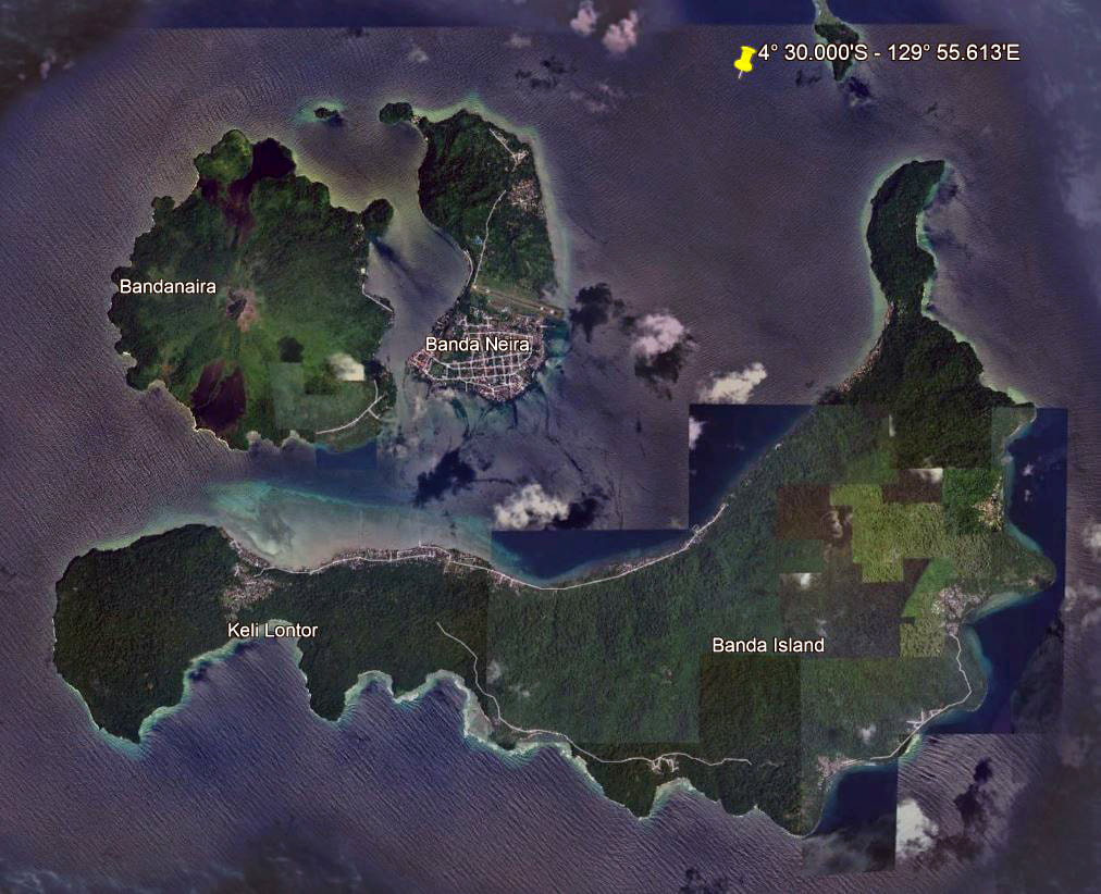
Point at 4½° South - north of Banda
|
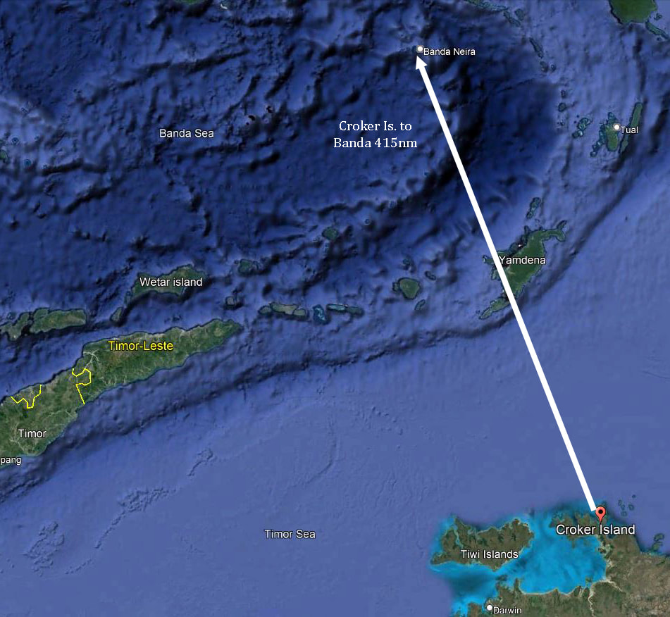
Tip of Croker Is. at 10° 58.192'S - Cape Wessel 11° 0.010'S
|
26/03/1636 VOC ships Amsterdam & Wesel arrived Banda
17/04/1636 Sailed for the South Land
18/04/1636 Arrived at Flat Point 4½° South
Ashore - Pool & steward Schiller killed by black Southlanders armed with Bows & Arrows.
30/06/1636 Returned to Banda
17/04/1636 Sailed for the South Land
18/04/1636 Arrived at Flat Point 4½° South
Ashore - Pool & steward Schiller killed by black Southlanders armed with Bows & Arrows.
30/06/1636 Returned to Banda
VOYAGE OF GERRIT THOMASZ POOL TO THE SOUTH LAND.
TRANSLATED FROM 'VALENTYN'S "BESCHRYVINGE VAN BANDA,"
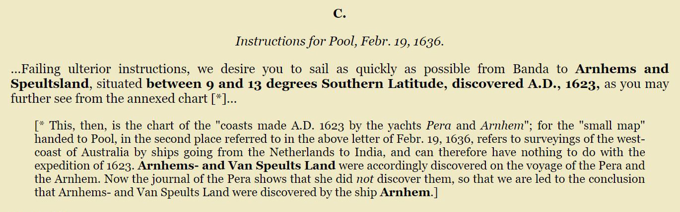
p. 47.On the 26th of March, 1636, there arrived two shallops, the Amsterdam and the Weasel, sent from Amboina, with orders to Governor Acoley at Banda, to give to the commander of these ships, Gerard Thomasz Pool, such information concerning the South Land as might be necessary for him to perform a voyage thither, under the orders of the honourable Company.
After he had received the desired instructions, and had been furnished with sufficient provisions and other necessaries, he sailed with those vessels on the 17th of April.
TRANSLATED FROM 'VALENTYN'S "BESCHRYVINGE VAN BANDA,"
p. 47.On the 26th of March, 1636, there arrived two shallops, the Amsterdam and the Weasel, sent from Amboina, with orders to Governor Acoley at Banda, to give to the commander of these ships, Gerard Thomasz Pool, such information concerning the South Land as might be necessary for him to perform a voyage thither, under the orders of the honourable Company.
After he had received the desired instructions, and had been furnished with sufficient provisions and other necessaries, he sailed with those vessels on the 17th of April.
|
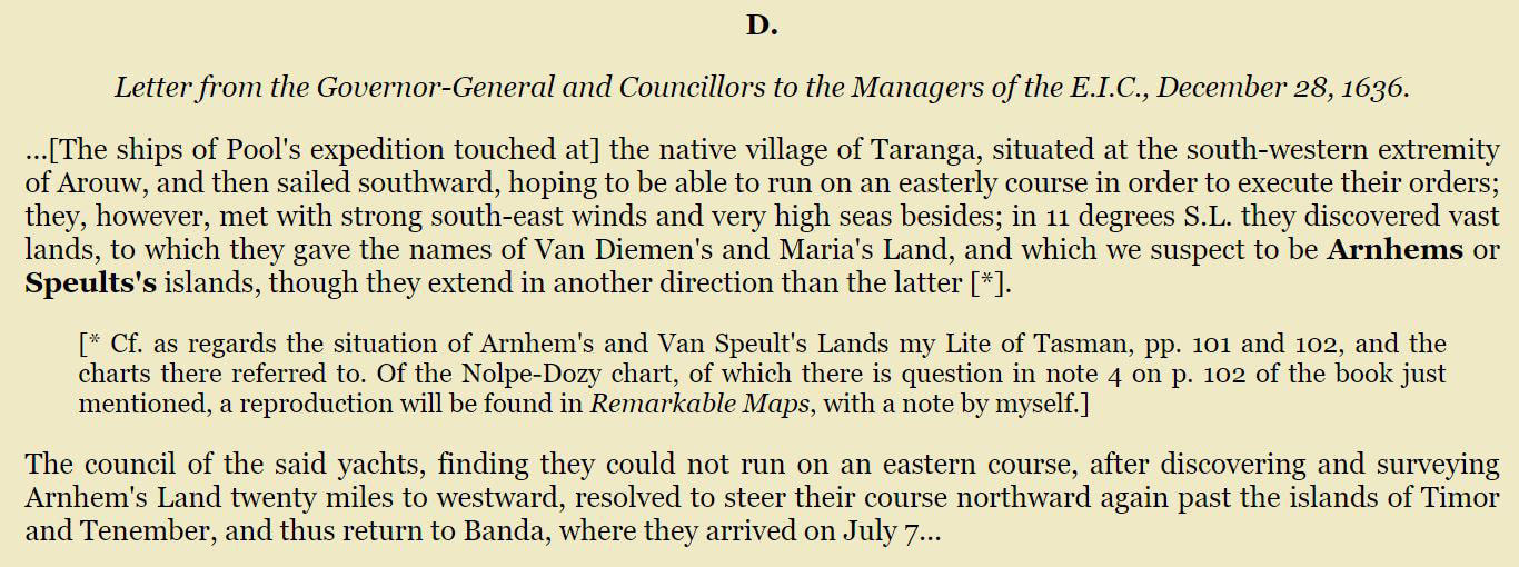
On the 30th of June following both these vessels returned, and informed the governor that, having reached the Flat Point in about 4½° of south latitude on the 18th of April, they had determined to send some of their people on shore to take a view of the country. The Commander Pool, desirous to see everything himself, resolved to be of the party and took with him his steward, Andries Schiller, a native of Nuremberg. They were scarcely landed, when a large body of wild Southlanders, who at first appeared friendly, but acte d afterwards in a hostile manner, surrounded them, in so much that it was not in their power to escape. The Commander Pool perceiving the danger greater {Page: 76} than he at first expected, was still in hopes to escape; but he found himself attacked one of the first and received a blow with a hazegay, which immediately brought him to the ground. When he recovered his senses and saw that his steward was still defending himself, he called out to him that he would do better to try to make his escape, as otherwise he would not be able to do it for the savages were coming on in yet greater numbers. He did so, but was likewise soon knocked down.
|
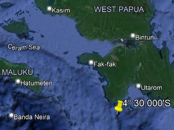
4.5 South is the Latitude of the top of Banda
|
The wild Southlanders, perceiving the hanger which the Commander Pool had in his hand, forced it from him and cut these two men to pieces, and carried them into the wood; but it never could be discovered what they did with them, nor what became of the two sailors who were likewise missing.
The crew could only tell, that these Southlanders have a very black skin, much like the Caffers of Angola, but with long black hair on their head, and were much stouter and taller in stature than any Europeans, and quite naked, with the exception of their middle. They also reported that one of them, appearing to be a chief, had a rough skin of some wild beast wrapped round his neck; and that they were armed partly with hazegays, and a kind of javelins with sharp iron points; and partly with bows and arrows.' (RH Major in Gutenberg 'Early Voyages to Terra Australis' p75)
The crew could only tell, that these Southlanders have a very black skin, much like the Caffers of Angola, but with long black hair on their head, and were much stouter and taller in stature than any Europeans, and quite naked, with the exception of their middle. They also reported that one of them, appearing to be a chief, had a rough skin of some wild beast wrapped round his neck; and that they were armed partly with hazegays, and a kind of javelins with sharp iron points; and partly with bows and arrows.' (RH Major in Gutenberg 'Early Voyages to Terra Australis' p75)
|
|
|
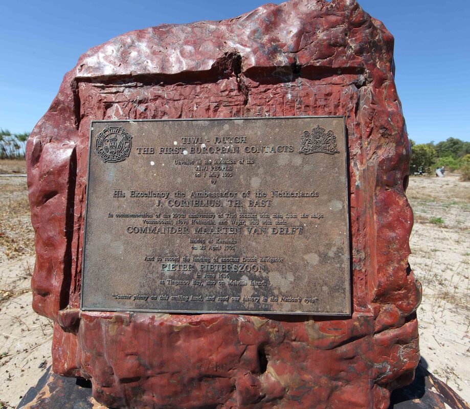
In the Darwin suburb of Wagaman the roads commemorate early voyagers to the Top End and the participating ships.
There’s an Amsterdam Circuit - Wessel Street & Klein Street which NT Place Names says was ‘Named after one of the Dutch vessels Klein, Amsterdam and Wesel which sighted Coburg Peninsula, discovered Dundas Strait and sailed along the northern shore of Melville Island in 1636. Pieter Pieterszoon was in command.’ Klein is Dutch for ‘small’ and the two vessels of the troubled 1636 Expedition were the Klein Amsterdam and the Wesel. The rogue comma is not the only error in this statement. |
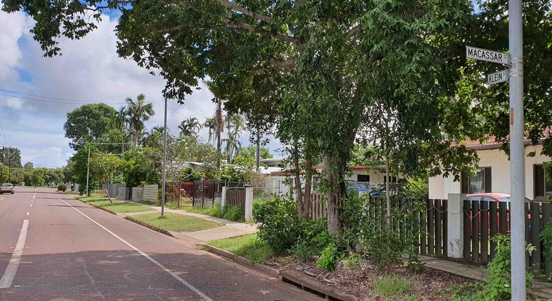
Klein Street Wagaman NT - runs parallel to Groote Street
|
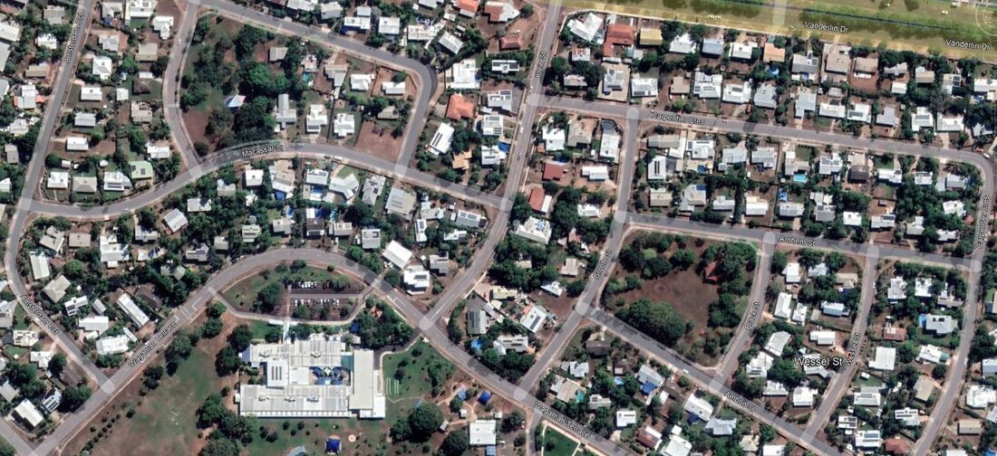
Google Earth Darwin Suburb of Wagaman - Amsterdam Circuit - Wessel Street & Klein Street
Cape Lavery: Believed to have been named during the HMAS Morseby 1944-45 hydrographic survey of Snake Bay by Commander CG Little RAN, as the Morseby's fairchart is the first record of the name. NT Placenames - Reasonable as the sandspit seemingly wasn't there much before this date.
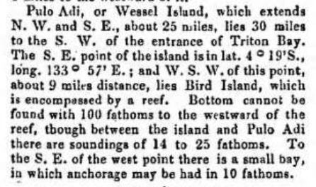
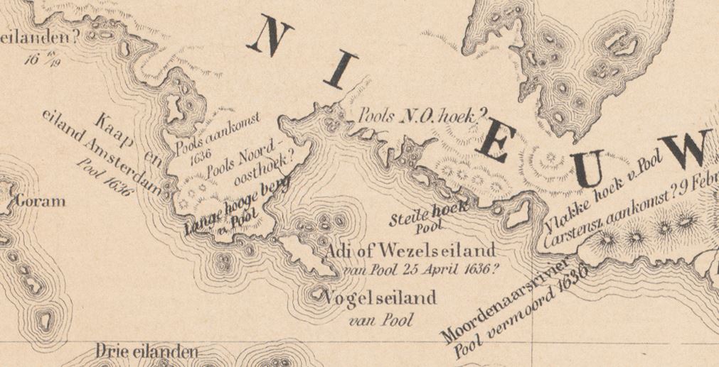
Wessel Island
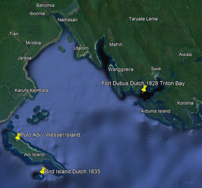
Adi - Wessel Island west coast PNG
|
1835 Wessel Is. GE Earl - Kloff & Modera paper nla.obj-52764184
|
|
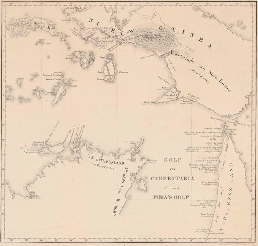
1859 van Dijk
Van Dijk did not believe the Pool/Pietersen Expedition was on the north Australian coast - the exploration of which was entirely down to the Pera simply because the Arnhem was so badly damaged that it had to return to Banda. It is the obverse of the same fallacy that Arnhem Land must have been discovered by the Arnhem because the Pera didn't do so. Van Djik may be mad but he's not Robinson Crusoe.
|