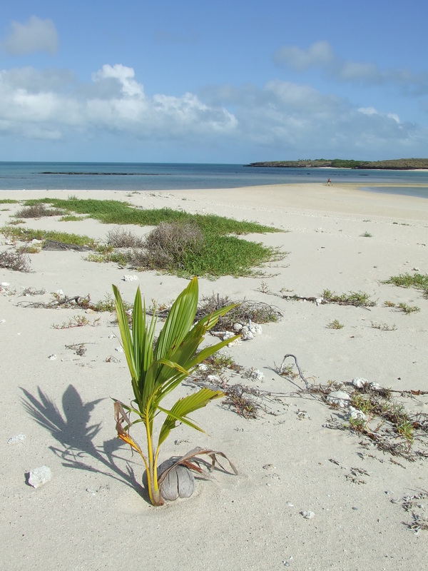
Ancient Coins in Arnhemland
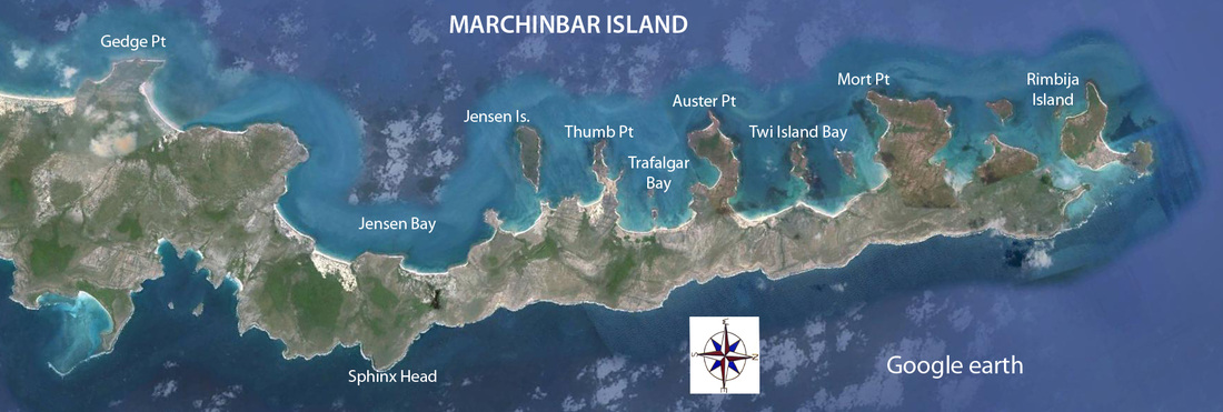
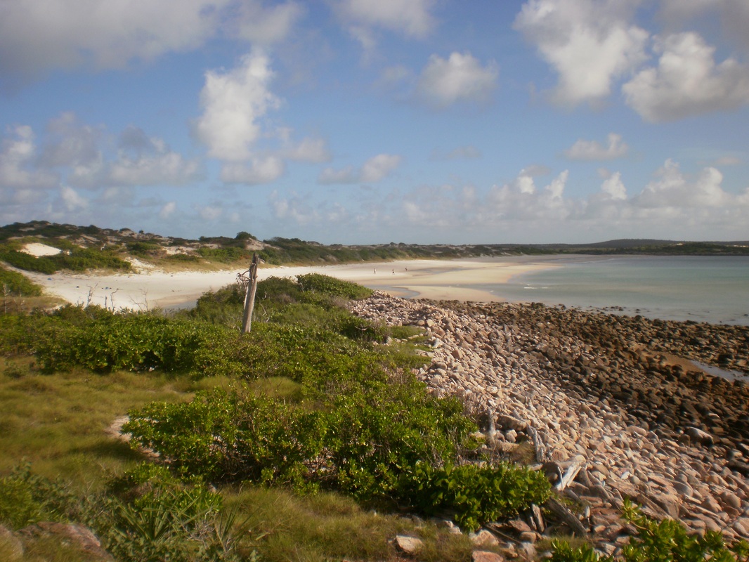
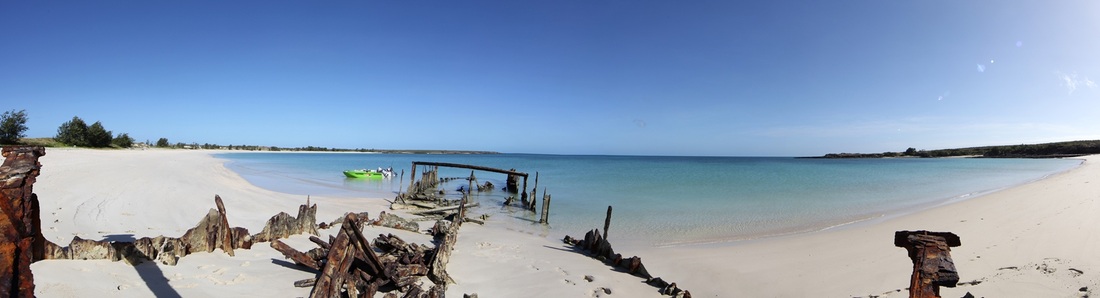
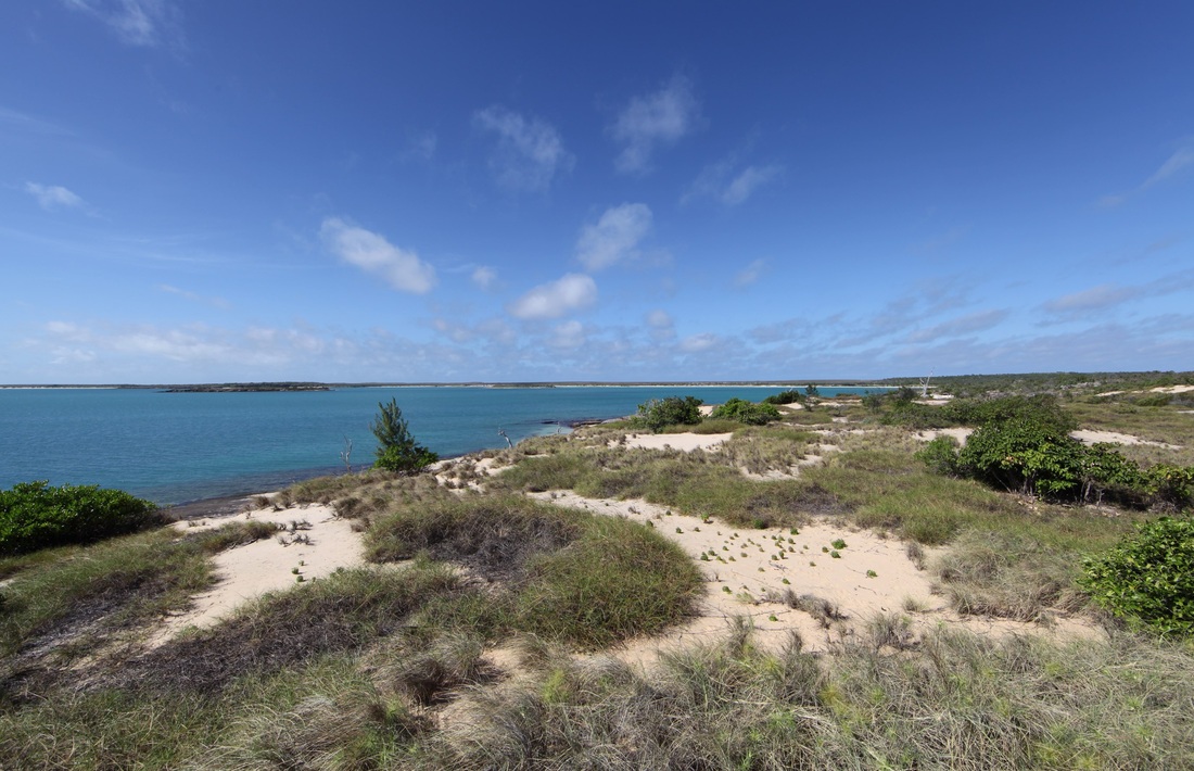
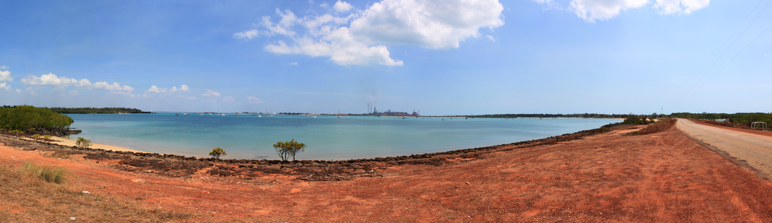
Google Earth image - Marchinbar Island, East Arnhem, Northern Territory -
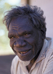
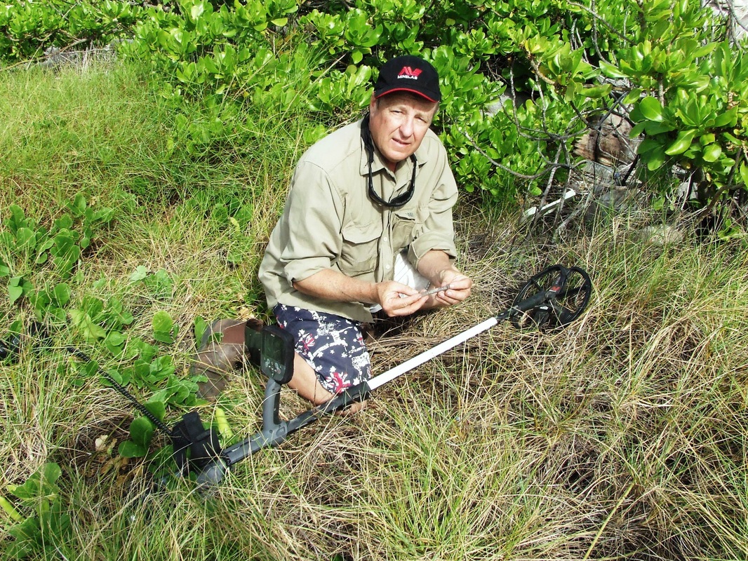
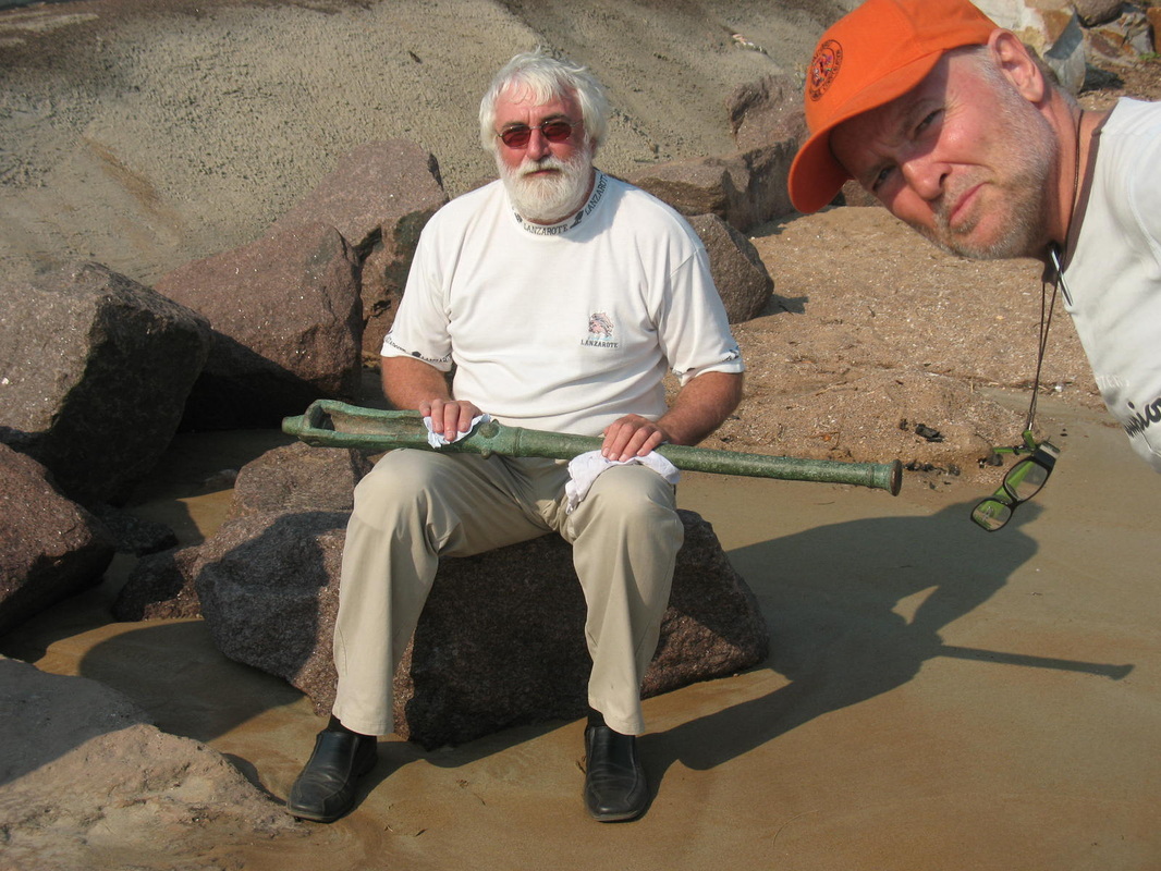
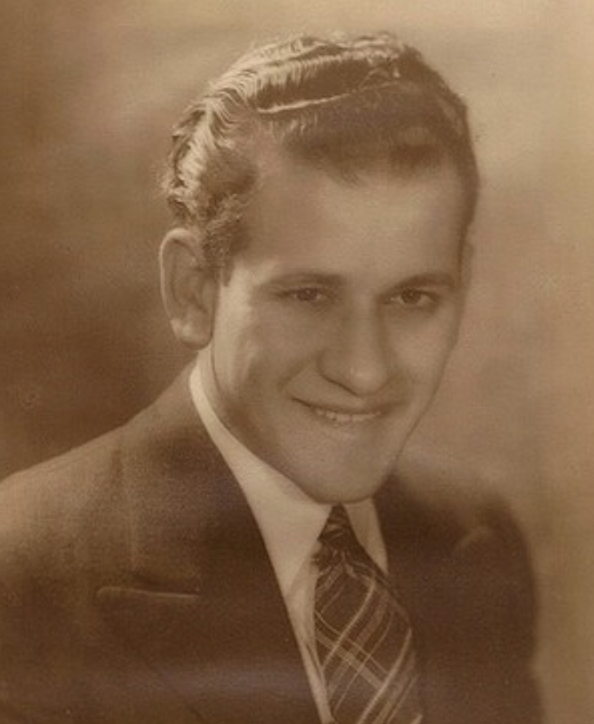 Morry Isenberg
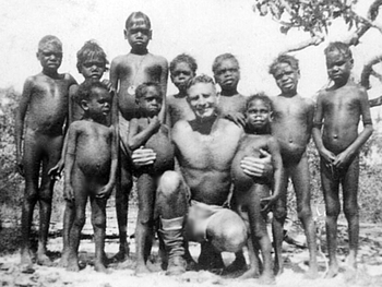
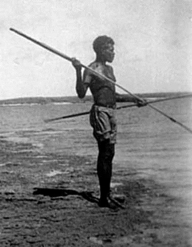
Morry Isenberg was stationed briefly on Marchinbar Island during 1945 as a RAAF radar operator. Whilst fishing he found nine small copper coins which he placed in a match tin - which made its way into his kit bag - where it remained until 1979 when Morry mentioned them to a friend - who in turn mentioned them to numismatist Dr Bill Mira who identified them as being from Africa & the Netherlands. In 1983 Morry Isenberg donated the coins to the Power House Museum in Sydney. In November 1983, H.P. Boland, Curator of Numismatics, Sydney Mint Museum gave a written valuation of $5,000. He stated that "They are the earliest dated coins so far discovered in Australia and represent an entirely new concept in early Australian history, the significance of which has yet to be determined." In December 1988 a valuer for the Commonwealth Government's Taxation Incentives for the Arts Scheme officially valued the Kilwa coins at $25 - $50 & the Netherlands Coins etc $5 - $10.
The coins were displayed during the bicentennial & some 180,000 people visited the museum by the end of 1988 when the display was taken down. It was noted that "the provenance has only been established on hearsay." Shakespeare wrote in The Tempest "they will not give a doit to relieve a lame beggar, they will lay out ten to see a dead Indian."
The coins were displayed during the bicentennial & some 180,000 people visited the museum by the end of 1988 when the display was taken down. It was noted that "the provenance has only been established on hearsay." Shakespeare wrote in The Tempest "they will not give a doit to relieve a lame beggar, they will lay out ten to see a dead Indian."
Despite being by far the oldest imported artefacts discovered in Australia there had never been an expedition to explore the find site.
The Marchinbar Hoard
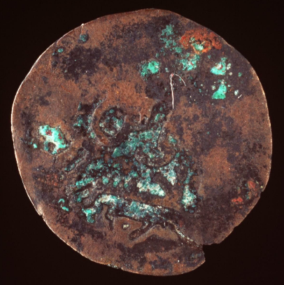
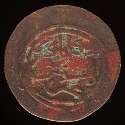
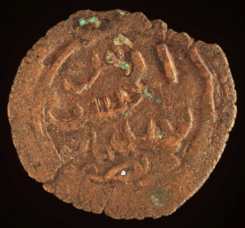
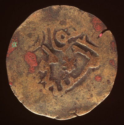
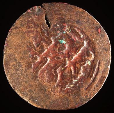
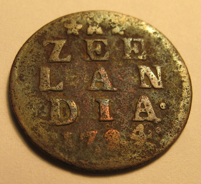

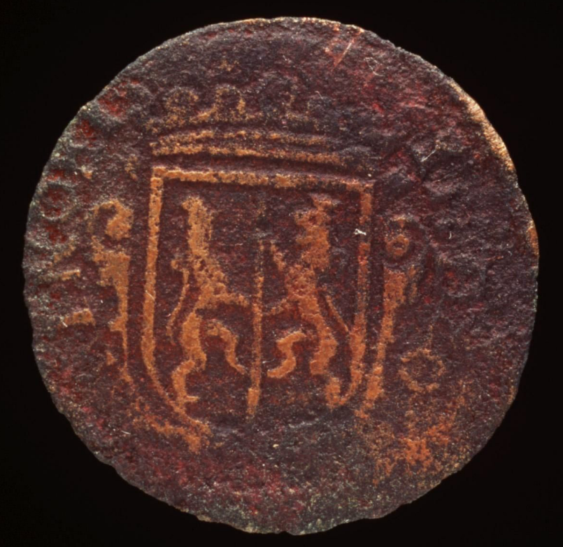
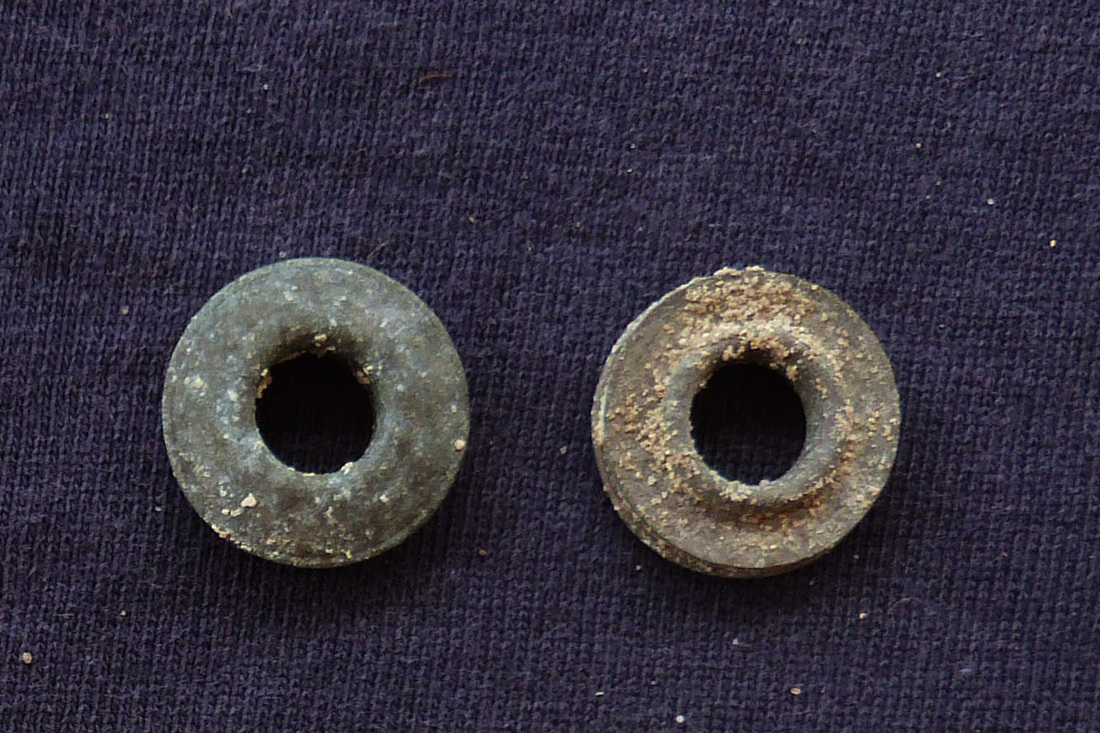
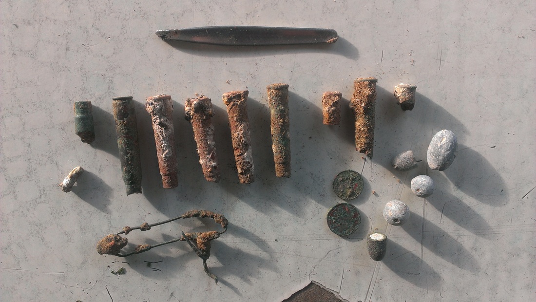
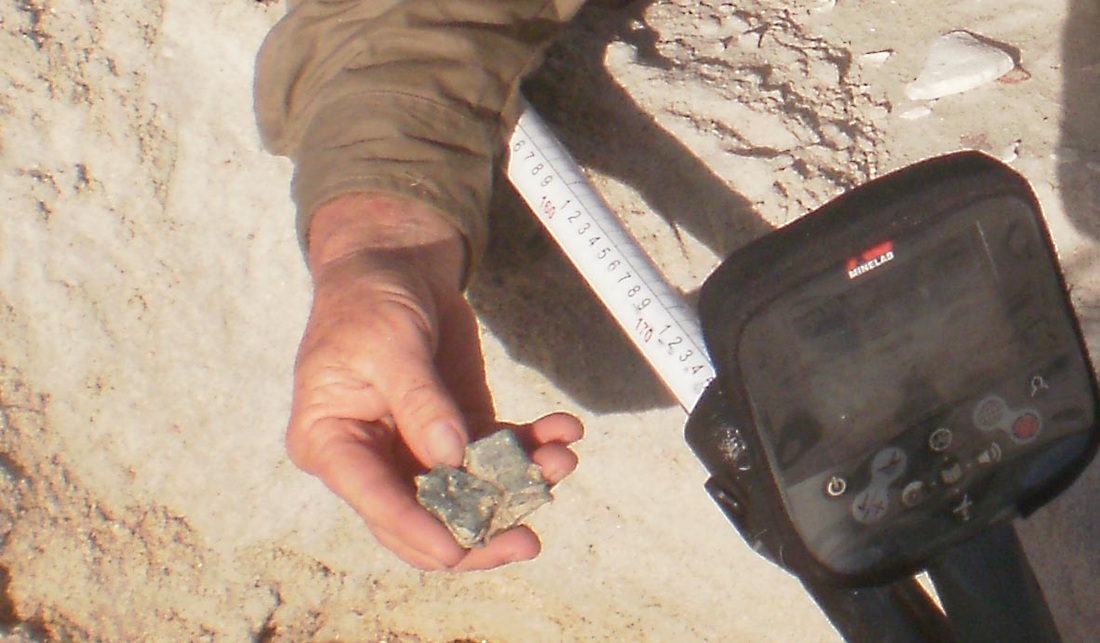
The Marchinbar Hoard consists of 5 Kilwa coins (East Africa) & 4 VOC Dutch coins {3 x Doits & 1 x Liard). The condition of the coins is fair to good. Dates range through 634 years. Almost identical in size, composition, weight & value or lack thereof. The Kilwa coins range from 1150 to 1333 (183 years). The Dutch coins are of European origin - all other Dutch coins found in N. Australia are of SE Asian manufacture at Batavia {Jakarta} or forgeries. The coins were evaluated by expert numismatists in the early 1980's, including Dr Mira, a member of the PastMasters group, as are Peter Lane and John Perkins. John is the foremost authority on Kilwa coinage & his evaluation of the Isenberg coins would bring unprecedented experience to bear. Unsuccessfully offered for sale for 5 pounds, the coins were lodged with the PowerHouse Museum in Sydney - these images are on their website with supporting information.....http://www.powerhousemuseum.com/collection/database/?irn=305390#ixzz304Lfp7JK
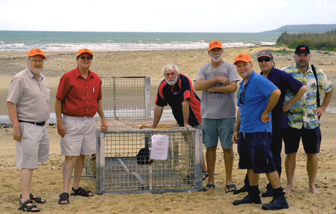
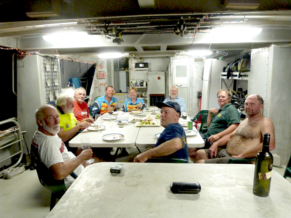
Expedition Sponsors 2013
Dedicated to the memory of Mrs Jean McIntosh who generously and enthusiastically supported this expedition.


UBUNTU Foundation Blidegg 10 9220 Bischofszell / Switzerland
Ancient Coins in Arnhemland Expedition
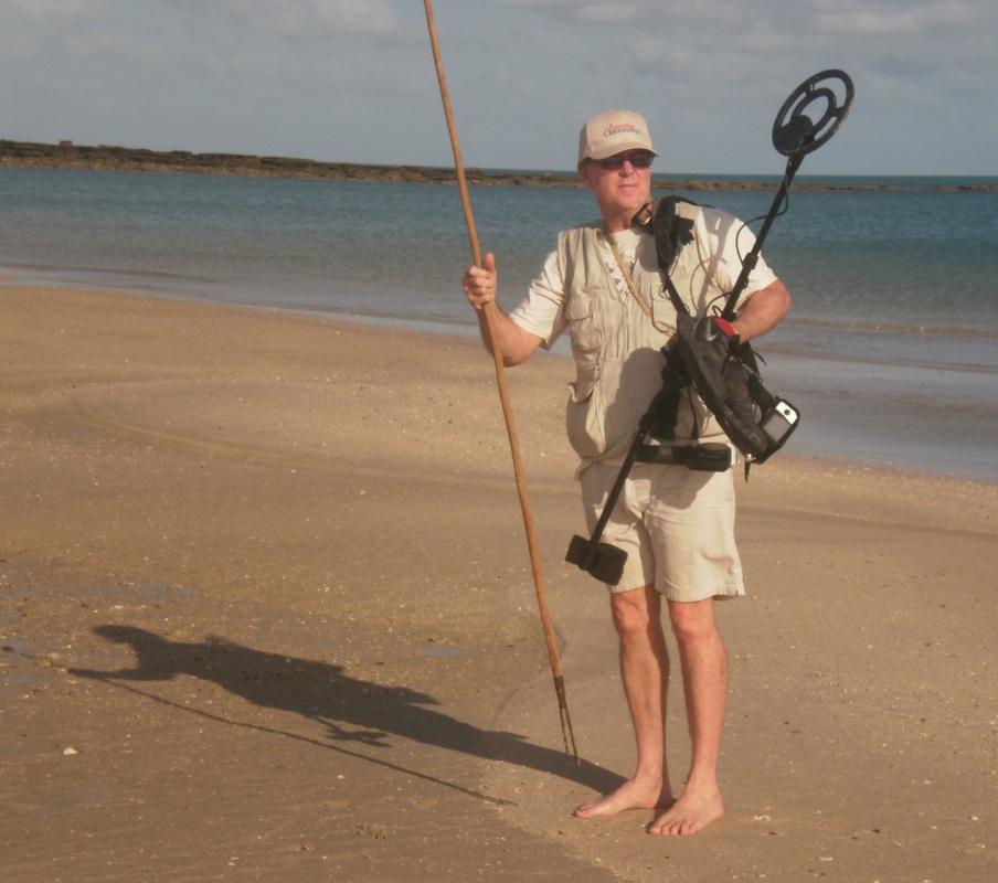
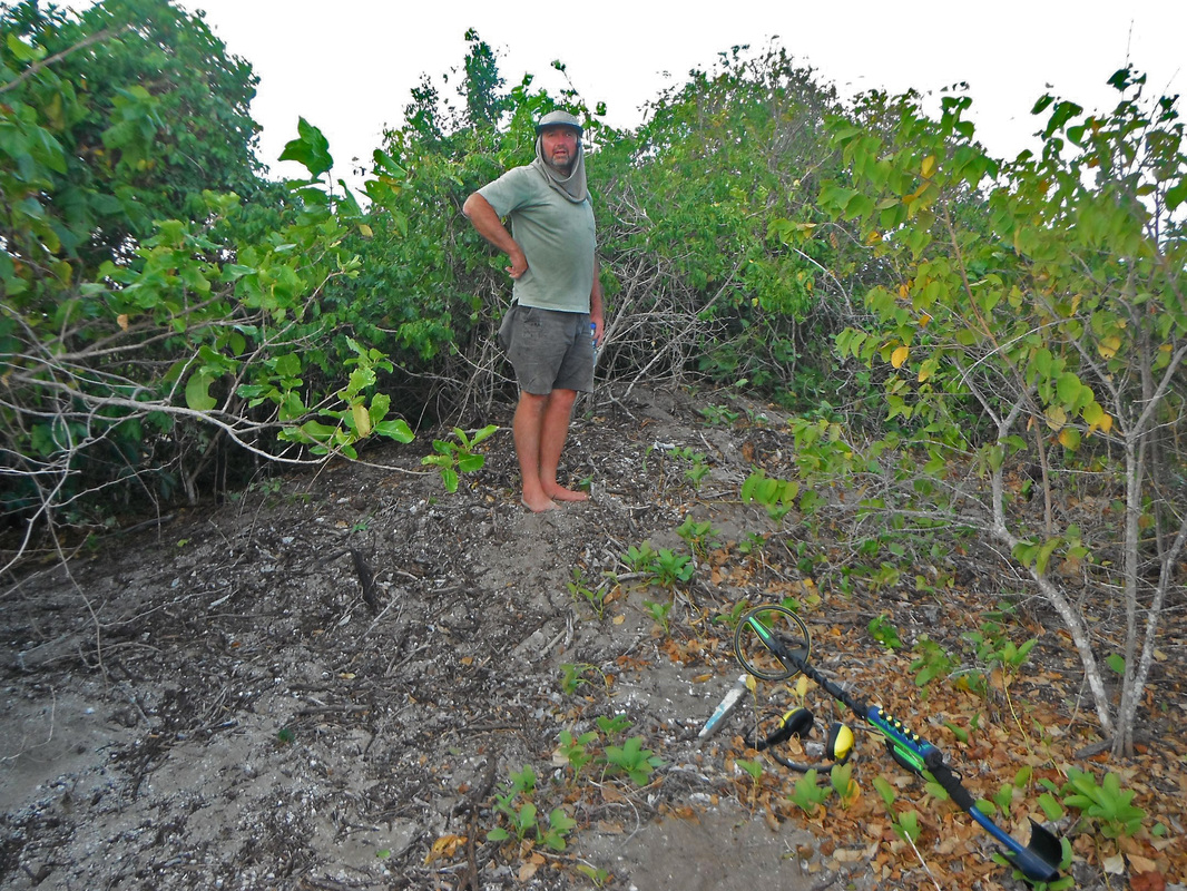
Minelab Metal Detection Training
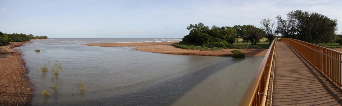
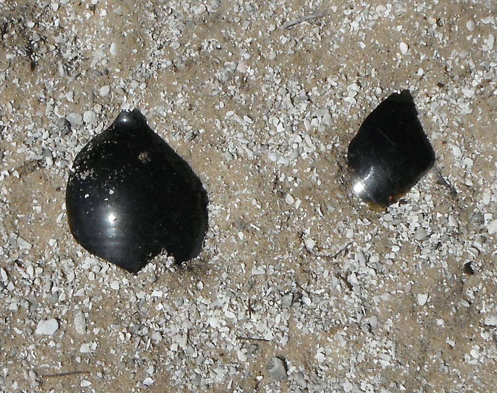
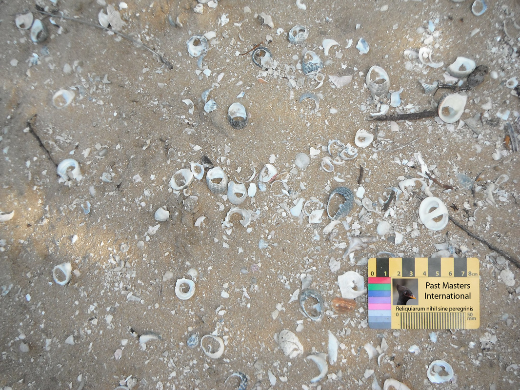
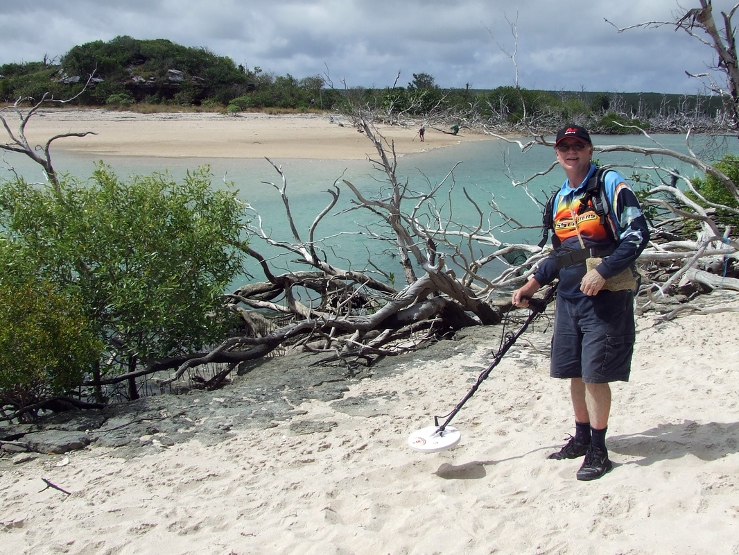
The mouth of Rapid Creek, Darwin NT - location for MD training - WWII finds & fishing weights - it is the largest coastal freshwater catchment in northern Australia.
Minelab trainer Nenad Lonic was flown up for a couple of days brief noviciate. The ABC film crew got so involved in the exercise that they missed the evening deadline - it was serious fun. Everyone was surprised at the amount of WWII finds at the end of the street.
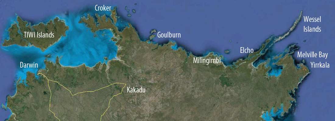
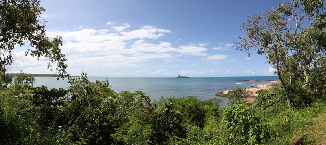
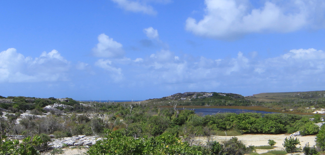
Google Earth map of the Top End - township of Nhulunbuy on the Gove Peninsular on eastern side of Melville Bay. Yellow line is sealed road.
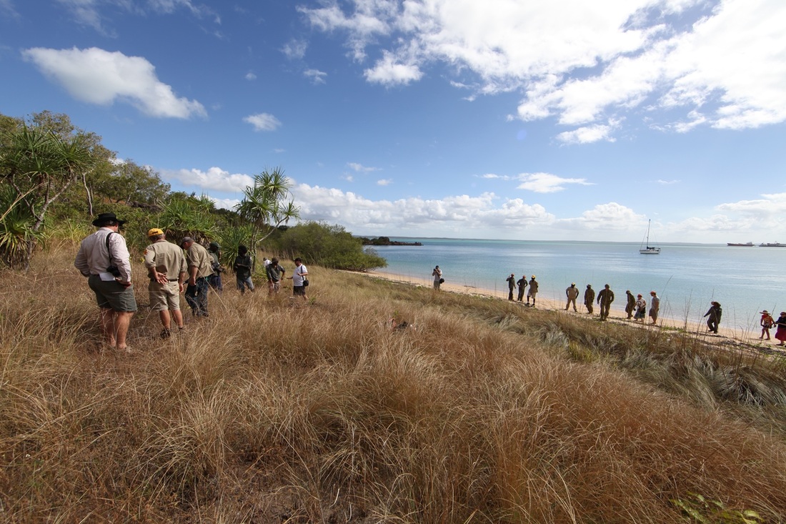
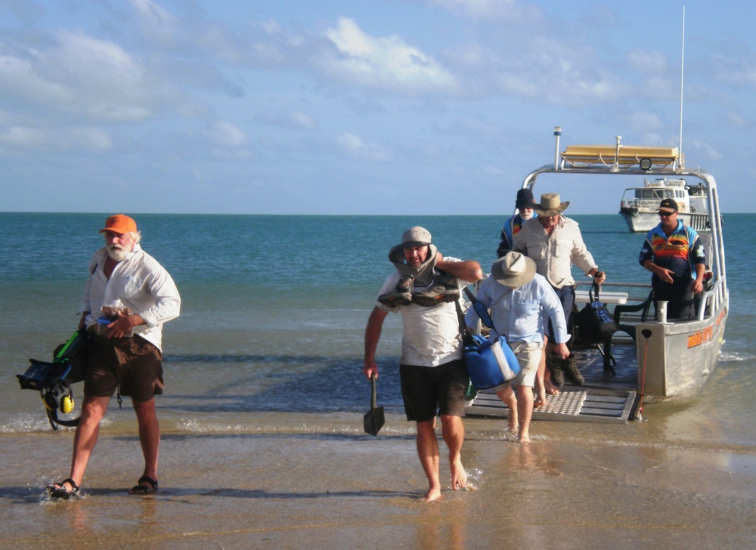
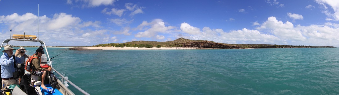
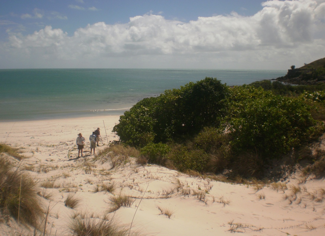
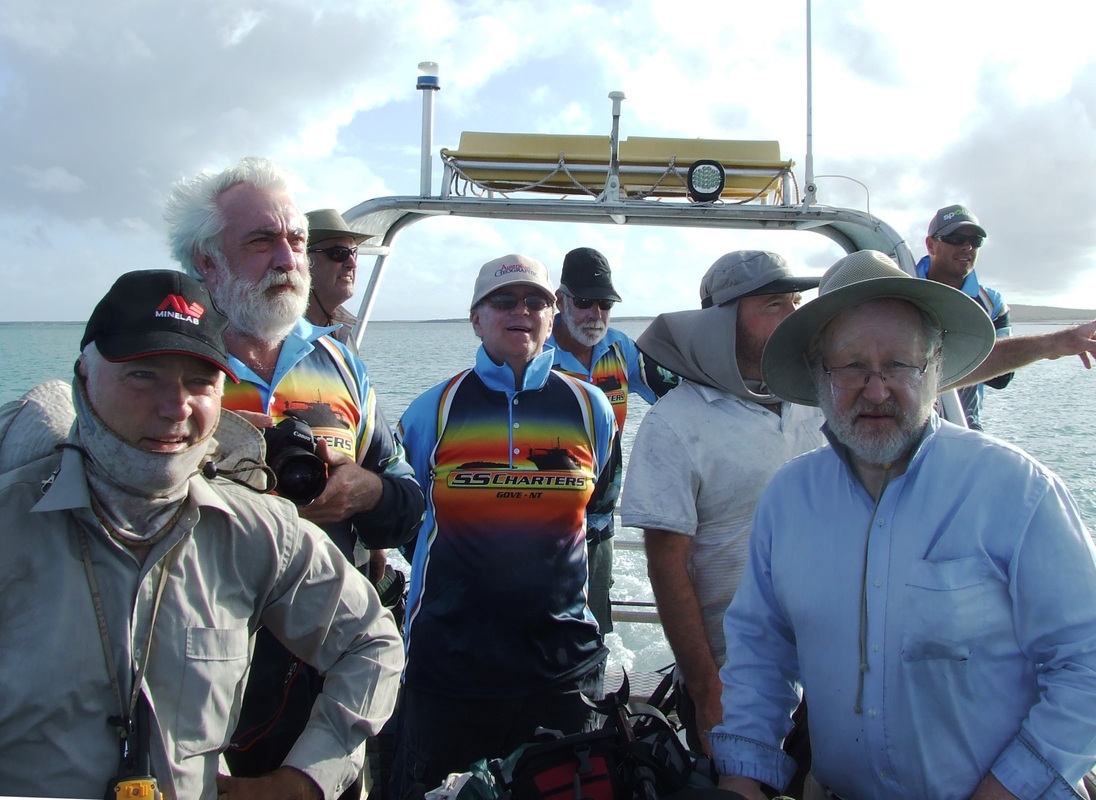
Itinerary: We flew out of Darwin on Qantas flight QF 1943 to Gove airstrip on the NE corner of Arnhemland where the mining township of Nhulunbuy is the regional centre based on Melville Bay with the adjacent community of Yirrkala as the hub for the Laynhapuy Homelands. Almost immediately after landing we got into 4x4 vehicles and travelled down the coast with out hosts the Dhimurru Rangers to visit the stone pictures at Wurrawurrawuy above Macassan Beach on the Gulf of Carpentaria.
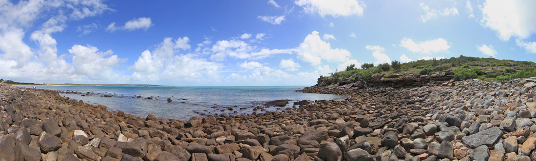
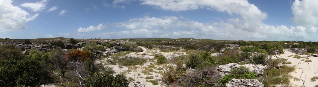
Exploratory Expedition - Day One - NE Arnhemland
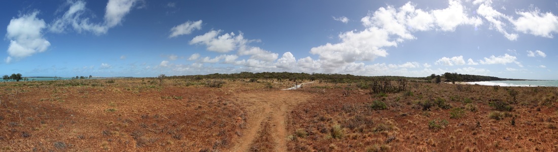
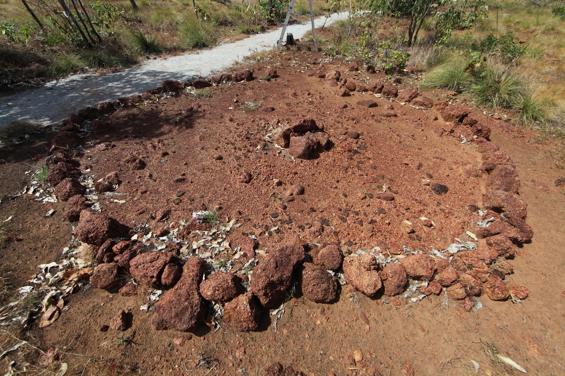
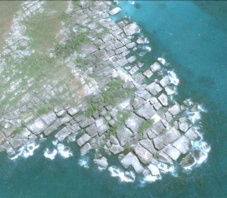
The entrance to the Wurrawurrawuy Stone Picture site at Macassan Beach - south of Yirrkala on the Gove Peninsular.
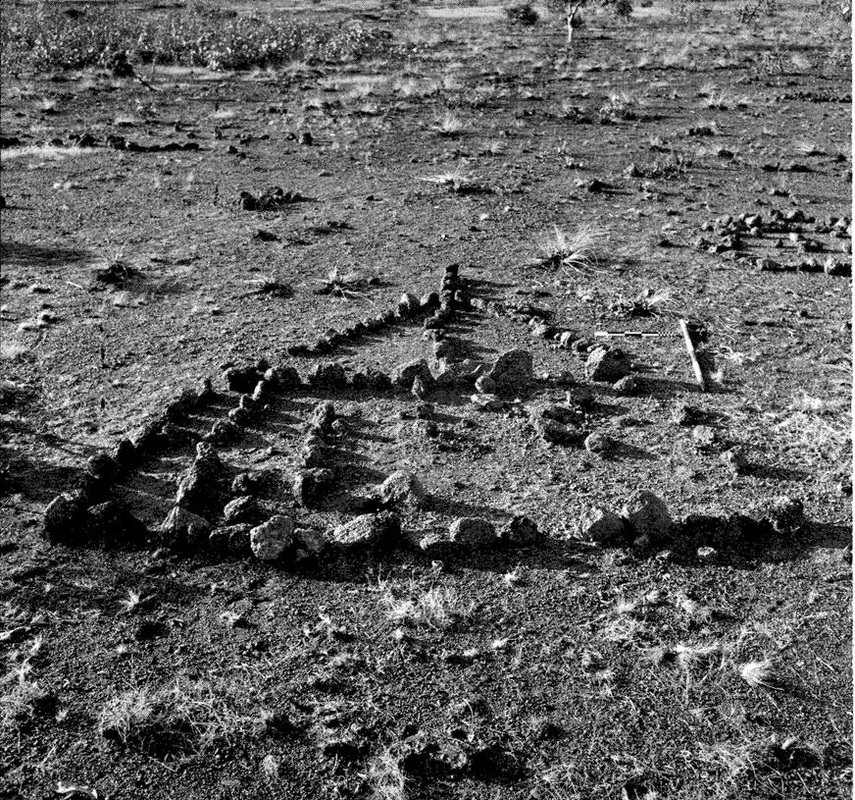
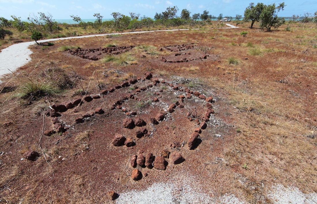
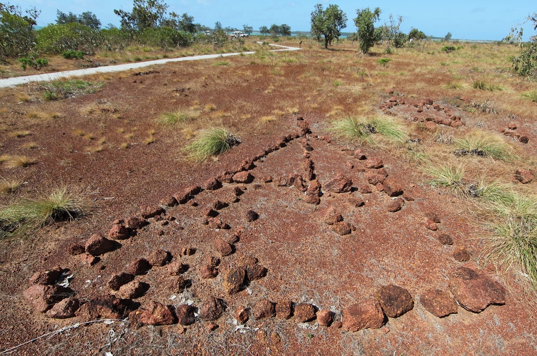
Wurrwurrwuy Stone Pictures
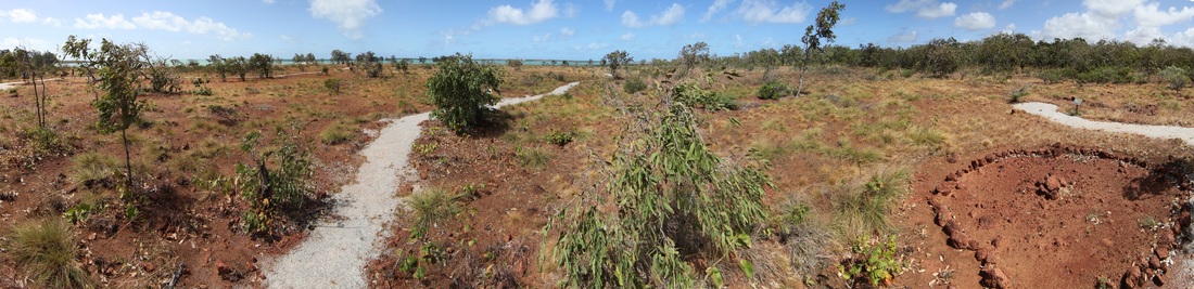
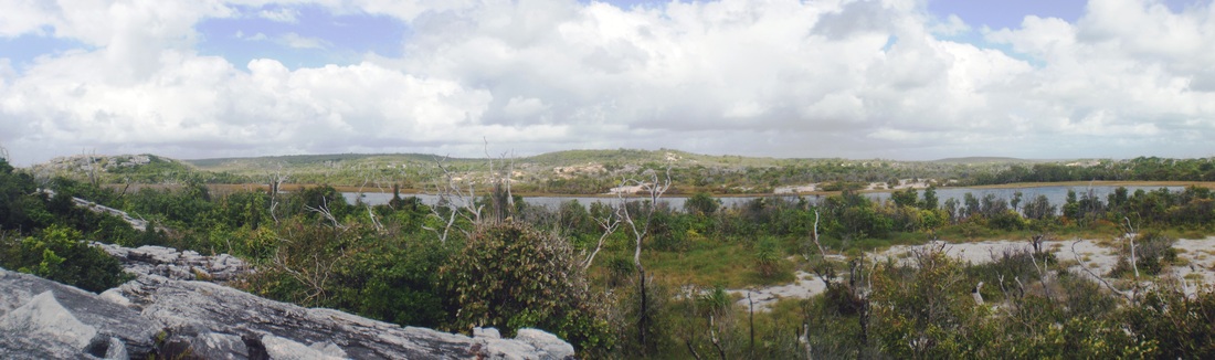
Panorama of the site including the 'round house'!
The PastMasters 2013 Ancient Coins in Arnhemland Expedition kicked off with a visit to the Wurrwurrwuy Stone Pictures at the invitation of our hosts the Dhimurru Rangers & traditional owners of the site on the SE Gove Peninsular, south of Nhulunbuy. We had been asked to provide in-put to considerations of how best to conserve the pictures which are composed of bauxite that erodes readily and may be disturbed by wallabies and cyclones. To prevent buffalo & vehicle incursion, the area has now been fenced by Dhimurru and pathways constructed. A specific issue is the proposal to replace some of the most badly degraded rock and we were able to demonstrate that this has been the practice in the past.


 Mawalan
The stone pictures were photographed and documented by Campbell Macknight & Bill Gray in 1970 and seen above their black & white images are matched to current ones. High resolution aerial imagery or preferably Lidar would expose the landscape which these artistic features populate and define. Quad-copter imagery would be valuable - perhaps on a calm Wet season day.
Many of the pictures are incomplete or overgrown and it is certain that there are many yet to be described. Perhaps they are landmarks of a trepang fleet journey from Macassar to the Wellesley Islands. Perhaps it is constructed in the same way as songline maps or spirit progresses such as the Wawilak sagas.
Many of the pictures are incomplete or overgrown and it is certain that there are many yet to be described. Perhaps they are landmarks of a trepang fleet journey from Macassar to the Wellesley Islands. Perhaps it is constructed in the same way as songline maps or spirit progresses such as the Wawilak sagas.
 Mungurrawuy
Macknight & Gray's informants were Mawalan Marika & Mungurrawuy Yunupingu whose forebears had created the pictures towards the end of the nineteenth century - when the Macassan trepang trade was in terminal decline. Their intention was to ensure that future generations would know the Macassan story that is such an important part of their heritage. Macassan influence permeates Arnhemland culture and identity which has to a great extent become the default Australian Aboriginal identity - thus the debt to the Macassans grows every year.
It is unquestionably Australia's earliest and longest lasting international trading relationship and almost entirely unknown outside of Arnhemland. The stone pictures are considered more closely at http://www.pastmasters.org.au/wurrawurrawuy-stone-pictures.html
It is unquestionably Australia's earliest and longest lasting international trading relationship and almost entirely unknown outside of Arnhemland. The stone pictures are considered more closely at http://www.pastmasters.org.au/wurrawurrawuy-stone-pictures.html
Minelab Metal Detector Training
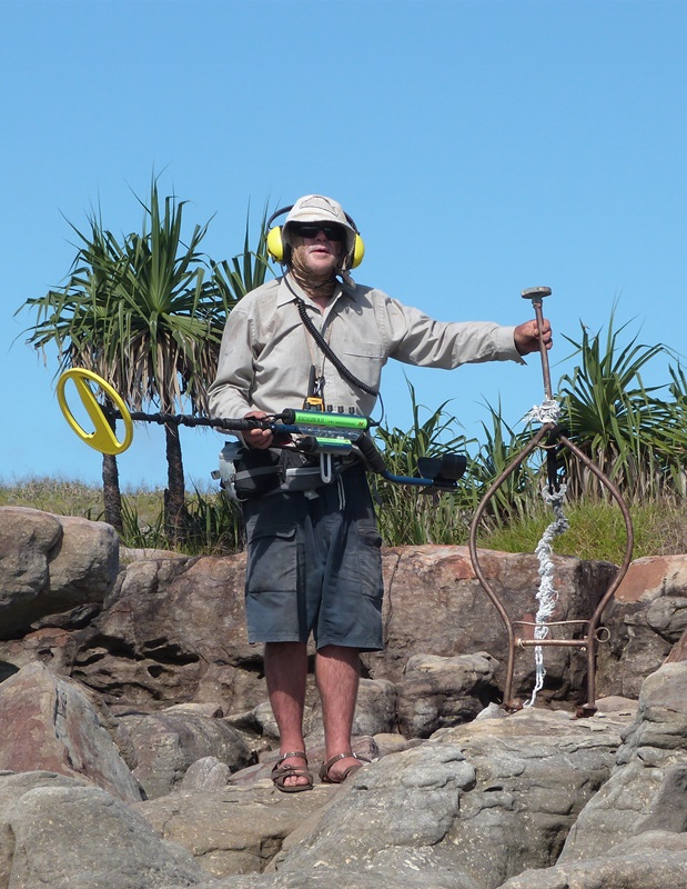
The day included a demonstration of Minelab Metal Detectors by expert Bob Sheppard of Heritage Detection Australia whose cost were covered by Minelab. The coast of the bauxite shelf is exposed to the SE trade throughout the Dry season - the circular stone image above appears to have an entrance that also faces south east affording cool breeze in the Dry & shelter in the Wet - another feature of the roundhouse is the fireplace which is off centre to allow for a central support. It would be an odd fish trap to have an exit.

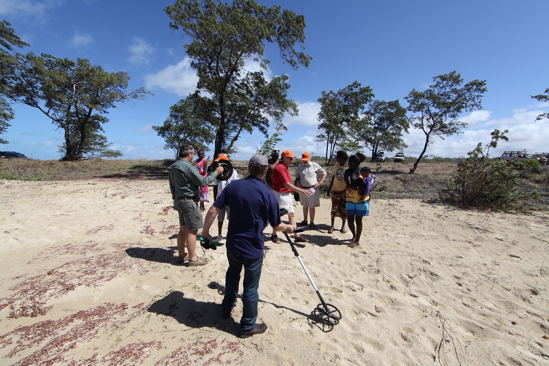
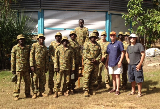
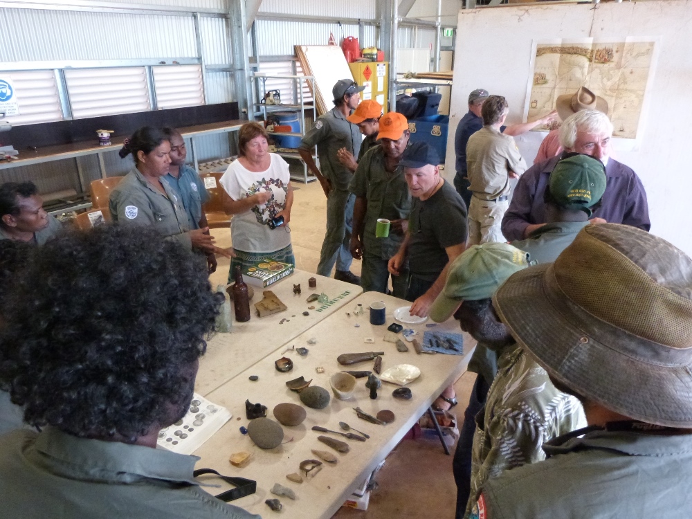
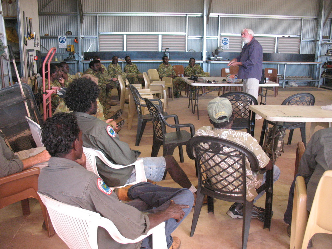
Expedition Day Two - Custodians & Curators Ranger Workshop
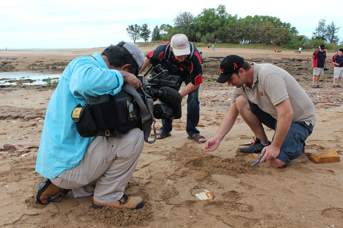
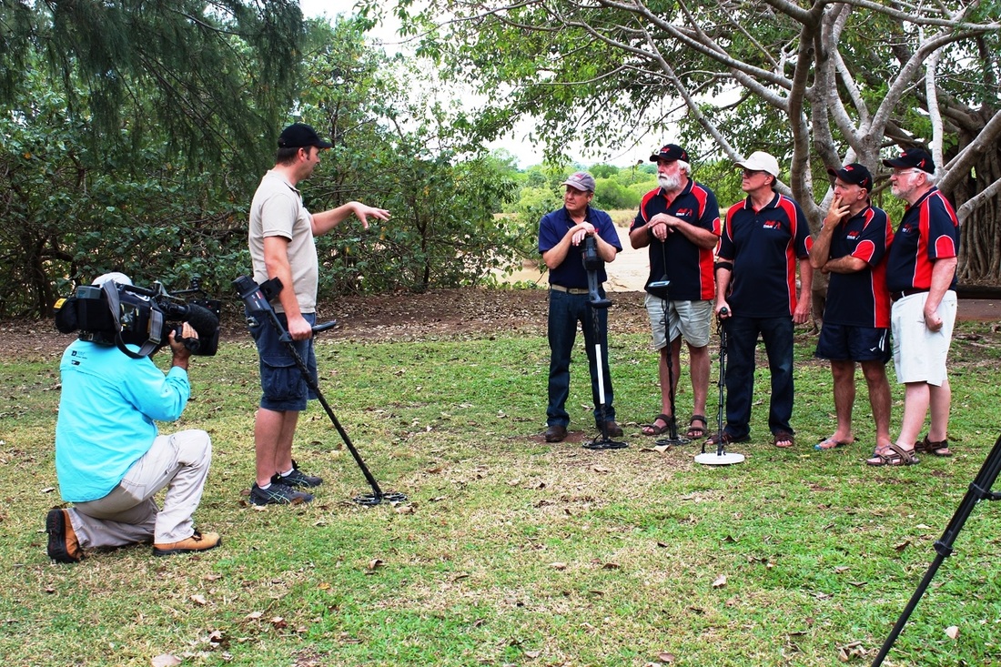
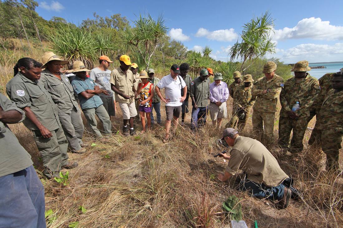
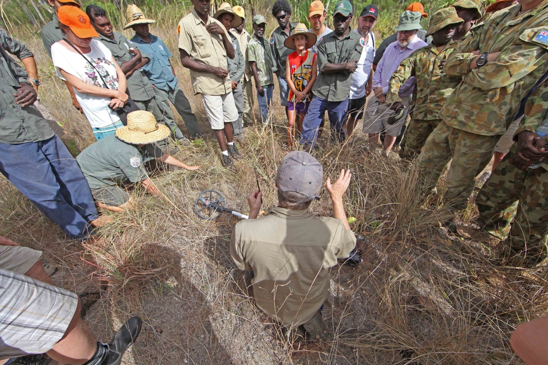
Itinerary Day Two: The Custodians & Curators workshop at the Dhimurru Rangers facility in Nhulunbuy began with an hour long overview for town dignitaries to introduce ourselves and appraise senior people of what we were going to be doing and speaking about to the Rangers and Norforce personnel. We introduced them to the Kilwa coins and the handling collection - explained the idea of site sensitising and metal detector demonstration.


Sensing & Site Sensitising in the Littoral Zone
Sensitising Rangers to what may be exposed by storm & cyclonic surge - tell tale factors, stonelines, smokehouse depressions, protective Marram-like Grass.
The concept recognises that the littoral zone is dynamic and increasingly prone to relative sea rise and storm induced exhumation. The Rangers are the only people routinely visiting much of this coastal country these days and the traditional knowledge that they receive can be compounded by an awareness of history and landscape archaeology. They can readily be taught to recognise characteristic features of Macassan and pre-Macassan sites - taught to add archaeological features to the existing mapping capacity and provided with resources for advice and assistance. In this way the Rangers have a reason to engage with senior people to discuss particular areas and are exposed to a range of skills and opportunities whilst developing, protecting and promoting their environmental, historical and archaeological capital. This blending of Balanda (white) and traditional knowledge is the foundation of our collaborative history making process that re-interprets oral history within a scientific structure - the duck egg nest becomes the pile of foreign ballast stones. Once this capacity is available to Rangers they will be uniquely empowered as custodians of their culture & curators of their inheritance - scientist & tour guide.
A cruise ship in Rocky Bay at Yirrkala in 2012
Today (4th March 2015) the Queen Mary II is docked in Port Darwin with 2300 passengers & 1300 crew - she is the second of six cruise ships arriving in six days - also today the French expedition cruise ship L'Austral carrying 200 passengers called in at Yirrkala on her way to Darwin. This is just one week in the cruise ship calendar that sees vessels pass within sight of the Arnhemland communities & there are more each year - a genuine opportunity. Many foreign tourist are mature age, educated and interested in history, culture, different lands and different people - an opportunity to visit a Macassan site with Yolngu guides would fulfil their expressed wishes - to meet real Aboriginal Australians and learn things that most Australians don't know.
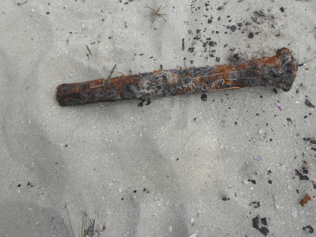
The discovery of nails close to a Macassan processing site is an issue as all sites are protected. No such nails have ever been recorded archaeologically in such a context, although the Yolngu advise that they have seen them on other sites and that the old people used to make fish spears out of them. A non-invasive MD sweep revealed metal objects of identical signature dispersed across the site whilst respecting the stoneline features. This suggest that they are somehow linked to the framework that sat on the walls supporting the wok-like cauldrons. This is a hitherto unreported aspect of the trepang trade funding is required to mount an expedition to detect, plot and document these artefacts in collaboration with senior Yolngu, Rangers & Norforce. There is a possibility that these nails came down as gifts or payment to Yolngu as they would be readily fashioned into fish spears or hammered into knives or spear heads. There is also the possibility that this iron originated as ore in Arnhemland where it abounds - as will be seen during the expedition below.
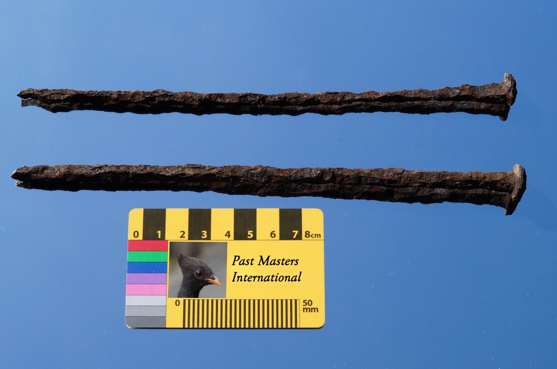

Subsequently a pair of nails was received from Traditional Owners and research is currently being undertaken at various laboratories but what is really needed is a proper metal detector survey to plot the nails - delineate & protect the sites in a way that is useful & meaningful to the people.

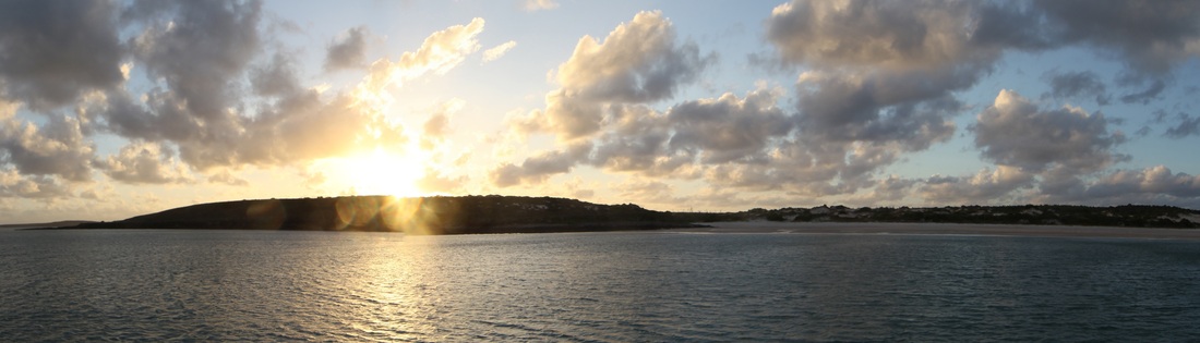
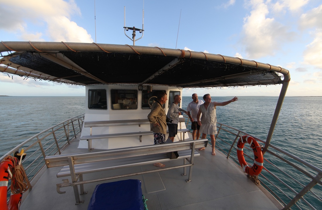
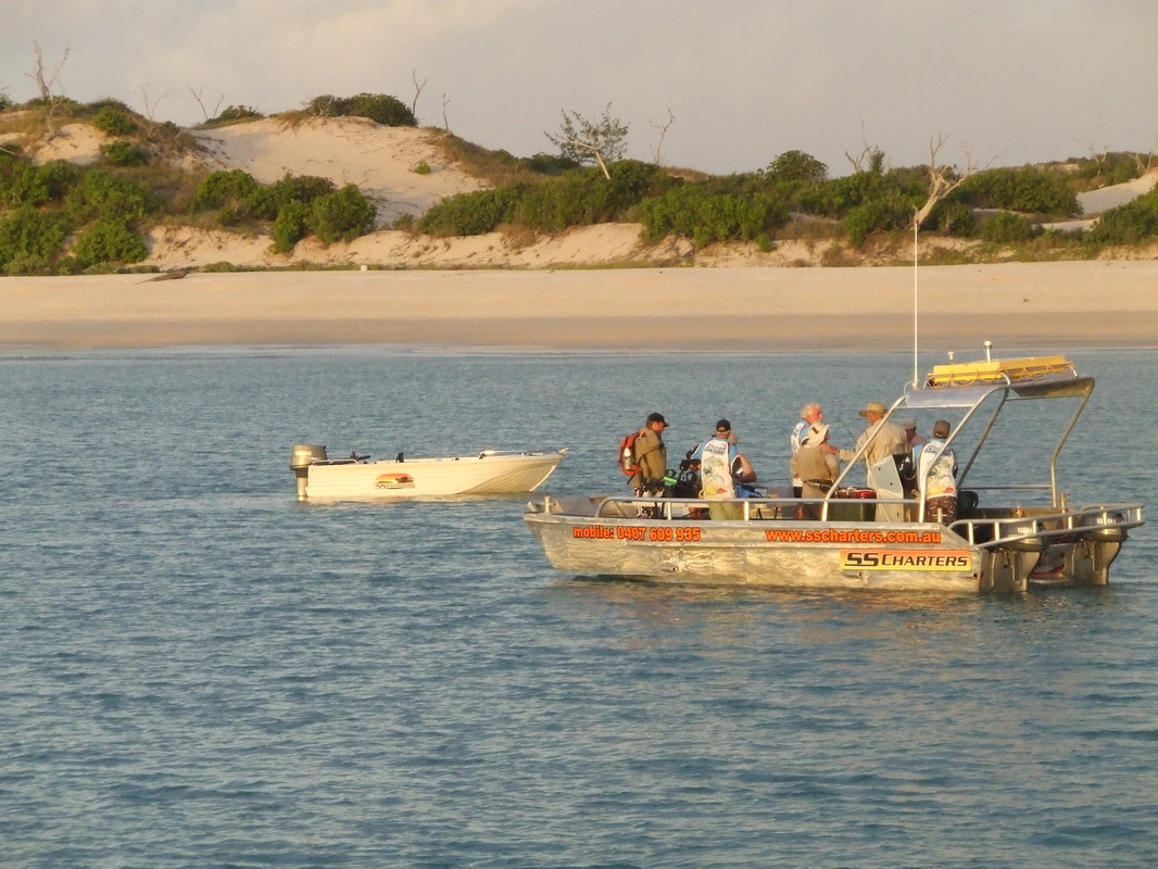
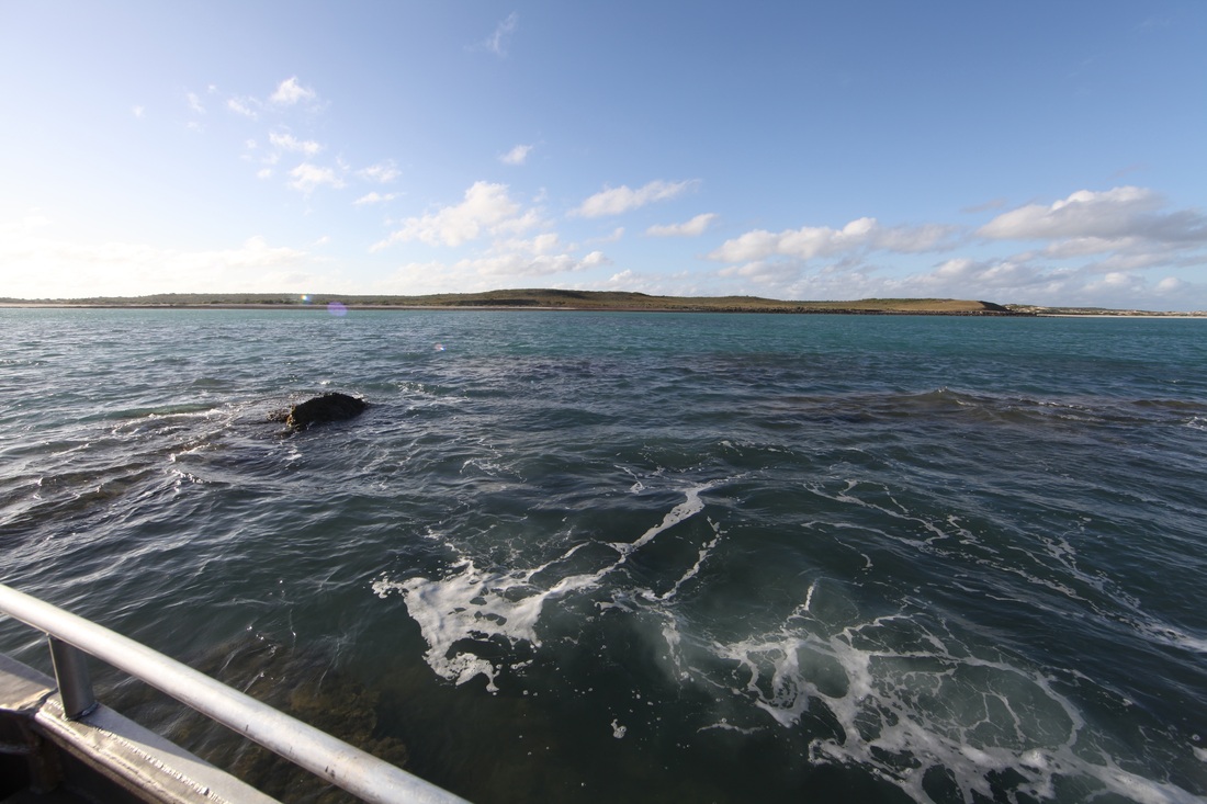
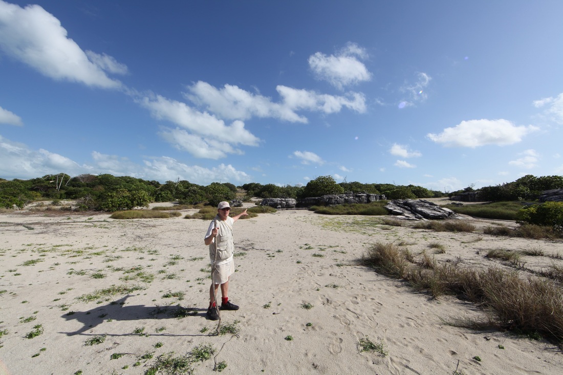
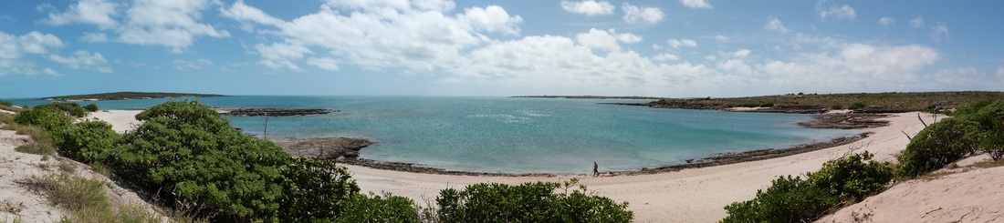
Leaving the calm of Melville Bay in the Hama Pearl II - for a tempestuous overnight passage to the Wessel islands.
Day 3 - Jensen Bay
Itinerary Day Three: Seven Men for Seven Days in the Wessels - We sailed overnight with the SS Charters vessel Hama Pearl II to awaken at Jensen Bay.
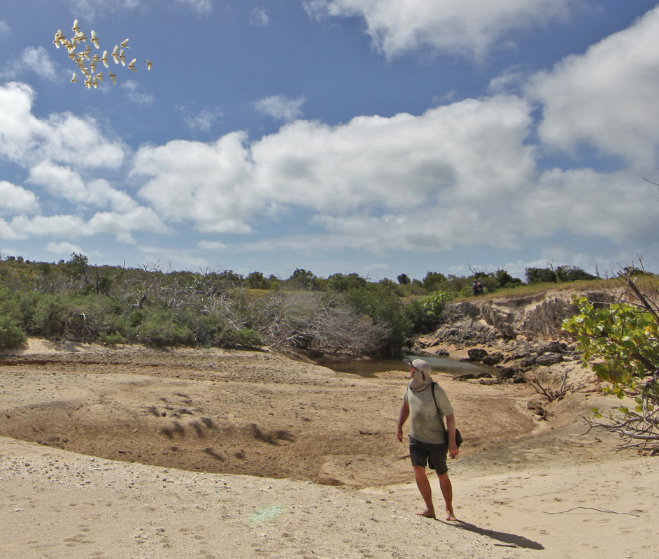
Dawn over Djinjan on Marchinbar Island at Jensen Bay - opposite Sphinx Head which is the highest point.
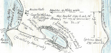
 Detail of Isenberg map - full map below
It had been intended to go through the 'Hole in the Wall' the Gulgari Rip which is a very narrow channel through Guluwuru Island famous for the current which turns on a switch and wherein a 70' trawler was spun around and dumped. It was too rough to enter the rip which necessitated backtracking out half way to the English Company Islands then south around the bottom of the Wessels and back up the sheltered western side.
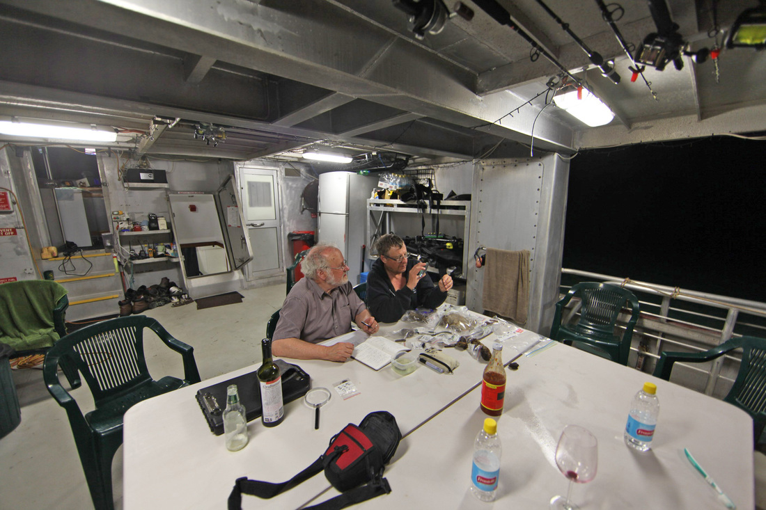
A very long night for the crew and Barry Johnson who stayed up for most of the drama but for others devoted to the tender medication of Dr. Walker - we awoke early and refreshed to venture onto the silent deck and witness the long looked for dawn over Djinjan. There are several 'treasure' maps, a couple drawn by RAAF surveyor Wyndham Richardson and others but this was the spot marked by Morrie Isenberg whilst assisted by Dr. Bill Mira, the numismatist who first identified the coins. Despite doubts raised by the memory's decay down the years and Morrie's fleeting deployment on 'Wessel Island' - this was the only site identified by the man who found the coins - it had to be our principal target. The circle describes the highest point - Sphinx Head - the logical place to put a radar unit - but we were dealing with the military mind.
A very long night for the crew and Barry Johnson who stayed up for most of the drama but for others devoted to the tender medication of Dr. Walker - we awoke early and refreshed to venture onto the silent deck and witness the long looked for dawn over Djinjan. There are several 'treasure' maps, a couple drawn by RAAF surveyor Wyndham Richardson and others but this was the spot marked by Morrie Isenberg whilst assisted by Dr. Bill Mira, the numismatist who first identified the coins. Despite doubts raised by the memory's decay down the years and Morrie's fleeting deployment on 'Wessel Island' - this was the only site identified by the man who found the coins - it had to be our principal target. The circle describes the highest point - Sphinx Head - the logical place to put a radar unit - but we were dealing with the military mind.
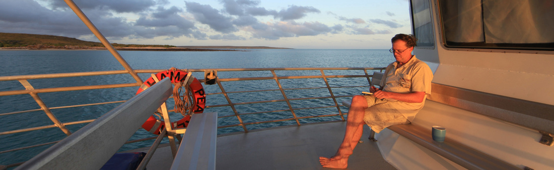
Ian McIntosh diarises his thoughts at the dawning of a long imagined day.
Ian writes: - "I have known about the Kilwa coins mystery since the late 1980s when I lived in the remote Aboriginal community of Galiwin'ku on Elcho Island in north-east Arnhemland. I was working with the traditional owner of the Wessel Islands, the late David Burrumarra M.B.E. on issues of social justice, sea rights & reconciliation. We tried to explain how 900 year old coins from East Africa could end up on a beach in the Wessel Islands over 10,000 kilometres away. These coins were among the first ever produced in sub-Saharan Africa. Only those from the Axumite Empire of Ethiopia, Carthage and Egypt predated them. We toyed with the idea of mounting an expedition but funding proved elusive and it was peripheral to our more politically-driven agenda." Ian's full account is below.
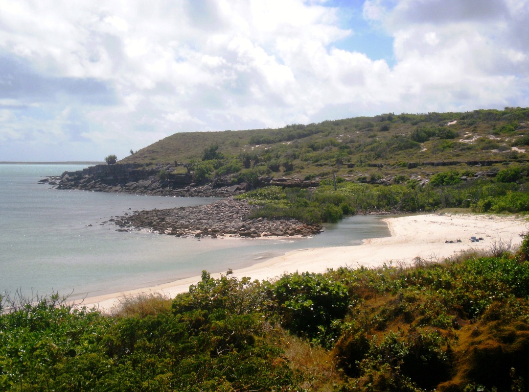
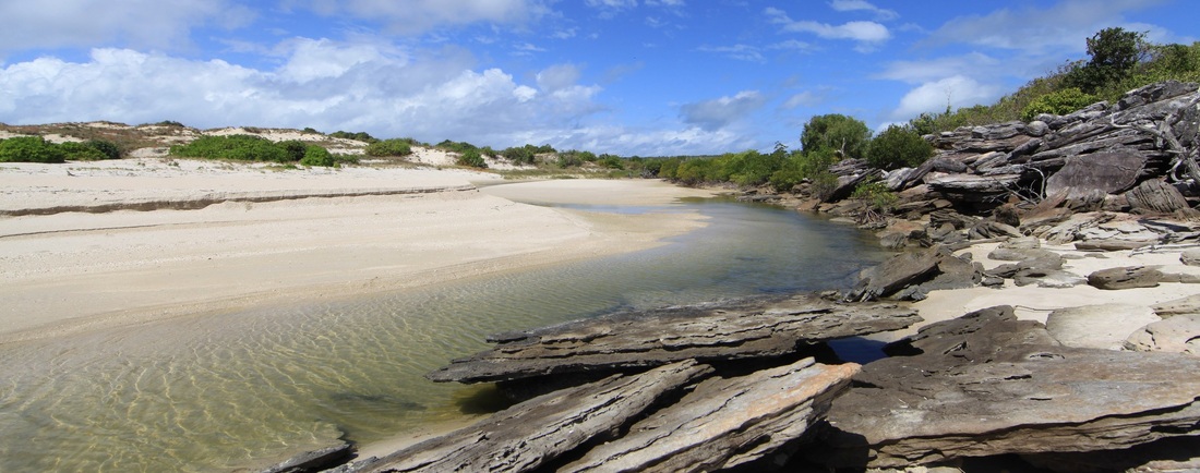
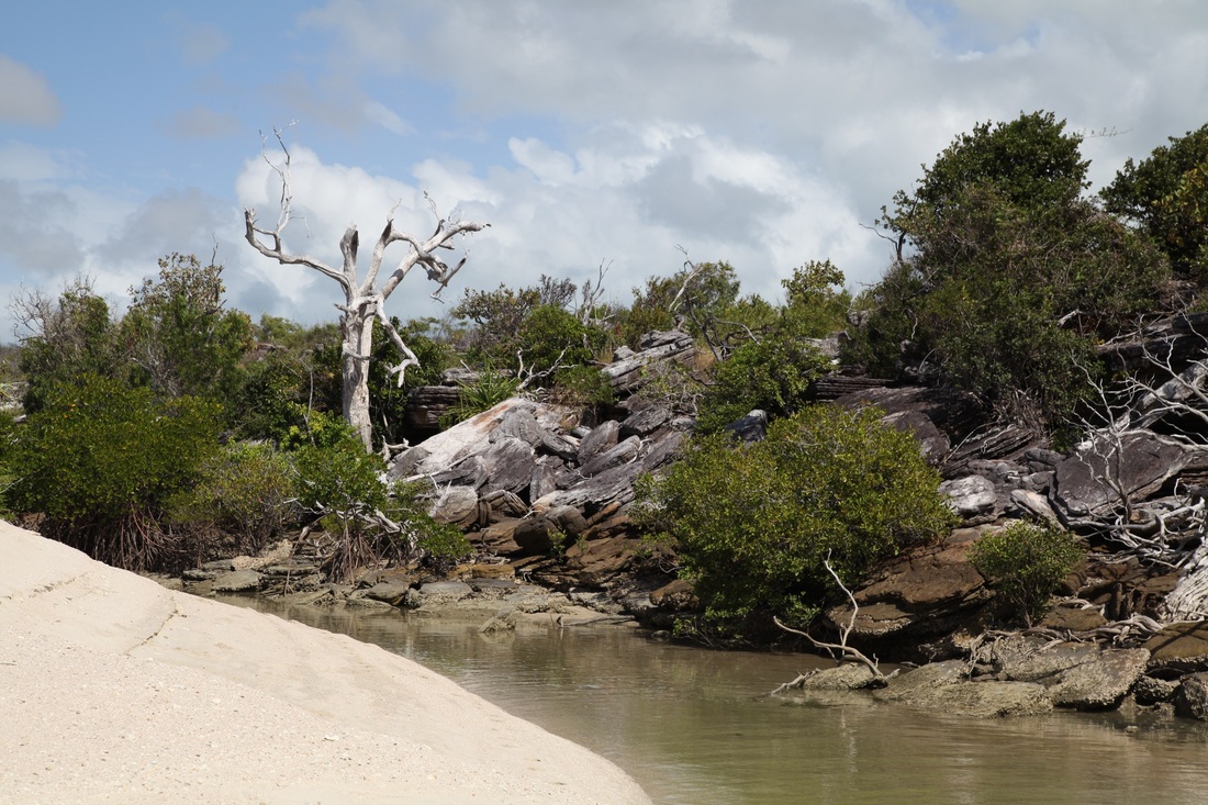
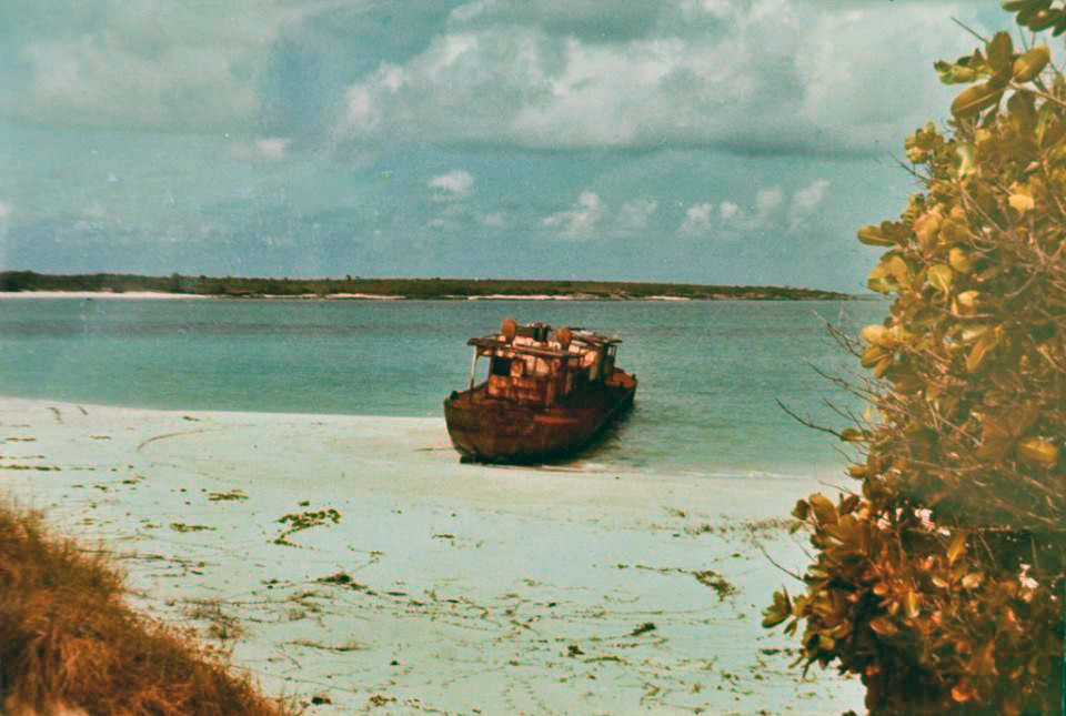
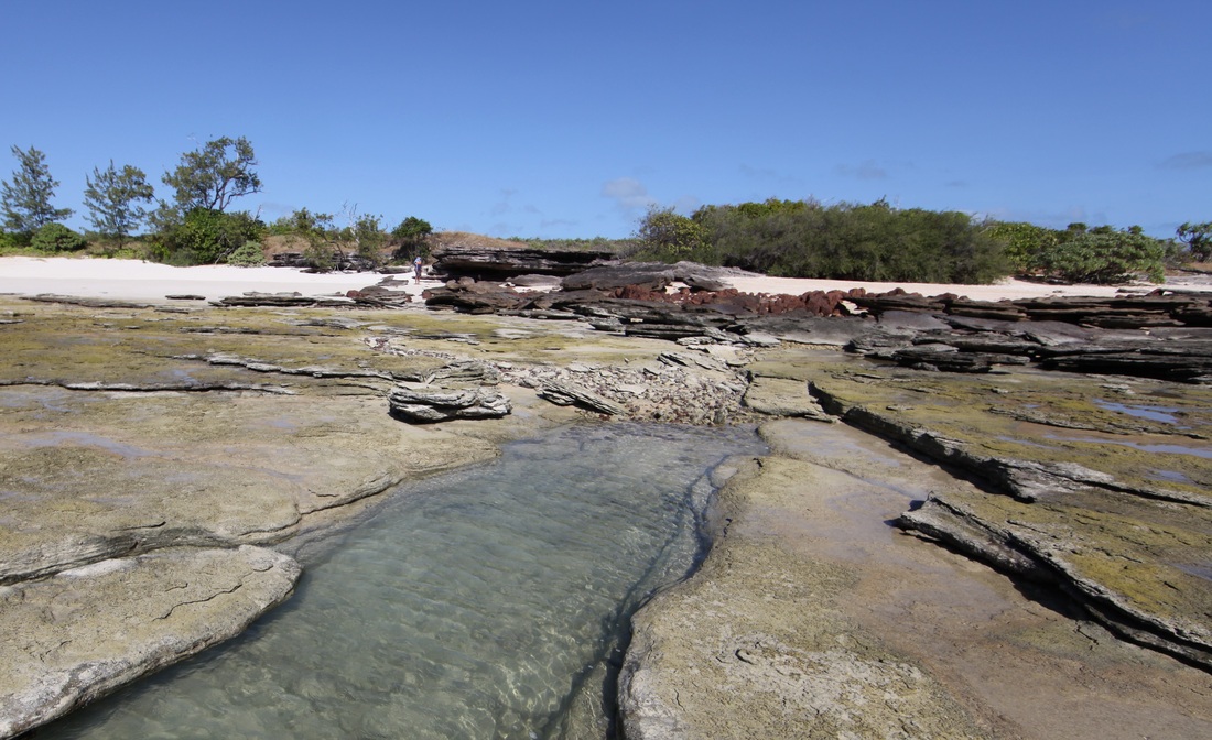
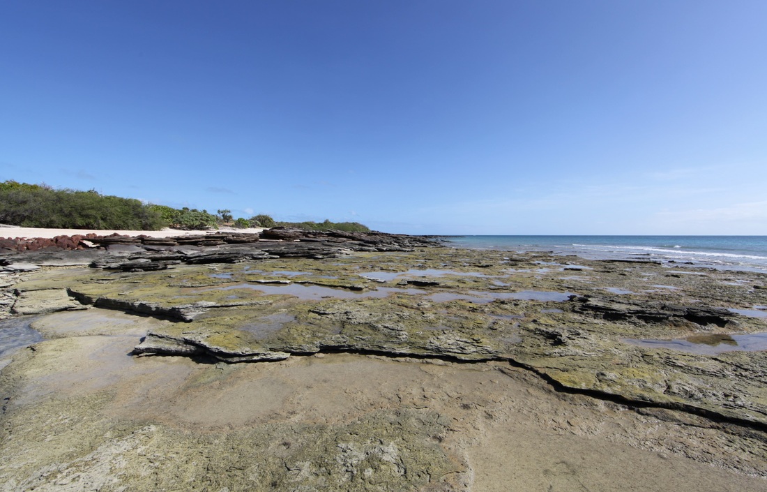
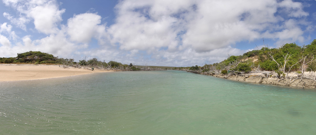
Djinjan - Jensen Bay
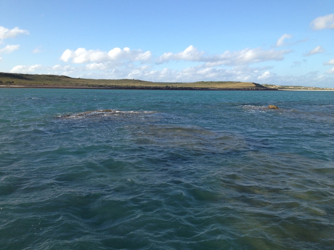
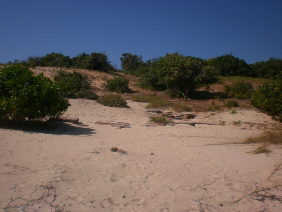
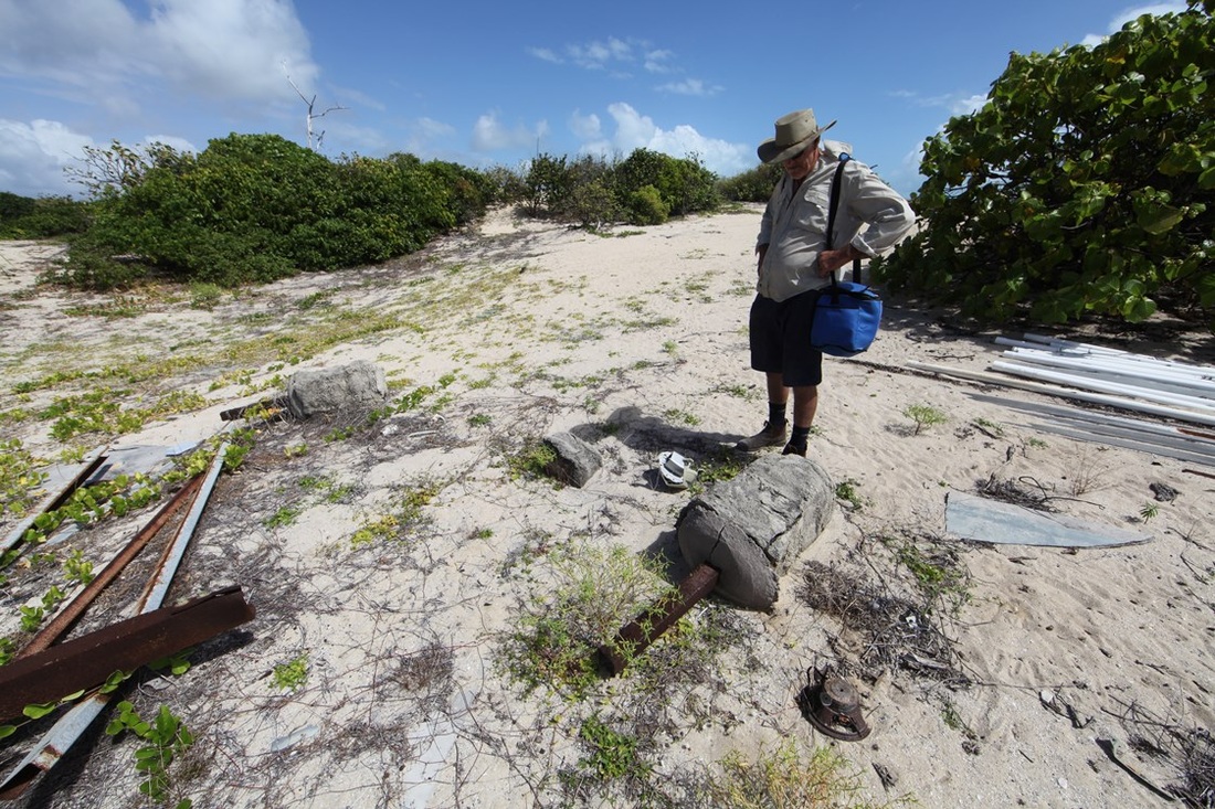
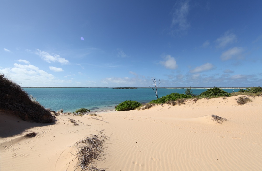
Djinjan - the first of the potential find sites of the ancient coins - possible remains of stone fish trap - looking SW. Shingle in the Wessels.


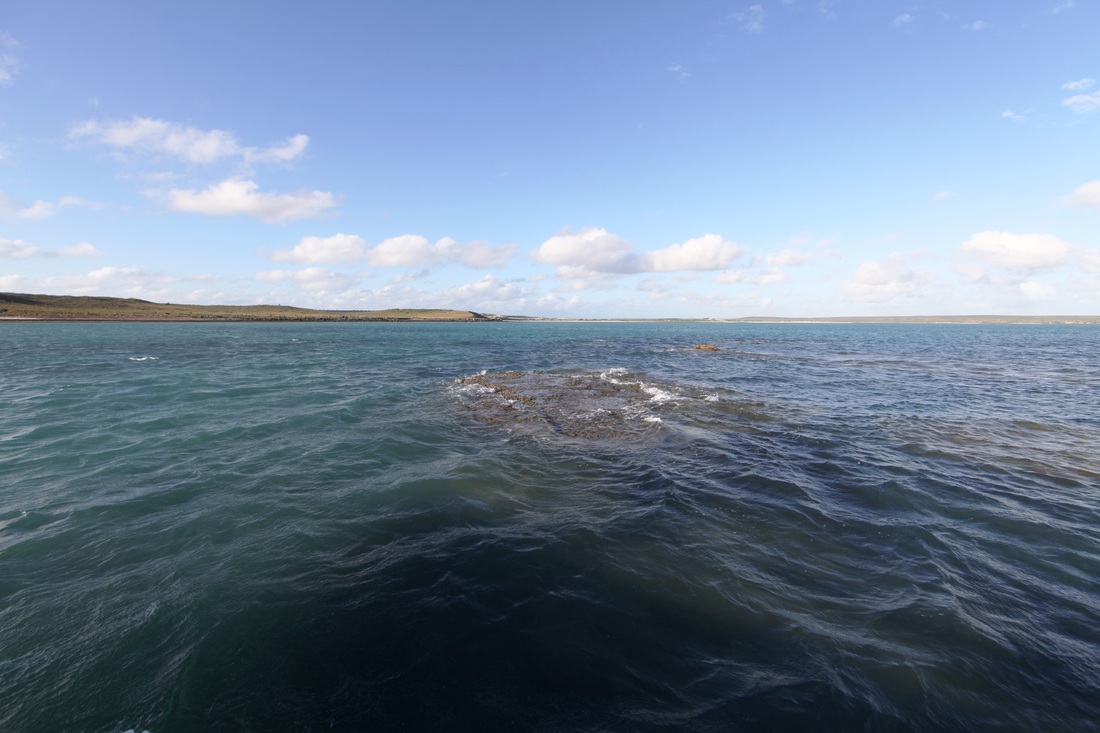
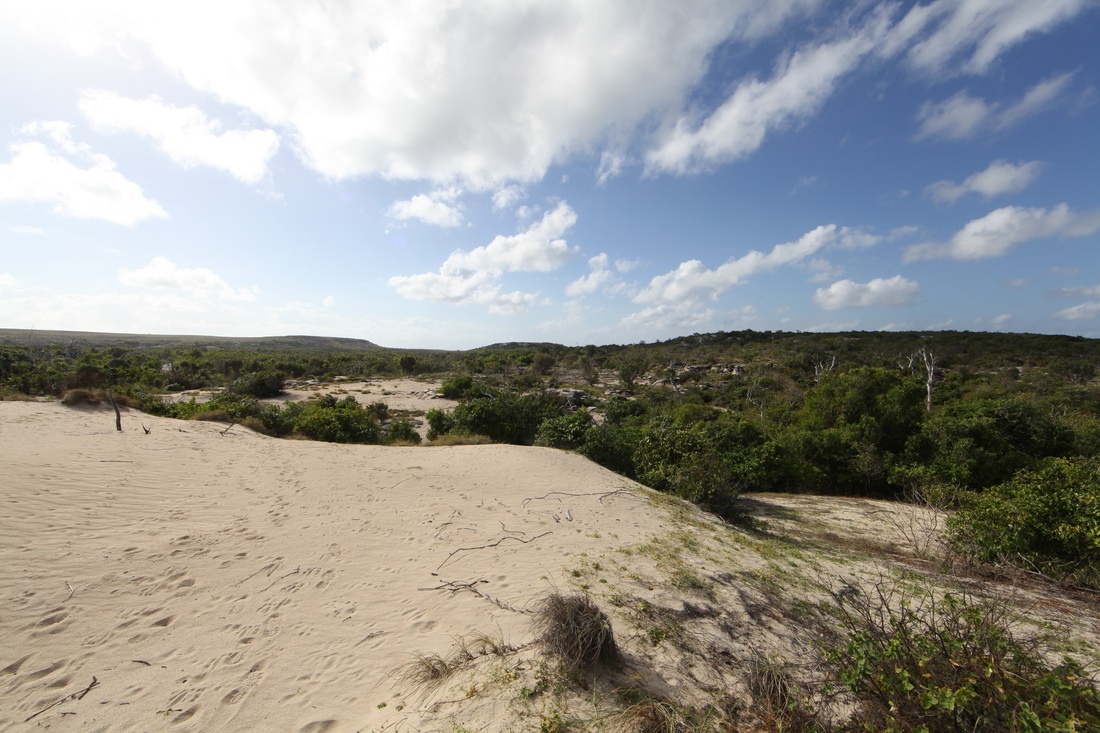
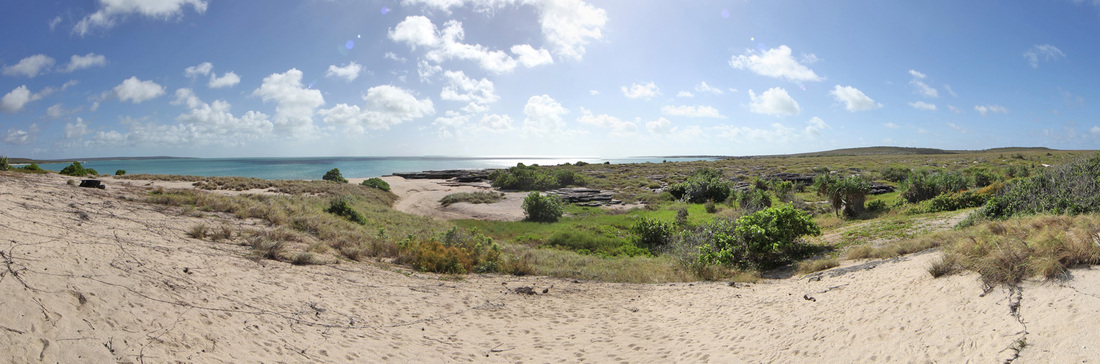
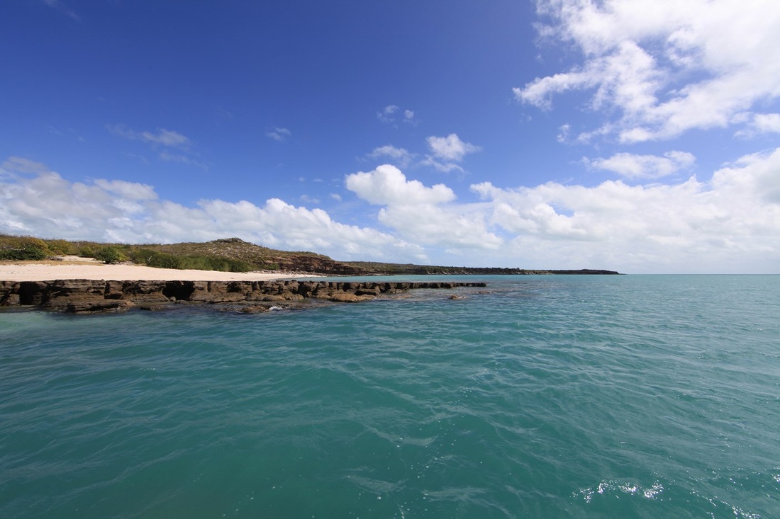
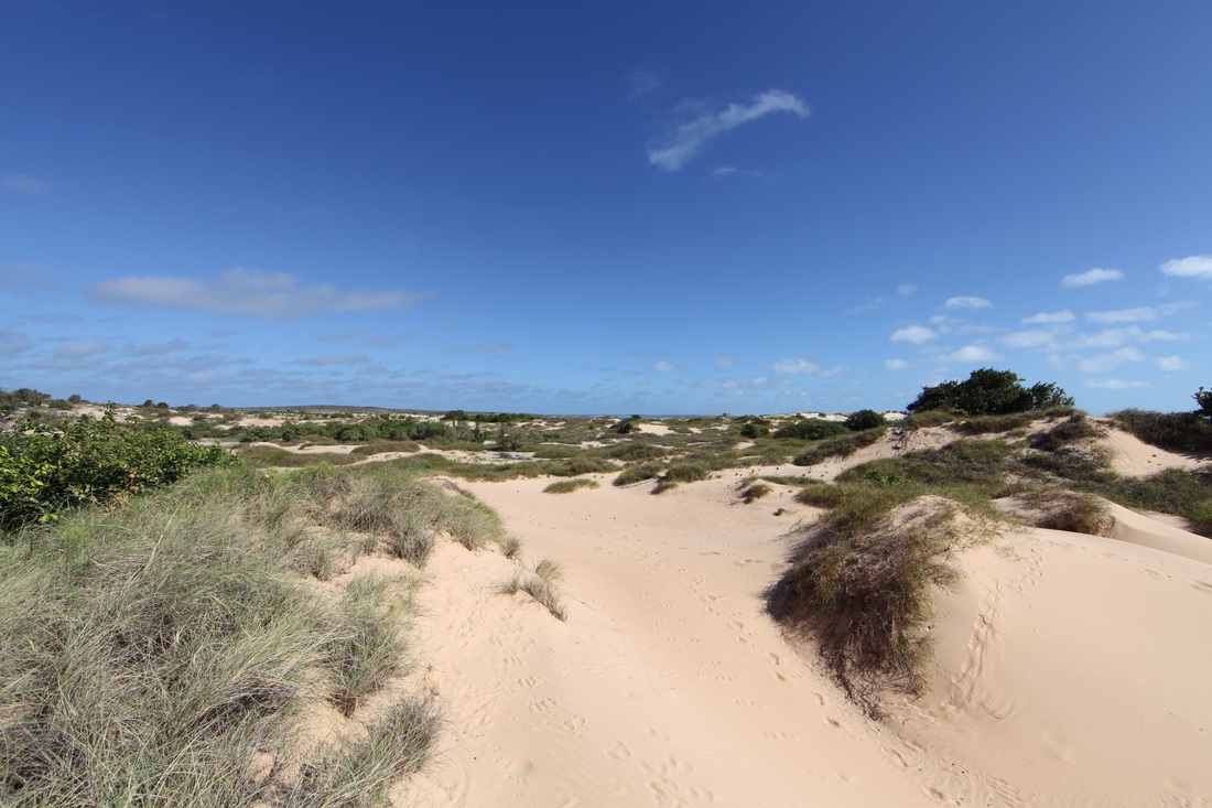
This was an exploratory expedition - most of us have years of experience in the bush and fully appreciate the danger of unrealistic expectation & believing that you actually know what's going on. This remains a wild & largely uncharted area - it is beyond the reach of Coastguards & Customs and dangerous water for yachts, as the only safe anchorage on charts is Jensen Bay where the channel runs towards the highest point of the island. The presence of the permanent freshwater lagoon & low narrow island make an ideal site to await the monsoonal winds to change to the south-east & carry you northwards.
The way station theory of pre-Macassan ships visiting northern Australia holds that vessels were driven south in the search for sandalwood, palm wax and gold as well as to avoid the predations of pirates. Other potential causes include gear failure, desperation or simply the fickle trade winds which swing hesitatingly between the SE Dry & NW Wet seasons. It is generally said that he first Macassan visitors were accidental arrivals.
It is suggested that ships which were unable to point close into the wind would move westerly along the north Australian coast between sites where there is permanent freshwater - sufficient to fill casks - close to the sea. These sites being marked by two old bronze cannon buried breach first in the sand & supporting a long pole - perhaps a flag on it. One pole gets lost in the backdrop but two really stand out and one of the Indonesian camps on Marchinbar that we found further up the island was marked by two poles. Hence the pairs of guns at Carronade Island - Dundee Beach & Port Darwin. Processing along the coast you must arrive at Jensen Bay - when the wind finally shifts around to the SE you merely need to lift the anchor to be on your way north to the Spice Islands, Tanimbar, Aru, Sulawesi, the Philippines and beyond. More than possible - this scenario is all but unavoidable.


Shifting camp on sunset - the low profile shows the need for Native Pilots such as Too Dark & Paddy Babawun
Day Four
Itinerary Day Four: Having shifted around the bluff we were visited during the evening by 12ft of ocean going gecko - crocodylus porosus.
Sunrise over lake Ngu'ngiw at Jensen Bay - to the right the land rises to Sphinx Head - to the left the level is the mission airstrip and then two hills.
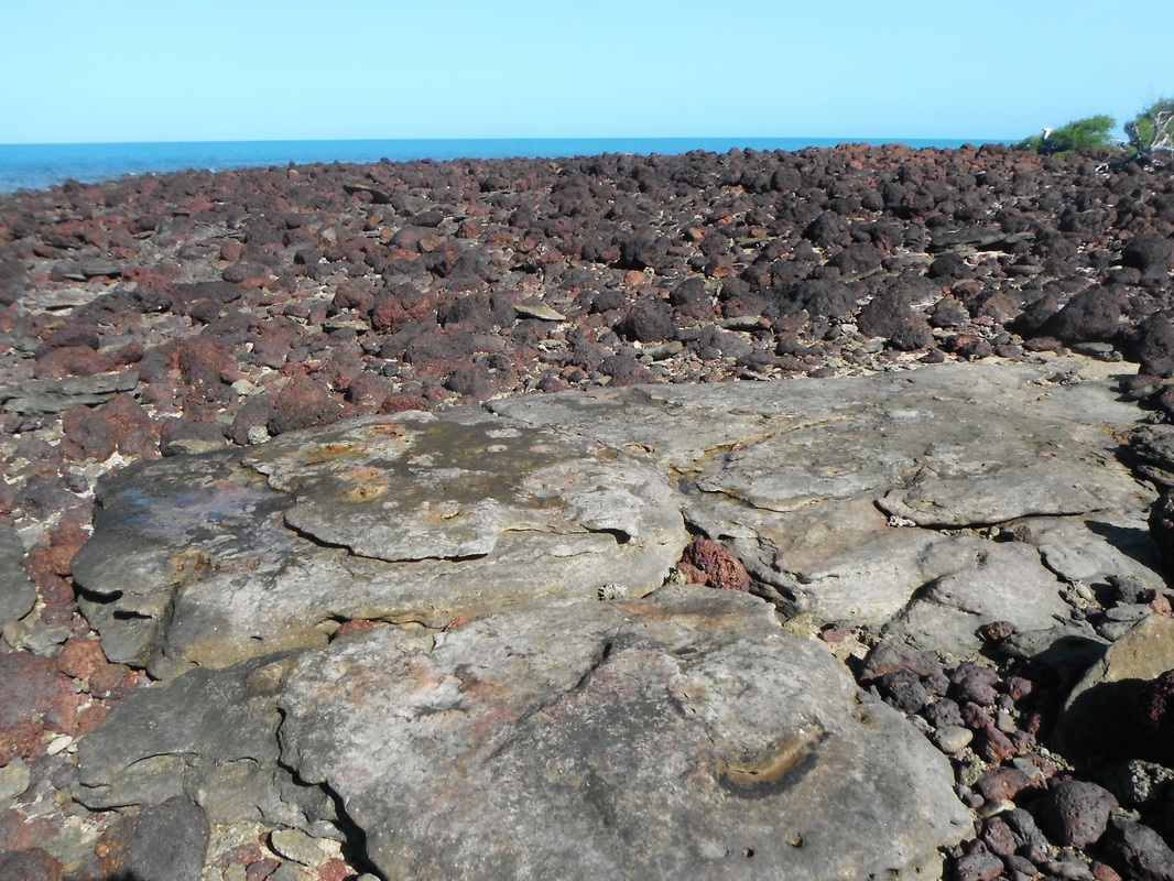
Rocks Awash
 Detail of surveyor Richardson's map - see full map below
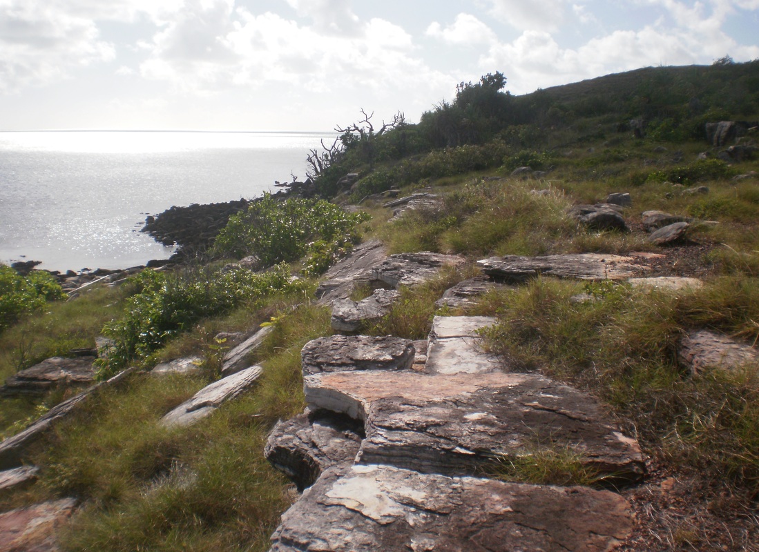
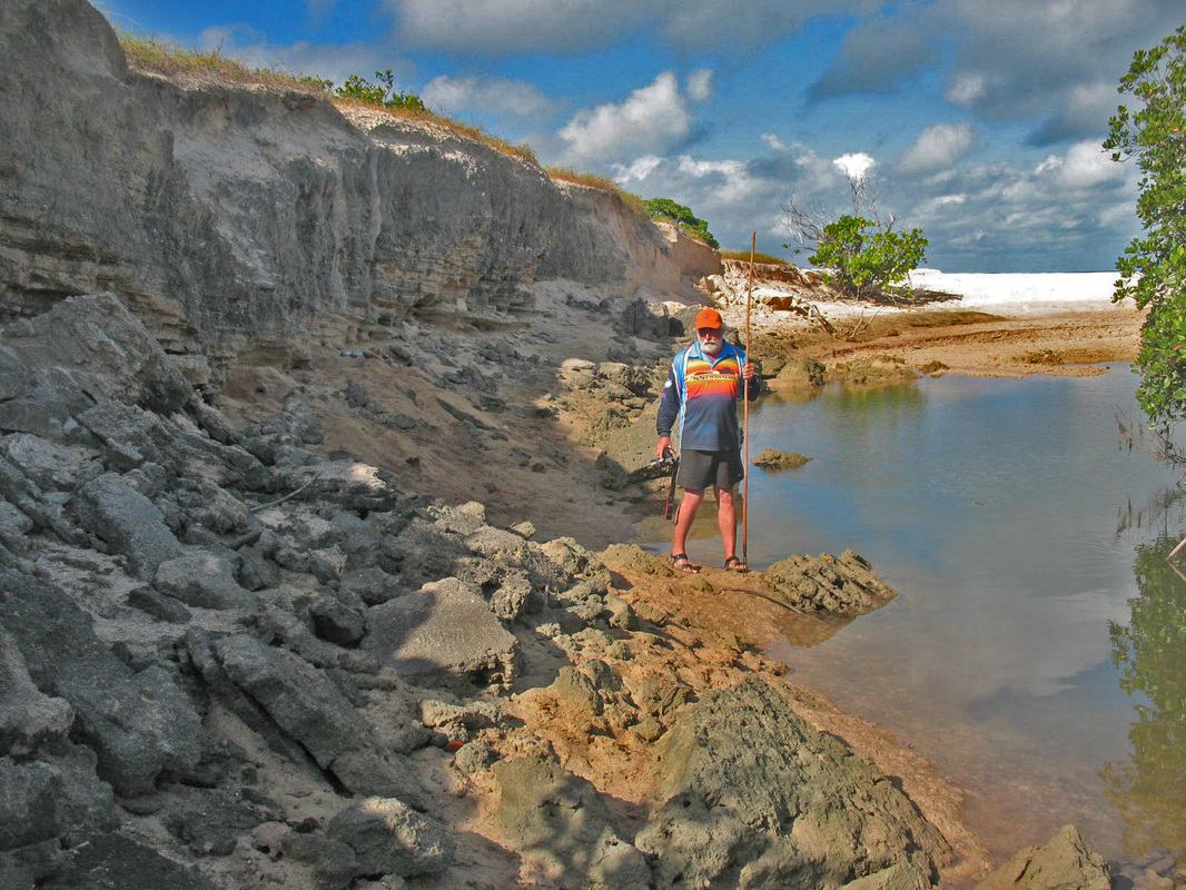
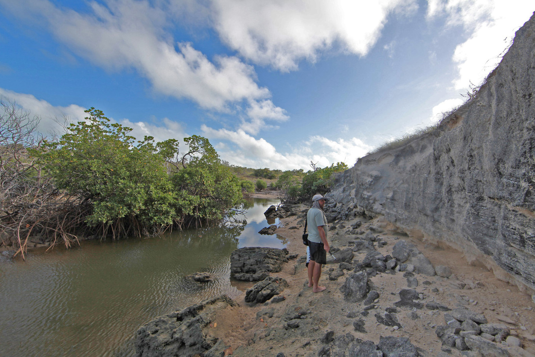
This is Rocks Awash on Wyndham Richardson's 1943 drawings, Margaret Reef on miners' maps of the fifies. It is a genuine widow-maker, protruding half a kilometre seaward - not from the point as might be expected - and bisecting at right-angles the fierce 4 knot south-running current.
The nature of the sandstone makes it erode in what Tim Stone describes as a 'block of chocolate' segmented formation and the absence or otherwise of silica will allow weaker segments to erode away entirely without disturbing those around it. In a reef this erosion creates pillars and voids like lift shafts - once something falls in there it stays there. Confounders include -the island is less than one mile wide at this point not four & Japanee Ck. is 15 miles south.
The nature of the sandstone makes it erode in what Tim Stone describes as a 'block of chocolate' segmented formation and the absence or otherwise of silica will allow weaker segments to erode away entirely without disturbing those around it. In a reef this erosion creates pillars and voids like lift shafts - once something falls in there it stays there. Confounders include -the island is less than one mile wide at this point not four & Japanee Ck. is 15 miles south.


One theory of coin deposition from multiple wrecks envisages the lightest objects (little coins) being winnowed out of the wreck and the reef - carried down the coast by the current and towards the beach by on-shore wave action. Objects will gather at the high energy (rocky) ends of the beach, as opposed to the low energy (sandy) middle of the beach. The nature of the sandstone and build up of washboard-like Chenier beach ridges persuade the creeks to form at the ends of the beach - these progressively hollow out the sandstone to form hooks like the handles of a trophy - these in turn erode to form two islands. This repetition of erosion creates mapping confounders as Two Island Bay, Trafalgar Bay, Two Isle Bay and Burston Bay - each has two islands.
The geological picture is compounded by the phenomenon of 'land rise' whereby at the edge of tectonic plates, such as at the Wessels, pressure builds up from collision with the next plate and the land rises as a consequence of this flexing. Tim Stone describes this as Hydro-isostatic Rebound such as when the land bounces back with the removal of the weight of glacial ice after an ice age - e.g. 20,000 years ago when the sea was 150 metres below current levels - the loss of ice saw land rise of 150 metres in northern Europe.
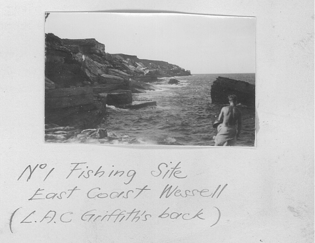
Thus the sea rises through the melt water but the land also rises and the result is relative sea level. Tim believes that this could be as recent as a thousand years ago in the Wessels & accounts for stranded beaches such as the one in the Google Earth image below. The geology is explored in more detail at the page entitled OSL Beach Dating http://www.pastmasters.org.au/osl-beach-dating.html and at the Pictorial History of Elcho Island http://www.pastmasters.org.au/elcho-island---a-pictorial-history.html - Conversely the resilience of the coast is exemplified in a series of images taken over 70 years of the beach south of Marchinbar where the survivors of the bombing of HMAS Patricia Cam landed & where stoker Percy Cameron and native coastwatcher Gitjbapuy Wanambi lie buried undisturbed to this day. http://www.pastmasters.org.au/hmas-patricia-cam.html images at bottom of page.
The geological picture is compounded by the phenomenon of 'land rise' whereby at the edge of tectonic plates, such as at the Wessels, pressure builds up from collision with the next plate and the land rises as a consequence of this flexing. Tim Stone describes this as Hydro-isostatic Rebound such as when the land bounces back with the removal of the weight of glacial ice after an ice age - e.g. 20,000 years ago when the sea was 150 metres below current levels - the loss of ice saw land rise of 150 metres in northern Europe.
Thus the sea rises through the melt water but the land also rises and the result is relative sea level. Tim believes that this could be as recent as a thousand years ago in the Wessels & accounts for stranded beaches such as the one in the Google Earth image below. The geology is explored in more detail at the page entitled OSL Beach Dating http://www.pastmasters.org.au/osl-beach-dating.html and at the Pictorial History of Elcho Island http://www.pastmasters.org.au/elcho-island---a-pictorial-history.html - Conversely the resilience of the coast is exemplified in a series of images taken over 70 years of the beach south of Marchinbar where the survivors of the bombing of HMAS Patricia Cam landed & where stoker Percy Cameron and native coastwatcher Gitjbapuy Wanambi lie buried undisturbed to this day. http://www.pastmasters.org.au/hmas-patricia-cam.html images at bottom of page.


Jensen Bay Coast
The dead trees recall Cyclone Monica April 2006 - beautiful but bitterly hard land.
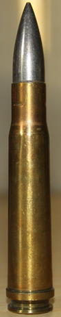
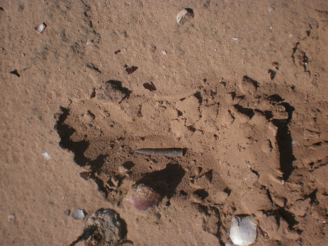
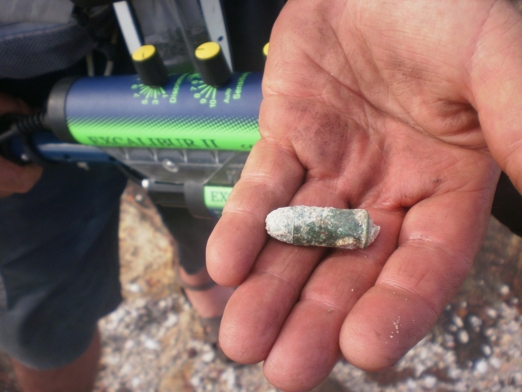
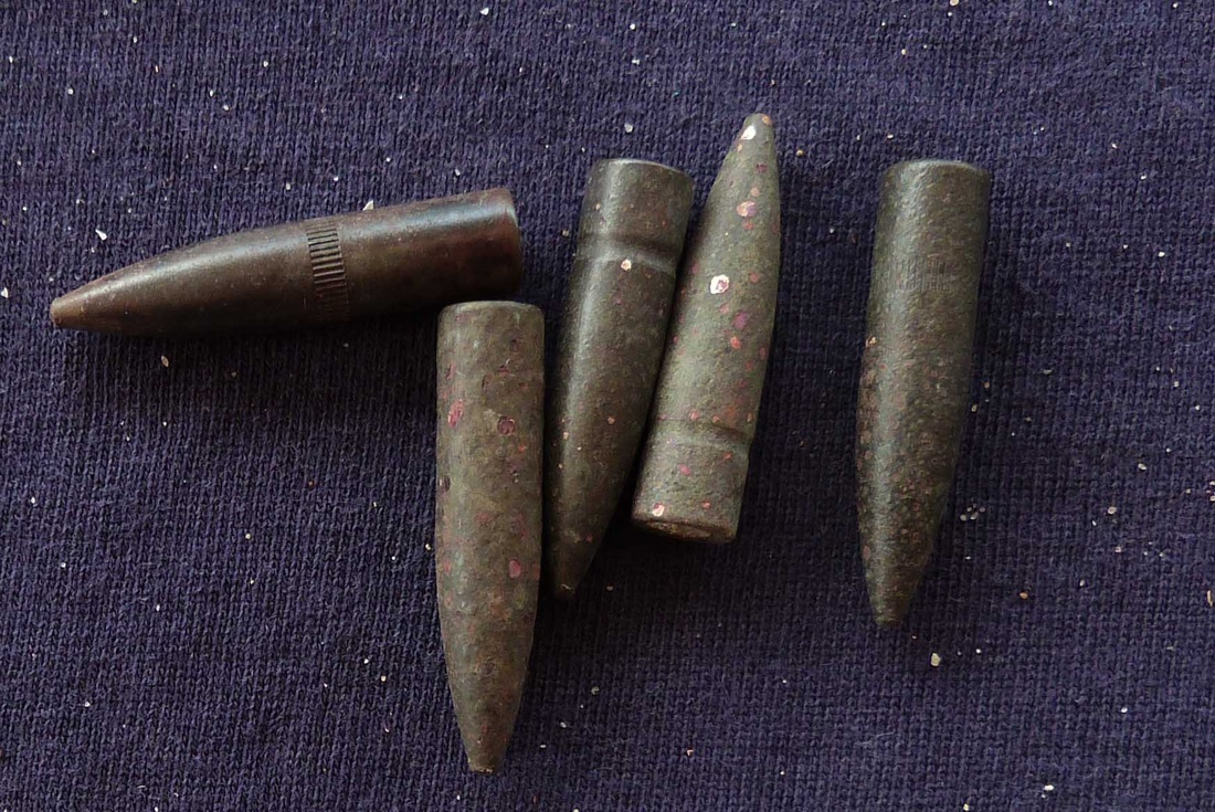
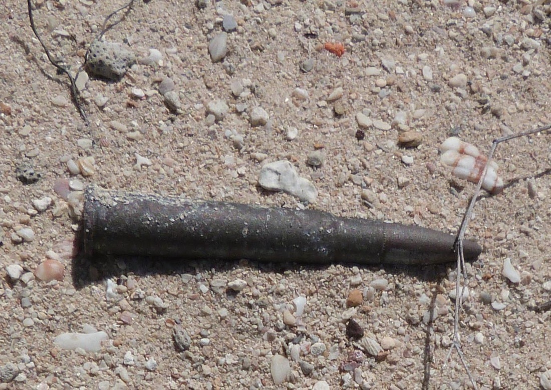
The sandy beaches are etched with the tracks of the little wallabies, birds and pre-handbag wildlife. The bay is shallow and bommies abound. The central image below shows a well formed gun emplacement, possibly with anti-aircraft capacity when landing stores but more probably used in the role of defence against attack by submarine as indicated by another of Bob Sheppard's finds, a Boys Rifle cartridge. This site would make a useful dig as a rare example of this type of defensive position in a contested war zone in Australia (outside of Canberra).

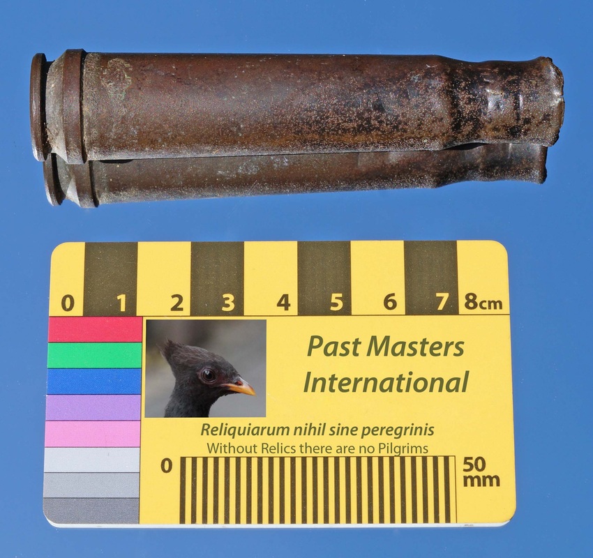
The Boys Rifle was a .50 calibre cartridge flared to take a .55 round for use against lightly armoured vehicles - putting it kindly - they had a ferocious kick & would leap alarmingly to the hazard of friend and foe alike.
The .55 Boys (13.9 x 99mm) is an anti-tank
cartridge used by the United Kingdom & Commonwealth forces in World War II.
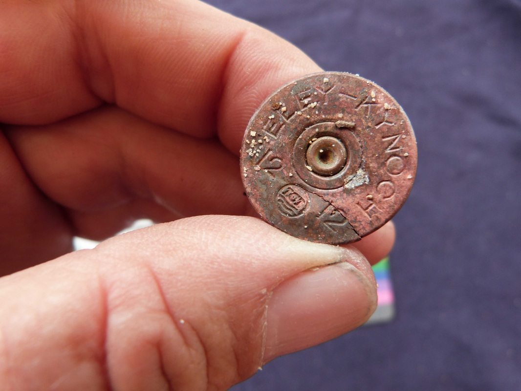
It was only used in the Boys Rifle. The ammunition
manufacturer was Kynoch 1942 WII (MkII).
Some bright spark managed to neck shoot a German Biber Class midget submarine in a canal in Belgium during WWII, puncturing the hulls below the conning tower and sending her to the bottom. On the strength of this the Boys Rifle was deployed against Japanese submarines which were known to operate in the area and probably supplied the Jake flying boats which bombed the SS Period & Macumba and sank the Maroubra and Patricia Cam during WWII. The additional pressure on the cartridge case resulted in a reinforcing band being added at he base to help future archaeologists identify finds.
Some bright spark managed to neck shoot a German Biber Class midget submarine in a canal in Belgium during WWII, puncturing the hulls below the conning tower and sending her to the bottom. On the strength of this the Boys Rifle was deployed against Japanese submarines which were known to operate in the area and probably supplied the Jake flying boats which bombed the SS Period & Macumba and sank the Maroubra and Patricia Cam during WWII. The additional pressure on the cartridge case resulted in a reinforcing band being added at he base to help future archaeologists identify finds.


Jensen Bay Inland
Looking east with the lagoon in the centre and the land rising steadily to the cliff on the shoreline.


Jensen Bay Lagoon
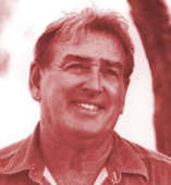
Jack Jensen's Camp
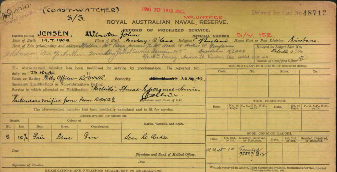
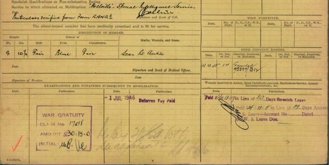
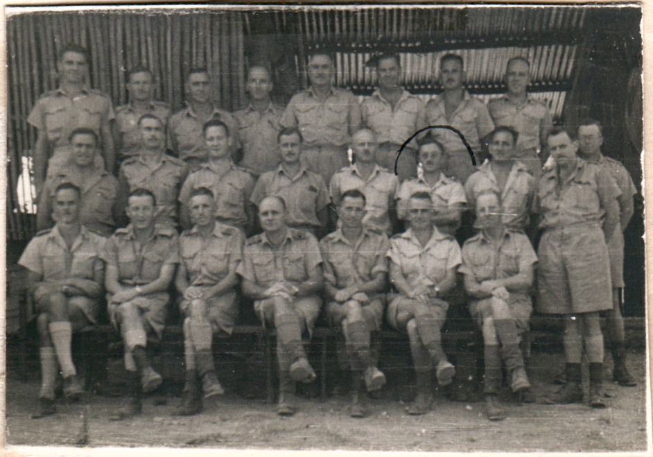
Winston John Jensen volunteered in 1939 joining up with the RANR at HMAS Melville Secret Intelligence Service in Darwin - the forerunner of HMAS Coonawarra today. This was a secret establishment eavesdropping on enemy communications in the Asia-Pacific area. SIS was the forerunner of MI6 national security operations and named not for Lord Melville of the Tiwi Islands & Gove harbour but for the inaugural chief of the British Secret Service William Melville - the 'M' in the bond films. Jack Jensen was appointed Protector of Aborigines in 1939 and began his lonely posting on Marchinbar Island that was to last throughout the war. He worked in New Guinea and returned to Jensen's Bay as caretaker of the Sphinx Head Mine which is where he met Cadet Patrol Officer and fellow Protector Ted Egan in 1953. Jack was a highly intelligent man who won all the quiz nights at HMAS Coonawarra in Darwin where he is believed to have ended his days. Any information on this man's extraordinary life and family would be gratefully received as he is a real Territorian and deserves to be celebrated.
Looking NNW from PO Jack (Winston John) Jensen's camp - Teacher, Special Intelligence Services Coastwatcher, Protector of Aborigines, Mine caretaker - unsung hero.
Jack Jensen was instrumental in saving the lives of the 14 survivors of the bombing of HMAS Patricia Cam some 25 miles south of Jensen Bay. Daily reconnaissance flights out of Horn Island looking for the Japanese invasion fleet passed over Jack's coastwatch station. Their triangular track brought them back from north of the TIWI Islands across Cape Wessel. Jensen frantically carved messages in the sand and was gesticulating violently at 11:00 when spotted by RAAF Beaufort A9-108 piloted by PO Len Gairns came over in a low level pass. Gairns wrote "I saw this bearded white man on the beach, waving furiously. He looked like Moses. He was not a sailor; I never learned who he was". It was Petty Officer Jack Jensen - Coastwatcher - Gairns dropped a message & did another circuit whilst Jensen drew an arrow in the sand sending the plane 25 miles southward to find the survivors who had carved PATCAM BOMBED, HAVE WATER & NO FOOD - Gairns dropped the few rations he had on board & another message asking 5 questions. Almost the full story at HMAS Patricia Cam page http://www.pastmasters.org.au/hmas-patricia-cam.html
 Ted Egan - Patrol Officer
Dear Mike - You reminded me that I spent a strange night at Marchinbar with Jack Jensen early 1953. He had telegrammed DENATAFF that he was certain an old blackfellow named Mugadbuy was going to kill him. I was sent on my first (real) bush trip. In appropriate fashion I "proceeded on patrol", taking a box of sandwiches and a cigarette swag, flying in an old Auster charter with Maurie Oliver, one of the famous old pilots of the time. It was a hairy trip. Lots of rain and storms. We landed on the minesite airstrip at Marchinbar and Jack met us, driving a grader of all things. There were about twenty other vehicles in various states of disrepair, although in a couple of cases they had just run out of petrol. Jack had used all the petrol – even the avgas – and was left with a few drums of diesel. Fortunately we had refuelled at Milingimbi.
I thought that the only madman at Jensen Bay was Jack, but he was employed as a "caretaker" by the mining company and he was required to stay there. We all camped on the beach that night – there were only Jack, Mugadbuy, the pilot and me on the entire island. A big croc walked right around our camp during the night. Huge tracks on the beach.
Mugadbuy was happy to agree with me that Milingimbi was a better place for him at the moment, so we took off, dropped him with Edgar Wells at Milingimbi on the way back to Darwin, at great expense to HM Govt. I never saw Jack again. My first job as a Cadet Patrol Officer and Protector of Aborigines was safely accomplished.
Cheers
TE
Jensen Bay South
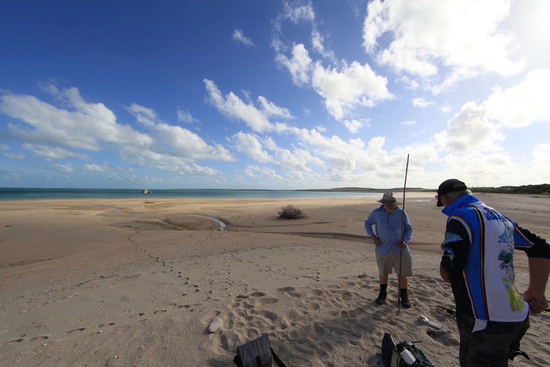
South end of the wider Jensen Bay - Peter Lane snaps away whilst Bob Sheppard relaxes after another mammoth effort. The new Fast Running lures work well.


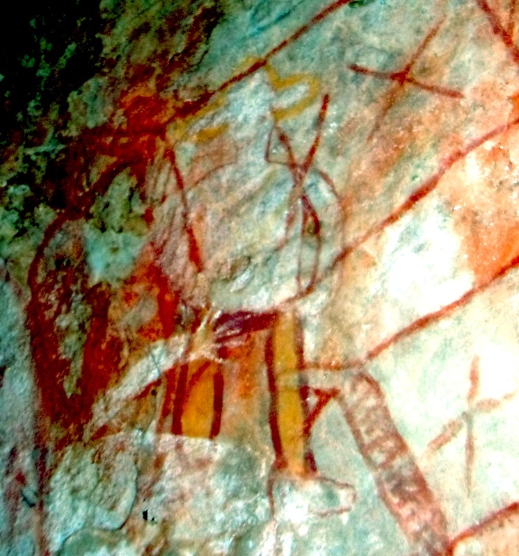
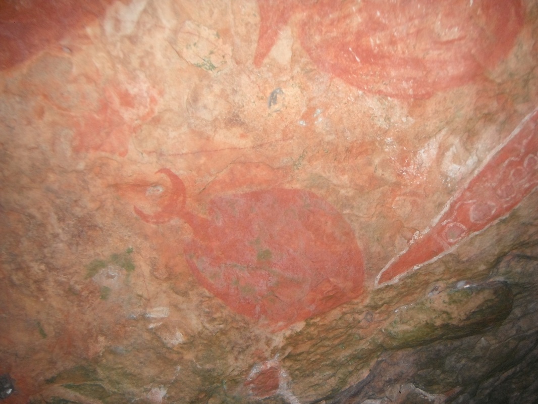
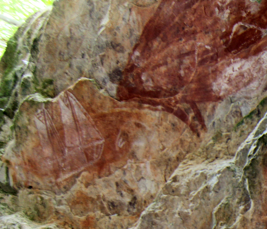
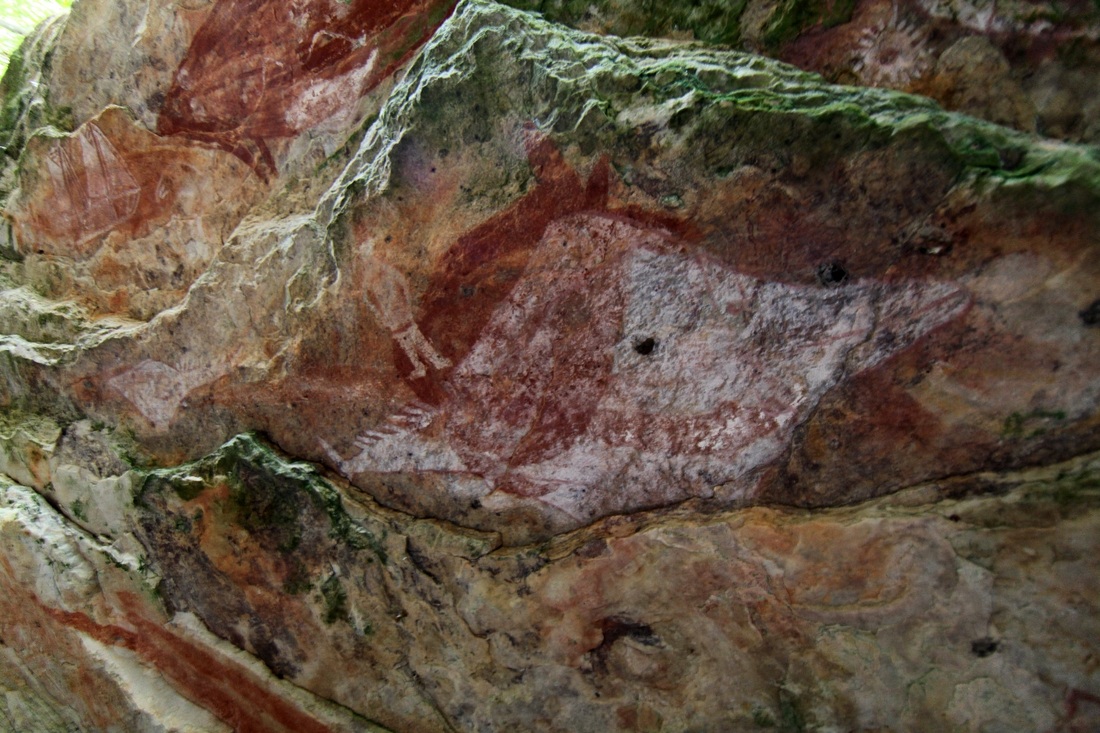
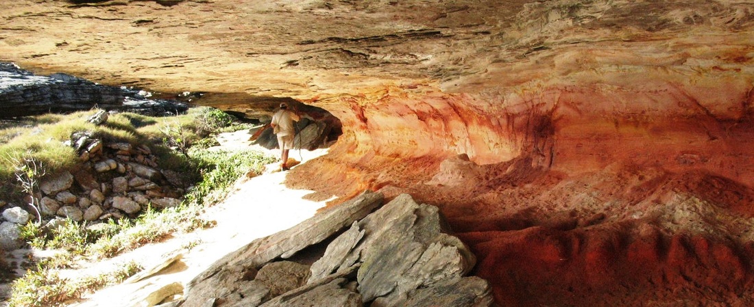
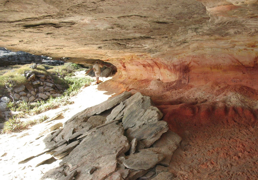
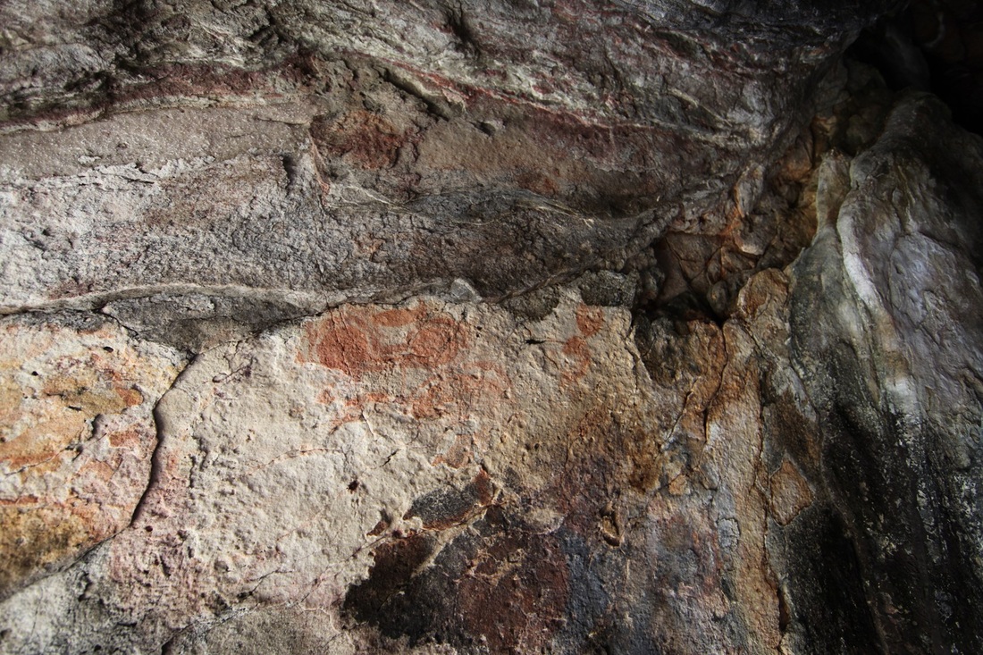
The Cave of the Serpent
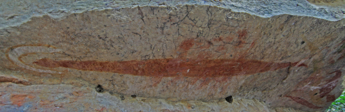
The fork-tailed Rainbow Serpent that inhabits the lagoon.
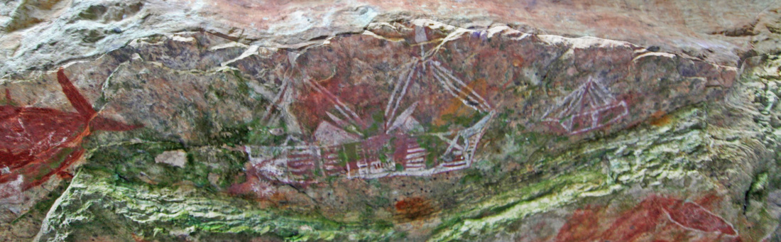
The dedicated steamer with the chrysanthemum prop - the artist must have seen below the waterline when it was turning - perhaps also been inside the vessel.


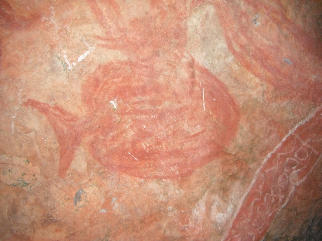
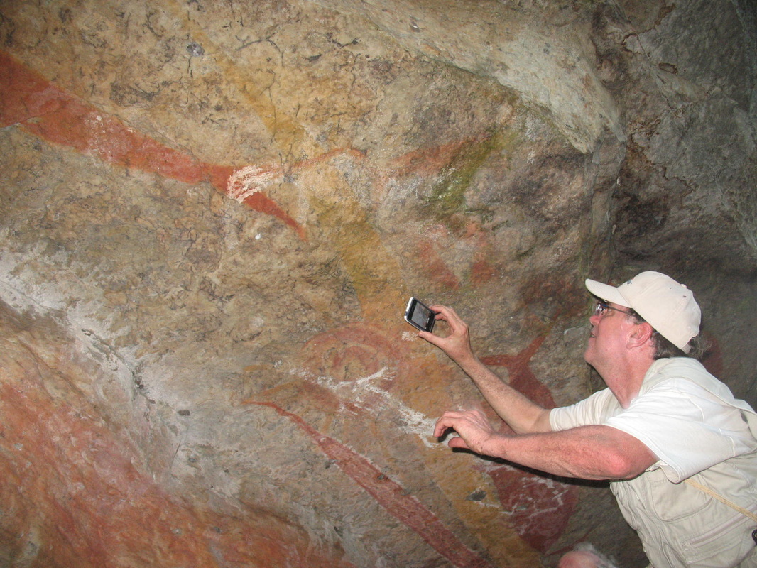


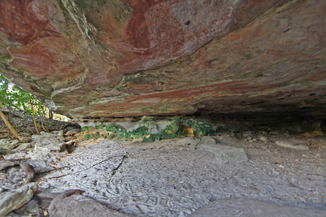

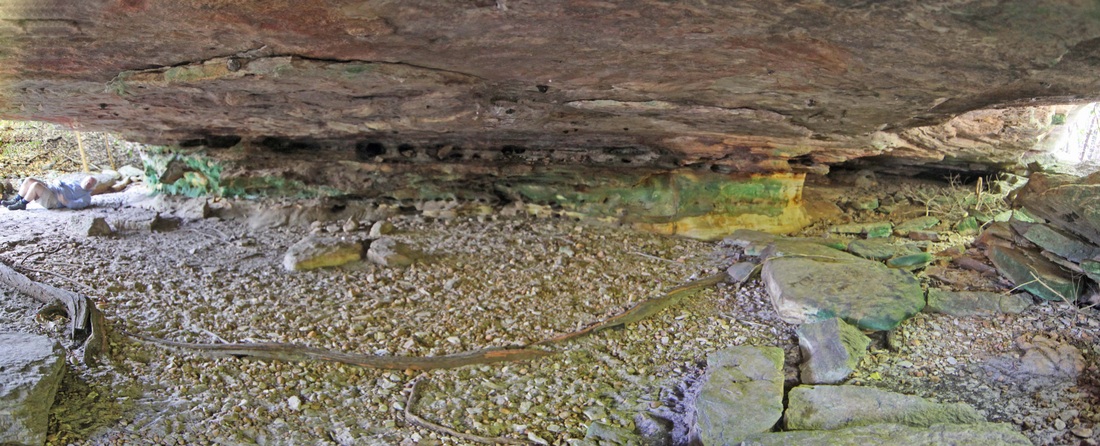
Peter Lane inspects the artwork - it is as if the sandstone sucks moisture from the cave.
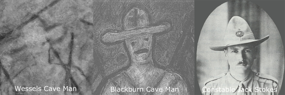
A triptych of the cave painting today - an artist impression from the late 1980's unknowing of Stokes & a picture from The Long Arm by H. Clarke. The cross motif on the shoulder in the cave painting is not a rifle - it is from the superimposed image of a crocodile & is intended to show a solid animal.
Bauxite Miners' Landing stages
This area looks as though it has received a deal of attention from the miners but it is not easy to be sure in this torture terrain.
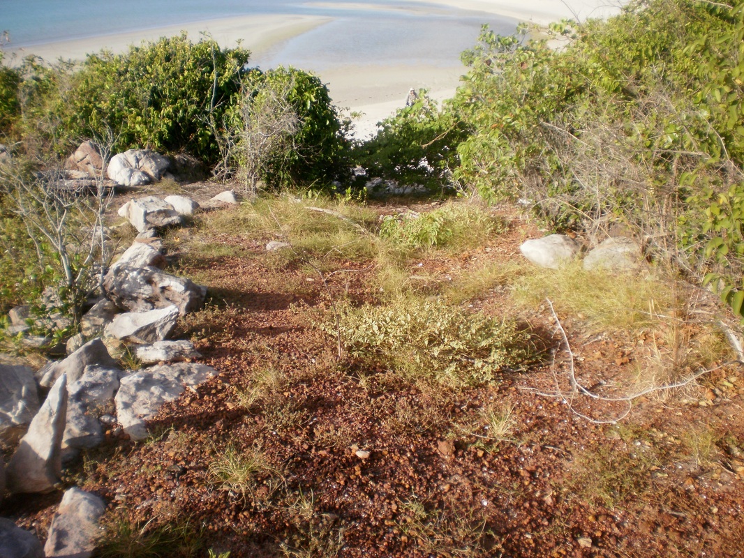

Martjanba Homeland Centre (Dec.)
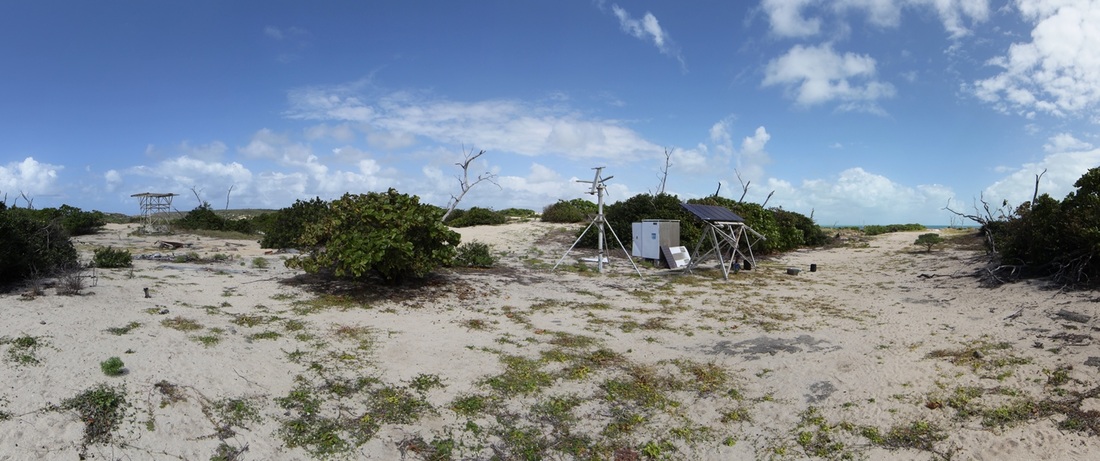
The skeletal remains of water tank - satellite telephone dish - battery box and solar panels.
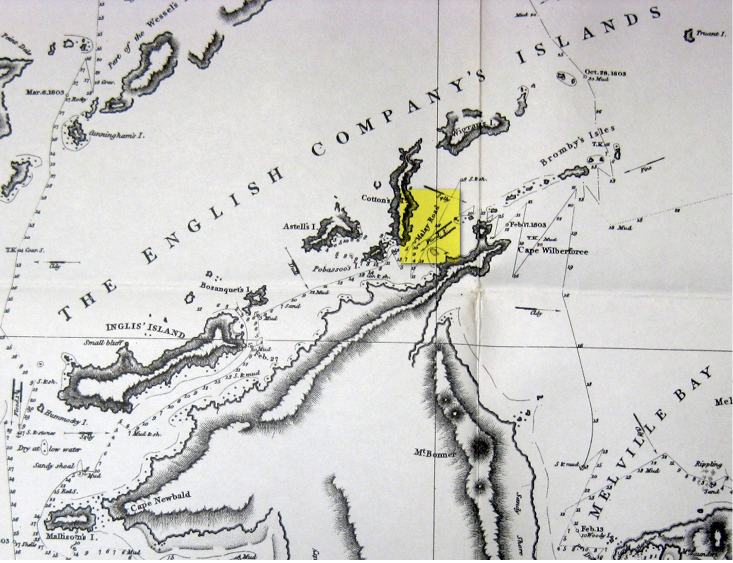 Malay Road on Flinders' chart
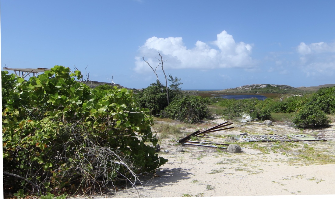
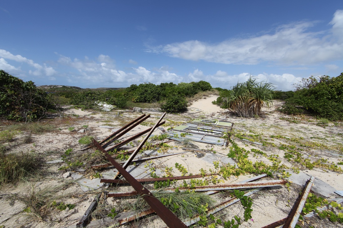
The outstation is gone, the airstrip is used only by drug runners and wildlife poachers and the rivers are netted by Indonesians with their rabid dogs and bilges full of malarial mosquito larvae. The land cries out for the people without whom the culture dies - serious research and guided tourism would need a degree of management, resources and stability that Ranger organisations cannot provide. A National Park encompassing the Wessel & English Company Islands - based adjacent to the existing pearling station around from the historically & culturally unequalled Cape Wilberforce would be required to stabilise a core about which education, employment & cultural survival could develop. All that needed is an cleared airstrip.
The Malay Road National Park would be a focus for international scientific collaboration especially with our SE Asian neighbours and a springboard for economic, cultural and social identity as East Arnhemland opens up from the days of the Missions and the Arnhemland Reserve. It needs vision & yindi rupiah.
The Malay Road National Park would be a focus for international scientific collaboration especially with our SE Asian neighbours and a springboard for economic, cultural and social identity as East Arnhemland opens up from the days of the Missions and the Arnhemland Reserve. It needs vision & yindi rupiah.
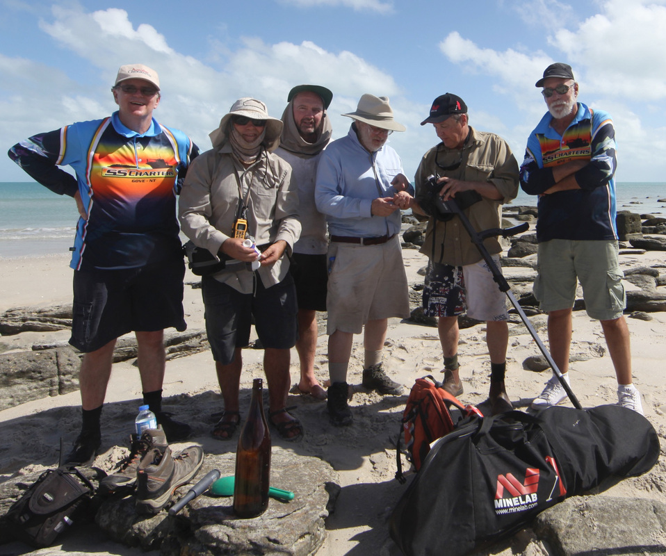
Day Five
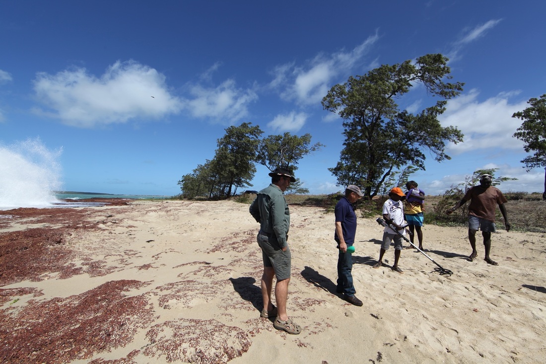
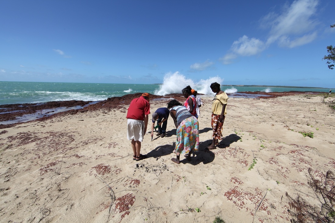
Itinerary Day Five: After reviewing our findings and despite the belief that this was not the right place - it was resolved to hit Djinjan hard then split up - some would go to the Eastern side and some do the western creek mouths.
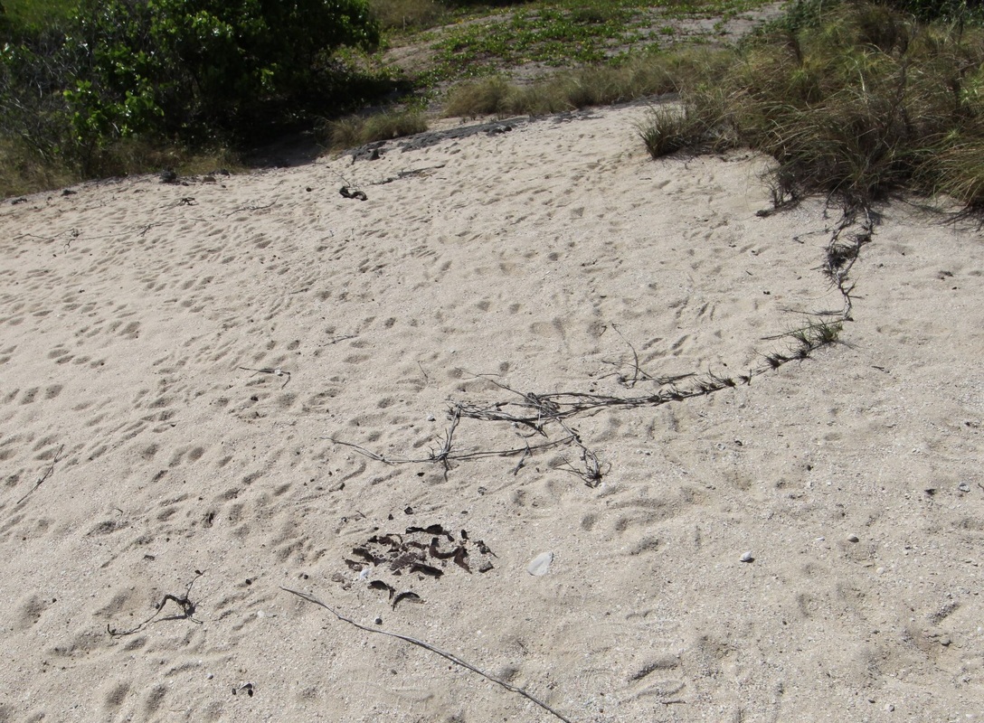
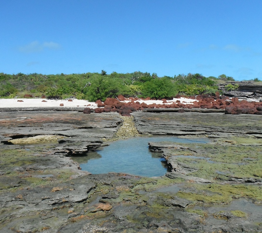
Djinjan Intensive
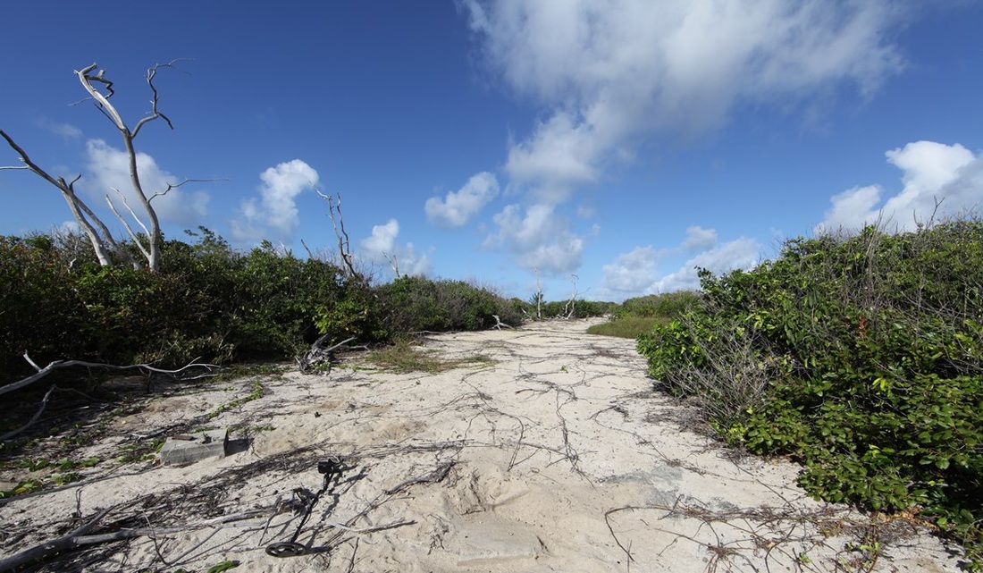
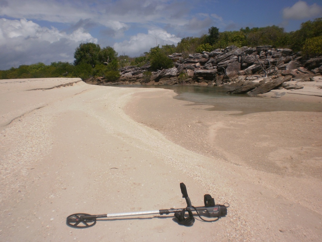
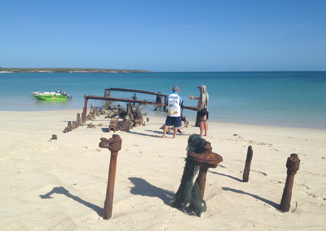
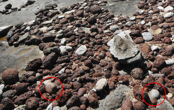
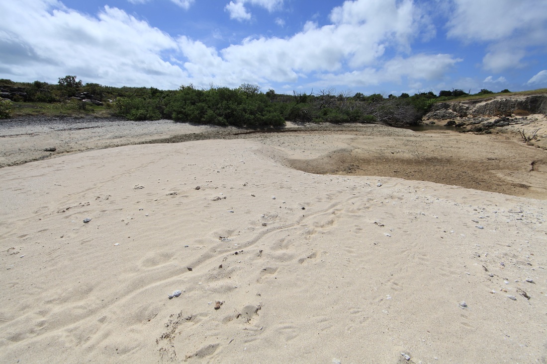
The spit at the mouth of the creek where Morry Isenberg's map indicated the coins were found - a less likely spot to fish with a handline is hard to imagine.
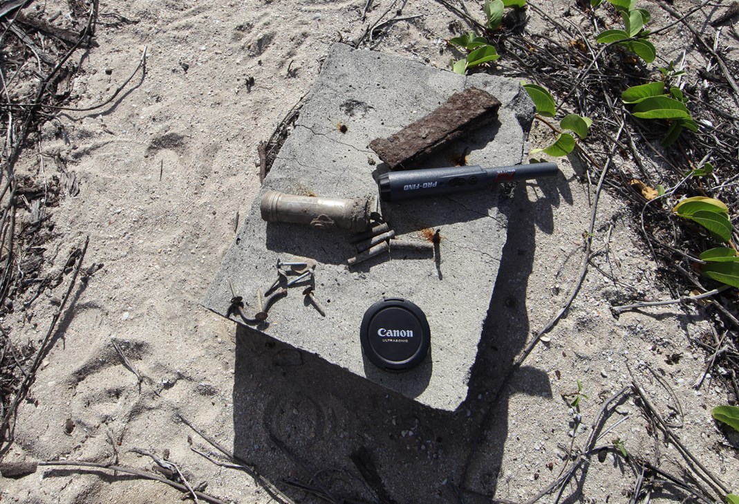
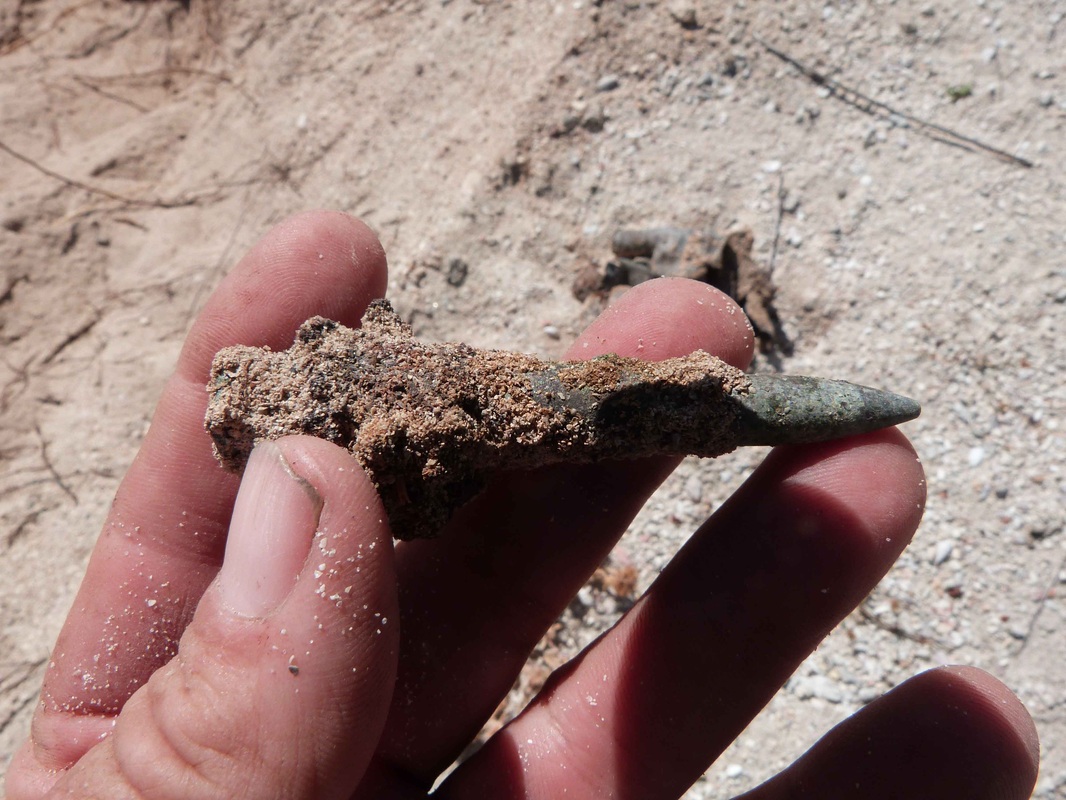
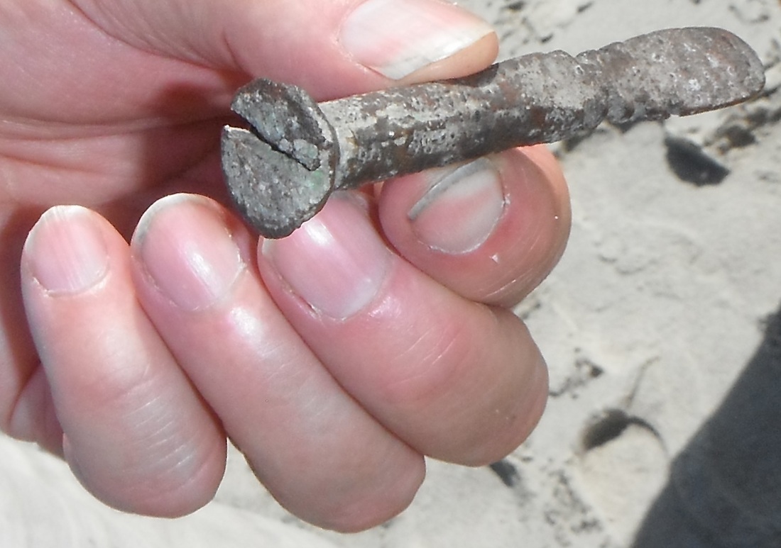
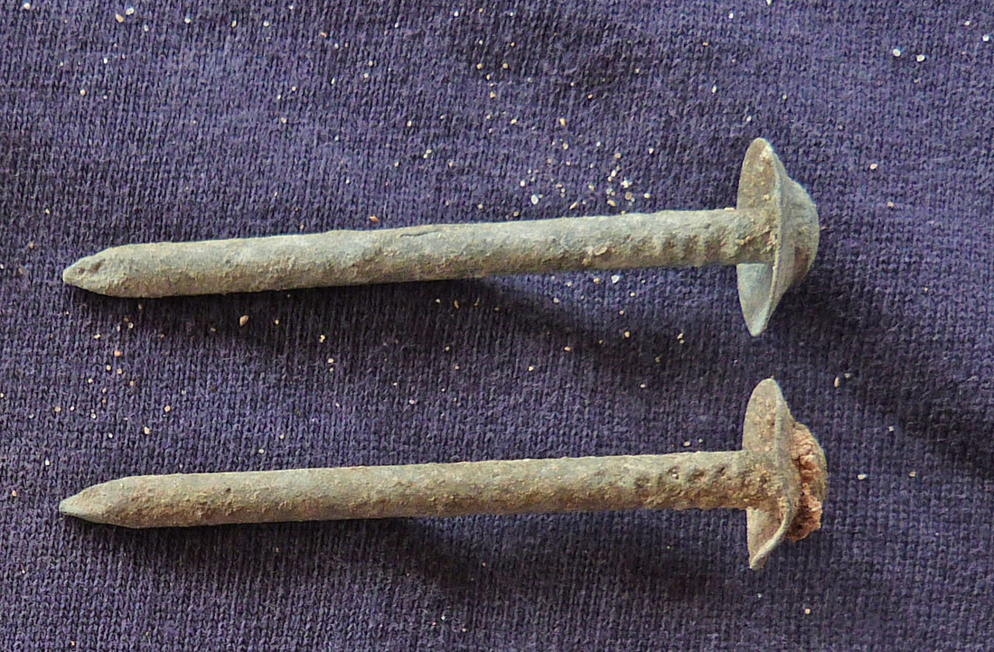
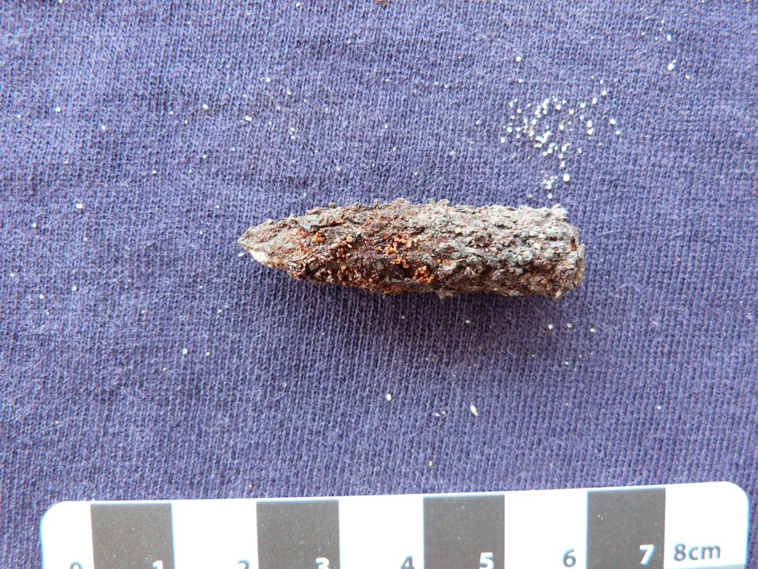
Bob Sheppard came up with this prize find of a copper ships screw refashioned into a tool for shucking oysters or putting stones into horses hooves.

Eastern Side
A Barry Johnson image - north Burston Bay
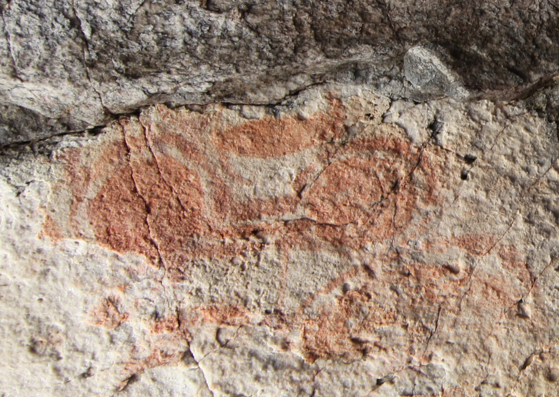
Cave Art
A Tim Stone image. The sandstone sucks moisture from the cave creating a desiccated aridity that is all the more surprising for the contrast with the outside outside.

Middle & Banyan Creeks
This is only called Banyan Ck because of Morry's mud map - there is no Banyan tree.
These creeks will fill up with sand during the Dry but get flushed out during a big Wet. It is thought that the nature of the area preserves the creeks at the ends of the beach but there may be significant changes in their accessibility. A rock bar or clay at the mouth will preserve the freshwater up the creek. This is why Top End river mouth are notoriously treacherous and shifty. The general absence of mangroves is curious but there is no ready source of floating seeks to repopulate a devastated area. There are no trepang so no Macassan predation for smoke houses and plenty of better timber around in normal times.


Day Six
Itinerary Day Six: We split into two groups - MH, BS, PL covered Jensen Island and the coast north of Jensen Bay whilst MO & BJ, IM & Brad went to Cape Wessel.
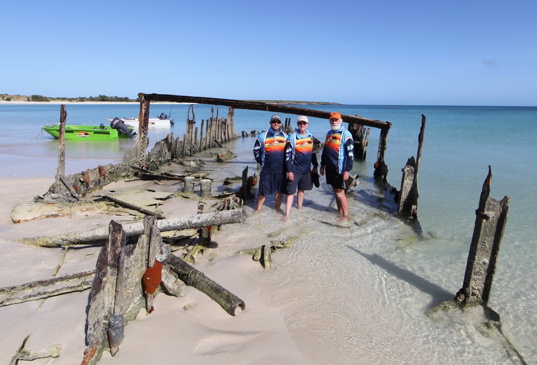
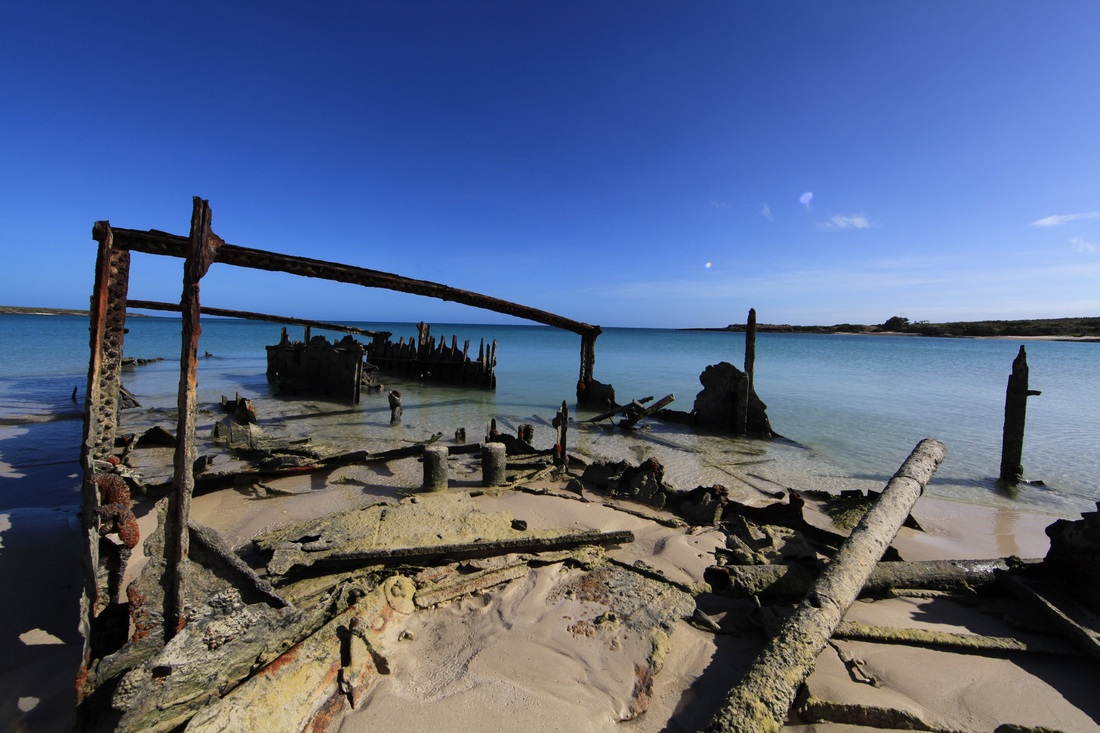
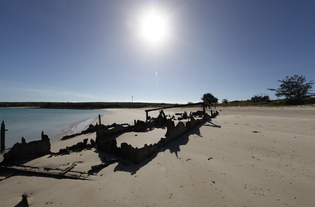
Cua Can 3 Wreck
The 1978 wreck of a Vietnamese refugee ship Cua Can 3 - Rimbija Island, Cape Wessel - visible on Google Earth
Indonesian ship Cua Can 3 looking NNW out of the bay - Cape Wessel Light just out of image to right 0.55km away
Cue Can 3 from the stern & the steering position looking NW - entrance to bay is shallow and rocky - so either very lucky or smart - perhaps he'd ben here before.
|
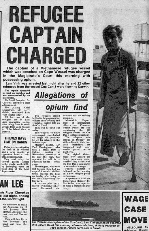
NT News article 17-5-1978
|

Iron Ore Site
Jensen Island

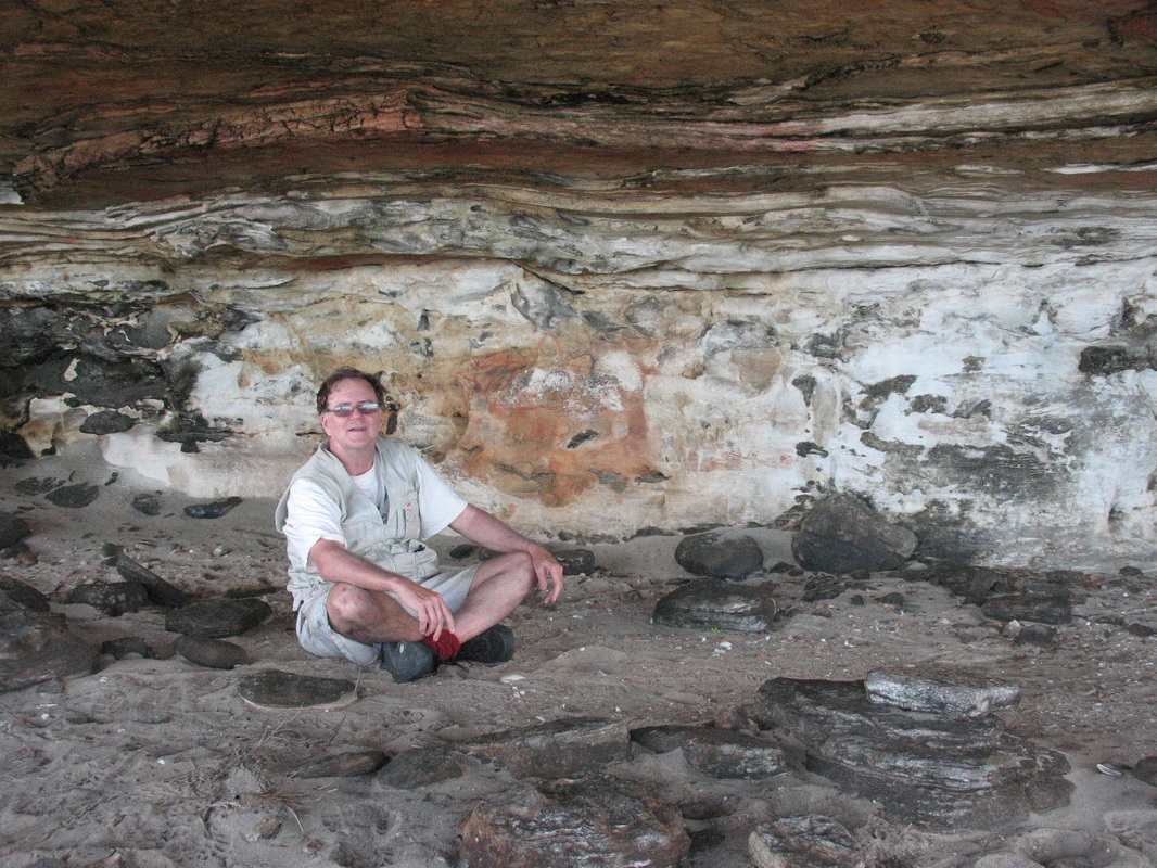
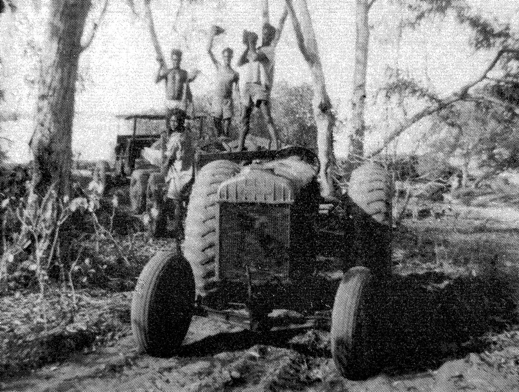
Shady Cave & Fordson Tractor Painting
Ian McIntosh relaxes in the cool of the cave that contains rock art of the Fordson Tractor C1C795 belonging to WWII RAAF Radar Uniit 312RS - probably a first for Fordson
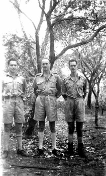 Adams, Bennett & Jaggard 25/5/43
JM Bennett recalled "......our unit was brought across the Gulf of Carpentaria from Horn Island by the MV Islander with a navel vessel escort. In mid-unloading, because of a scare that a Japanese attack was imminent, the Islander left for Darwin with most of our gear - including the radar.
Thanks to the foresight of our administrative CO, S/L Bob Jaggard, while on Horn Island we had swapped our utility (which would never have succeeded in crossing the beach, let alone the sandhills) for a tractor. So we managed to get the unloaded gear under cover of trees about half a mile inland - about an hour before a low flying Japanese plane appeared. Fortunately, the crew members, who were clearly visible to us, were too busy watching the Aborigines to spot us, despite the efforts of a well-meaning guard (the same one who had held up the Horn Island CO) who left the cover of the trees in a futile attempt to shoot the plane down with his rifle." - Extract from unpublished manuscript '312RS at Wessel Island' kindly shared by Professor Bennett's daughter Jane.
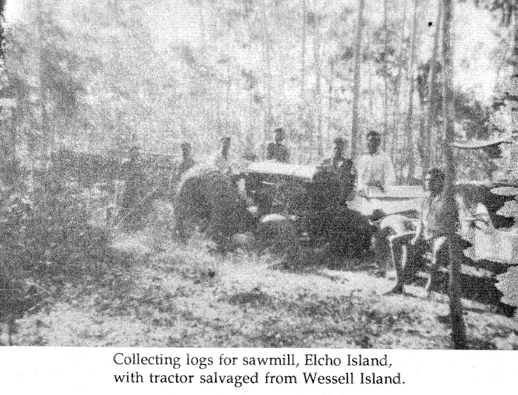
Thanks also to Elizabeth Guy for sharing her recollections of her husband Harold's trip to Jensen Bay to collect the tractor & other useful gear that had survived the attention of the locals. They had driven the tractor into the sea but managed to man-handle it back up the beach where Harold & crew dismantled it - loaded the parts into a dingy & onto the Aroetta for shipmen to Elcho Is. mission where it sat for some months due to pressure of work - "Harold decided to see how Dainambu would succeed at dismantling it. With the help of another boy apprentice, Danydjati, Dainambu greatly surprised his teachers by having the tractor dismantled by the end of the day.......Dainambu was to one day become Elcho's chief engineer." (Elizabeth Guy pc & "Only a Wife")
The tractor dig great work - especially the building of Harold's wharf in Cadell Strait near the current barge landing. There was dismay when he was ordered to send the tractor to Yirrkala because Elcho had two and they had none. There are large lumps of tractor-esk bones behind Laynha's office at Yirrkala which is located above the old garden area - it won't be far away.
Thanks to the foresight of our administrative CO, S/L Bob Jaggard, while on Horn Island we had swapped our utility (which would never have succeeded in crossing the beach, let alone the sandhills) for a tractor. So we managed to get the unloaded gear under cover of trees about half a mile inland - about an hour before a low flying Japanese plane appeared. Fortunately, the crew members, who were clearly visible to us, were too busy watching the Aborigines to spot us, despite the efforts of a well-meaning guard (the same one who had held up the Horn Island CO) who left the cover of the trees in a futile attempt to shoot the plane down with his rifle." - Extract from unpublished manuscript '312RS at Wessel Island' kindly shared by Professor Bennett's daughter Jane.
Thanks also to Elizabeth Guy for sharing her recollections of her husband Harold's trip to Jensen Bay to collect the tractor & other useful gear that had survived the attention of the locals. They had driven the tractor into the sea but managed to man-handle it back up the beach where Harold & crew dismantled it - loaded the parts into a dingy & onto the Aroetta for shipmen to Elcho Is. mission where it sat for some months due to pressure of work - "Harold decided to see how Dainambu would succeed at dismantling it. With the help of another boy apprentice, Danydjati, Dainambu greatly surprised his teachers by having the tractor dismantled by the end of the day.......Dainambu was to one day become Elcho's chief engineer." (Elizabeth Guy pc & "Only a Wife")
The tractor dig great work - especially the building of Harold's wharf in Cadell Strait near the current barge landing. There was dismay when he was ordered to send the tractor to Yirrkala because Elcho had two and they had none. There are large lumps of tractor-esk bones behind Laynha's office at Yirrkala which is located above the old garden area - it won't be far away.


South Island
Tim, Brad & Ian inspect the erosion patterns - the image below is from our lunch site looking back up the beach to this feature - the water was wonderfully cool.
Trafalgar Bay
Day Seven
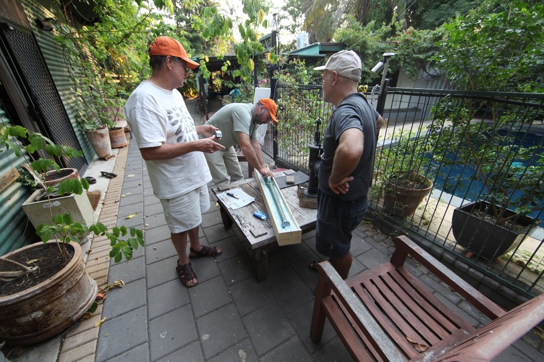
OSL Beach Dating
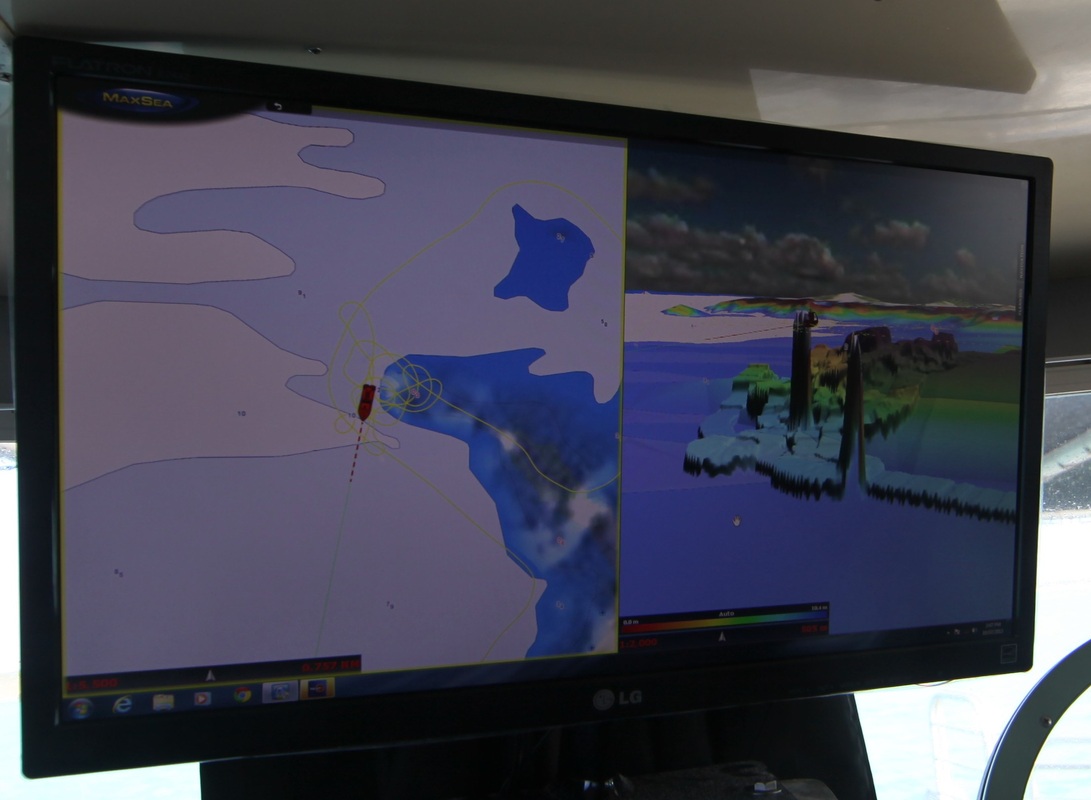
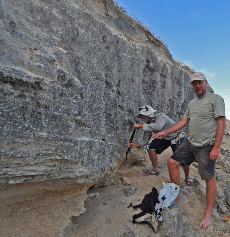
Optically Stimulated Luminescence {OSL} 'beach dating' is the evolving study of sand particles to establish the date at which the beach was laid down - went out of the sunlight. The samples are processed at Dr Matt Cupper's laboratory at Melbourne University where he & Tim subsequently dated the sands trapped in the barrel of the swivel gun found by Christopher Doukas at Dundee Beach.
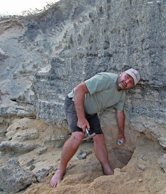
The procedure involves the insertion of a section of 40mm pvc pipe into the section of beach carved by the creek. This prevents light reaching the entombed silica sand particles which are subsequently compared to the exposed sands on the end of the tube. OSL and the geomorphological process are explained in greater depth at the OSL Beach Dating page - http://www.pastmasters.org.au/osl-beach-dating.html
The procedure involves the insertion of a section of 40mm pvc pipe into the section of beach carved by the creek. This prevents light reaching the entombed silica sand particles which are subsequently compared to the exposed sands on the end of the tube. OSL and the geomorphological process are explained in greater depth at the OSL Beach Dating page - http://www.pastmasters.org.au/osl-beach-dating.html
Two Isle Bay
Japanee Creek & Lagoon
The remnants of Indonesian fishing net can be seen at either side of the creek with the skeletal remains of the Paperbark swamp behind.


An oceanic oasis - this was once a superb freshwater lagoon containing hundreds of Paperbark trees and supporting an enormous amount of wildlife.
Day Eight
Melville Bay causeway built in WWII - Township of Nhulunbuy & the plant.
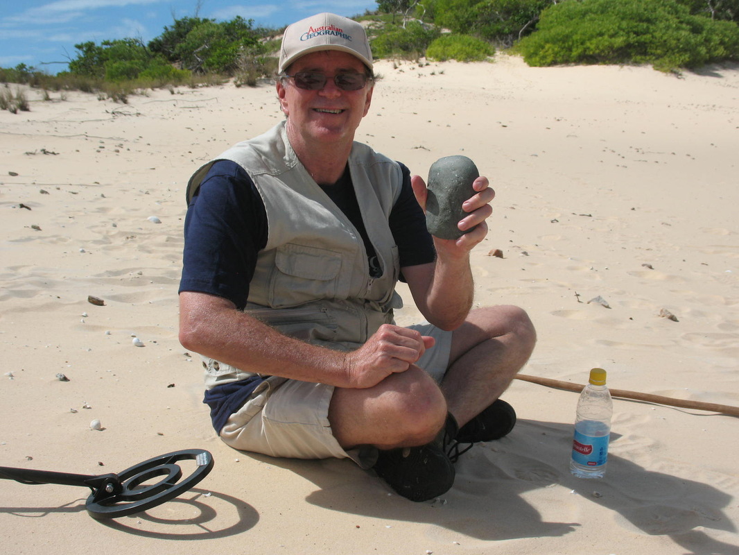
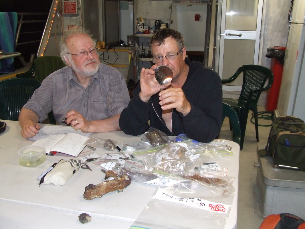
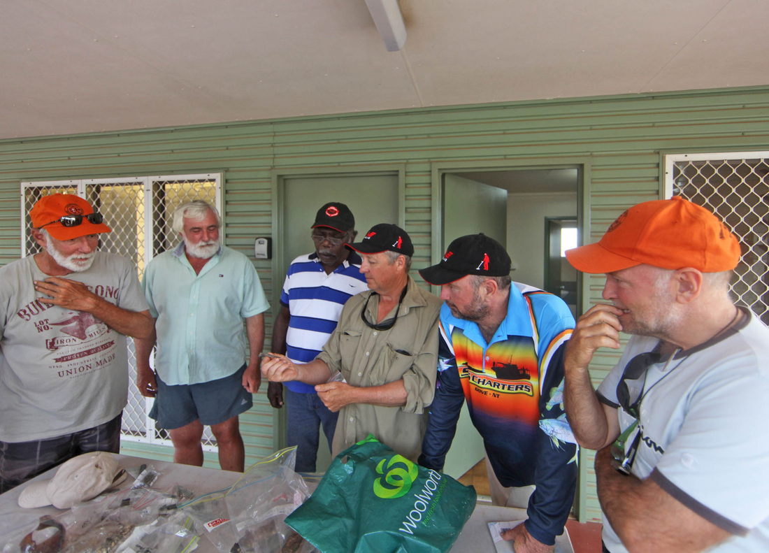
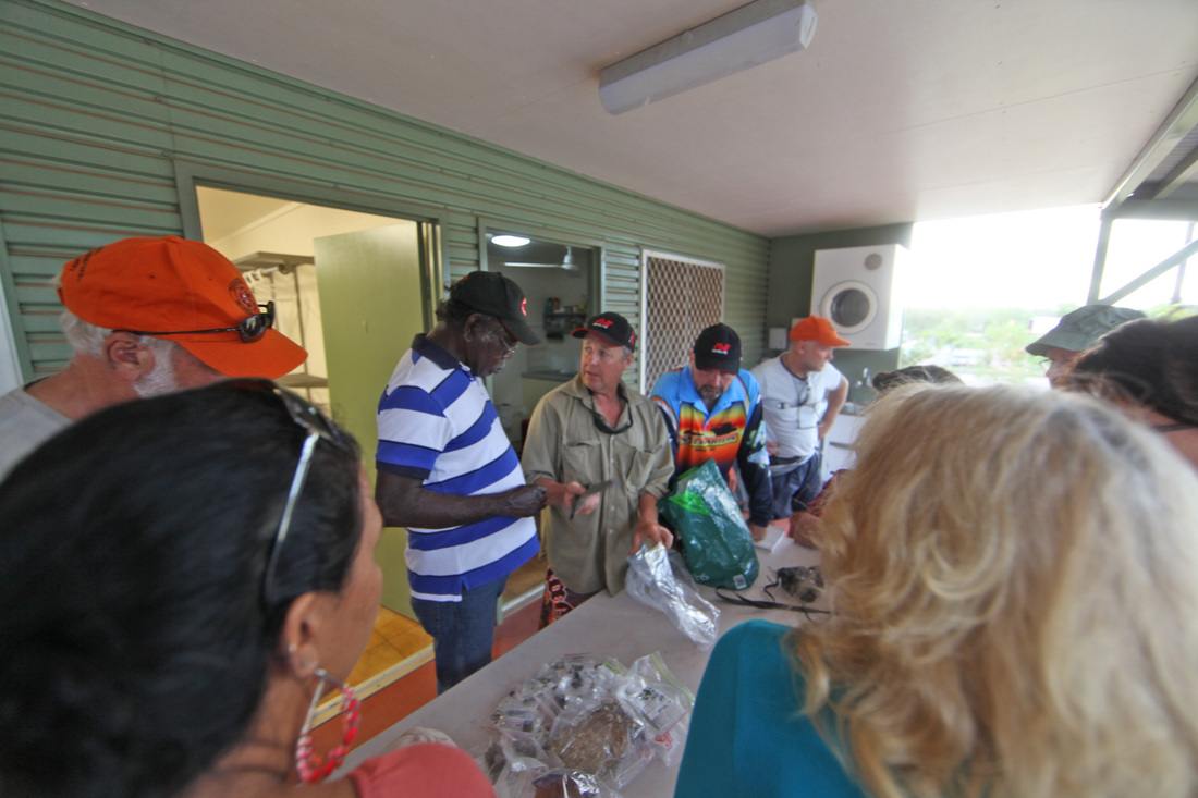
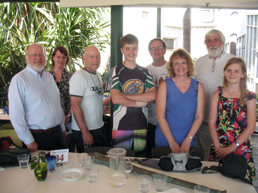
Back in Nhulunbuy for the show & tell session - all finds are bagged, numbered and recorded. Those not currently undergoing analysis are in the care of Terry & Clely Yumbulul. Once the stone axe has been fully examined it will be returned to its proper place on the Wessels.

Day Nine
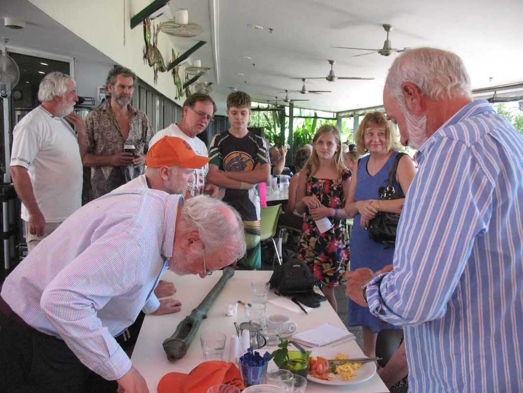
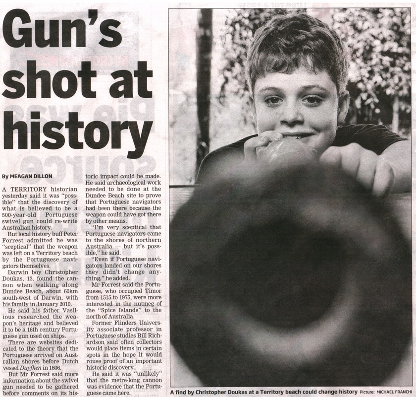
Dundee Swivel Gun
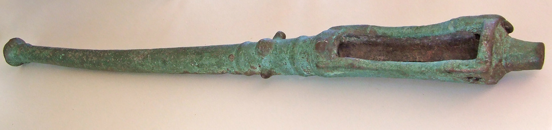
The Dundee Gun found by Christopher Doukas in 2010
Realisation that OSL dating would work equally well on the contents of the barrel of the swivel gun led to a meeting at the museum with the Doukas family and the gun going south with Tim & Mike then on to Matt Cupper's laboratory at the University of Melbourne. A minimum date for submersion of the sand particles out of the sunlight is 250 years with the hope that this may be extended as analysis progresses. A world first application of this technology. Detail on the Dundee Gun project under Projects & Activities tab or http://www.pastmasters.org.au/dundee-beach-swivel-gun.html

Additional Information
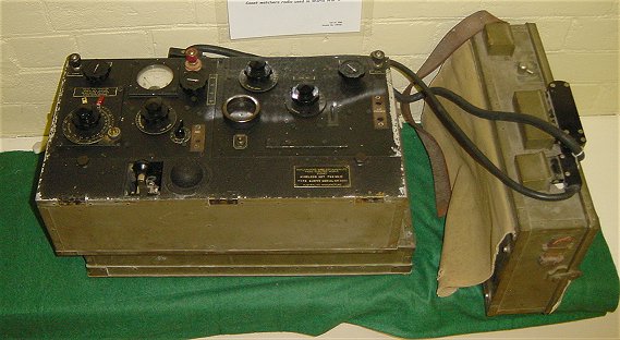
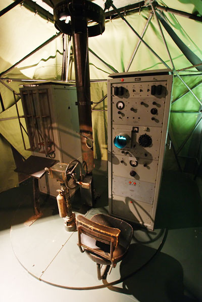
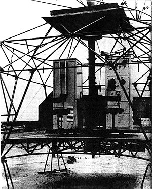
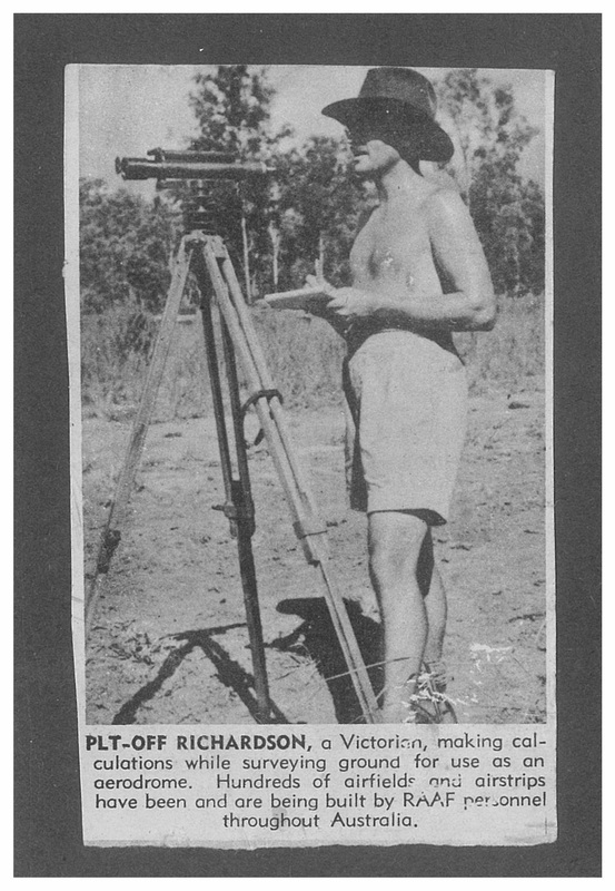
RAAF Radar Unit 312RS
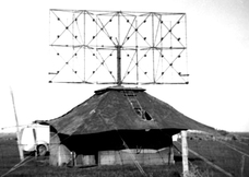
The LW/AW set was developed in 1942 in Australia by the Council for Scientific and Industrial Research (later CSIRO) Radiophysics Laboratory in response to the need for a portable air defence radar station that could be readily deployed in northern Australia, New Guinea and the islands to Australia's north. The sets were built by the NSW Railways workshops. A total of 56 units were used by the Australian forces, 60 by the US Army in the Pacific and a further 12 in Burma.
To facilitate portability, the LW/AW set had a hand-turned aerial - the radar equipment and operator were housed in a canvas tent and the photos below show the internal layout. The operator, transmitting equipment and antenna all sat on a rotating platform which the operator turned by hand, thus changing the direction of view of the set. The operator's display was a small cathode-ray tube 'A-scope' (range-only display). The physical orientation of the antenna, read off a bearing scale at the top of the antenna shaft, gave the direction of target returns. (Sources Ozatwar - Radar Yarns & Ian McKellar's Defending the Eye of the Needle)
Further information about 312RS, NT radar sites and Coastwatcher Jack Jensen - http://www.pastmasters.org.au/wessel-islands-radar-312rs.html
|
|
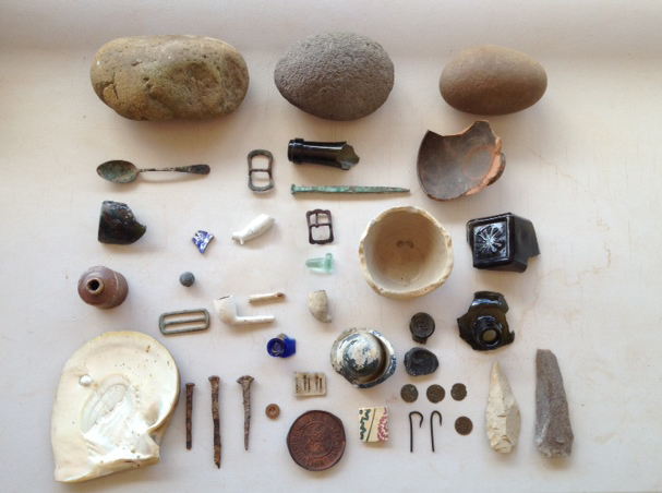
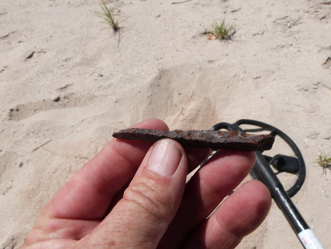
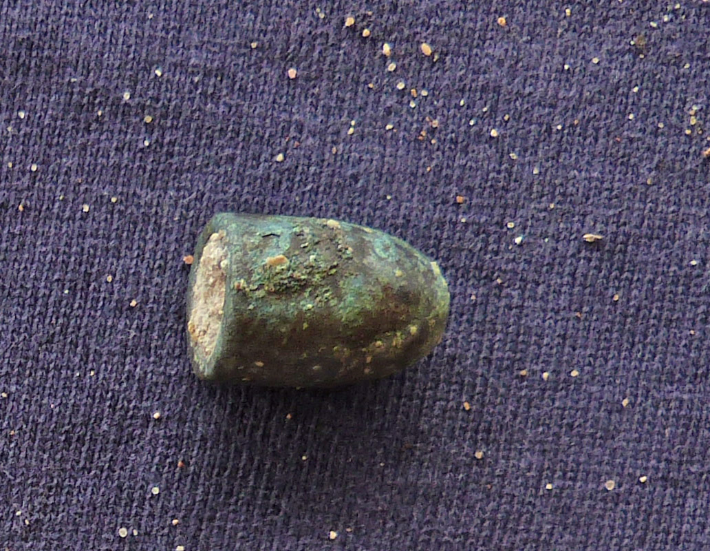
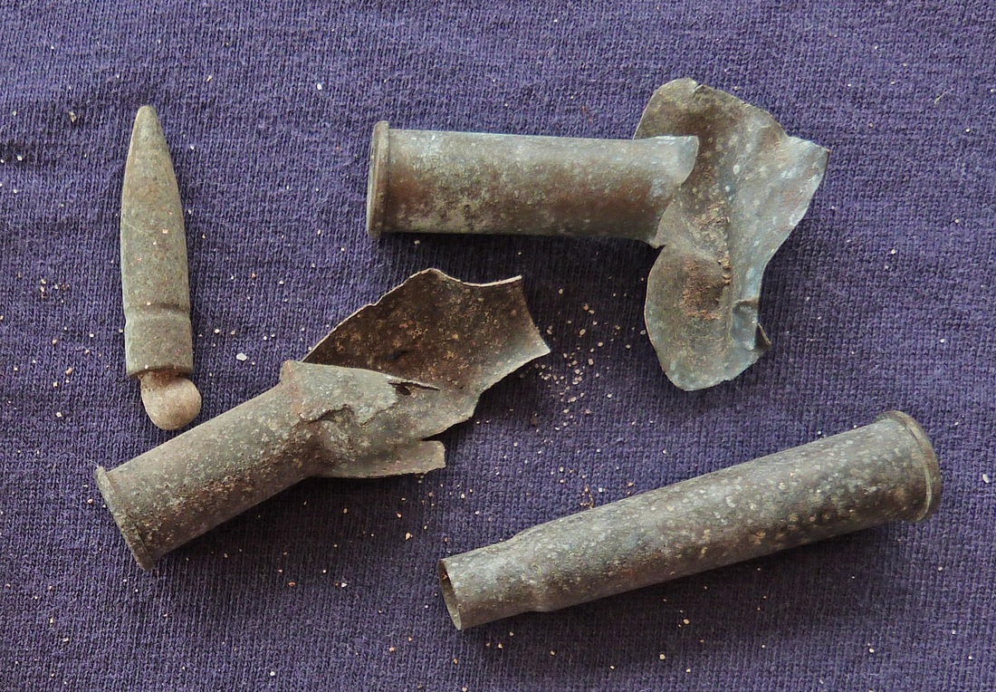
Morry Isenberg's Finds
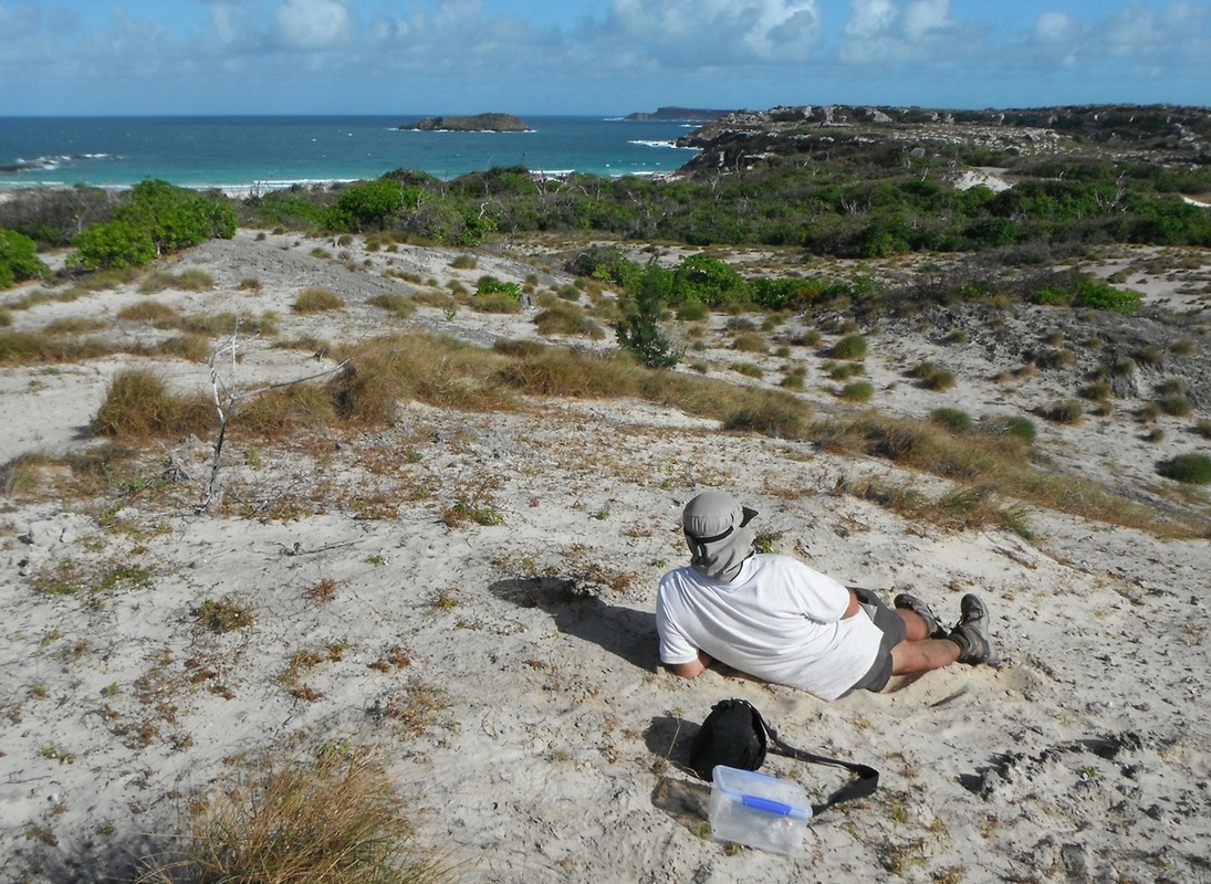
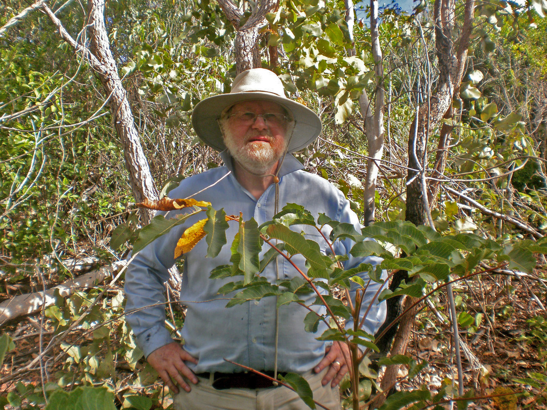
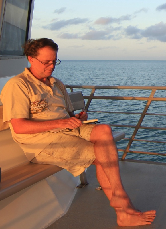 Dr. Ian McIntosh, Jensen Bay 2014
I have known about the
Kilwa coins mystery since the late 1980s when I lived in the remote Aboriginal
community of Galiwin'ku on Elcho Island in north-east Arnhemland. I was working with the traditional owner of the Wessel Islands, the late David Burrumarra
M.B.E. on issues of social justice, sea rights & reconciliation. We tried to explain how 900 year old coins from East Africa could
end up on a beach in the Wessel Islands over 10,000 kilometres away. These coins were
among the first ever produced in sub-Saharan Africa. Only those from the
Axumite Empire of Ethiopia, Carthage and Egypt predated them. We toyed with the idea of mounting an expedition but funding proved elusive and it
was peripheral to our more politically-driven agenda.
Over the years, a small photo of the world heritage ruins of Kilwa’s Portuguese/Omani fort, tacked to the wall of my study, would remind me of those conversations. Burrumarra was Australia’s first Aboriginal anthropologist & a pioneer of the Yolngu (Aboriginal) communities of Yirrkala & Galiwin’ku. As the leader of the Warramiri-Golpa clan he would speak with unrivalled authority on the history of Yolngu connections with the wider world, for the north-east Arnhem Land coast is alive with references to past contacts. At the ‘beginning of time,’ for example, he told me that a harpooned whale had dragged a large sailing canoe on to the Australian coast. I wondered to myself if there were any physical traces of this historic encounter. Burrumarra would also talk about a beach where “men with hats of mirror” had come ashore, a possible reference to armour. Were they Portuguese freebooters, the ones who had looted and burned Kilwa in 1505? There are also accounts of Yolngu being swallowed by whales and regurgitated as white men, and of ‘universal travellers’ associated with the great celestial river called the Milky Way descending from the heavens in their Dreaming sea craft known as the Djulpan. The range of narratives seemed endless.
Over the years, a small photo of the world heritage ruins of Kilwa’s Portuguese/Omani fort, tacked to the wall of my study, would remind me of those conversations. Burrumarra was Australia’s first Aboriginal anthropologist & a pioneer of the Yolngu (Aboriginal) communities of Yirrkala & Galiwin’ku. As the leader of the Warramiri-Golpa clan he would speak with unrivalled authority on the history of Yolngu connections with the wider world, for the north-east Arnhem Land coast is alive with references to past contacts. At the ‘beginning of time,’ for example, he told me that a harpooned whale had dragged a large sailing canoe on to the Australian coast. I wondered to myself if there were any physical traces of this historic encounter. Burrumarra would also talk about a beach where “men with hats of mirror” had come ashore, a possible reference to armour. Were they Portuguese freebooters, the ones who had looted and burned Kilwa in 1505? There are also accounts of Yolngu being swallowed by whales and regurgitated as white men, and of ‘universal travellers’ associated with the great celestial river called the Milky Way descending from the heavens in their Dreaming sea craft known as the Djulpan. The range of narratives seemed endless.
The academic study of myth and history is well advanced, though we understood that making definitive statements about what actually transpired was problematic. Arnhem Land, however, provides us with a unique opportunity; a rich source of material for contemplation including a stunning array of Yolngu rock art showcasing wave upon wave of foreign visitation.
Among the more tantalizing of Burrumarra’s narratives were those associated with the ‘flying fox people’ who, in partnership with Yolngu, made boats from native timbers and iron implements (anchors, knives and axes) from local ironstone.
Elsewhere in Aboriginal Australia, early settlers and explorers were considered to be ghosts. Arnhem Land was no different. The small red flying fox known to Yolngu as the Matjurr gathers by the tens of thousands in the paperbark forests and jungles of the Wessel Islands each year. Then, after feasting on blossoms for a month or so, they head north towards New Guinea, never to return. For the Yolngu, they are traveling to the land of the dead, for the very next year, another batch has arrived & is ready to depart the known world. The first whites on the coast were identified by Yolngu using the sign of the arms crossed over the chest, the same as for the Matjurr. The deceased in the form of these white apparitions, had come back to life.
Astonishing also are the Yolngu narratives that indicate that the Yolngu knew of the titanic struggles underway in the East Indies between crusading Portuguese empire-builders and besieged and growing Islamic civilizations. The Portuguese & Dutch sought total domination of Indonesia’s spice trade - in Yolngu myth & ritual we see innumerable references to barbarous incursions, staunch resistance and the race for Christian & Islamic converts. Did the First Australians witness this centuries-long conflict first-hand?
My interest in the Kilwa coin mystery was reignited in 2012 after I had given a presentation at a conference on Macassan history and heritage at the Australian National University. One prominent Australian historian, Campbell Macknight, asked for my opinion on how the coins found their way to Australia. I wondered if they were talisman, good luck charms carried by Indonesian sailors who had interacted with the people of north-east Arnhem Land over many years. What if multiple hands had been involved? It would implicate north Australia’s indigenous peoples in the ancient Indian Ocean trading network, also known as the Maritime Silk Route, which linked such ports as Kilwa & Zanzibar in East Africa with Arabia, Persia, India, China, & Indonesia.
My interest in the Kilwa coin mystery was reignited in 2012 after I had given a presentation at a conference on Macassan history and heritage at the Australian National University. One prominent Australian historian, Campbell Macknight, asked for my opinion on how the coins found their way to Australia. I wondered if they were talisman, good luck charms carried by Indonesian sailors who had interacted with the people of north-east Arnhem Land over many years. What if multiple hands had been involved? It would implicate north Australia’s indigenous peoples in the ancient Indian Ocean trading network, also known as the Maritime Silk Route, which linked such ports as Kilwa & Zanzibar in East Africa with Arabia, Persia, India, China, & Indonesia.
During World War 2, RAAF serviceman Maurice Isenberg of Sydney had been manning a radar base on the Wessel Islands that tracked the movements of hostile Japanese air and sea craft. Darwin had been devastated by Japanese attack in 1942 and advanced warning bases such as Isenberg’s were a vital part of the war effort. On a quiet moment fishing, he chanced upon five copper coins from the once thriving Swahili port of Kilwa in modern Tanzania. He also found four Dutch coins from the East India trade at the same place. The rare Kilwa coins, which bear the names of various Sultans, were over 900 years old.
The Wessel Islands Kilwa coins are a complete mystery. Kilwa coins have only ever been found in two places beyond the immediate vicinity of their manufacture in East Africa, one in the ruins of Great Zimbabwe in southern Africa and one in the Dhofar region of Oman on the Arabian Peninsula. Dutch coins, by comparison, have been found all along the Arnhem Land coast, especially in association with the trepang (bêche de mer) fishing camps of the Macassans from Sulawesi. These monsoon traders, under colonial rule by the Dutch, frequented the Australian coast on a seasonal basis for perhaps 150 years or more beginning in the mid-1700s.
According to Burrumarra’s son, clan elder Terry Yumbulul, the Yolngu are guided in their reflections about ancient contacts by their oral history, sacred mythology, as well as place names. The 130 kilometre long wall of rock that is the Wessel Islands is rich in sites that speak of extensive foreign interaction through countless generations.
Any number of hypotheses can be developed to explain the presence of the Kilwa coins in Arnhem Land. Macassan traders, for example, developed close working ties with the Aboriginal land owners over many generations. Did they offer up coins to the Yolngu for access to their land and sea resources in the first wave of contact? While the Wessel Islands were not a source of the trepang species desired by Macassans for their Chinese clients, the large freshwater lake on Marchinbar, the northern Wessel Island, was probably a reconnoitring point for the Macassan fleet right up to the late 1800s. Yolngu are still very familiar with the location of many Macassan camp sites, often marked by tamarind trees and the stone lines that supported trepang cooking pots, as well as the whereabouts of many Macassan shipwrecks.
Records describe how Yolngu travelled aboard the trepangers’ praus to many south-east Asian ports, like Makassar, Singapore, and Banda. In discussions with me, some Yolngu even wondered if their ancestors had travelled further afield, as far as East Africa.
In the same speculative manner, some of our expedition team believe that the Portuguese were in some way involved as they had controlled the waters to the immediate north of Australia from the early 1500s, and had major forts in Makassar, Ambon and on the island of Aru. The unparalleled Chinese expeditions led by the Muslim eunuch Zheng He (with over 30,000 men) in the early 1400s had touched upon the Swahili coast including Kilwa. Could some of these have found their way down into south-east Asia and eventually Australia?
The Arabs had been trading along the Zanj coast from the Horn of Africa to Mozambique from the latter part of the first millennium and were also well established in Asian ports like Cambay, Calicut, Malacca and Guangzhou. A shipwreck in the 800s at Belitung Island near Sumatra dates from the Tang Dynasty & testifies to early Arab mobility to the north of Australia. Alternatively, the former colony of Tanganyika was a German possession until after World War One, and so was New Guinea, and there was probably communication between them. Could coins have come to Australia via this connection?
In a 2012 article in Australian Folklore, I shared the view that Burrumarra and I had discussed in the 1980s that the coins might have represented the worldly wealth of the Indonesian shipwreck survivor from the late 1800s, a man called Budiman who lived close to where the coins were found.
One thing was very clear to us all. These many hypotheses challenge Australia’s ‘myth of isolation’. The idea that Australia lay secluded in the great southern ocean, hidden from view until the European ‘enlightenment’, is an anachronism, a relic of the mindset that produced the myth of terra nullius. With the Kilwa coins, we have potential evidence of much earlier contacts from across the vast Indian Ocean that challenge the out-dated Captain Cook-centred view of Australian history.
| australia’s_kilwa_coins_conundrum.pdf |
Opinions
Sandy Horne, Expedition Researcher
Many sources remain to be explored so important clues may be just a page-turn away. Worthy of consideration as sources of the coins are such 19th century explorers as Matthew Flinders & Phillip Parker King who are known to have visited the region. One explorer in particular came to my attention. Francis Cadell was a well-travelled man of questionable character who made his name as an adventurer & explorer before setting off to chart Australia’s northern coastline in 1867. Given his familiarity with the Wessel Islands, there is some suggestion that Cadell could have been the source of the coins.
Peter Lane, Numismatist
As the coins were all found within a few metres of each other it is reasonable to postulate that they arrived there at the same time. The most recently struck coin is dated 1784 and is worn, which suggests that the coins arrived there anywhere from 1800 to 1900. When coins are lost in sand they hit the surface and instantly disappear, so it is highly unlikely they were accidentally lost as some were found on the surface. Tim Stone, our geomorphologist, claims that ‘waves, wind and currents are very effective sorting agents on beaches. Beaches are often capped by deposits of coarse sediments (e.g. whole shells, pebbles) above the high water mark. It is possible that the coins got to the top of the beach face by 'normal' wave action in the same way as any coarse sediment. …From a geomorphic perspective, there is no reason to doubt Isenberg's account of his find. He was just lucky the coins happened to be at (or near) the surface that day. A day later he probably wouldn't have found anything.’ Thus coming from a shipwreck is the most plausible explanation.
Bob Sheppard, Heritage Detection
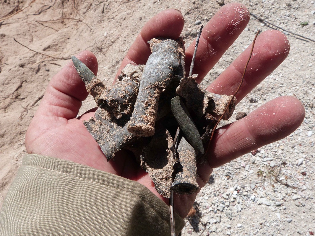
I believe that both the African and Dutch coins arrived on the Wessel Islands sometime after 1784. Are the coins shipwreck related? Possibly, but the ship might not be close by. My field research on Western Australian wrecks shows lots of wreckage nearby. This is related to the salvage and activities of survivors. This isn't the case on Marchinbar Island and we used metal detectors to search a large area. So how did the coins and other shipwreck material reach there? We know indigenous inhabitants or survivors can move material a long way from a wreck site and this may be the case. The important shipwreck related artefacts that the expedition located using metal detectors included a modified brass screw, an iron "dump" and an iron chisel, which can all be used as tools and appear to have been deliberately hidden for later use. Therefore, I believe these items could have been selected from shipwreck material and traded or moved from elsewhere. Further searches will probably locate more shipwreck related items and possibly more coins.
Mike Hermes, Archaeologist
The conquest of the Spice Islands by the Portuguese in the early 1500s intensified the hunt for slaves to tend to the immensely valuable and labour intensive crops. Slavers from Kupang in Timor and other ports in what is now eastern Indonesia raided Australia’s Tiwi Islands and perhaps also the Wessels. But why were the slavers carrying obsolete coins from such a far flung Sultanate? Were they used as barter items in remote areas where formal currency was unknown, or were they used as a ballast material, the copper also being a cashable commodity in certain ports? For Aborigines the coins may have been imbued with a spiritual or sacred power and significance, and become heirlooms passed down through the generations. A number of Arnhem Land communities traditionally kept bones of ancestors in a ‘spirit bag’ and perhaps the coins were also revered and retained.. Finally, perhaps in the nineteenth century when small pox decimated the Yolngu population, the spirit bag containing the coins was interred, lost or discarded. The bag rotted away, leaving a small but bizarre collection of coins spanning 500 years.
Dr John Perkins, Numismatist
From the first moment when I read about the Kilwa coins on Marchinbar Island I was captivated. How did these little copper coins I was studying and normally did not leave East Africa end up on a remote island of Northern Australia? Only one other example has been found outside of Africa, in Oman, and even within Africa there is only one example not to have been found on the East African coast, in Great Zimbabwe. At the same time Kilwa type coins still are regular surface finds at relevant sites and they were collected profusely by travellers in the 19th and early 20th centuries. These coins probably never played a part in international trade activities and were a very local phenomenon. What makes it even more intriguing is that on the Swahili East African coast there are sites neighbouring one another, where coins are found in abundance in one and are absent from the other. So even where they originate they were a very local matter.
The key lies in their preservation and the associated finds. Four Dutch coins dating from the late 17th to late 18th centuries were found with these coins. The Kilwa coins are in average condition and it is unlikely that they were submerged for any length of time, this combined with the dates of the Dutch coins makes early shipwreck unlikely. The Kilwa coins could have made their way to Malacca, probably as a talisman and not as currency. There are reports of Kilwan traders in Malacca dating as early as the 16th century. From there, together with the Dutch coins, they could have made their way to Australia in the possession of a trepang fisher or trader. The later dates do not make these finds in any way less important. Marchinbar remains only one of two places where these coins have been found outside of Africa, you could not make it up.
Many sources remain to be explored so important clues may be just a page-turn away. Worthy of consideration as sources of the coins are such 19th century explorers as Matthew Flinders & Phillip Parker King who are known to have visited the region. One explorer in particular came to my attention. Francis Cadell was a well-travelled man of questionable character who made his name as an adventurer & explorer before setting off to chart Australia’s northern coastline in 1867. Given his familiarity with the Wessel Islands, there is some suggestion that Cadell could have been the source of the coins.
Peter Lane, Numismatist
As the coins were all found within a few metres of each other it is reasonable to postulate that they arrived there at the same time. The most recently struck coin is dated 1784 and is worn, which suggests that the coins arrived there anywhere from 1800 to 1900. When coins are lost in sand they hit the surface and instantly disappear, so it is highly unlikely they were accidentally lost as some were found on the surface. Tim Stone, our geomorphologist, claims that ‘waves, wind and currents are very effective sorting agents on beaches. Beaches are often capped by deposits of coarse sediments (e.g. whole shells, pebbles) above the high water mark. It is possible that the coins got to the top of the beach face by 'normal' wave action in the same way as any coarse sediment. …From a geomorphic perspective, there is no reason to doubt Isenberg's account of his find. He was just lucky the coins happened to be at (or near) the surface that day. A day later he probably wouldn't have found anything.’ Thus coming from a shipwreck is the most plausible explanation.
Bob Sheppard, Heritage Detection
I believe that both the African and Dutch coins arrived on the Wessel Islands sometime after 1784. Are the coins shipwreck related? Possibly, but the ship might not be close by. My field research on Western Australian wrecks shows lots of wreckage nearby. This is related to the salvage and activities of survivors. This isn't the case on Marchinbar Island and we used metal detectors to search a large area. So how did the coins and other shipwreck material reach there? We know indigenous inhabitants or survivors can move material a long way from a wreck site and this may be the case. The important shipwreck related artefacts that the expedition located using metal detectors included a modified brass screw, an iron "dump" and an iron chisel, which can all be used as tools and appear to have been deliberately hidden for later use. Therefore, I believe these items could have been selected from shipwreck material and traded or moved from elsewhere. Further searches will probably locate more shipwreck related items and possibly more coins.
Mike Hermes, Archaeologist
The conquest of the Spice Islands by the Portuguese in the early 1500s intensified the hunt for slaves to tend to the immensely valuable and labour intensive crops. Slavers from Kupang in Timor and other ports in what is now eastern Indonesia raided Australia’s Tiwi Islands and perhaps also the Wessels. But why were the slavers carrying obsolete coins from such a far flung Sultanate? Were they used as barter items in remote areas where formal currency was unknown, or were they used as a ballast material, the copper also being a cashable commodity in certain ports? For Aborigines the coins may have been imbued with a spiritual or sacred power and significance, and become heirlooms passed down through the generations. A number of Arnhem Land communities traditionally kept bones of ancestors in a ‘spirit bag’ and perhaps the coins were also revered and retained.. Finally, perhaps in the nineteenth century when small pox decimated the Yolngu population, the spirit bag containing the coins was interred, lost or discarded. The bag rotted away, leaving a small but bizarre collection of coins spanning 500 years.
Dr John Perkins, Numismatist
From the first moment when I read about the Kilwa coins on Marchinbar Island I was captivated. How did these little copper coins I was studying and normally did not leave East Africa end up on a remote island of Northern Australia? Only one other example has been found outside of Africa, in Oman, and even within Africa there is only one example not to have been found on the East African coast, in Great Zimbabwe. At the same time Kilwa type coins still are regular surface finds at relevant sites and they were collected profusely by travellers in the 19th and early 20th centuries. These coins probably never played a part in international trade activities and were a very local phenomenon. What makes it even more intriguing is that on the Swahili East African coast there are sites neighbouring one another, where coins are found in abundance in one and are absent from the other. So even where they originate they were a very local matter.
The key lies in their preservation and the associated finds. Four Dutch coins dating from the late 17th to late 18th centuries were found with these coins. The Kilwa coins are in average condition and it is unlikely that they were submerged for any length of time, this combined with the dates of the Dutch coins makes early shipwreck unlikely. The Kilwa coins could have made their way to Malacca, probably as a talisman and not as currency. There are reports of Kilwan traders in Malacca dating as early as the 16th century. From there, together with the Dutch coins, they could have made their way to Australia in the possession of a trepang fisher or trader. The later dates do not make these finds in any way less important. Marchinbar remains only one of two places where these coins have been found outside of Africa, you could not make it up.
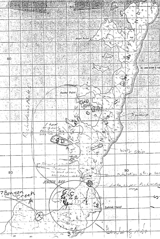
This map of Marchinbar Island was annotated by Dr Mira with in-put from Morry Isenberg. The absence of accurate maps, wartime secrecy and the passage of years have eroded any knowledge of the site of the radar camp and doover.
|
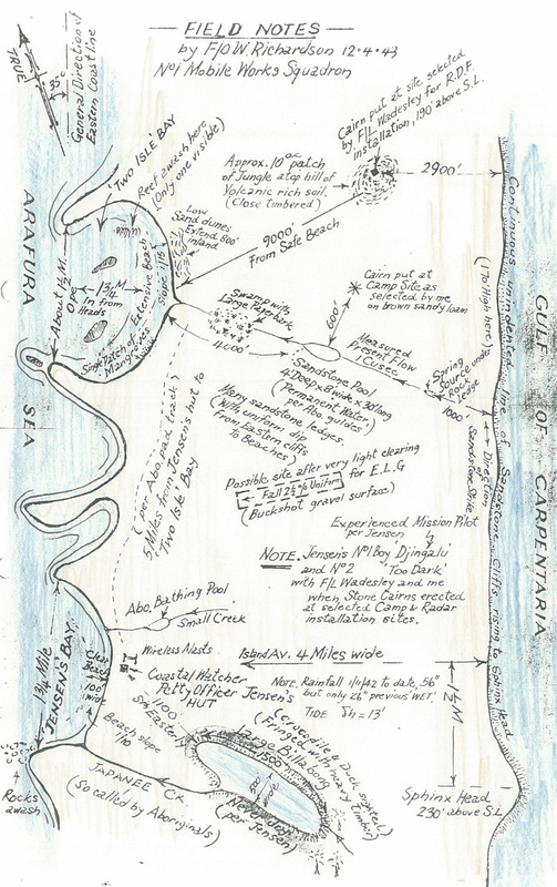
Field sketch by RAAF surveyor Wyndham Richardson.
|
5 Kilwa coins (AD 1294-1493)
4 European Dutch coins (AD 1690-1784)
As a group the Kilwa coins cannot have been deposited much before 1493.
The Marchinbar Hoard must've been deposited between 1493 & 1784.
The Portuguese were formally established at Oecussi on Timor in 1515.
As a single hoard it could not have been deposited before 1784 which is later than when Pobassoo said that the trepang trade began.
Resources
Newspaper Articles
|
General - Coin & Ceramics Articles
| ||||||||||||||||||||||||||||||||||||||||||||||||||||