Shells - Middens & Mounds
Common coastal midden.
|
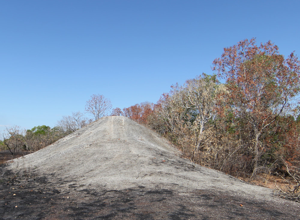
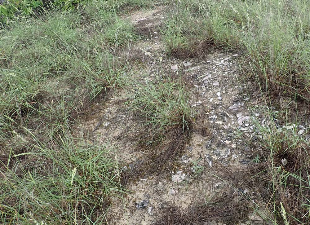
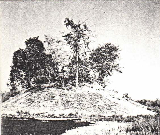
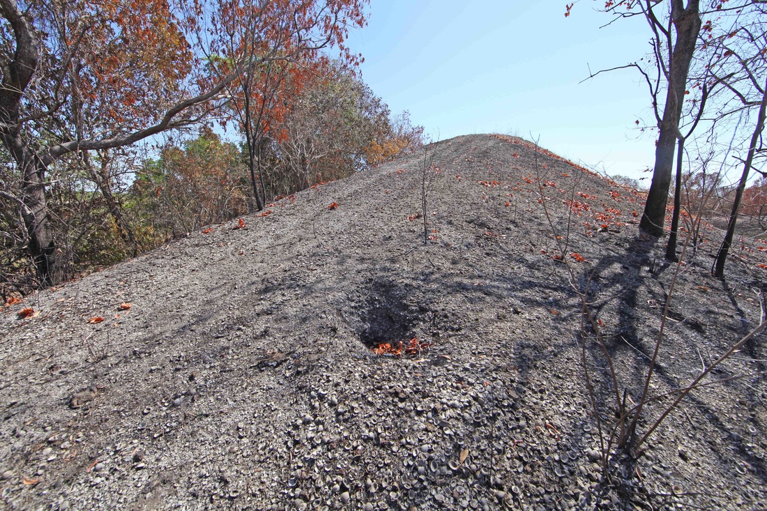
Shell mound
|
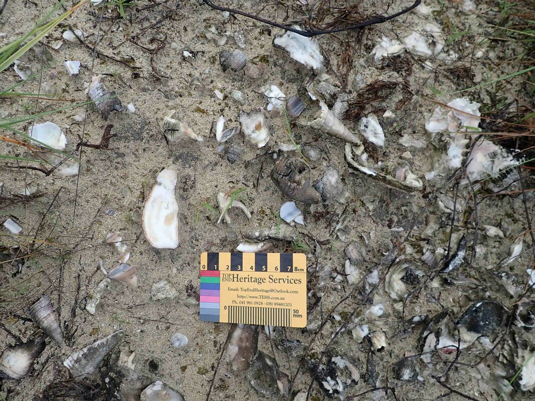
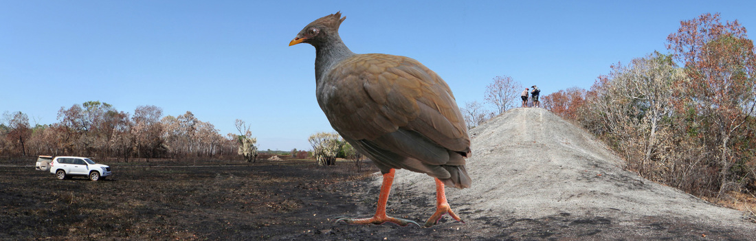
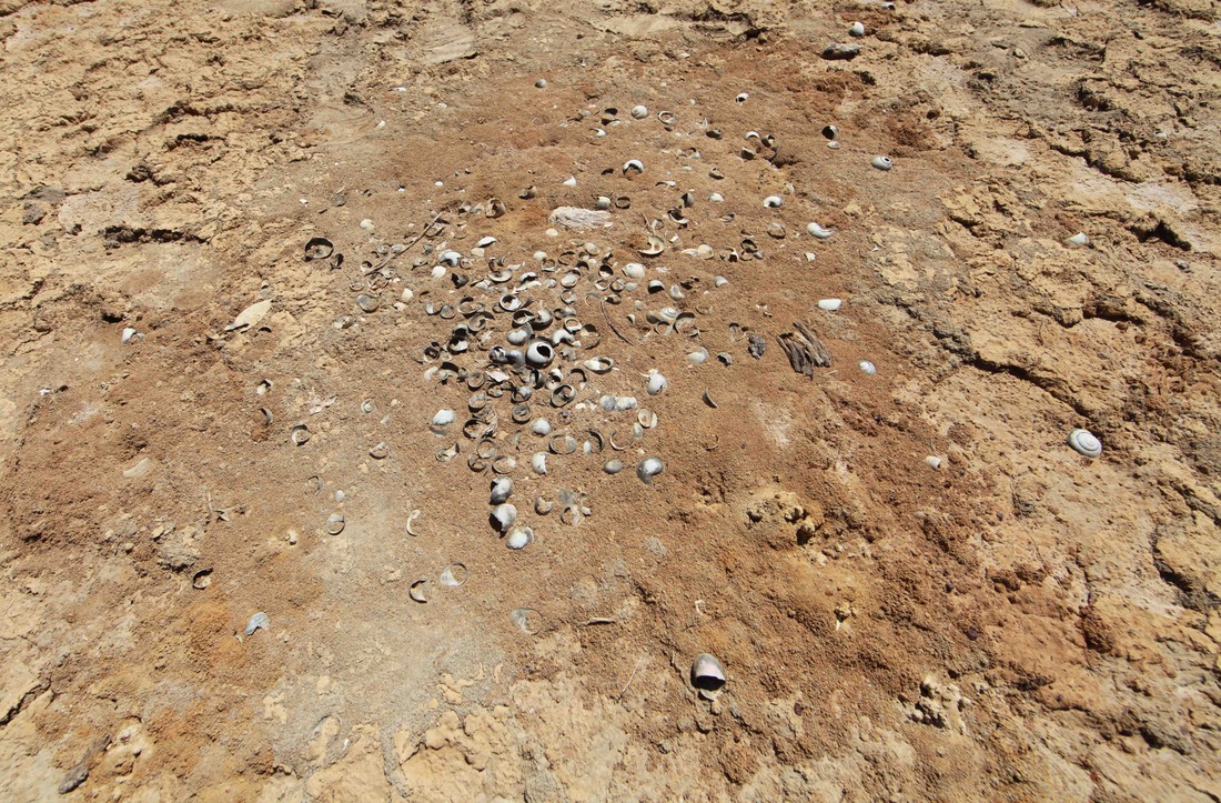
Diversity of midden material
|
The purpose of this page is to illuminate the difference between shells in middens & shell mounds by graphically demonstrating the processes that conspire to create these features which proliferate across the shallow tropical coast of Northern Australia and in similar environments around the world.
We'll start with 'middens' because we've all been teenagers and these sites are still not hard to find even in the Darwin area. The shell mounds are more complex and the processes mature over quite long periods of time. Also the terminology may be unfamiliar & the systems counter-intuitive - e.g. 'wave sorting' that leaves the heaviest things at the top. Whilst some will enjoy exploring the ideas behind geo-morphology & geo-chronology, the images will hopefully make the science accessible & form the basis of developing an understanding of these daily processes that shape so much of our planet.
We'll start with 'middens' because we've all been teenagers and these sites are still not hard to find even in the Darwin area. The shell mounds are more complex and the processes mature over quite long periods of time. Also the terminology may be unfamiliar & the systems counter-intuitive - e.g. 'wave sorting' that leaves the heaviest things at the top. Whilst some will enjoy exploring the ideas behind geo-morphology & geo-chronology, the images will hopefully make the science accessible & form the basis of developing an understanding of these daily processes that shape so much of our planet.
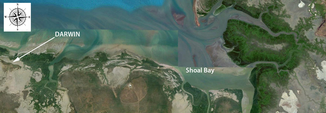
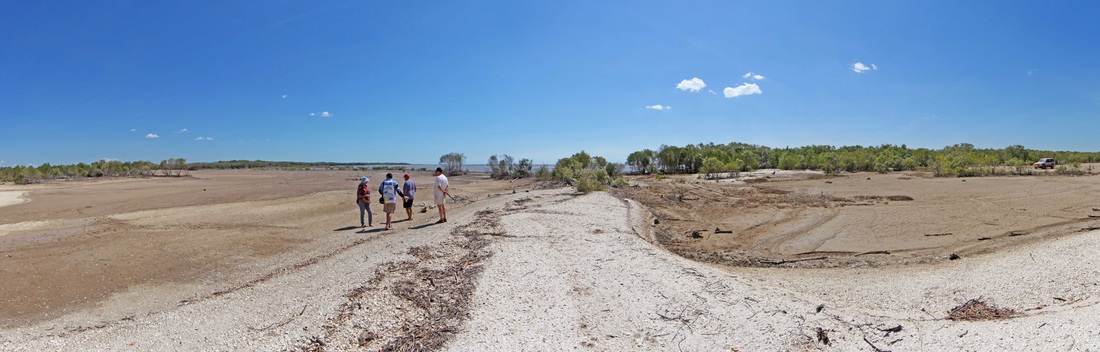
Google Earth image of the Shoal Bay sand trap just to the north-east of Darwin. Top right is Hope Inlet where the Beagle moored before discovering port Darwin in 1839
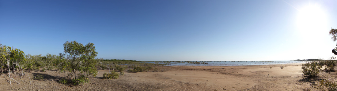
A shallow embayment in Shoal Bay
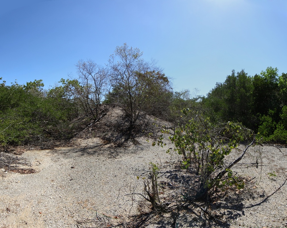
The Anatomy of a Shell Mound
The historical record contains references to the shell mounds which are abundant around the Top End coast. Local Aboriginal people have consistently maintained that the mounds are not a product of their activity. The record is consistent from Point Essington in 1839 to Milingimbi in 1989 when Council was told that they could no longer use the shells for concrete hard core which they had done since pre-war Mission days.
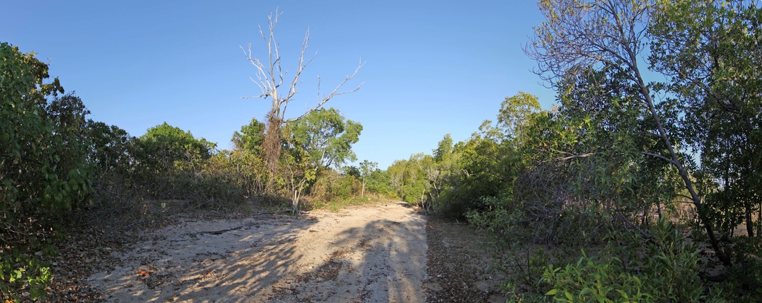
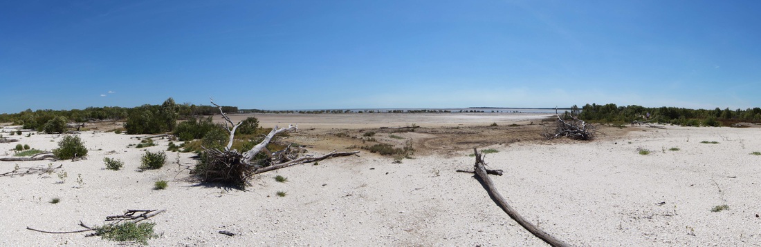
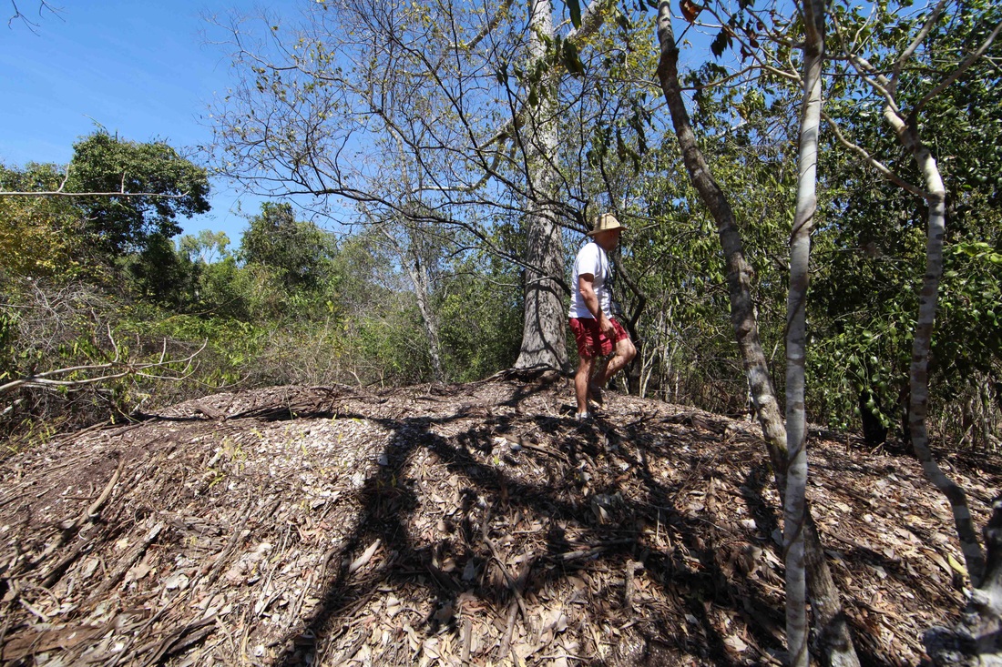
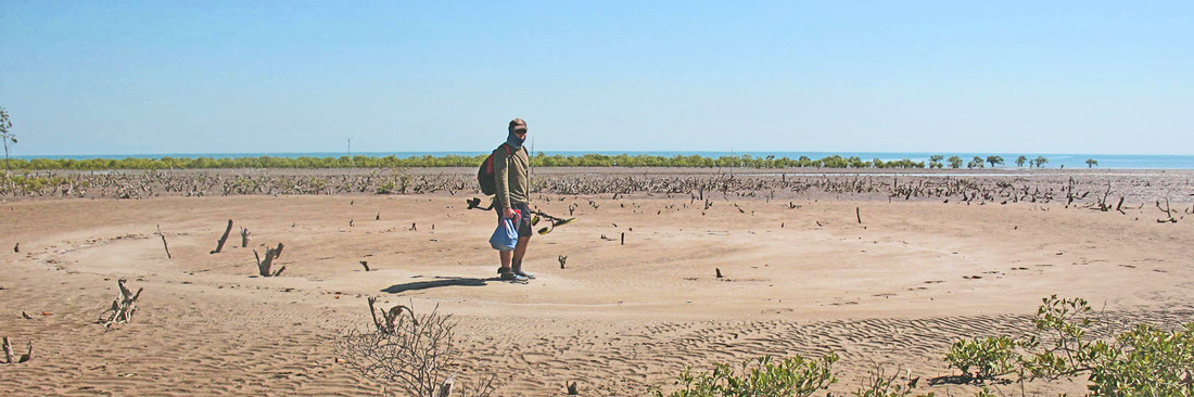
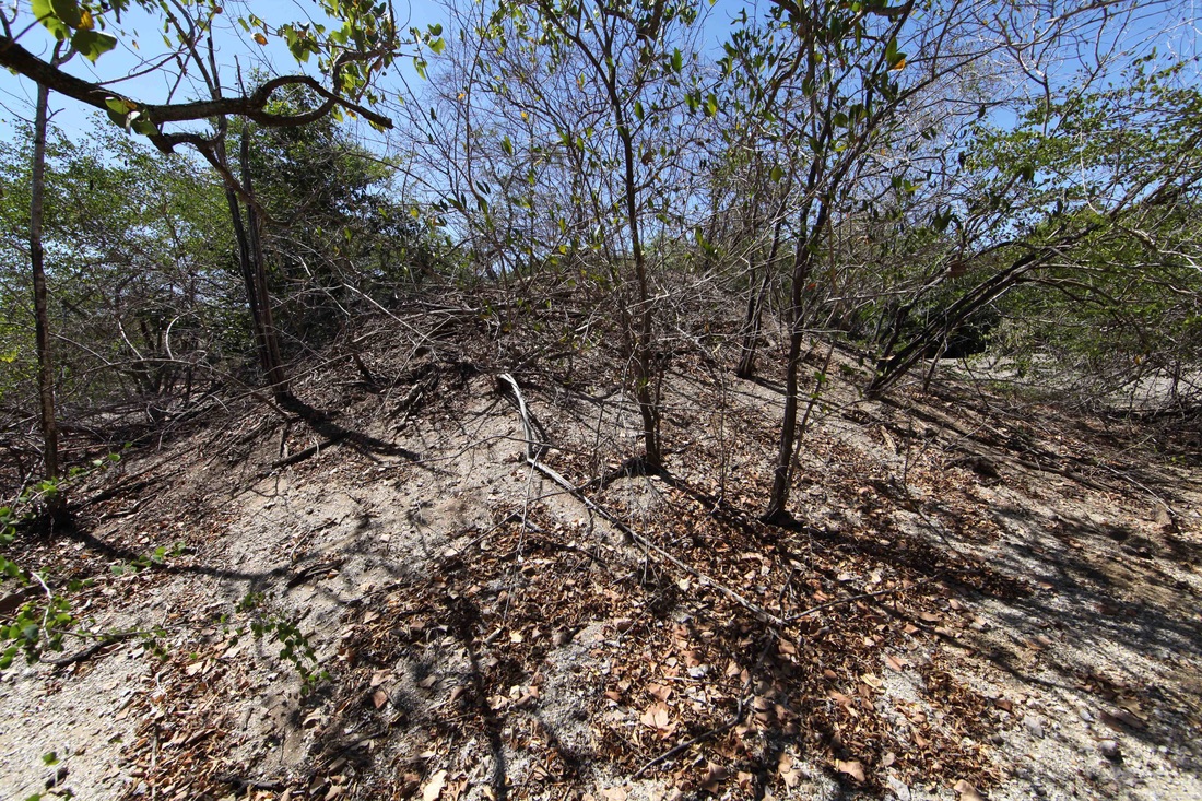
View across the shallows to the mangroves & old beach ridge at back - covered in coastal vine thicket - a handy trap for finds.
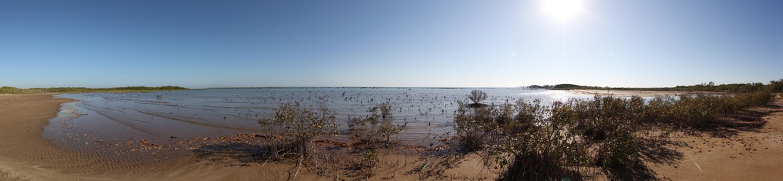
View from current mangrove line out to the developing mangrove line at the lip of the bay. Such a shallow area is ideal for building shoals & mustering shells.
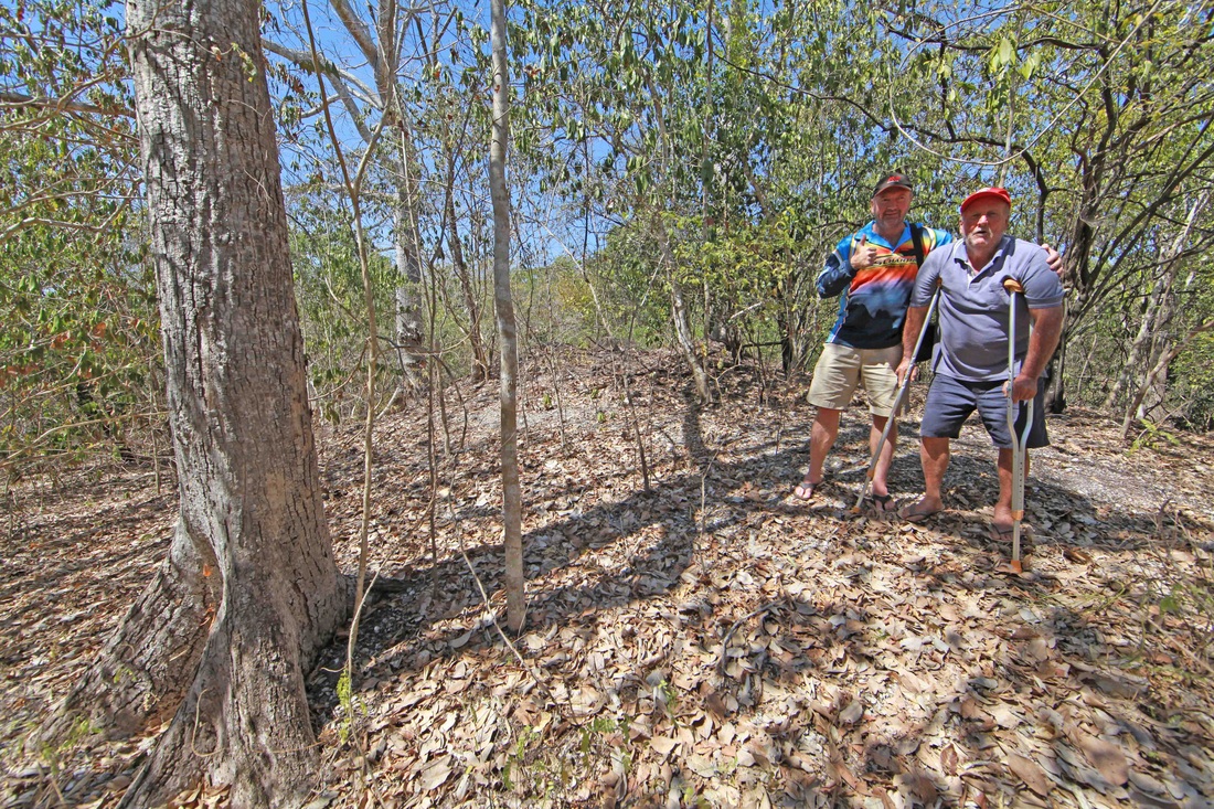
The old beach ridge - as the new beach ridge forms on the lip of the bay the mangrove copse at right is deprived of water & will be engulfed by vine thicket.
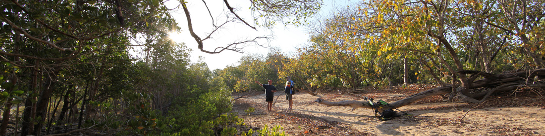
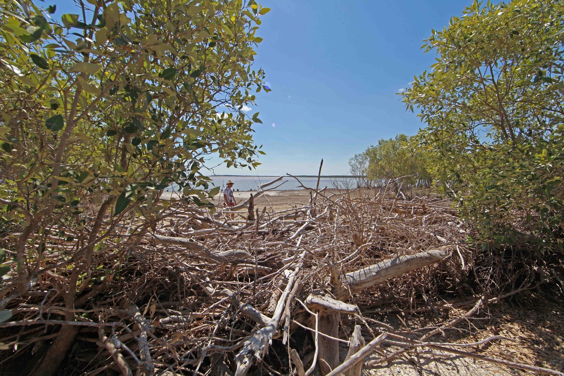
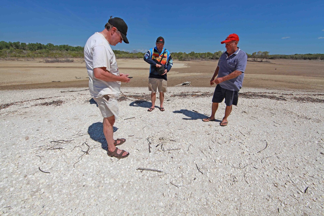
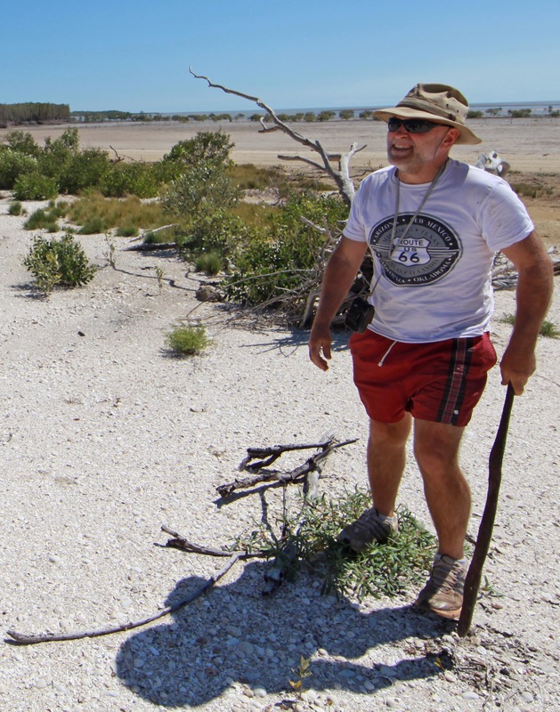
Billy Boustead & Tim Stone discuss the evolution of these beach ridges with the mangrove fringe on the left and vine thicket at right.
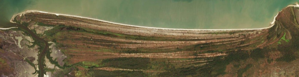
The washboard plain north of the Finniss River mouth clearly showing the successive ridges & 'time averaging' zones where the ridges converge like crow's feet.
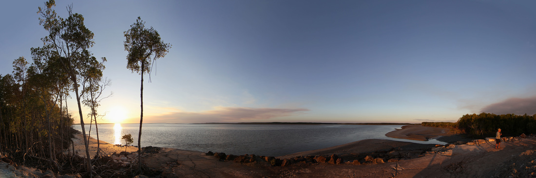
The Shoal Bay Environment
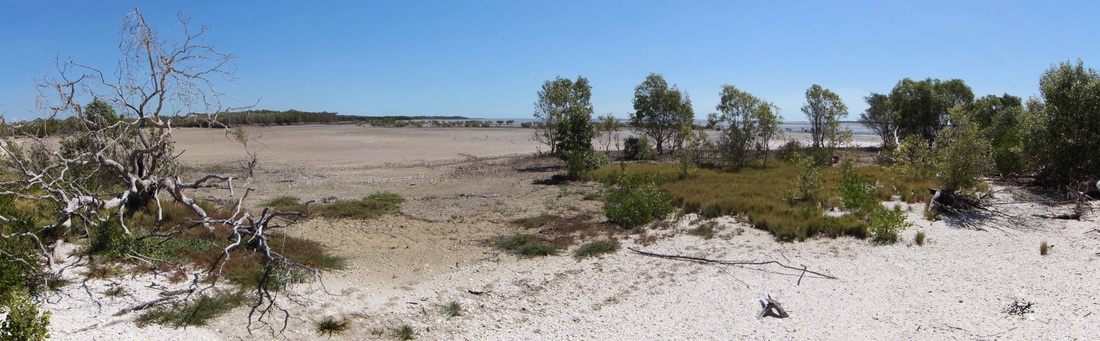
Shallow bays - salt flats - fringing mangroves & the hungry sea's middens of shells supporting coarse grasses and the beginnings of a new shoreline.
Wash-over debris driven ashore by King tides & cyclones help to create a harsh estuarine environment with daily tidal drought & deluge - nor any drop to drink.

The Shell Mound Scenario
- Blood muscles inhabit the anaerobic mud of the intertidal zone - starved of light & oxygen-poor they are reservoirs for viruses.
- A localised mass extinction event kills many millions of blood muscles
- (perhaps they cook when a new beach front ridge forms excluding most tides - what else lives & dies in there & why not seem in mounds)
- (perhaps cyclonic rain at extreme low tide drives them to the surface to die)
- The shells (many intact) are driven ashore by wave action
- They are Wave Sorted into long ridges of shells at the shoreline
- A mangrove fringe develops in front of the shore line
- Coastal vine thicket develops on shore producing leaf litter
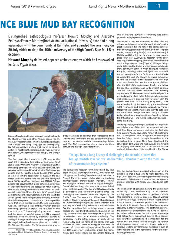
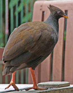
- Orange footed scrum fowls nest in the shell ridges which do not get inundated in the Wet - image
- They introduce litter & seeds which they fertilise
- Trees grow in the fertile, well drained shell mound atop the ridge beyond white ants (termites)
- This stabilises the mound as more litter & shell is introduced by the megapodes
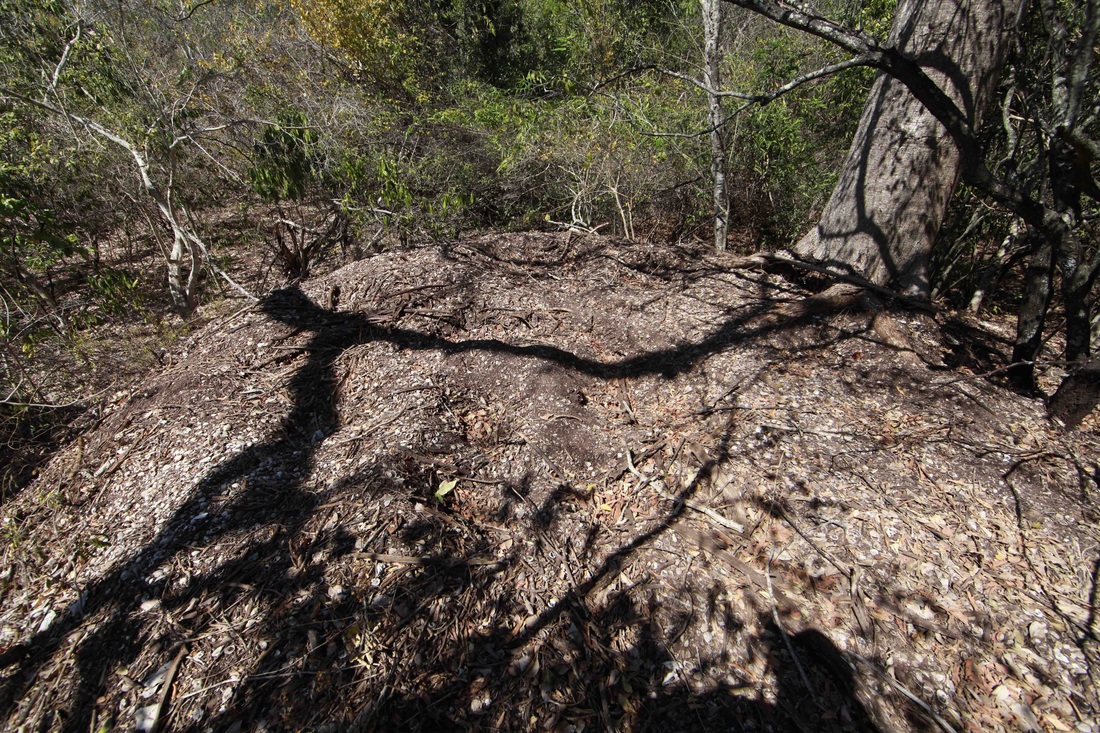
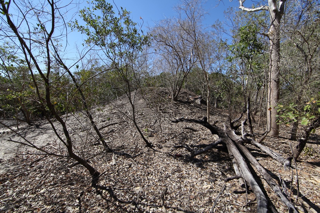
- A mound grows above the ridge of shells
- A catastrophic fire denudes the top of the mound
- All organic matter rots away
- The mound is left with the top compacted & at such a height as to be unattractive to megapodes
Common Misconceptions & Observations
It is a common misconception to interpret the blackened, sooty appearance of the shells is the result of cooking when it is in fact due to cyanobacteria - below the surface the shells are snow white.
Blackfellas & Bush Chooks - The Shell Mound or Midden Controversy
“At the bottom of the western basin one of our people found the skeleton of a human body; and the skull and some of the bones were brought on board, but they were too imperfect to be worth preserving. The traces of natives were found every where, but they did not show themselves. In one of our excursions a tree was observed that had been cut down by some sharp instrument, and we had afterwards reason to believe that the natives were possessed of iron tools, which they might have obtained from the Malays. A curious mound, constructed entirely of shells, rudely heaped together, measuring thirty feet in diameter, and fourteen feet in height, was also noticed near the beach, and was supposed to be a burying-place of the Indians.” PP King 22 April 1818
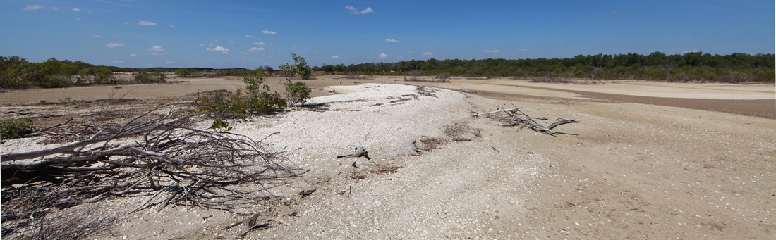
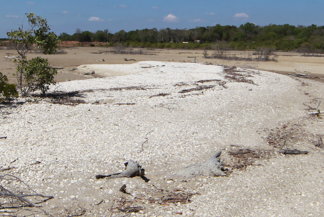
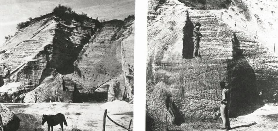
A wave-formed shell drift shows the gradual slope on the left where shells are deposited and the steep edge on the right where the deposit is compacted and raised.
The above image demonstrates how normal tidal action upon a shallow beach face conspires to accumulate shells in wing shaped ridges with steep leading and gentle trailing edges.
There is considerable controversy over the origin of the shell mounds that are a feature of the coastal fringe of north Australia. They are found in two styles, the classical pyramid mound and the linear ridge variety - occasionally in transition between the two.
One school maintains that they are middens left by generations of Aboriginal people eating shells in the same place and certainly Aboriginal people would sit on them because they are unpleasant for snakes whilst being high and dry. It is also an irresistible vantage point for anyone. Aboriginal oral history reports the hiding of tools & weapons in the mounds and occasionally the interment of bodies therein. The opposing school maintains that the mounds are aggregated and sorted up by tidal action and further raised by the obsessive compulsive action of the Orange Footed Scrub Fowl (Bush Chook).

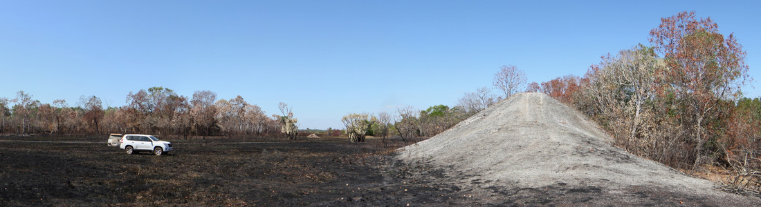
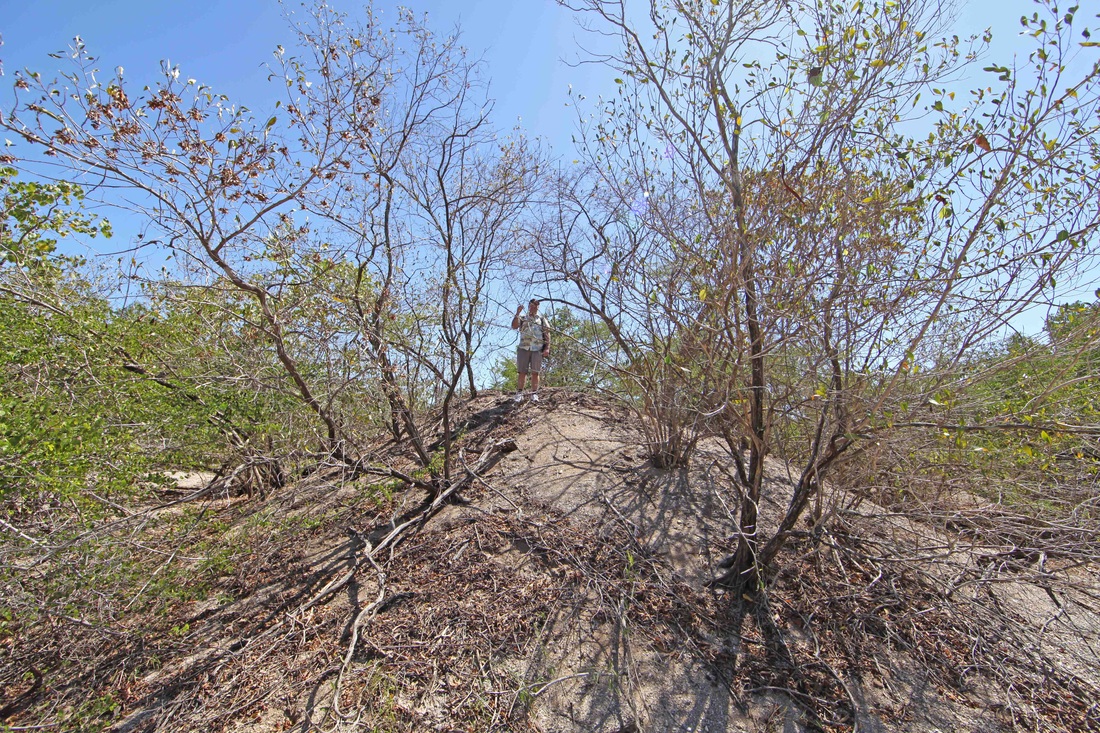
Shell dune at Hope inlet with LandCruiser for scale. An irresistible climb - even on a quad bike. Front section retains original beach ridge formation.
View from top of 5m high mound - mounds and ridges extend around this promontory - billions of shells.

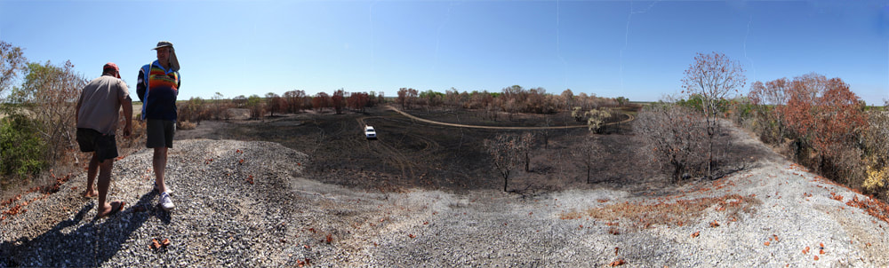
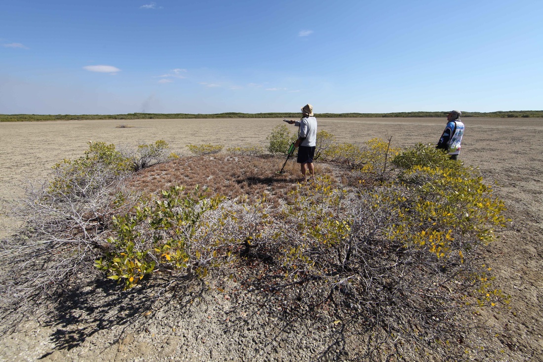
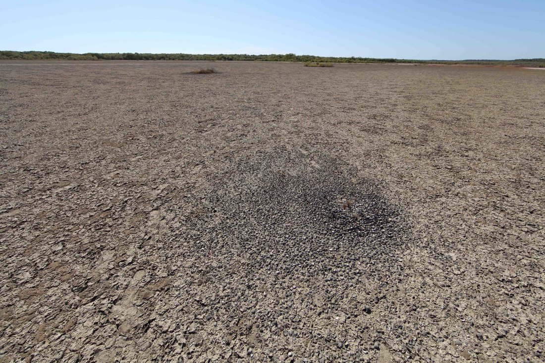
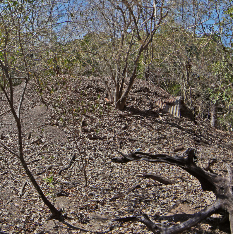
View of promontory mound site from the saltpan - vestigial mounds, as at right of image, mark another, earlier tideline. Classic Dry season bushfire in distance.
The counter-intuitive Wave Sorting or Sorting-Up process - larger shells are deposited on the top as the undertow winnows out smaller items & silt collects at the base.
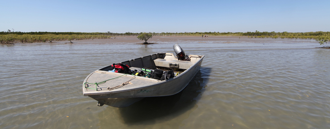
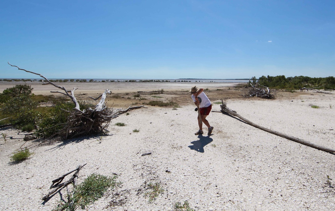
Mike Hermes reporting in after a day out on Shoal Bay - scene from Billy Boustead's boat ramp reviver & mud crab dreaming site.
The Rise & Fall of the Shell Dune
Mike Hermes lends scale to a nascent shoal - the rise and demise of these features characterise the bay.


The article below is The Weipa Shell-Mounds - Works of Man or Nature? by renowned anthropologist Bill Stanner. He talks about the North Queensland mega-mounds but the tropical, inter-tidal zone processes are exactly the same - unfortunately he had scant knowledge of bush chook dementia. Flinders extols their virtues when he is moored in Melville Bay. Aboriginals would once have taken a heavy toll of the birds and it has taken 40 years since Cyclone Tracy for them to again become numerous in Darwin - which affords much humbug but also an opportunity to observe their bizarre and most engaging behaviour. They all too readily demonstrate a diligence & co-operative industry entirely out of character with Darwin's suburban jungle. The Cane Toad inspired demise of the goannas has removed their principal predator but this may change in time as they build immunity or moderate their behaviour.
|
|
| ||||||||||||||||||||||||||||||||||
| |||
If seafood is cooked most common food poisoning bacteria and viruses will be killed; however, cooking won't remove all toxins and chemical pollutants in shellfish and fish. To avoid these risks, seafood should only be harvested from safe waters, chilled and stored correctly and purchased from licensed suppliers. Food Safety Information Council.
Johnson DL, Horwath Burnham J. Introduction: Overview of concepts, definitions, and principles of soil mound studies. In: Horwath Burnham JL, Johnson DL, editors. Mima Mounds: The Case for Polygenesis and Bioturbation: Geological Society of America Special Paper 490. 2012, p. 1–19. There are mound landscapes like this this all over the world including north and southern Australia. (Dr. T. Stone)
Channel Island Mounds

These images show mounds on Channel Island in Darwin harbour.
This is the site of the old quarantine station & leprosarium which is detailed at http://www.pastmasters.org.au/channel-is-centenary---quarantine-to-lazarette.html
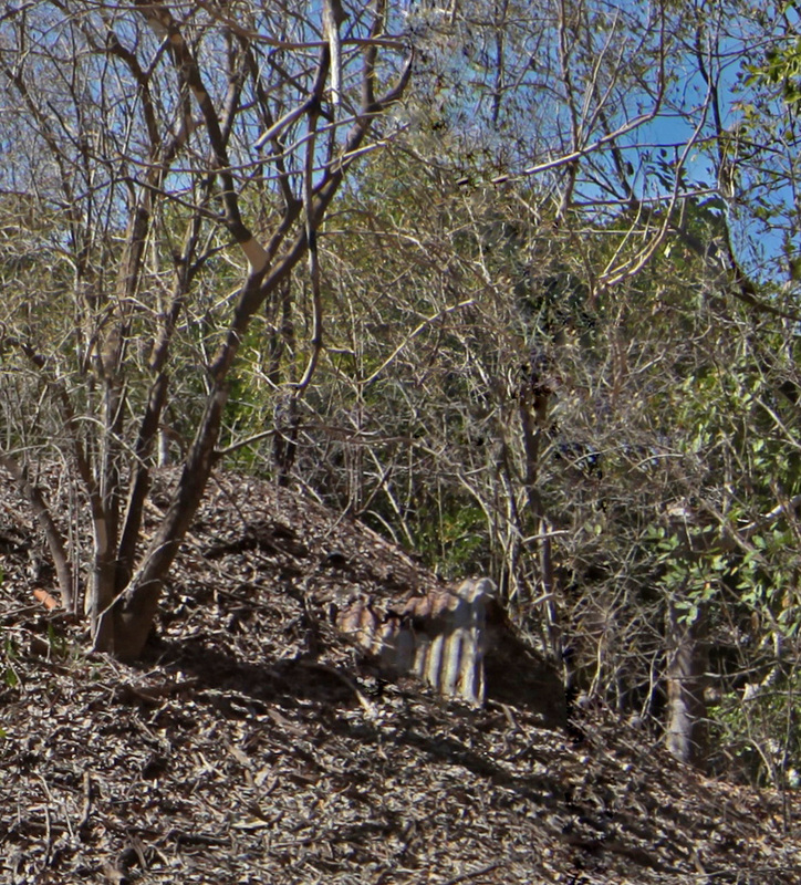
The images below show a corrugated iron water tank that has been deposited by a cyclone. The mound has continued to grow around the tank.
Fear of the disease would have made this a no-go zone since its inception in 1931 and very probably since its earliest use for quarantining Chinese lepers which began in 1885.
There were severe cyclones in 1937 and Tracey in 1974. The leprosarium was closed in 1955 and it is certain that no Aboriginal people have camped here since that time.
The lack of fresh water, the proximity of graves and the lingering pall of the disease conspire to make this a distinctly undesirable camp.
The only other potential culprit with previous for mound building is still in residence.
This is the site of the old quarantine station & leprosarium which is detailed at http://www.pastmasters.org.au/channel-is-centenary---quarantine-to-lazarette.html
The images below show a corrugated iron water tank that has been deposited by a cyclone. The mound has continued to grow around the tank.
Fear of the disease would have made this a no-go zone since its inception in 1931 and very probably since its earliest use for quarantining Chinese lepers which began in 1885.
There were severe cyclones in 1937 and Tracey in 1974. The leprosarium was closed in 1955 and it is certain that no Aboriginal people have camped here since that time.
The lack of fresh water, the proximity of graves and the lingering pall of the disease conspire to make this a distinctly undesirable camp.
The only other potential culprit with previous for mound building is still in residence.

Consideration
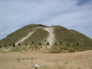
The Sambaquis shell mounds of southern Brazil
The Mounds Controversy stretches around the globe! Are the large shell and earth mounds (sometimes referred to as shell matrix sites) middens formed by human activity or natural deposits that humans simply interact with? The 'sambaquis' of southern Brazil, shown here, are the world's largest shell mounds standing up to 25 metres high and over 300 metres long. Indigenous artefacts and human remains are found scattered throughout these deposits but radiocarbon dating shows that the shells are roughly the same age from the very bottom of the mound to the top (c. 3300 years), which is inconsistent with human agency. These incongruities once divided Brazilian archaeologists but few question that these massive deposits are middens today. How do we reconcile these conflicting lines of evidence? (Dr. Ian McIntosh)
Comment by geomorphologist PastMaster Tim Stone:-
'This particular Brazilian mound is most likely a record of marine transgression around 3300 years ago. Whether it was widespread or not is unknown because geomorphologists are yet to interrogate the data.
Anadara mound formation in north Australia is coincident with marine transgressions of lesser magnitude in the periods 2400-1300 years ago and from 1000 years ago posited from the chenier plain record.
Peculiar isn't it, that human origin is proposed for these mounds during periods of higher sea level.' (Dr. TS Stone)
9 Billion Weipa Cockles
All documented and personal testimony to the origin of these mounds by senior, local cultural people is that they are not made by Aboriginals - they are naturally occurring. The next response by experienced observers, such as Bill Stanner, is to point to the immense number of cockles (i.e. two valves) which so far exceeds the capacity of any nation to consume that no further argument is entered into. The question of how many cockles there are in a particular area is addressed by Bailey:-
"It is a mound 110 m x 45 m with a maximum thickness of 3 m and an estimated volume of 2250 m3. It sits on a low ridge of sandy soil about 1.5 m high and is one of a cluster of ten mounds strung along the edge of the open forest on rising ground. The largest mound is over 5 m high and 2300 m3 in volume, while the smallest is little more than a surface deposit about 40 m x 20 m with an estimated volume of 10 m3.
The total volume of all the Weipa mounds is estimated as 222 800 m3. Samples of shell collected in the course of excavation by means of a sampling procedure described elsewhere (Bailey, 1975) show that the mean weight of shell is 880 t 110 kg/m3 and the mean number of cockles (two valves per cockle) 41 800 2 7420/m". The Weipa mounds as a whole therefore represent 196 000 tonnes of shell or about nine thousand million cockles.” (Bailey 1977)
The total volume of all the Weipa mounds is estimated as 222 800 m3. Samples of shell collected in the course of excavation by means of a sampling procedure described elsewhere (Bailey, 1975) show that the mean weight of shell is 880 t 110 kg/m3 and the mean number of cockles (two valves per cockle) 41 800 2 7420/m". The Weipa mounds as a whole therefore represent 196 000 tonnes of shell or about nine thousand million cockles.” (Bailey 1977)
Comparison & Consideration
Constituents of an average Mound & average Midden:-
MOUND MIDDEN CONSIDERATION
Number of shells Millions Dozens Mounds can number into the billions
Variety of shells Single Multiple Middens have Longbums, razor clams, etc.
Artefacts No Yes Pounding & anvil stones, scrapers, knapped glass
Age of shells All the same All the same Mound a single event no stratification - Midden a temporary site
Other material No Yes Fishbones
The -tjpi Suffix Hypothesis
|
Archaeology in Oceania, Vol. 55 (2020): 153–167
DOI: 10.1002/arco.5213 Toponyms from 3000 years ago? Implications for the history and structure of the Yolŋu social formation in north-east Arnhem Land FRANCES MORPHY , HOWARD MORPHY, PATRICK FAULKNER and MARCUS BARBER FM, HM: The Australian National University; PF: The University of Sydney; MB: CSIRO ABSTRACT The paper focuses on a set of toponyms found on the coast of Blue Mud Bay in northern Australia, in an area today occupied by Yolŋu (Murngin) peoples. In the first part of the paper, we present an analysis, based on geomorphological, archaeological, anthropological and linguistic evidence, to suggest that these toponyms have been in place for at least 3000 years, and that they are early Yolŋu toponyms. |
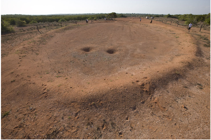
The Lulumu 'ground sculpture' near Malitjpi
|
We then argue that certain social practices and cultural mechanisms, which continue today, work to form a complex, multi-media and multi-sensory archive of names-in-place, within the frame of a robust system of intergenerational transmission. It is plausible that such a system has considerable time-depth. Yolŋu oral histories suggest, indeed, that Blue Mud Bay was the origin point from which Yolŋu-Matha languages and Yolngu forms of kinship and governance then spread inland to the north, west and south.
| -tjpi_suffix_morphy.pdf |