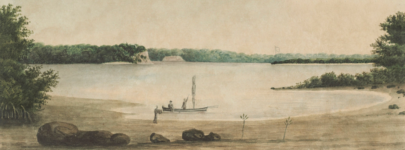
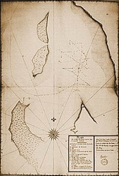
Port Essington by PP King - Narrative of a Survey 1818/22 Vol. 1 - notated by Capt. Bremer in 1824 "Record Point. Here a flag was hoisted by the Tamar & a bottle buried - to record possession having been taken."
Claiming Australia
by
Peter Lane
Addendum by Michel Laroche
© 16 Feb 2022
Abstract
European nations have claimed Australia for more than 500 years. This article records these claims along with some of the coins and medals of the eras in which they were made. When Spain and Portugal divided up the non-Christian world between themselves, with the consent of the Pope, no other nation signed the agreements. Much later Britain, France and the Netherlands, who were not party to the treaties, ignored the claims and proceeded to colonize those regions. However, the 1788 (see below) western border of NSW was drawn at the first Spanish and Portuguese treaty and the current eastern border of WA is the same as the second treaty.
No First Nations people agreed to, or were involved in, European territorial claims. I acknowledge that Indigenous people have been here since the dreamtime and their story is of the greatest importance.
For over two hundred years James Cook’s act of claiming the east coast of Australia for Britain has been celebrated, though this act is now a hotly debated topic. I do not wish to argue the rights or wrongs of what he did or did not do. I simply want to record all claims of Australia made by European nations, which have been virtually lost or ignored in the debate about James Cook. Arguably the most significant consolidated publication on all the first European sightings of the Australian coast is ‘We Discovered an Island’ by Stephen Yarrow published in 1980. I have been unable to find any consolidated publication on all ‘claims’ on the internet and in libraries.
1494 June 7, the Treaty of Tordesilla
Portugal and Spain were the first European nations to claim Australia, even though they were probably unaware of its existence. Some historians claim that they did. The two Iberian nations divided the unknown ‘non-Christian World’ between themselves. Their first treaty, known as the Treaty of Tordesillas, was signed in Tordesillas, Spain and authenticated in Setúbal, Portugal. It divided the newly-discovered lands outside Europe between the Portuguese Empire and the Spanish Empire (Crown of Castile). The focus was on South America, and nothing was mentioned about the other side of the world. The north-south meridian was recorded as ‘370 leagues west of the Cape Verde islands’ (off the west coast of Africa). This was about halfway between the Cape Verde Islands (already Portuguese) and the islands discovered by Christopher Columbus on his first voyage (claimed for Spain).
However, if you draw the meridian line 135° East it would be in the north, near Milingimbi, Arnhem Land in the Northern Territory and in the south near Elliston on Eyre Peninsula South Australia.

|
|
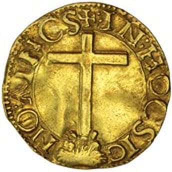
Portugal Gold cruzado, no date, mint not known, 22 mm
John II (João II) 1481-1495 Courtesy Noble Numismatic sale 119 lot 3101 |
|
|
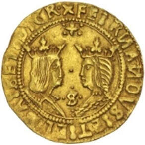
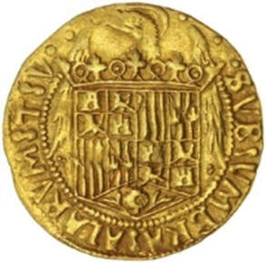
Spain Gold double excelente, no date, Seville Mint, 26 mm
Ferdinand and Isabella Spain 1469-1504 Courtesy Noble Numismatic sale 92 lot 2378 Reference: Treaty of Tordesillas - Wikipedia |
1529 April 22, Treaty of Zaragoza
When the two Iberian nations started to trade in the Spice Islands in the Far East there was a need for a second treaty and this document was signed by King John III of Portugal and the Castilian emperor Charles V, in the Aragonese city of Zaragoza. It was called The Treaty of Zaragoza (also spelt Saragossa). East of the longitude 129°E was Spain’s and to the west Portugal’s. That meridian is now the eastern border of Western Australia. Both these treaties involved the Pope’s approval on the understanding that non-believers would be converted to Christianity.
|
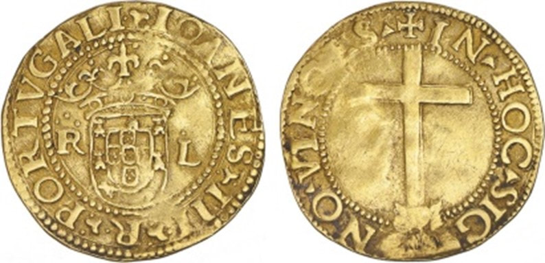
Portugal gold Cruzado, no date, Lisbon Mint, 22 mm
John III (João III) (1521-1557) courtesy Numisma: Auction 124, Lot 208 |
|
|
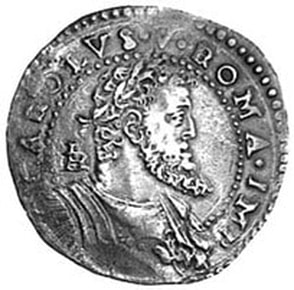
Naples and Sicily, silver mezzo [half] ducato, c1516-1554 14.92 grams
Charles V (Carlos) King of Naples 1516-1556 Courtesy Noble Numismatics Sale 53, Lot 2609 |
*Charles V: born 1500 died 1558, Holy Roman Emperor, King of Germany, King of Italy, King of Spain (Castile and Aragon), Archduke of Austria, Lord of the Netherlands, Duke of Burgundy, and ruler of the American Spanish colonies.
Reference: Treaty of Zaragoza - Wikipedia
Reference: Treaty of Zaragoza - Wikipedia
1642, December 3, Abel Janszoon Tasman, Heemskerck and Zeehaen, North Bay, Tasmania
On 24 November 1642 - Tasman reached the west coast of Tasmania, north of Macquarie Harbour. He named his discovery Anthony Van Diemen’s Land, after Antonio van Diemen, Governor-General of the Dutch East Indies.
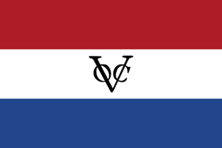
On December 1642 - Tasman organised a small party, in two boats to go, ashore to plant the Dutch flag and formally claim the land for Holland. The carpenter joined that party, bearing the flag and flagpole with its carved insignia of the Dutch United East India Company (Vereenigde Oost Indische Compagnie or VOC). But as squalls set in, it became apparent that the two small boats could not penetrate the surf at North Bay. At Tasman’s direction the carpenter Pieter Jacobszoon swam through the surf, and erected the flagpole within a semi-circle of mature trees close to the shore. Tasman made two separate observations on this successful operation. In the first he characterised the flagpole’s purpose as ensuring ‘that those who shall come after us may become aware that we have been here, and have taken possession of the said land as our lawful property’. Planting a flag had become a validating act, recognised among colonial powers. (See SA Australiana Study Group Report 70 pp1-4 by Philip Jones)
* Note that the spelling of Tasman’s second name ‘Janszoon’ is that used in the Australian Dictionary of Biography, although it has also been spelt elsewhere as Jans and Janzoon. Tasman recorded the island state in Dutch as ‘Anthoonij van Diemenslandt’ (Anthony Van Diemen’s Land). Sometime later ‘Anthony’ was dropped. Often Van Diemen's Land, has been misspelt as ‘Van Diemans’ and ‘Van Dieman’s’. On 1 January 1856 the island was officially renamed ‘Tasmania’.
Tasman rewarded the crewman who first saw Tasmania with three pieces of eight (three Spanish dollars of eight reals) and a can of arrack, a potent spirit.
|
|
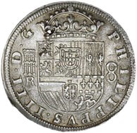
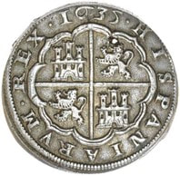
Silver Spain eight reales, 1635, Segovia Mint (Spain), 37 mm
Phillip IIII (1621-1665) Courtesy Noble Numismatics Sale 123, Lot 1614 |
At the time, Spanish eight reales were accepted internationally due to its regular weight in silver, so it is not surprising Tasman had them on board his ship.
|
|
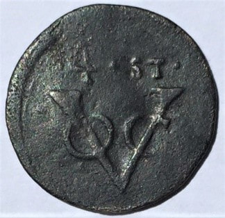
VOC copper quarter stiver, 1644, 25.5 mm
Minted in Batavia by a Chinese moneyer named Conjok, from 19 August to 21 September 1644. No VOC coins were minted in 1642. Private collection |
* In 1644, the date on the above coin, Abel Tasman sailed into the Gulf of Carpentaria but he was not the first European to visit the region. His fellow Dutchmen William Janszoon (also spelt Jansz) were there in 1605-1606, and Jan Carstenszoon (also spelt Carstensz) in 1623.
Reference: Kenihan G.H. Ed. The Journal of Abel Jansz Tasman 1642 with documents relating to his exploration of Australia in 1644, (Facsimile edition), Australian Heritage Press, Adelaide [1964]
Reference: Kenihan G.H. Ed. The Journal of Abel Jansz Tasman 1642 with documents relating to his exploration of Australia in 1644, (Facsimile edition), Australian Heritage Press, Adelaide [1964]
1770 August 22, Lieutenant James Cook (1728-1779), HMB Endeavour, Possession Island, Queensland
Cook was at Possession Island, near the northern extremity of Cape York in far north Queensland, when he wrote the following entry in his journal.
… 'but the Eastern Coast which belongs to the Dutch Navigators from the Lat. [Latitude] of 38° South [Point Hicks, NSW] down to this place, I am confident, was never seen or Visited by any Europeans before us; and not withstanding …I had in the name of His Majesty taken possession of several places upon the coast, I now once more hoisted English colours and in the Name of His Majesty King George the Third took possession of the whole Eastern coast from the above Lat. down this place by the Name of New Wales.* together with all the Bays, Harbours, Rivers and Islands situated upon the said Coast; after which we fired 3 Volleys of small Arms, which were answer’d by the like number from the ship.'
… 'but the Eastern Coast which belongs to the Dutch Navigators from the Lat. [Latitude] of 38° South [Point Hicks, NSW] down to this place, I am confident, was never seen or Visited by any Europeans before us; and not withstanding …I had in the name of His Majesty taken possession of several places upon the coast, I now once more hoisted English colours and in the Name of His Majesty King George the Third took possession of the whole Eastern coast from the above Lat. down this place by the Name of New Wales.* together with all the Bays, Harbours, Rivers and Islands situated upon the said Coast; after which we fired 3 Volleys of small Arms, which were answer’d by the like number from the ship.'
|
|
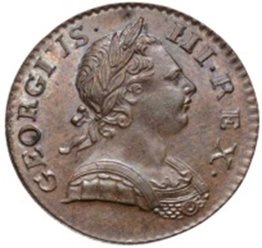
United Kingdom, copper 1770 halfpenny, London Mint, 28 mm
George III (1760-1820) Courtesy Noble Numismatics Sale 93. Lot 2457 |
|
|

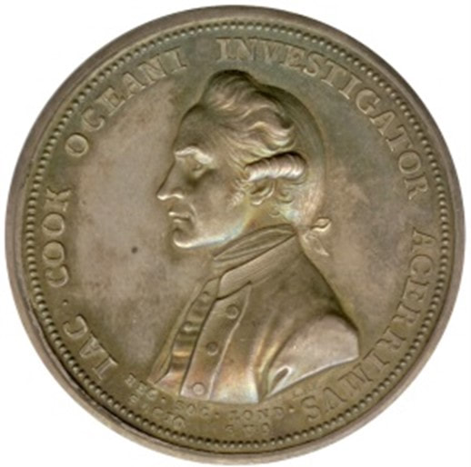
Captain James Cook memorial medal, c 1784
Silver, 43 mm, by L Pingo for the Royal Society Private collection |
Reference: Cook, James. Captain Cook’s journal during his first voyage round the world made in HM Bark “Endeavour”, 1768-71. Libraries Board of South Australia, Adelaide, 1968.
1772 March 30, Commander Louis François Marie Aleno de St. Aloüarn (1738-1772), Gros Ventre, Turtle Bay, Dirk Hartog Island, Western Australia
When St. Aloüarn arrived at Dirk Hartog Island the western half of Australia was known as New Holland and while the Dutch had visited and charted the west coast of Australia, they had never claimed the region. A copy of St. Aloüarn’s journal that records the taking of possession on page 39, is held in the South Australian State Library: (see addendum for the full translation and further comments).
St. Aloüarn: Log of St. Alouarn’s voyage 1772
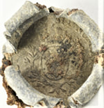
At Baie de Prise de Possession (“Bay of Taking Possession” later named Turtle Bay, Dirk Hartog Island, Western Australia) recorded that he instructed Officer Lieutenant Mengaud de la Hage to take a ceremonial team to a suitable location on the island to raise the flag and take possession of a portion of New Holland, for King Louis XVI. To verify the claim a document confirming same, bottles and at least two coins were left on the site of the claim. A clerical error was recorded in the Journal stating they took possession of the land to the North-West of the place where the claim was made instead to the North-East. Thus theoretically the claim of the land was just a handful of acres rather than a vast territorial claim.
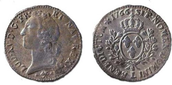
Green’s 2006 WA Museum Report: This records that a bottle, coin and lead seal was discovered on Dirk Hartog Island by a team of private archaeologists in January 1998, and on 1st April the same year a team from the Western Australian Maritime Museum also discovered a bottle, seal and a coin on the island. Both coins are a French écu, the first one found is dated 1766 and the other 1767 and it is believed that all these objects relate to the ‘claim’.
St. Aloüarn: Log of St. Alouarn’s voyage 1772
At Baie de Prise de Possession (“Bay of Taking Possession” later named Turtle Bay, Dirk Hartog Island, Western Australia) recorded that he instructed Officer Lieutenant Mengaud de la Hage to take a ceremonial team to a suitable location on the island to raise the flag and take possession of a portion of New Holland, for King Louis XVI. To verify the claim a document confirming same, bottles and at least two coins were left on the site of the claim. A clerical error was recorded in the Journal stating they took possession of the land to the North-West of the place where the claim was made instead to the North-East. Thus theoretically the claim of the land was just a handful of acres rather than a vast territorial claim.
Green’s 2006 WA Museum Report: This records that a bottle, coin and lead seal was discovered on Dirk Hartog Island by a team of private archaeologists in January 1998, and on 1st April the same year a team from the Western Australian Maritime Museum also discovered a bottle, seal and a coin on the island. Both coins are a French écu, the first one found is dated 1766 and the other 1767 and it is believed that all these objects relate to the ‘claim’.
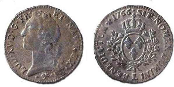
|
The French écu (6 livres) of Louis XV 1715-1774, dated 1766, Bayonne Mint, found at Dirk Hartog Island in January 1998, believed to have been left there by the St. Alouarn expedition. Courtesy, WA Museum.
|
The French écu (6 livres) of Louis XV 1715-1774, dated 1767 found at Dirk Hartog Island in April 1998
Courtesy, WA Museum.
* These two French coins are currently on display at the Western Australia Museum, Perth.
Courtesy, WA Museum.
* These two French coins are currently on display at the Western Australia Museum, Perth.
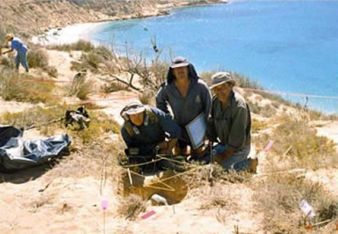
The WA Maritime Museum team: L to R: Bob Sheppard, Mike McCarthy & Bob Creasy at the find site, co-ordinates of the claim as recorded in St. Aloüarn Journal.
Image courtesy Bob Sheppard |
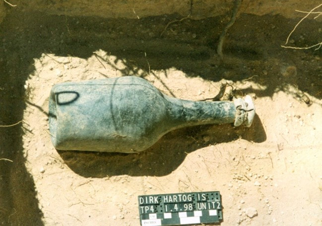
Bob Sheppard located the metal cap and the museum staff excavated the bottle. The bottle neck was facing East when found and Bob believes the other bottle faced north (North-East, the claim line).
Image courtesy Bob Sheppard |
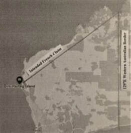
A Line drawn from Dirk Hartog Island to the WA border.
|
Whilst the projection of this line is not exactly N-E, from Dirk Hartog Island, I postulate that was what was intended. This line stretches to the northern coast of the WA Eastern border, being the old 1529 Treaty of Zaragoza meridian. Thus the land the French intended to claim was all on the Portuguese side of that treaty (the last of the two treaties). When Cook took possession of the East Coast he only claimed the land he sighted, (from Point Hicks NSW to Possession Island Qld). Neither St. Aloüarn nor any other French expedition had visited the coast to the North East of Dirk Hartog Island. The two Portuguese and Spanish meridian treaties have played a major role in the formation of British boundaries in Australia, so it is reasonable to assume that the French also acknowledged the most recent Treaty’s meridian. The coastal region that St. Aloüarn ‘claimed’ was certainly strategically located, being close to the spice trade of the East and a relatively safe place to establish a fort, as the only real threat would have been from other European nations.
|
References:
Report on the 2006 Western Australian Museum, Department of Maritime Archaeology, Cape Inscription National Heritage Listing Archaeological Survey by Jeremy Green [on-line] St. Alouarn, Francois de, Journal of Francois de St. Alouarn: log of St. Alouarn's voyage 1772. [Publication details not identified – hand written copy in French] p39
Bloom, Walter R. “The role of the French écu in the colonization of Western Australia” Journal of the Numismatic Association of Australia, Vol.9, 1998 pp 34-42 [on-line]
Bloom, Walter R. “Another French écu surfaces in Western Australia”. Journal of the Numismatic Assoc. of Australia, Vol.11, 2000 pp 47-49 [on-line]
Godard Philippe and Tugdual de Kerros Translated by Odette Margot, Myra Stanbury and Sue Baxter 1772: The French Annexation of new Holland, The tale of Louis de Saint Allouarn Western Australian Museum, Welshpool WA, 2008
Leading up to the NSW settlement: 1770-1787
Joseph Banks (later knighted), whilst on board the Endeavour in May 1770, suggested Botany Bay as a possible site for a British settlement. In August 1783 James Matra, who also sailed on the Endeavour on the same voyage, suggested establishing a colony at Botany Bay. His idea became known as the ‘Matra proposal’. The Pitt government in mid-1786 decided to establish a colony in Australia. At the time Thomas Townshend, 1st Viscount Sydney was the Home Secretary, and he appointed Captain Arthur Phillip RN to govern the colony.
|
|
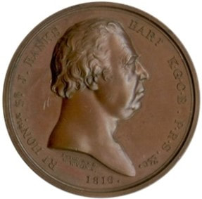
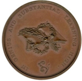
Joseph Banks (1743-1820), 1816 medal
Bronze, 40 mm, by B. Wyon after T. Wyon Junior Private collection Reference: Botany Bay as a Penal Colony (australianhistoryresearch.info) |
1788 January 26, Governor Arthur Phillip (1738-1814), First Fleet, Sydney Cove, NSW
The First Fleet landed in Sydney Cove with Governor Arthur Phillip as its commander and he raised the Union Flag (The Union Jack dates from 1801, when the cross of St Andrews was added). This is the date Australia Day is commemorated.
Reference: History ‐ Australia Day
Reference: History ‐ Australia Day
1788 February 7, Judge-Advocate David Collins (1756-1810) formalises NSW Boundaries, Sydney NSW.
The Colony of NSW was formally proclaimed as instructed by the Home Secretary, Thomas Townsend, 1st Viscount Sydney. The official ceremony was performed by Judge-Advocate David Collins, the account of this event was recorded in his official account of the colony:
As soon as the hurry and tumult necessarily attending the disembarkation had a little subsided, the governor caused his Majesty's commission, appointing him to be his captain-general and governor in chief in and over the territory of New South Wales and its dependencies, to be publicly read, together with the letters patent for establishing the courts of civil and criminal judicature in the territory, the extent of which, until this publication of it, was but little known even among ourselves. It was now found to extend from Cape York (the extremity of the coast to the northward) in the latitude of 20 degrees 37 minutes South, to the South Cape (the southern extremity of the coast) in the latitude of 43 degrees 39 minutes South; and inland to the westward as far as 135 degrees of East longitude, comprehending all the islands adjacent in the Pacific Ocean, within the latitudes of the above-mentioned capes.
By this definition of our boundaries it will be seen that we were confined along the coast of this continent to such parts of it solely as were navigated by Captain Cook, without infringing on what might be claimed by other nations from the right of discovery. Of that right, however, no other nation has chosen to avail itself. Whether the western coast is unpromising in its appearance, or whether the want of a return proportioned to the expense which the mother-country must sustain in supporting a settlement formed nearly at the farthest part of the globe, may have deterred them, is not known; but Great Britain alone has followed up the discoveries she had made in this country, by at once establishing in it a regular colony and civil government.
The ceremony of reading these public instruments having been performed by the judge-advocate, the governor, addressing himself to the convicts, assured them, among other things, that ‘he should ever be ready to show approbation and encouragement to those who proved themselves worthy of them by good conduct and attention to orders; while on the other hand, such as were determined to act in opposition to propriety, and observe a contrary conduct, would inevitably meet with the punishment which they deserved.’ He remarked how much it was their interest to forget the habits of vice and indolence in which too many of them had hitherto lived; and exhorted them to be honest among themselves, obedient to their overseers, and attentive to the several works in which they were about to be employed. At the conclusion of this address three volleys were fired by the troops, who thereupon returned to their parade, where the governor, attended by Captain Hunter and the principal officers of the settlement, passed along the front of the detachment, and received the honours due to a captain-general; after which he entertained all the officers and gentlemen of the settlement at dinner, under a large tent pitched for the purpose at the head of the marine encampment.
The ceremony of reading these public instruments having been performed by the judge-advocate, the governor, addressing himself to the convicts, assured them, among other things, that ‘he should ever be ready to show approbation and encouragement to those who proved themselves worthy of them by good conduct and attention to orders; while on the other hand, such as were determined to act in opposition to propriety, and observe a contrary conduct, would inevitably meet with the punishment which they deserved.’ He remarked how much it was their interest to forget the habits of vice and indolence in which too many of them had hitherto lived; and exhorted them to be honest among themselves, obedient to their overseers, and attentive to the several works in which they were about to be employed. At the conclusion of this address three volleys were fired by the troops, who thereupon returned to their parade, where the governor, attended by Captain Hunter and the principal officers of the settlement, passed along the front of the detachment, and received the honours due to a captain-general; after which he entertained all the officers and gentlemen of the settlement at dinner, under a large tent pitched for the purpose at the head of the marine encampment.
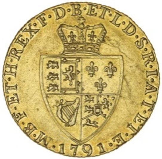
The Western boundary of 135° East was the true meridian of the Treaty of Tordesillas line (as agreed between Portugal and Spain 1494) based on the South America line. This meridian is roughly a line between Milingimbi, NT, and Elliston, SA. On 1 July 1841 New Zealand became an independent colony.
|
|

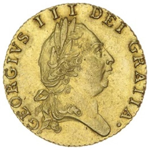
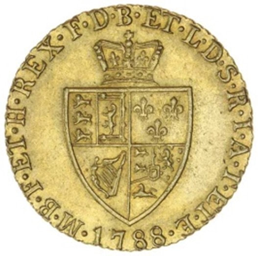
United Kingdom, Gold 1788 half guinea, London Mint, 21 mm
George III (1760-1820) Courtesy Noble Numismatics, sale 110, lot 1054 Reference: Collins David An Account of the English Colony of NSW, Vol 1 by David Collins, Printed for T. Cadell Jun. and W. Davies in the Strand, Lonson, 1798 Chapter 1.
|
1791 September 29, Commander George Vancouver (1758-1798), Discovery and Chatham, King George Sound, WA
Possession Point, (now the town of Albany) King George Sound, WA, George Vancouver recorded in his Journal:
'The necessary observations being made at this station, the British colours were displayed, and having drank his Majesty’s health, accompanied by the usual formalities on such occasions, we took possession of the country from the land we saw north-westward of Cape Chatham, for far as we might explore its coasts, in the present majesty, for him and for his heirs and successors. This port, the first which we had discovered, I honoured with the name King George the Third’s Sound…'
(Note the spelling changed to modern form. Cape Chatham was renamed Chatham Island located approx. 130 kilometres west of King George Sound.)
According to D.J. Mulvaney in his book, Encounters in Place (1989), p.38 he wrote:
…'the British government never recognised Vancouver’s resourceful full-dress imperial action in annexing the coastal territories of the southern Nyungar people from Walpole to Esperance…'
|
|

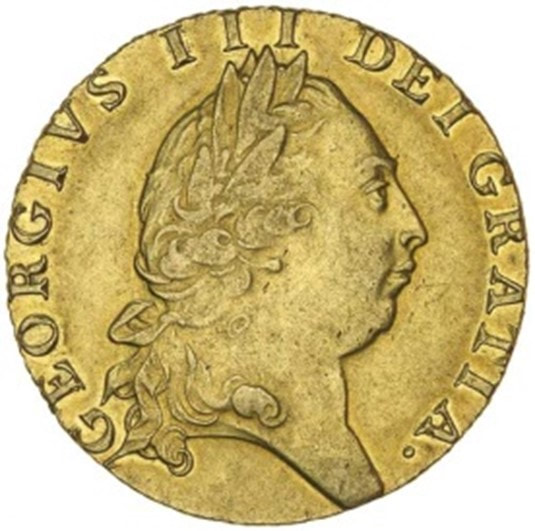
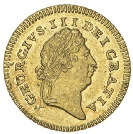
United Kingdom, Gold 1791 Guinea, London mint, 24 mm
George III (1760-1820) Courtesy Noble numismatics, sale 104, lot 1819 |
1802, December 14, Lieutenant Charles Robbins (1782-1805)
The 1788 British claim of NSW extended north to Cape York and to the southern tip of Tasmania as, at that time, it was assumed that Bass Strait did not exist. It was not until 1798-99, when the island was circumnavigated by Matthew Flinders and George Bass, that it was realised that Tasmania was a separate island. This created a grey area of European ownership and when the French expedition, led by Nicolas Baudin, left Sydney in November 1802 bound for Bass Strait, Governor Philip Gidley King was concerned that Baudin would claim the Strait for France. Within five days of Baudin leaving, he dispatched Lieutenant Charles Robbins of HMS Cumberland to claim King Island for the British. Robbins with sixteen of his men hoisted a British flag in a gumtree and fired three volleys, using gunpowder borrowed from the French. This claim was made in the middle of a French scientific camp at Sea Elephant Bay, on 14th December 1802. At the time there were some hundred Frenchmen on the island and they thought the act was hilarious and did not take it seriously. Today there is an obelisk on the spot to commemorate the claiming of King Island.
|
|
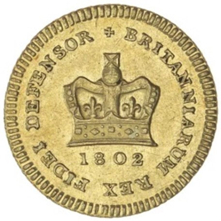
United Kingdom George III gold third guinea 1802, 17 mm
Courtesy Noble numismatics, Sale 103, lot 1806 Reference: Claiming of King Island | Monument Australia |
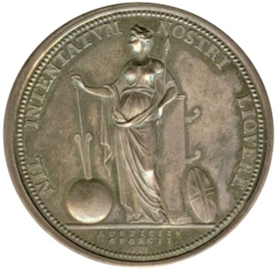
1824 Tiwi Islands and Cobourg Peninsula
Henry Bathurst, 3rd Earl Bathurst gave orders to Captain John James Gordon Bremer (1786-1850) to establish two settlements in Northern Australia and to sail to Sydney first to get assistance from Governor Thomas Brisbane. Bathurst stipulated due to the sites being west of the NSW boundary that:
“…wherever the first settlement be established, it is highly important that formal possession be taken of, and His Majesty’s Colours hoisted upon each of the three points mentioned herein, the Naval Commander’s attention therefore has been particularly drawn to that point.”
And
“My Lords, I am commanded to signify to you His Majesty’s pleasure that a Ship of War should be dispatched without delay to the North West Coast of New Holland, for the purpose of taking formal possession, in the name of His Majesty, of that part of the said Coast contained between the western Shore of Bathurst Island and the eastern side of Coburg Peninsula, including the whole of Bathurst and Melville Islands, [Tiwi Islands] and the said Peninsula.”
Reference: Bathurst, Earl, 1824, Letter: Earl Bathurst to Governor Thomas Brisbane, Historical Records of Australia, Series 1, Vol.2, 17 February, pp 227-228.
On 24 August 1824 HMS Tamar and HMB Lady Nelson and Countess of Harcourt sailed from Sydney with Captain John James Gordon Bremer in command. He was accompanied by Captain Maurice Barlow, Lieutenant John Septimus Roe, Ensign Everard, 23 men of the 3rd Regiment, a subaltern, 26 men of the Royal Marine, a surgeon, three commissariat workers, three free men seeking adventure and 44 convicts. As Fort Dundas was then outside the NSW Colony’s boundary, the convicts had to volunteer and were induced by being given a Ticket-of-Leave after 12 months at the Fort. The Fort was established with the hope of establishing a trade post with the Malays.
On 20 September 1824 Bremmer arrived at the bay of Port Essington, on the Cobourg Peninsula, due east of Melville Island (a Tiwi Island).
“ a projecting point in the bay, called by Capt. King Table Rock. Here we brought up in 5 fathoms water, when the officers were landed, and possession was taken of the same, in the name and on the behalf of His Majesty King George the Fourth. —A Union Jack was hoisted on a staff, and three vollies [sic] of small arms fired, which was answered by a royal salute from the Tamar; the crew manning the yards and cheering. The whole moved on board again, the flag having been previously secured in a tree.”
This account was written up in The Australian, 10 March 1825, p3, and the paper’s source was described as ‘gleaned from a private journal’.
Another version of this event was found and recorded in Derek Pugh’s, The British in North Australia 1824-29 Fort Dundas, 2017. P12.
When the fleet arrived, Bremer formally unfurled the Union flag on Point Record and took possession of the land stretching west from Cape York to 129 E longitude, in the name of King George IV. Lieutenant John Septimus Roe scattered some coins and buried a bottle there containing a copy of the possession documents.
The whereabouts of the coins, bottle and document are unknown.
26 September 1824, Melville Island:
“At 2 30’ came to anchor in 15 fathoms water, off Luxmore Head, the place pointed out as the future settlement. Marines landed from the Tamar to take possession; Union Jack hoisted, and a feu-de-joie fired [a rifle salute fired by soldiers on a ceremonial occasion, each soldier firing in succession along the ranks to make a continuous sound]; answered by royal-salute from His Majesty's ship. This seemed greatly to surprise the fish. It was most amusing to see them leaping out of the water, numbers going to the height of 8 and 10 yards above the surface. The spot of land where the flag is hoisted is the highest part that I can see, not exceeding one hundred feet. The adjacent parts are apparently subject to inundation, or within the reach of spring tides, which makes it little else than a salt water swamp. On going ashore I found some deserted wigwams, and a place where fires had been made, though not recently. I suppose the natives must have moved for water, none being found in the vicinity.”
Reference: The Australian, 10 March 1825 p3.
The following day Lieutenant Charles Roe was sent to Bathurst Island to take possession of that island.
“… the Declaration read aloud to my boat’s crew, and all the noise 8 person were capable of making was called into action in giving 9 cheers to the crown our undertaking.”
(Roe, letter to father, 1824).
Reference: Pugh Derek, The British in North Australia 1824-29 Fort Dundas, 2017, p 13.
* Construction of the Fort began 27 September 1824 and it was officially proclaimed on 21 October. The fort was named after Robert Dundas, the First Lord of the Admiralty, whose title was Viscount Melville. Thus Robert had a fort named after him and the island after his title. All the forts on Tiwi Islands and on the Cobourg Peninsula were a failure and were abandoned; Fort Dundas 1824-1829, Fort Wellington 1827-1829, Victoria Settlement 1838-1849.
The northern territorial claims of 1824 were ratified in London on 16 July 1825 by Henry Bathurst, 3rd Earl Bathurst (1762-1834). The new western boundary being 129° East was the same as the Treaty of Zaragoza meridian. This line extended to the Southern Coast of Australia.
|
|

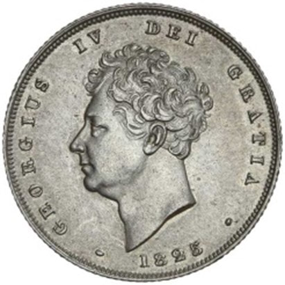
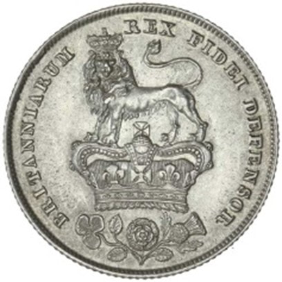
United Kingdom, silver 1825 Shilling, (design type 1825-1829) 24 mm
George IV (1820-1830) Courtesy Noble Numismatics, sale 117, lot 1758 |
1827 January 21, Major Edmund Lockyer (1784-1860), King George Sound WA
In 1826 the French government sent Captain J.S.C. Dumont D’Urville on a world cruise that included Western Australia. To avoid a possible French settlement there, Earl Bathurst sent a dispatch on 1 March 1826 instructing Governor Darling to form a settlement at Western Port Victoria, and send an expedition to Shark Bay WA. Ten days later Bathurst modified his instructions, ordering a survey of King George’s Sound prior to the survey of Shark Bay in order that “if the circumstances of the place be in other respects favourable, a Settlement may be first made in that quarter.” These instructions were received in September 1826 and on 9 November HMS Fly and Dragon sailed for Western Port and the Amity for King George’s Sound. The expedition to WA was under the command of Edmund Lockyer, a major in the 57th regiment.
Lockyer was given secret instructions.* Governor Darling ordered Lockyer in the event of an encounter with the French, to claim the whole of Australia as subject to the British government, stating that:
'any division of it, which may be supposed to exist under the designation of New South Wales, being merely ideal and intended only with a view of distinguishing the more settled part of the Country.'
In the general instructions, Lockyer was ordered to select the most suitable site for a penal settlement and to take formal possession… to conciliate the natives; and to explore the country.
The Amity was loaded with soldiers of the 39th Regiment, convicts and a few free settlers, all up around fifty persons, and the brig arrived at the Sound on 25 December 1826. The following day one of the convicts was speared by an Aboriginal. On the 10 January 1827 sealers arrived, and Lockyer learnt that they had murdered and abducted Aborigines, explaining why the Aborigines speared the convict.
Lockyer named the new settlement Frederick’s Town in honour of H.R.H. the Duke of York, (later changed to Albany) and on the 21 January 1827 the colours were displayed, a royal salute was fired from the battery and a feu de joie by the troops. As there were no encounters with the French during Lockyer’s time at the Sound, only the region was claimed, thus the Sound became an enclave of NSW.
Reference: King George's Sound Settlement - Research Data Australia
1829 May 2, Captain William Henry Fremantle (1766-1850), H.M.S. Challenger, Fremantle WA
On 5 November 1828, Sir George Murray, the Secretary of State for the Colonies requested that the British Admiralty take formal possession of the western coast of Australia. On 30 December 1828 Sir George Murray issued instructions to James Stirling to act as Lieutenant-Governor of an independent colony to be formed at Swan River. When Stirling left England to govern there were not defined boundaries.
In March 1829 C.M. Schomberg, the commodore at the Cape of Good Hope, sent captain W.H. Fremantle in HMS Challenger to take possession of the West coast of Australia and await the arrival of Stirling. Fremantle landed and took possession at the locality named after him.
On 2 May 1829, Fremantle hoisted the Union flag in a bay near what is now known as Arthur Head, and in accordance with his instructions, took formal possession ‘of the whole of the West Coast of New Holland” in the name of Britain’s King George IV.
In England the Western Australia Act dated 9 February 1829 received Royal Assent on 14 May 1829 confirming the settlement as a British colony. On 28 April 1831 Letters Patent defined the limits of Captain Stirling’s authority as from Hartog’s Island to 129° East Longitude, the current WA boundary and being the Treaty of Zaragoza meridian.
* 1826 December, until 1831 March 7
The region of King George's Sound, WA was declared an enclave of NSW, before being absorbed by the WA Colony.4
|
|

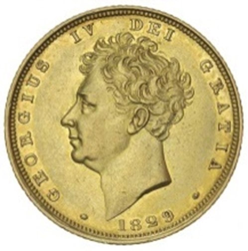
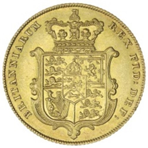
United Kingdom, Gold 1829 Sovereign, London Mint, 22 mm
George IV, (1820-1830) Noble Numismatics Sale 99, lot 2964 |
References:
Historical Records of Australia, Series III, Vol VI, The Library Committee of the Commonwealth Parliament, 1923, pp.XVI-XVIII author Frederick Watson (available online - HathiTrust Digital Library )
Fremantle (tnfast.com)
Find & Connect: WESTERN AUSTRALIA – CONCEPT: Colony of Western Australia (1829 - 1901)
Western Australia border - Wikipedia
Addendum - RM Laroche
The French Claim:

De Saint Aloüarn an historical timeline
https://museum.wa.gov.au/research/research-areas/maritime-archaeology/batavia-cape-inscription/cape-inscription/de-saint-alouarn
1770
In 18th Century France, there was a widespread belief in a vast southern land, often referred to as Gonneville Land. This continent was considered to be distinct from New Holland, the position of which was only roughly known and marked on the charts of the day. Even after James Cook returned from the Pacific in 1770, the identification of this land remained one of the most important discoveries still to be made. During an interlude of peace following the Seven Years’ War, the French Government decided to support an expedition, which would hopefully equal Cook's achievements, solve the mystery of the Utopian land filled with gold and other riches and restore the prestige of the French navy following defeats during the war.
1771
In 1771, a young, ambitious naval officer and Breton noble, Yves-Joseph de Kerguelen-Trémarec, was given permission by the King of France, Louis XV, to undertake a voyage of exploration to the Southern Ocean with the aim of discovering the Terres Australes.
His second-in-command was fellow Breton Louis François Marie Aleno de Saint Aloüarn, in command of Gros Ventre, They managed to round Cape Leeuwin and sailed north, but bad weather and poor rigging led de Kerguelen’s and de Saint Aloüarn's ships becoming separated.
1772
On the evening of 29th March 1772, the ship Gros Ventre entered Shark Bay and anchored in Turtle Bay and the following day de Saint Aloüarn sent the ship's boat (pinnace) ashore with officer Mengaud de la Hage, the boat's crew and five soldiers to reconnoitre the land and claim possession. After walking about three leagues (lieues) (12km) inland, finding little evidence of human occupation, they returned to the coast and took possession of the land. Prise de Possession took place on the northern cliff of Dirk Hartog Island, overlooking La Baie des Tortues (Turtle Bay).
The annexation was commemorated by raising a flag, firing a volley of rifle shots and reading a prepared document written in the usual terms in such circumstances. It was then inserted into a bottle, which was buried at the foot of a small shrub or tree. Near it they placed deux écus de six francs (two six franc coins).
|
On 8th April, Gros Ventre left Shark Bay and headed for Timor arriving on 3rd May 1772, with many of the crew sick. As he was unable to get the necessary provisions in Dili, de Saint Aloüarn left on 1st July for Batavia to get them there and then make the journey back to Ile de France (Mauritius).
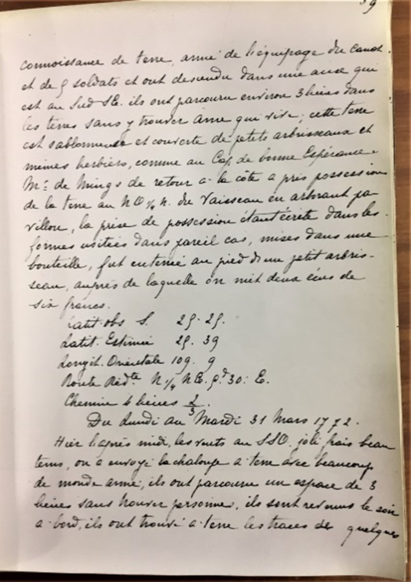
He managed to supply the ship and set sail for Mauritius on 8th August, but by then both he and Mengaud de la Hage were sick from fevers contracted in Batavia. Early in September the Gros Ventre finally arrived back in Mauritius, but de Saint Aloüarn was ailing fast and died on 27th October 1772 in Port Louis, Ile de France (Mauritius). He had celebrated 34th birthday just a few weeks earlier as he sailed through the Sunda Strait. Following here is your French into English translation of the above excerpt document. Previous page (not illustrated): 'Ce matin Mr de St Allouarne a envoyé le canot avec un officier pour prendre… Previous page translation: 'This morning Mr de St Allouarne sent the ship’s boat with an officer to engage into … |
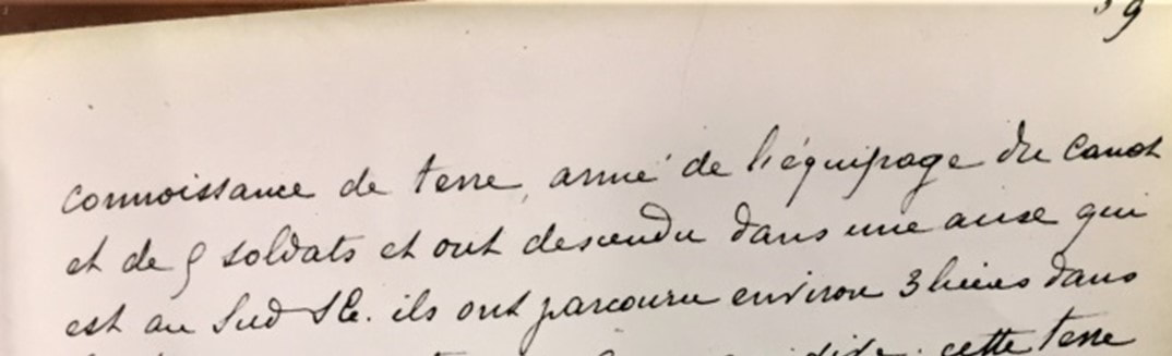
connaissance de terre
… a land search, constituted by the crew of the ship’s boat and 9 soldiers landed in a cove which is South.
… a land search, constituted by the crew of the ship’s boat and 9 soldiers landed in a cove which is South.
They covered about 3 leagues (14 km) in land without meeting any soul; this land is sandy & covered by small shrubs and similar herbaria, as those of the Cape of Good Hope.
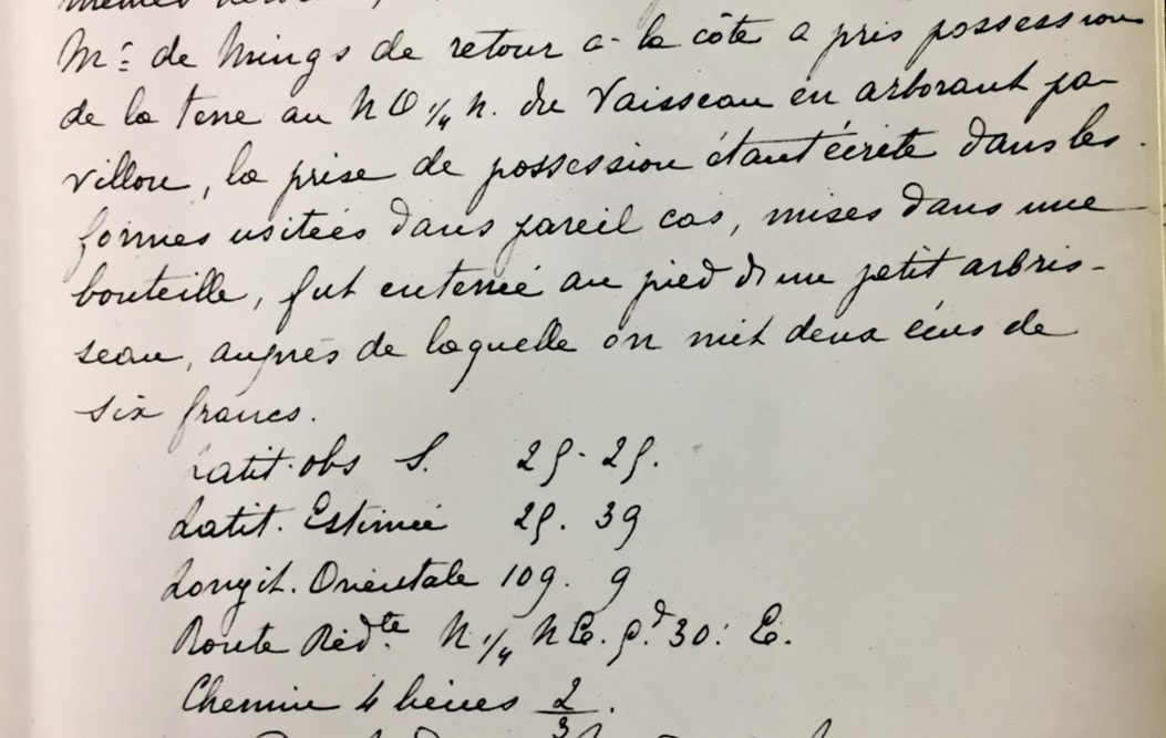
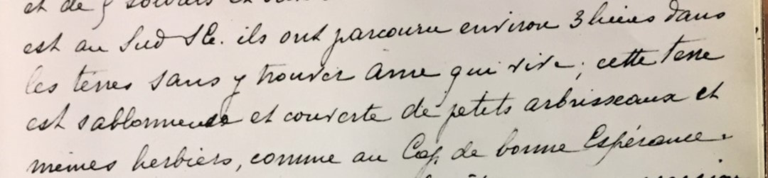
Mr. (Monsieur) De Mings (Lieutenant Mengaud de la Hage) upon his return to the coast took possession of the land at a ¼ hour to the NW of the ship by raising the flag; the taking possession having been written in the usual forms in such circumstances, placed in a bottle, was buried at the foot of a small tree, near which were put two écus coins of six francs.
Latitude observed South 29. 29
Latitude Estimated 29. 39
Longitude Orientale 109. 9
Latitude observed South 29. 29
Latitude Estimated 29. 39
Longitude Orientale 109. 9
https://museum.wa.gov.au/exhibitions/voyages/about/stalouran.html
|
|
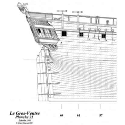
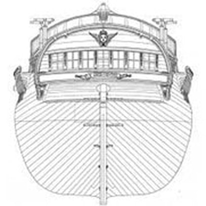
Plans du “GrosVentre” par Gérard Delacroix
|
|
https://shipsofscale.com/sosforums/threads/le-gros-ventre-gabare-1766-1779-by-gerard-delacroix.3025/
LAROCHE R-M, ORFr, BA.Edu.VET Longwood Pty #1385 Sodwalls Road Tarana NSW 2787 Telephone: 61-(0)2 63 375 827 Email: [email protected] |