BURNT MOUNDS - BREWING & CHAMBERED CAIRNS
The Burnt Mounds Mystery
These archaeological anomalies are the poor cousins of the great stone circles & chambered tombs. A fair indication of their importance is being named after their spoil heaps. They have spawned some fevered hypotheses being variously dubbed communal kitchens, ritual centres, pig processing shops and sheep skin tanneries. This page suggests that they are for brewing beer & initiate a suitably reverential continuity of design through many thirsty millennia.
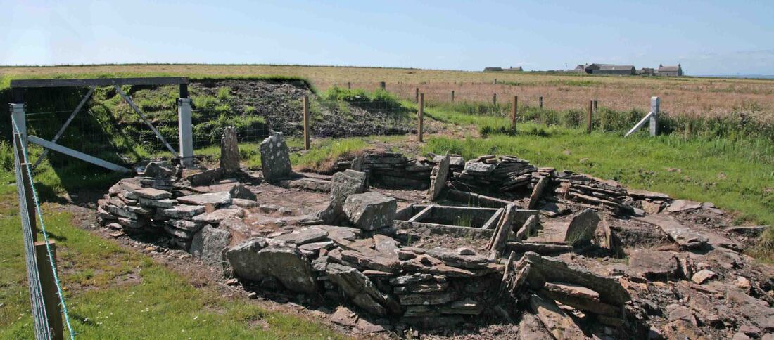
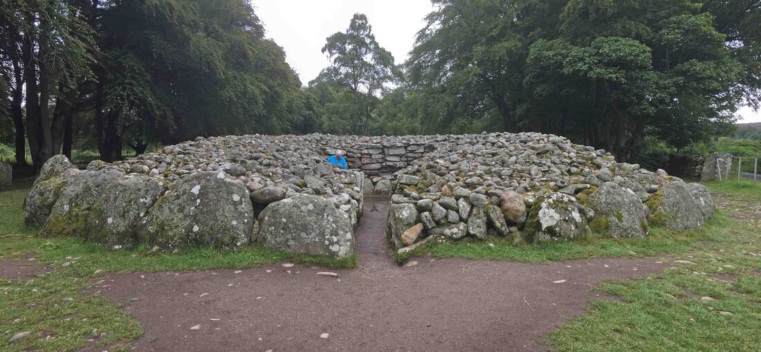
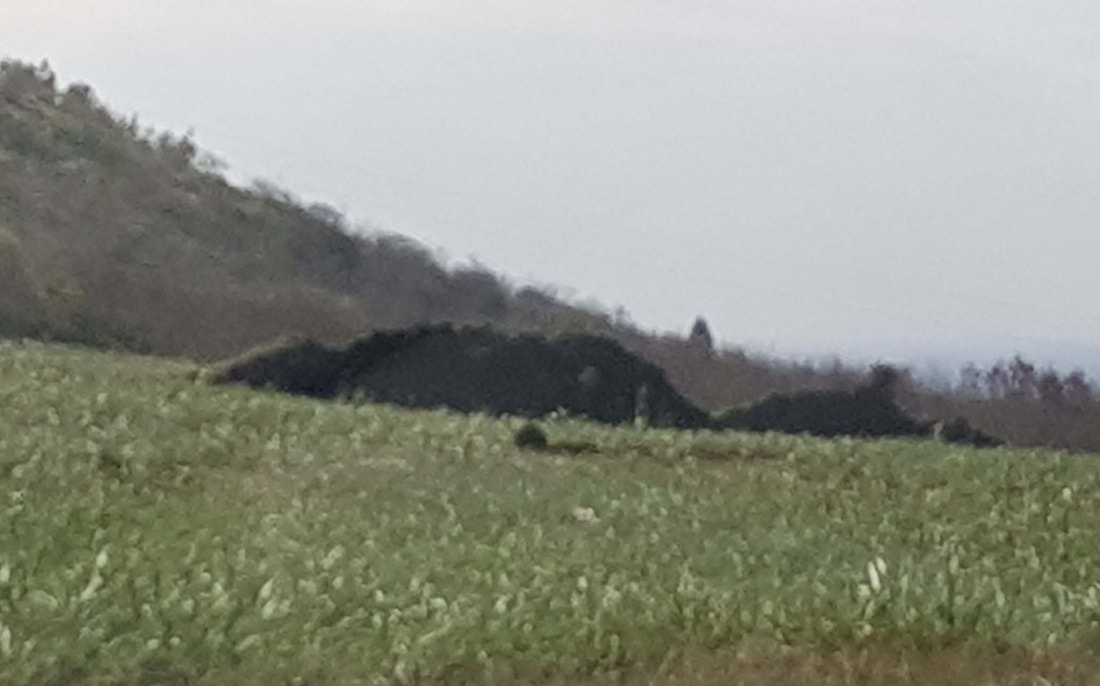
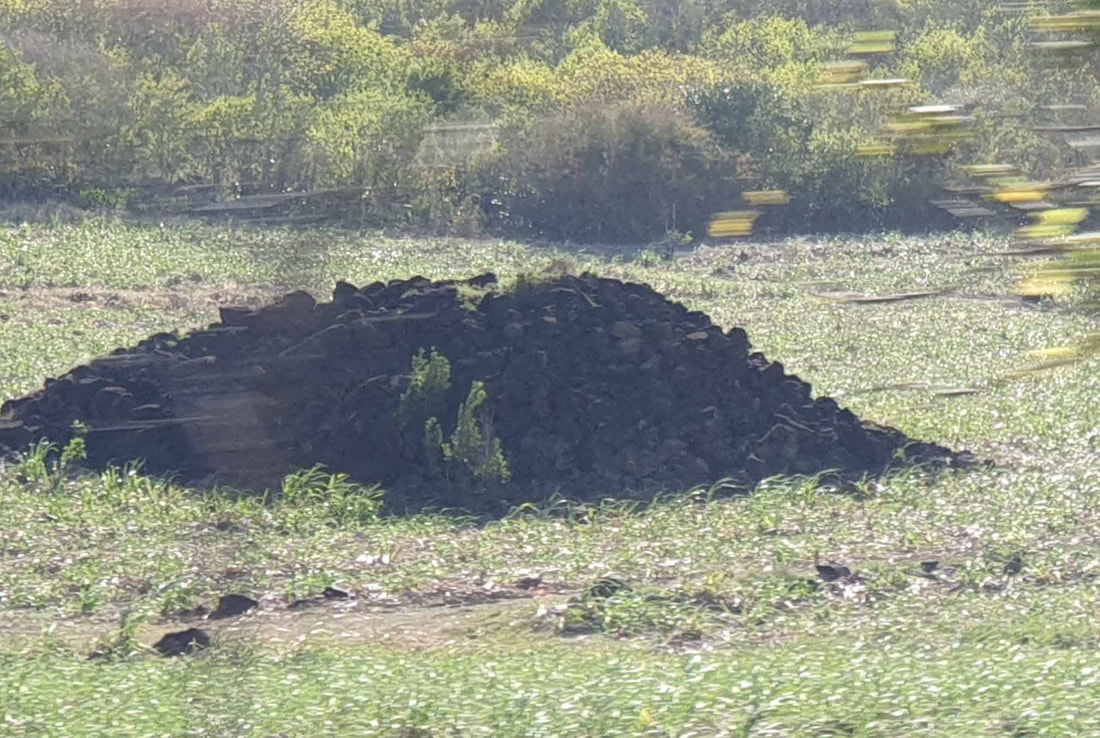
The Bronze Age Burnt Mound showing the relationship between the mound of ash, charcoal & split stones at left and the building on the edge of the wet area.
Abstract
The diagnostic features of these buildings are:-
Confusion arises as the manufacture of gruel, unleavened bread and beer are basically the same. However, whilst gruel & bread require merely profane domestic processes - the production of intoxicating liquor is often imbued with intonations of the sacred & divine.
The following examples indicate a continuity of location, purpose and design that starts in the Orkneys with the earliest farmers and continues through 'villages' such as Skara Brae down to Brochs and echoes even in the Viking Drinking Halls adjacent to the same fields which still produced their grains some five millennia later.
- Location within the waterlogged edge of a swamp.
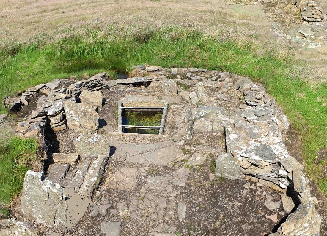
- The stone cistern is centrally located within the building.
- Invariably co-located with the agricultural production of Barley.
Confusion arises as the manufacture of gruel, unleavened bread and beer are basically the same. However, whilst gruel & bread require merely profane domestic processes - the production of intoxicating liquor is often imbued with intonations of the sacred & divine.
The following examples indicate a continuity of location, purpose and design that starts in the Orkneys with the earliest farmers and continues through 'villages' such as Skara Brae down to Brochs and echoes even in the Viking Drinking Halls adjacent to the same fields which still produced their grains some five millennia later.

A model of the Burnt Mound & building
The Burnt Mound

|
The Burnt Mound contains ash, carbonised timber residue and boiling stones that have split in the quench. It has been suggested that this timber was driftwood from North America which could be tested. Mounds in other areas have exclusively peat ash so the deforestation may reflect climate change or increased human predation. The high cliffs suggest collecting driftwood on this scale is arduous but concurrent with the collection of suitable beach stones.
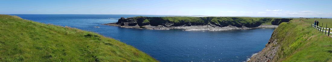
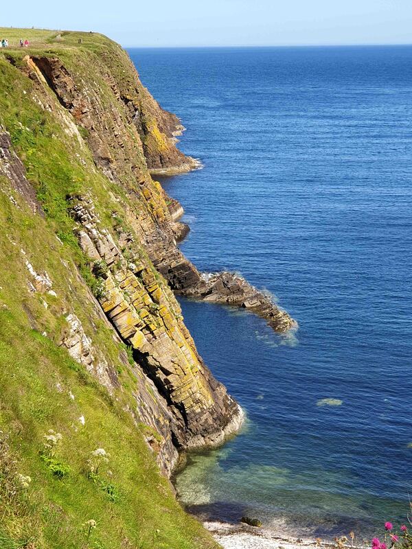
The inlet below the burnt mound near Skara Brae & the Tomb of the Eagles
|
The Brew
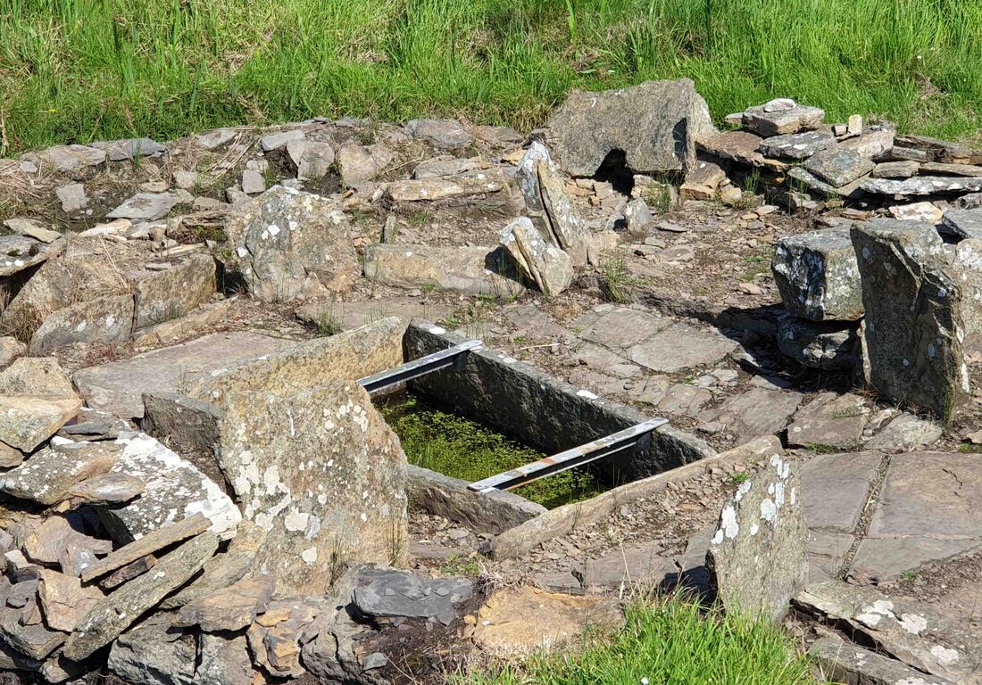
The central 'cist' - prounounced kist it was recently current for coffin being a stone built box- sometime reliquary -sometime ossuary.
Selected beach stones are used for heating water by exposure within a fire & quenching before addition to the cistern. Repeated cycles cause the stones to split in half in a characteristic way. The warmth would have encouraged germination in the cooler months.
The absence of yeast sources necessitates the Barley Mash process which requires the corn grains to be pulped by large stones as soon as they germinate which is when the transition is made from starch to sugar. These large pounding stones are found within these sites.
"The first beers likely underwent a continuous mash and fermentation. Sprouted grains were ground and mixed with water in a vessel of wood or even in skin bags. This vessel was heated either by fire, by dropping in heated rocks, or by setting it out in the hot sun. Fermenting flora would have been introduced from both the grains and the air. The fermented gruel could then be consumed, or the liquid could be drawn off as beer and the remaining grains and yeast mixed with wheat flour to make a leavened bread.
The fermentation of ancient beers would have involved many different yeasts and bacteria. The trick would have been to keep the pH down low enough to inhibit noxious bacteria." https://www.morebeer.com/articles/Brewing_Ancient_Beer
The fermentation of ancient beers would have involved many different yeasts and bacteria. The trick would have been to keep the pH down low enough to inhibit noxious bacteria." https://www.morebeer.com/articles/Brewing_Ancient_Beer
Managing the pH with Peat Bog Water
"The pH of pure water is 7. In general, water with a pH lower than 7 is considered acidic, and with a pH greater than 7 is considered basic. The normal range for pH in surface water systems is 6.5 to 8.5, and the pH range for groundwater systems is between 6 and 8.5." Beer has a pH of 4. https://www.freedrinkingwater.com/water-education/quality-water-ph-page2.htm
"The pH scale is logarithmic, which means that each whole pH value below 7 is ten times more acidic than the next whole value, for example pH 5 is ten times as acidic as pH 6. A neutral pH (7) occurs when the concentration of hydrogen ions equals the concentration of hydroxyl ions in a solution. Distilled water that has been shielded from air is a neutral solution with a pH of 7.
Orono Bog is a peatland with varying degrees of acidity. The raised part is very acidic, which means that hydrogen ions are in great excess of hydroxyl ions in that area. From the start of the boardwalk to the center of the bog the pH ranges from about 6.6 to 3.6. A pH of 3.6 is about 1000 times more acidic than a pH of 6.6. Most wetland plant species that grow by the beginning of the boardwalk cannot survive at the raised center of the peatland because at low pH they cannot obtain enough mineral nutrients." https://umaine.edu/oronobogwalk/wp-content/uploads/sites/393/2015/03/Peatland-Acidification-pH.pdf
The Brewery
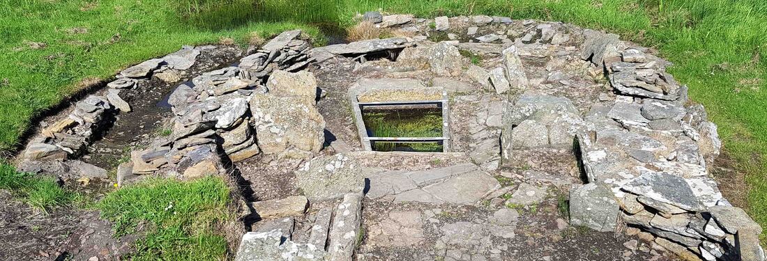
The concentric walls around a central stone cistern are characteristic of burnt mounds and brochs.
The stone cistern (cist) is centrally located within the building. It is the focus of activity with the stalls arranged accordingly. The fireplace is on a stone shelf and quite small suggesting a low intensity of usage over a long period.
The controlled replenishment and drainage of the cistern suggests that groundwater levels remained constant as the climate cooled, fish species changed and the treeline receded southward. There is a natural spillway along the cliff top for overflow. Warming over recent centuries may give a false impression of water level stability - this could be tested by coring & analysis of the spillway area. Metal detector survey of the adjacent swamp may reveal the ritual deposition of high status iron objects as the brewing process may have held a spiritual/magical cache - similar to that supposedly attendant upon metal creation & working.
The buildings have been extended and repaired over long periods of usage which suggest a highly valued output, of high status and value worthy of investment of scarce resources and labour. The feature of the central sunken stone cistern is repeated in the Broch (200BC - 200AD) and at Skara Brae - the continuity is noted below at Westerness where the cornfields, the pub and the church accompany the Viking Drinking Hall currently under excavation.
Granary or Striking Floor
The warmth of the Burnt Mound Brewery building would have encouraged germination in cooler months as evidenced by the residue of catastrophic fires in 'granaries'. The objective is to store the grain for food and next season's seed by intervention to stop germination. This is usually achieved by burial in clay pits which have a cap so that the top inch or two germinates, exhausts the available oxygen and the remainder is thus preserved. The effect of this struck corn on domesticated animals and birds would have not passed unnoticed. The faltering struggle to keep grain dry invites the invention of brewing.
Neolithic Granary?
Herewith extracts from a breathless report in Current Archaeology. The central stone cistern is a feature focus in the Granary, Broch, Burnt Mound & Village of Skara Brae. In this instance it becomes an ornate post pad essential at one end of the building but seemingly superfluous at the other.
'An entire Neolithic settlement, predating Skara Brae, has been found on the tiny Orkney Island of Wyre.' [Current Archaeology]
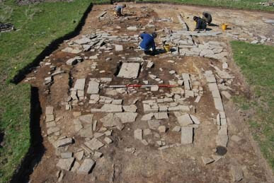
'An axial post-hole in the centre of each of the two parts of the house suggests that the roof was supported by a central ridge pole that formed a frame, which sloped down to the stone wall heads. The northern post-hole had been reworked at least three times, suggesting that the building was maintained for a considerable length of time.
In the last phase, an elaborate square stone-lined box was used to foot the post. This was left to rot in situ, revealing it was 20cm in diameter — not large timber in comparison to the rest of the UK, but a sizeable tree for Orkney and certainly enough to have supported a thatched roof.'
"Working on, we soon discovered that House 3 was not any old farmstead. The first (and earliest) phase of use in its northern part was particularly interesting: spread across the floor were several thick layers of charred material, 70mm deep in places, comprising tens of thousands of barley grains.
"We had found one of the largest assemblages of Neolithic cereal in Scotland (currently under analysis by Rosie Bishop as part of her doctoral research at the University of Durham).
"The intensity of grain-production evidence in the house is so unusual it leads us to suspect that the building may have had a more agricultural function—a granary perhaps?
"Working on, we soon discovered that House 3 was not any old farmstead. The first (and earliest) phase of use in its northern part was particularly interesting: spread across the floor were several thick layers of charred material, 70mm deep in places, comprising tens of thousands of barley grains. We had found one of the largest assemblages of Neolithic cereal in Scotland (currently under analysis by Rosie Bishop as part of her doctoral research at the University of Durham). The intensity of grain-production evidence in the house is so unusual it leads us to suspect that the building may have had a more agricultural function—a granary perhaps?
"Whatever the case, there was something else unusual about this house: mixed into the burnt grain layers were several sizable chunks of wood charcoal, suggesting that a large fire had ripped through the building. The heat was intense enough to redden the underlying glacial till within the central northern part of the house. Yet both the huge quantities of grain and the fire seem to have been confined to the northern half of the building, while the southern portion — with its series of shallow pits and scoops cut into the floor – was largely unaffected, and continued to be used after the fire.
"Dramatic as the conflagration must have been, it did not mark the end of life of the building. Neither was the structure cleaned out. Rather, the charred grain was pushed to the sides of the room, spilling into open pits and gullies, while the scoop hearth was sealed with a large flagstone slab. A quern rubber was placed on top on this charred grain layer, and the area affected by the fire was covered with a thick layer of mixed clay. Thus all evidence of the charred remains was hidden, while the quern was left visible above the new floor surface. The occupants then placed a small polished stone axe (one of the 15 recovered so far from the site) next to the quern and built-up further levelling layers and floor deposits. We found several further quern fragments elsewhere across the site, often broken and deliberately placed within closing deposits.
"Why this ‘strange’ activity? All the evidence, from the vast quantities of grain involved to the actions of the farmers in the aftermath, makes us suspect that the fire was started intentionally. It was probably a ritual act, rather than the result of a series of accidents. Indeed, some Early Neolithic houses in Ireland also appear to have been deliberately burnt down, suggesting buildings had a life cycle of their own, perhaps linked to that of their owners. Or perhaps something else was going on — a religious or social act reflecting the importance of grain in the lives of these early farmers?" [Current Archaeology]
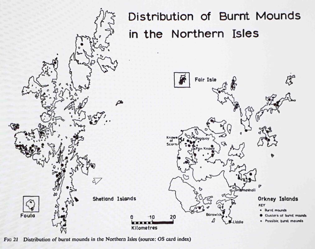
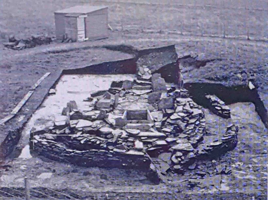
Excavation of two Orcadian burnt mounds at Liddle and Beaquoy - John Hedges
Hedges, J. (1975). Excavation of two Orcadian burnt mounds at Liddle and Beaquoy. Proceedings of the Society of Antiquaries of Scotland, 106, 39-98. Retrieved from http://journals.socantscot.org/index.php/psas/article/view/8913
John Hedges image
|
John hedges image
|
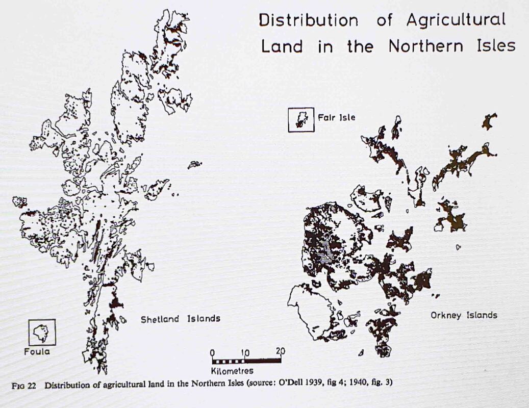
"certain areas of land are more cultivatable than others (fig 22) and this is reflected in recent agrarian patterns of settlement. It happens that the distribution of burnt mounds is almost identical (fig 21)" J. Hedges
Liddle Building - Hedges image
|
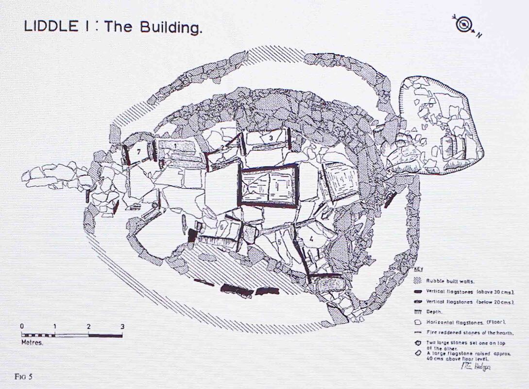
The Liddle Burnt Mound - hedges images
|
Hypothesis Testing
Detail of Burnt Mound layout.
Beerstone
There are many calcium deposits in the environment but given the continuity of design, location and usage the testing of pottery and cistern stones should be persuasive. The similarity between the plan view of a burnt mound building and a broch strongly suggests a developing tradition.
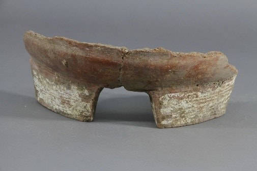 Mijaya pottery 3400-2900BC Fulai Xing image
Analysis of Neolithic pottery from the Mijiaya site in China's Shaanxi province revealed residue from various ancient grains & plants and traces of a calcium residue on brewing equipment called 'beerstone'.
Calcium Oxalate is soluble in water and a moderately acidic compound found in a number of food items. It is a calcium salt of oxalate with the chemical formula CaC2O4(H2O)x, where x can vary. All forms are colorless or white & are the major constituent of human kidney stones.
Beerstone is a significant issue for brewers and distillers as bacteria, mold and yeast become trapped within the scale and contaminate the process.
Current Theories
Inverness - Cooking - Washing Wool - Saunas?
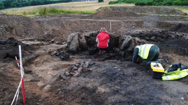 AOC Archaeology image
INVERNESS, SCOTLAND--BBC News reports that road construction in Inverness has uncovered burned mounds dating to the Bronze Age. The mounds, made up of piles of burned waste, ash, and stones shattered by heat, were formed by repeated burning.
Researchers from AOC Archaeology Group explained that the mounds are usually horseshoe shaped and found close to streams. The heated stones are thought to have been placed in pits filled with water in order to to heat it for cooking, washing wool, or as saunas. The excavation team also uncovered kilns that were used to dry grain, as well as Neolithic pottery fragments. [Grain drying kilns might be a clue.]
Researchers from AOC Archaeology Group explained that the mounds are usually horseshoe shaped and found close to streams. The heated stones are thought to have been placed in pits filled with water in order to to heat it for cooking, washing wool, or as saunas. The excavation team also uncovered kilns that were used to dry grain, as well as Neolithic pottery fragments. [Grain drying kilns might be a clue.]
Consideration
Tannery - The process of turning hides into leather involved burial or very prolonged soaking in association with organic materials containing tannic acid - hence tanning.
Kitchen - The Irish idea that these are communal kitchens arises because the production of gruel from germinated grains is the first step in making unleavened bread and beer. However, it is a domestic process at the centre of every roundhouse - not requiring major infrastructure - the middens do not support this proposition nor do the finds within the buildings.
Saunas - really
Hunting Lodges - Hedges asks why build temporary structures out of stone & why locate them in agricultural areas.
Washing Wool - no need for heated water - no evidence and abundant opportunities in wetlands without major stone buildings.
Conclusion
The determined and prolonged investment of high value resources in the manufacture of a product with no discernible need, benefit or uncommon residue can only mean one thing - cheers.
Chambered Cairns & Stalled Spaces
Unstan Cairn
Tomb of the Eagles

The Tomb of the Eagles, aka Isbister Chambered Cairn, 5000 year old stone age tomb, South Ronaldsay Island
Tomb of the Eagles - Simon Longland Image
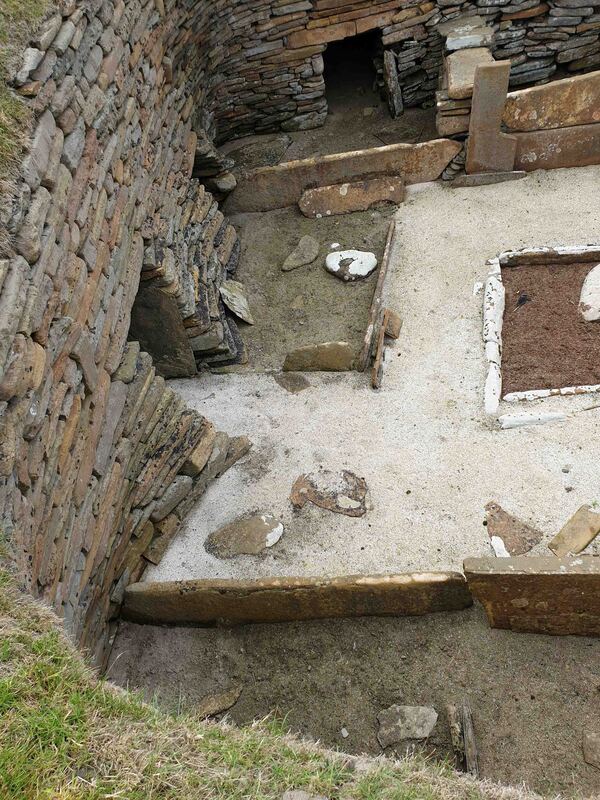
Skara Brae
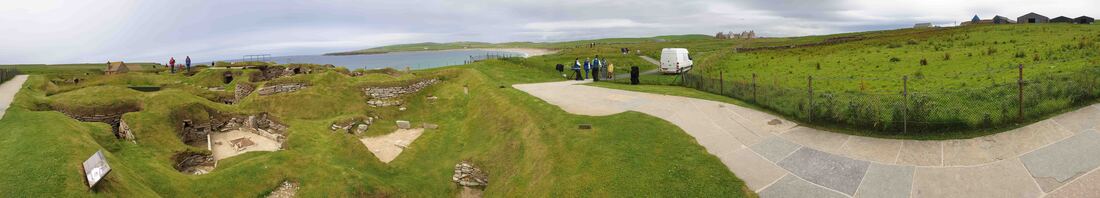
Skara Brae neolithic village with Skaill House in the distance and the farm at right.
Radiocarbon dating suggested that the settlement dated from the late Neolithic — inhabited for 600 years, between 3200BC & 2200BC. The Neolithic in Britain is the New Stone Age 4000BC to 2000BC when farming, polished stone tools & pottery became commonplace.
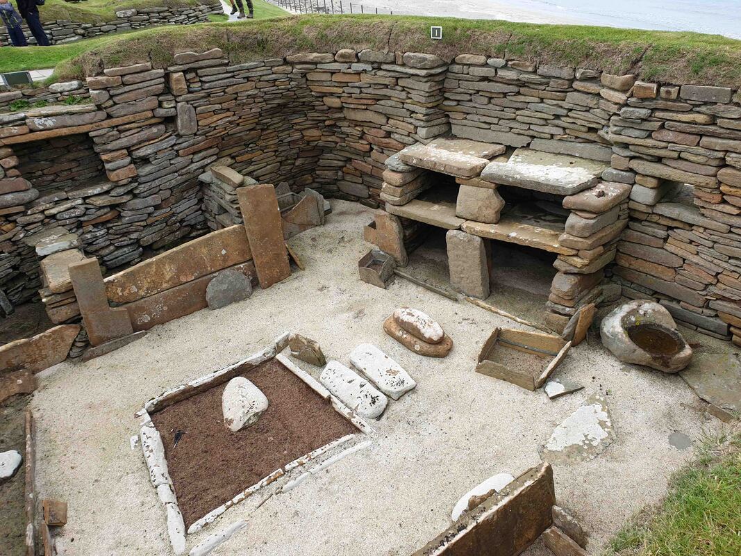
Presumed to be hearths perhaps they had a more convivial purpose.
|
Exquisite Skara Brae batter & lintel
|
The proposition that the slabbed sections are beds makes as much sense as siting the water cistern in the middle of the floor. The rebate in the wall behind the 'dresser' at right suggests a flue.

Skara Brae - the cist in centre of the rcell is not a practical domestic arrangement.
Rock Heap to Chambered Cairn
Abstract
The following images demonstrate that a basic necessity of groundbreaking agriculture is the removal of large stones. In many areas this resulted in dry stone walls and some thousands of miles of these persist in Britain today. It is apparent that the amount of material in a cairn is far greater than is required for structural purposes - especially as the end result is an earth covered grassy mound.
Clava Cairns
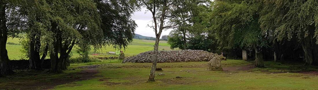
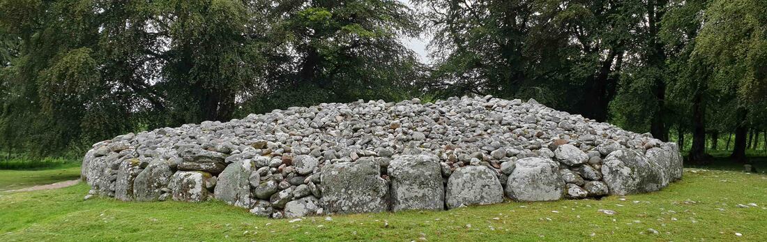
The chambered cairn construction could have evolved from the essential clearing of fields for agriculture.
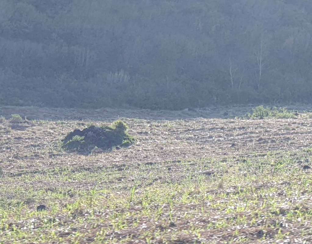
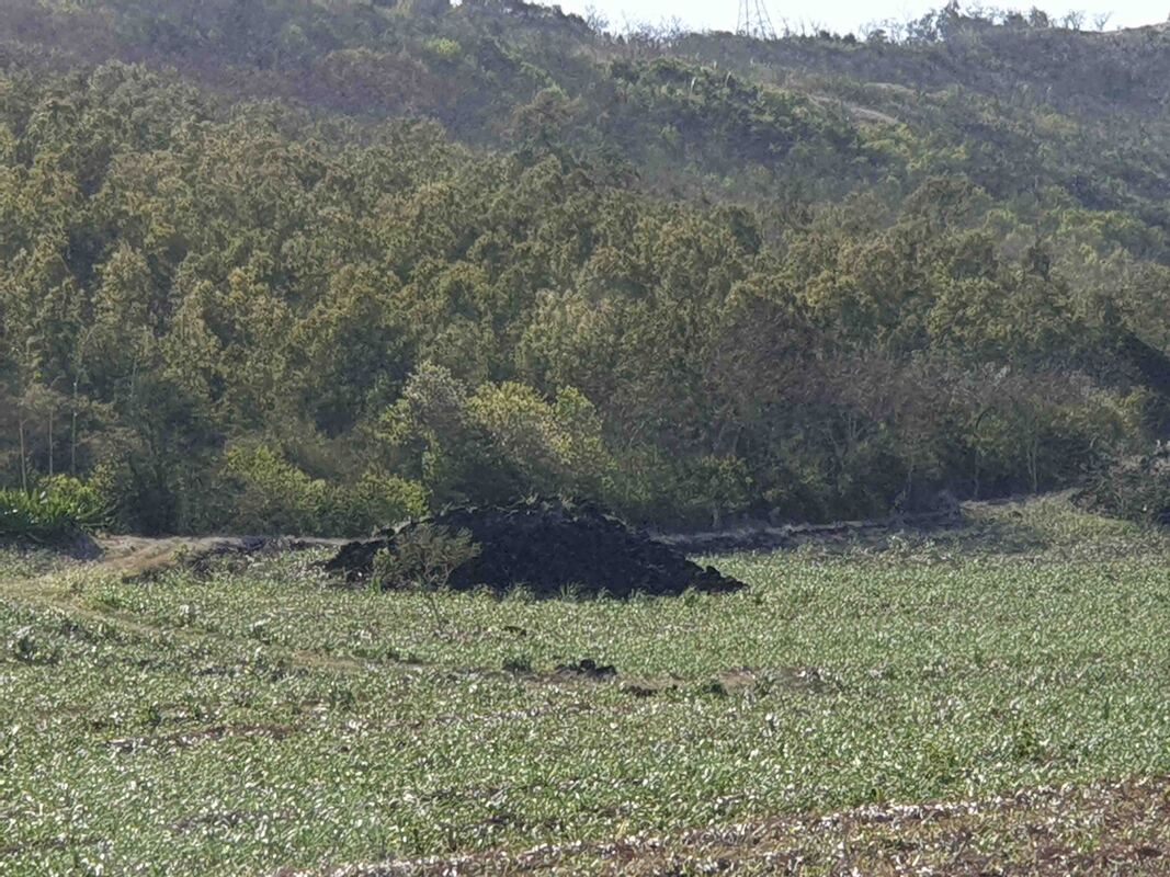
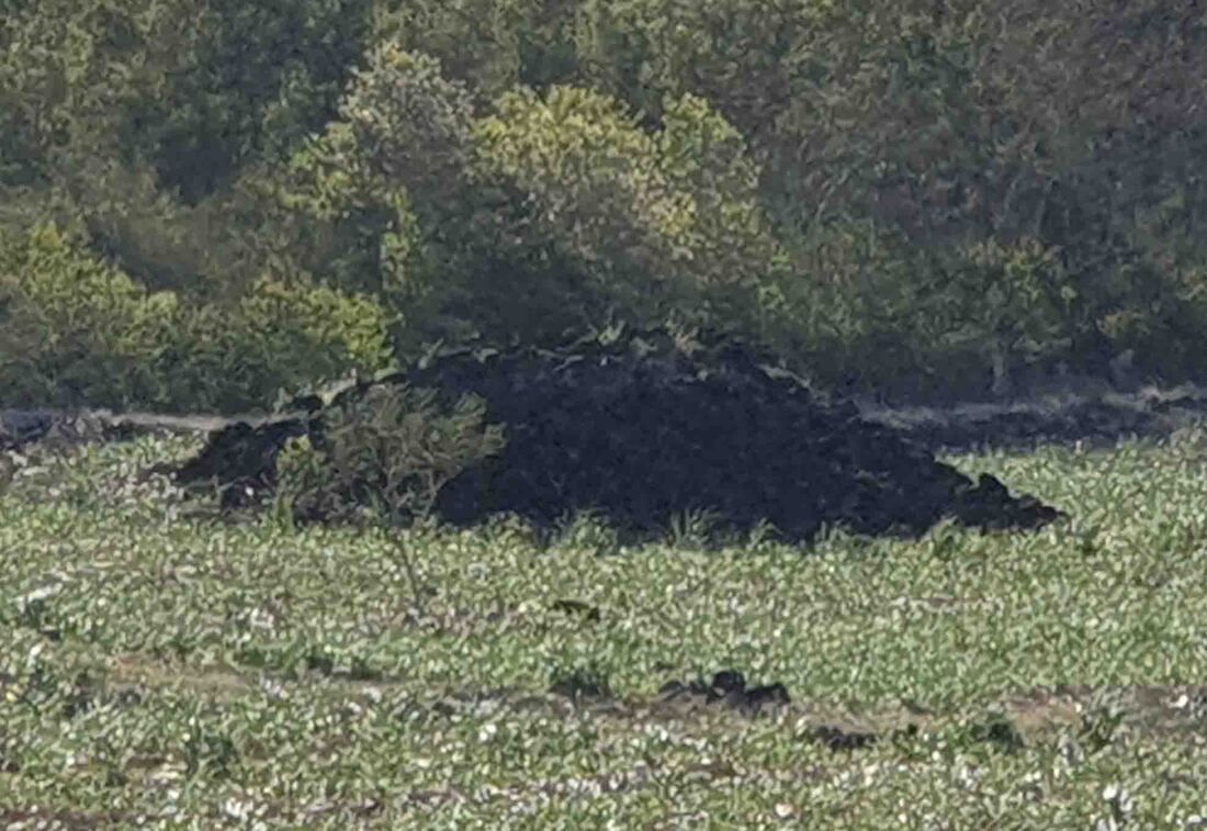
Mauritius Mounds
The images show current evidence of fields being cleared for agriculture whereby stones are piled in a single location. It is suggested that this basic function of agriculture created the opportunity for excavating convenient cavity shelters in the rubble and evolved to planned deposition around a central clear space and as open range land gave way to defined enclosures so the mounds became field walls and steadily evolved into systematic construction.
|

|
|
|
|
|
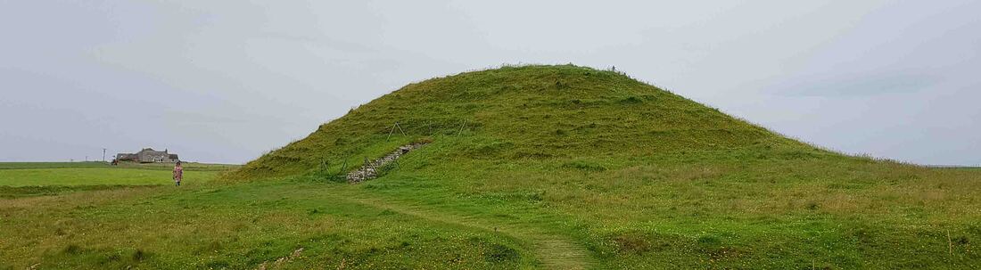
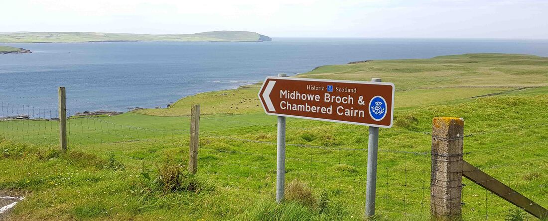
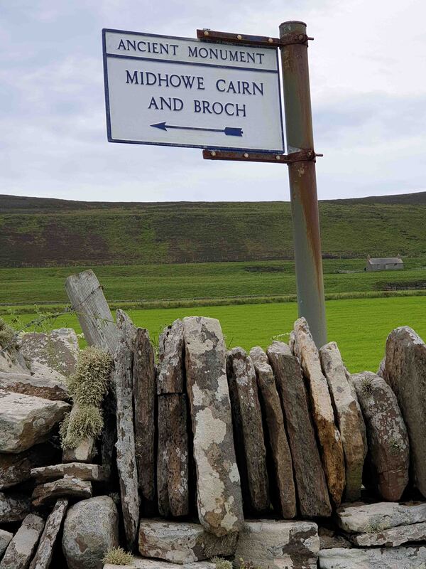
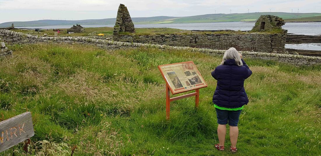
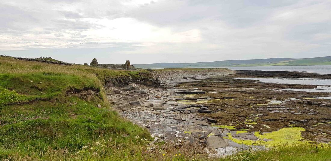
Rousay Island
Below L>R The Wirk Norse Hall - Ruins of Skaill Farm & dig on Viking Drinking Hall - St Mary's Kirk - Midhowe Cairn under roof & the Broch. Unidentified feature at right.

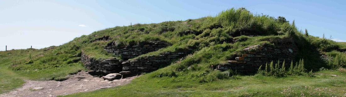
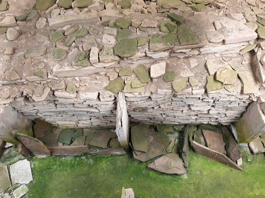
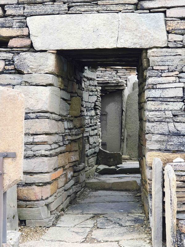
The Midhowe Chambered {Stalled} Cairn within its protective building.
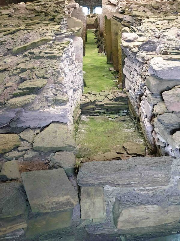
Inside Midhowe Cairn
|
Westerness - Rousay Island
The stalls inside Midhowe Cairn
|
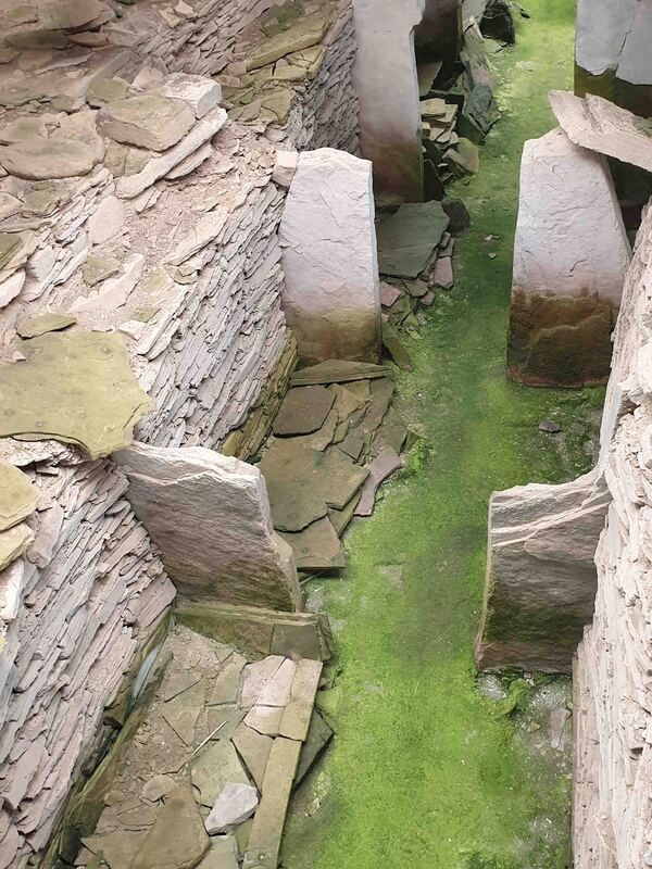
Inside Midhowe Cairn - Neolithic 4000 - 2000 BC - the first farmers.
|
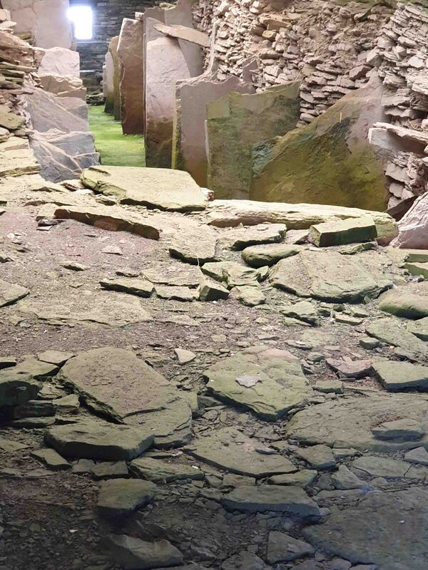
Inside Midhowe Cairn
|
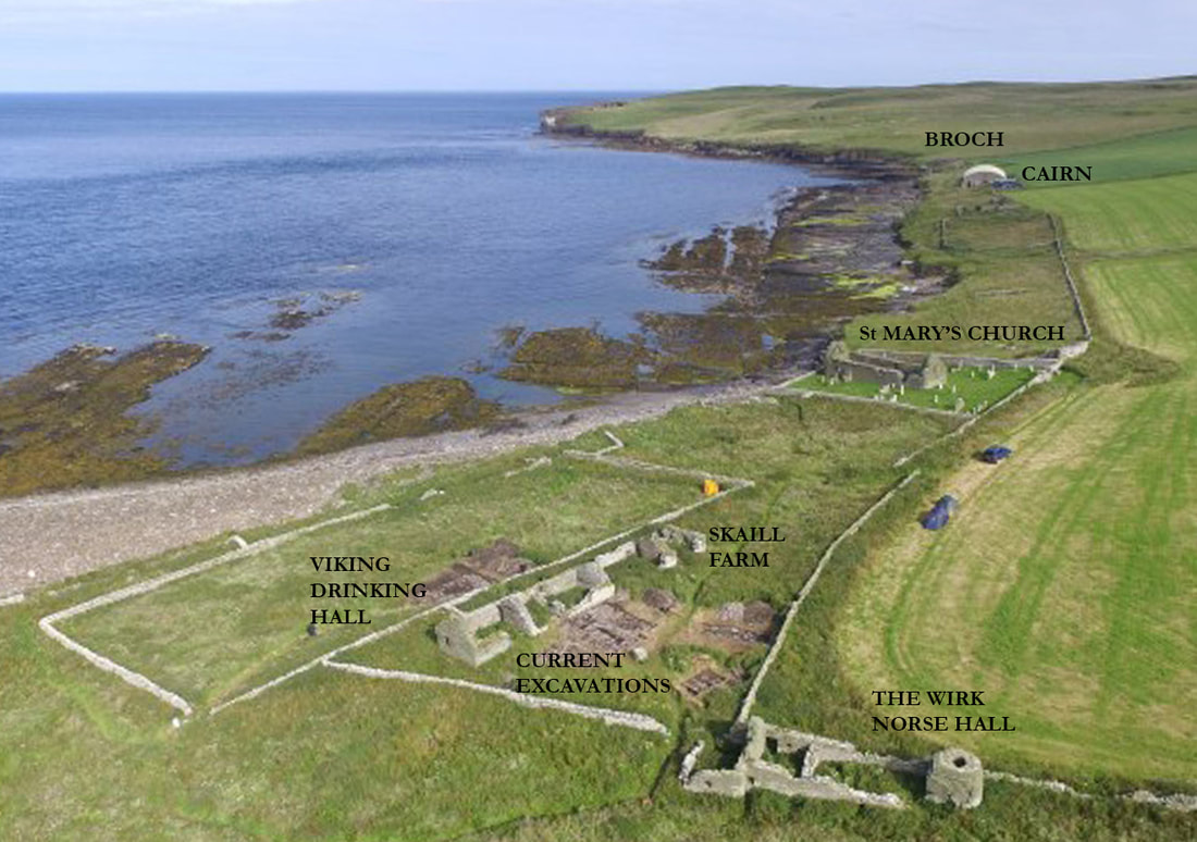
Bobby Friel image of Westerness shore with added captions.
|
The name - Midhowe - derives from the cairn which is the central element of 3 ancient features here on Eynhallow Sound. Howe derives from the Old Norse word 'haugr' meaning mound or barrow.
The Brock is Iron Age - the Cairn is Neolithic & the building is courtesy of Walter Grant of Grants of St James'. Dis-articulated human remains of 25 individuals were found which led to the earlier designation of 'tomb' but so too were many & various animal and fish bones including bream (presumably gilt-head) indicating a more Mediterranean sea temperature. Also called a 'stalled' cairn, there is no single explanation of purpose to the construction. The bottom of the hill is ideal for field clearing for agriculture - perhaps in the future it will be akin to excavating a U-Store It facility. |
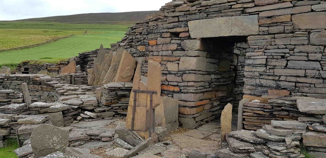
Midhowe Broch
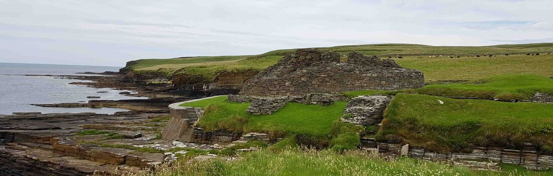
The Midhowe Broch at c30ft high would have been impressive & unassailable from the seaward side where the entrance is located.
The Broch is not convincing as a fortified stronghold - it is not on an elevated site - there is no defensible perimeter for animals, valuables or defenders and attackers would simply go around it. Neither is it obviously a tower-house or fortified dwelling as there is no means of active defense from parapet, bow slot or window. It would certainly be highly visible and invite vessels to drop anchor in the bay.
Midhowe Broch and defensible cutting
|
|
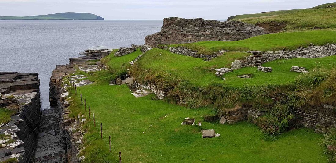
A Broch is a double skinned tower ~200BC to 200AD - Iron Age
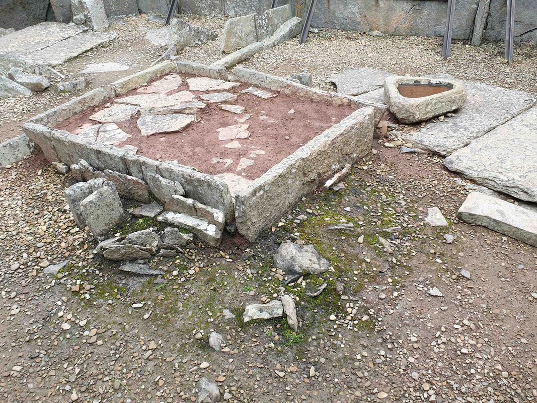
The central cist feature is described as a communal water tank.
|
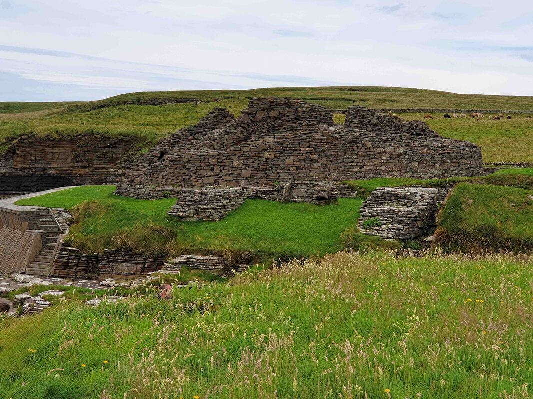
Highest quality masonry work at the broch
|
"Large slabs of local flagstone were used to divide the interior (diameter 9.6 metres) into two smaller, semi-circular rooms. These were then further divided into smaller cells, each with its own hearth and water-tank.
Water was supplied from a spring that flowed up through a crack in the rocks and during the excavations, it was written that the main storage tank retained water which: 'remained clear and drinkable all the years the work of excavation was going on." Orkneyjar
Water was supplied from a spring that flowed up through a crack in the rocks and during the excavations, it was written that the main storage tank retained water which: 'remained clear and drinkable all the years the work of excavation was going on." Orkneyjar
The similarity with the Burnt Mounds, Skara Brae & Granary cisterns is striking - being located in the centre of the floor - surrounded by stalls.
St Mary's Church
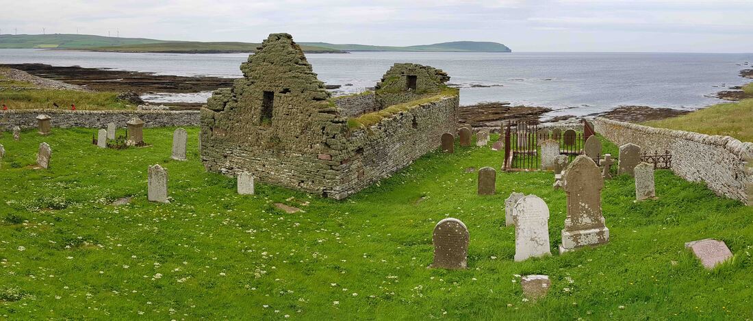
St Mary's Church - Built in 1600's perhaps on site of 1300's church associated with the Wirk. Church closed mid 19th century last burial 1920's
St Mary's Kirk - behind is Skaill Farm ruin & Viking Hall site.
|

|
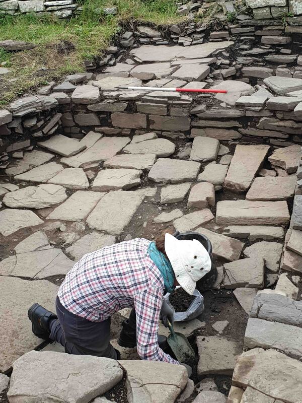
Viking Drinking Hall
Perhaps a thousand years later than the Burnt Mound - this site continues the tradition of exploitation of cereal production. Skaill is a Norse work meaning Hall so it has long been suspected that this site contained on of the iconic Drinking Halls which was revealed in the 2019 dig.
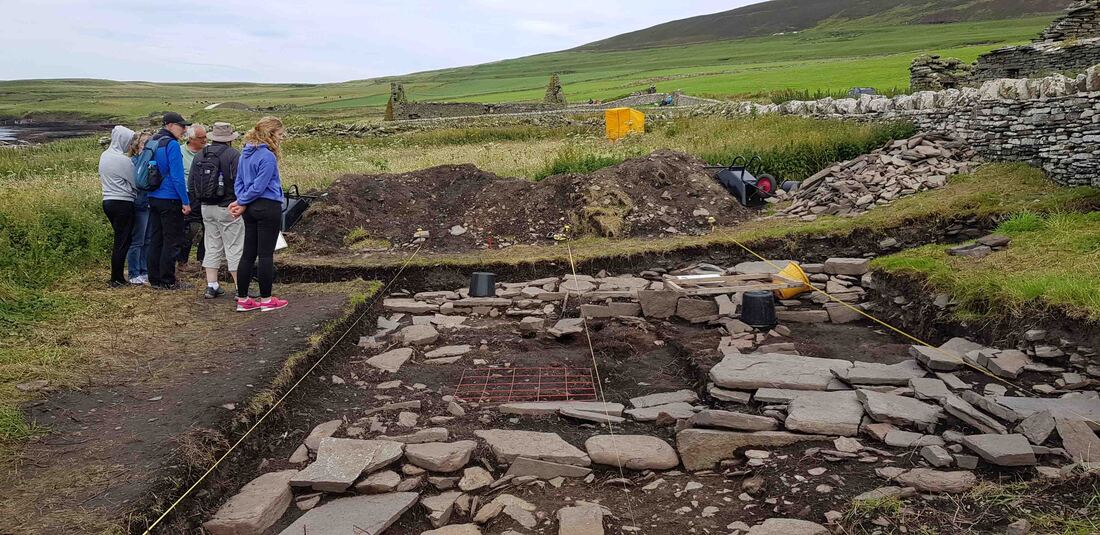
University of Highlands & Islands generously share their time & triumph.
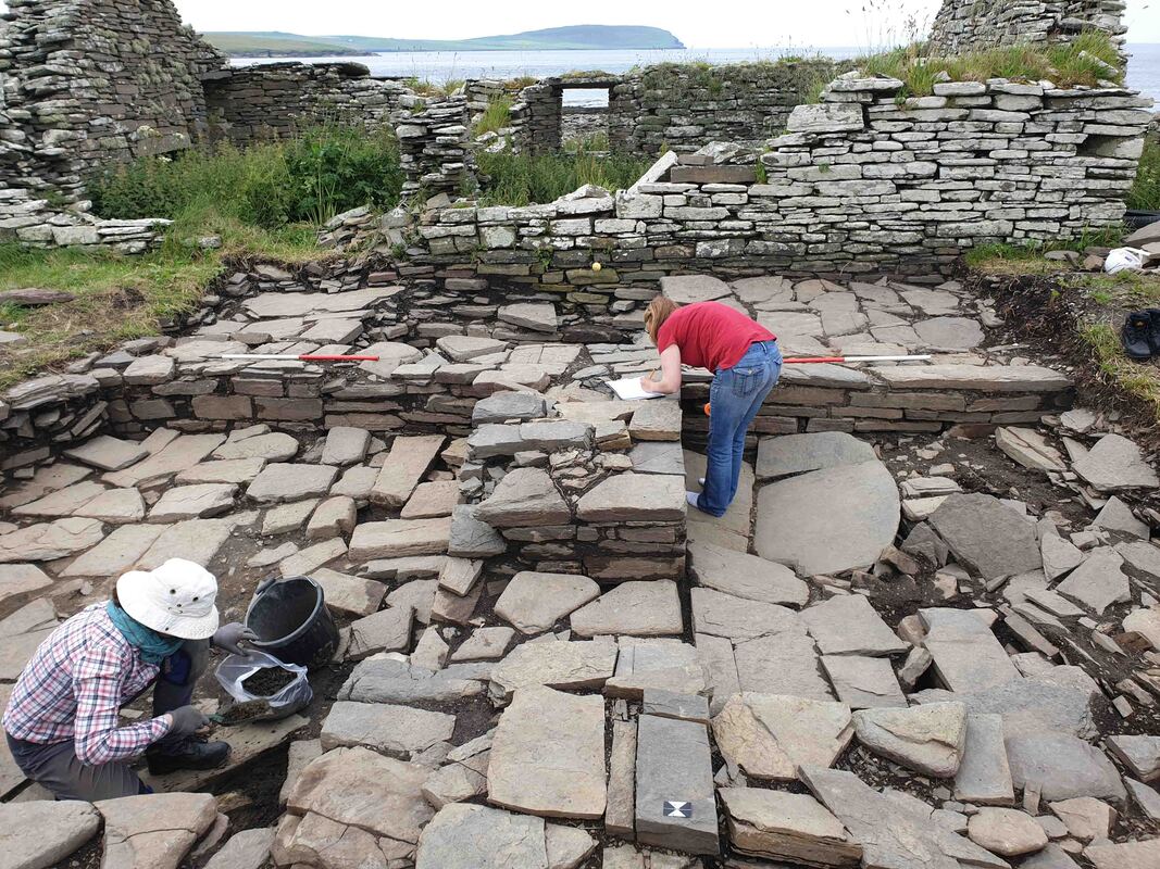
University of Highlands & Islands reveal 10-12th Century Norse Hall.
|
With Skaill Farm ~ 1000 years of occupation to mid 19th century.
|
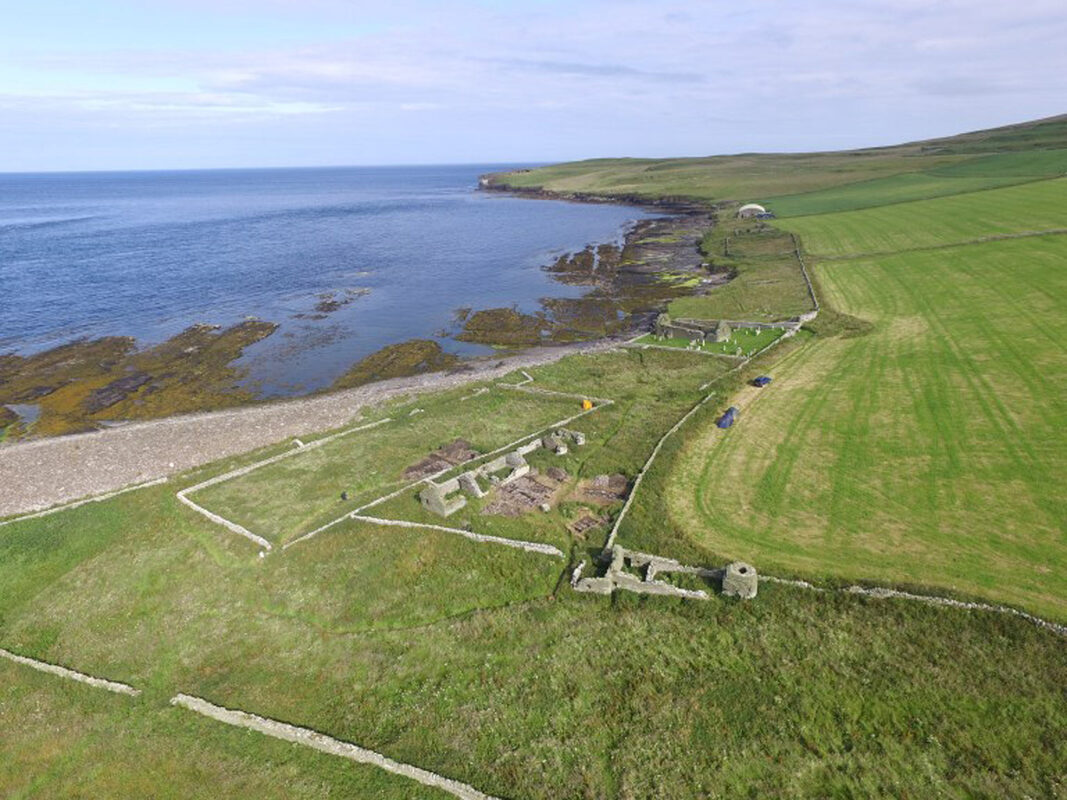
The Wirk - Skaill Farmhouse & Viking Drinking Hall - St Mary's Kirk - roofed Midhowe Cairn & Midhowe Broch. A Bobby Friel image.