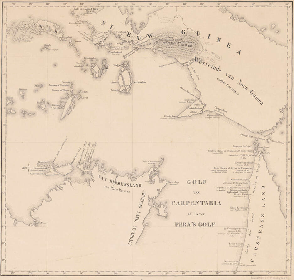
1859 van Djilk
Four centuries ago, in our region, there were two notable occurrences – The 1623 ‘Amboina Massacre’ wherein 10 English, 10 Japanese and one Portuguese were put to death by local Dutch Governor who may have had a touch of the sun & imagined everyone was plotting to kill him – a belief supported by testimony under torture.
The second, equally earth shattering event was the ‘Voyage of the Pera & Arnhem’ which is widely believed to have resulted in the discovery of more of the Gulf of Carpentaria & Arnhem Land. Many Dutch scholars were derisive of the claims of VOC discoveries and it was generally conceded, after Flinders’ visit of 1802, that no European had previously visited the bottom of the Gulf of Carpentaria.
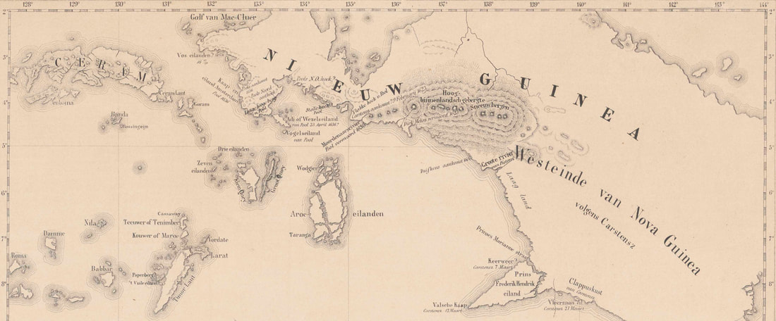
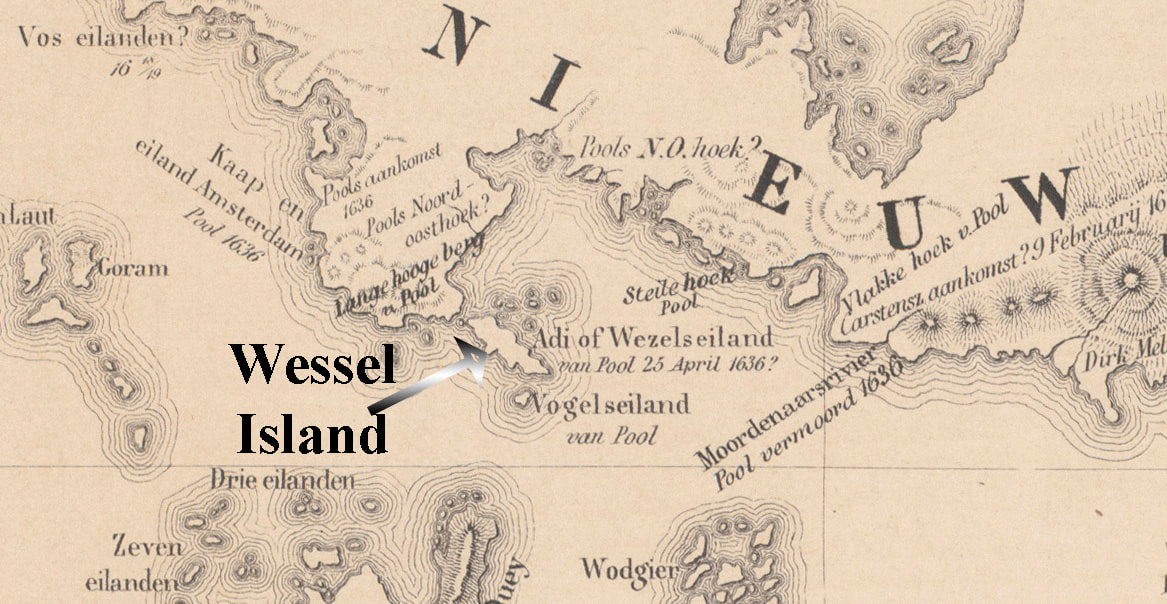
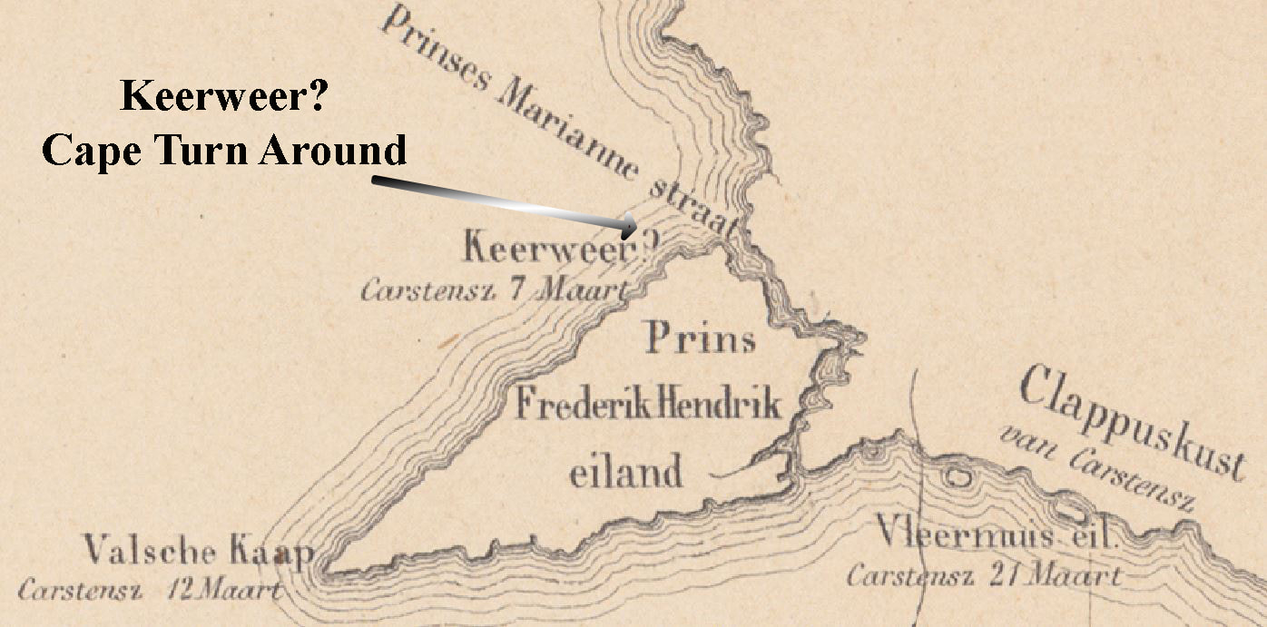
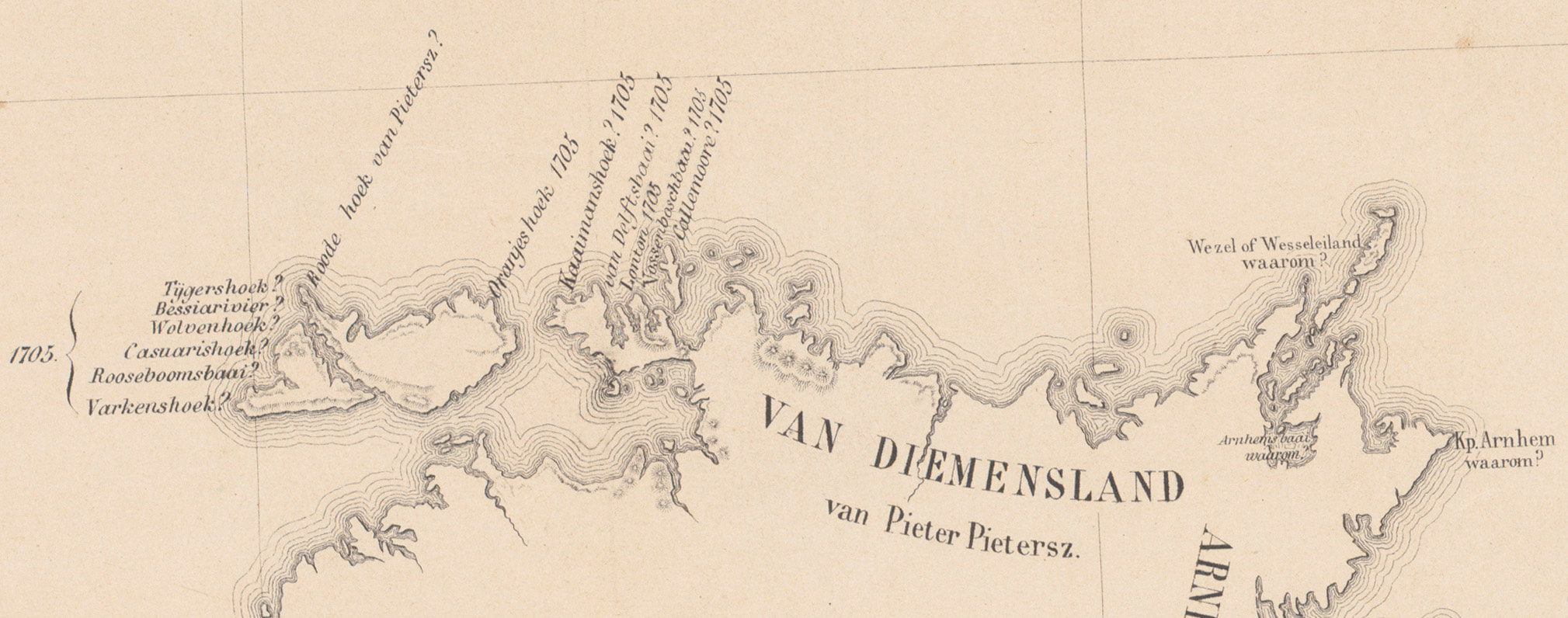
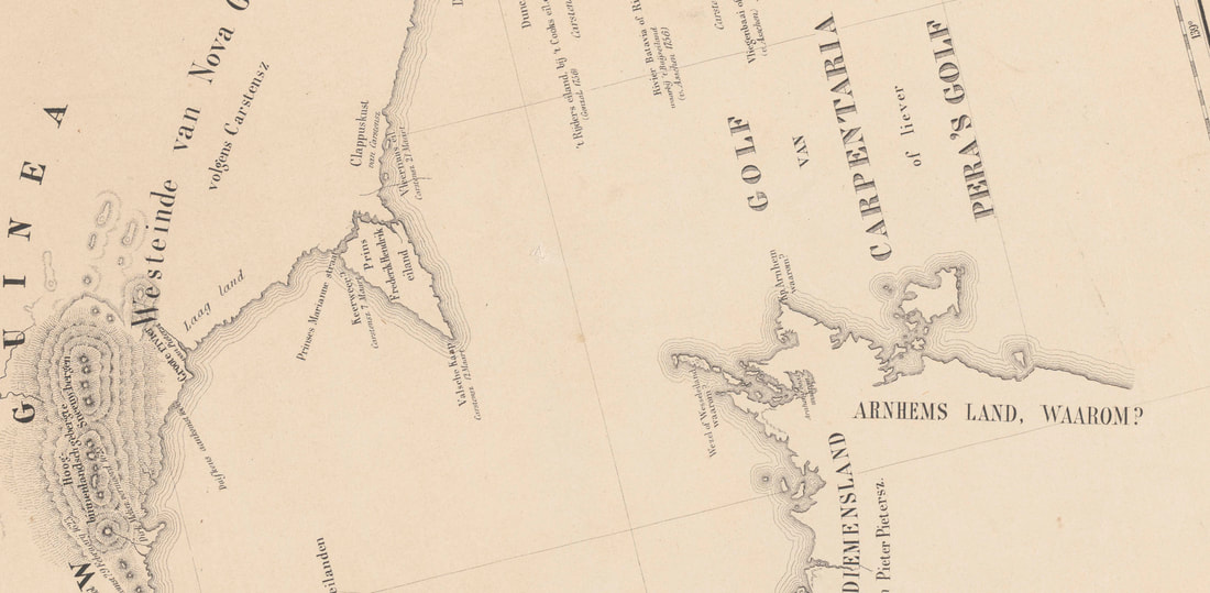
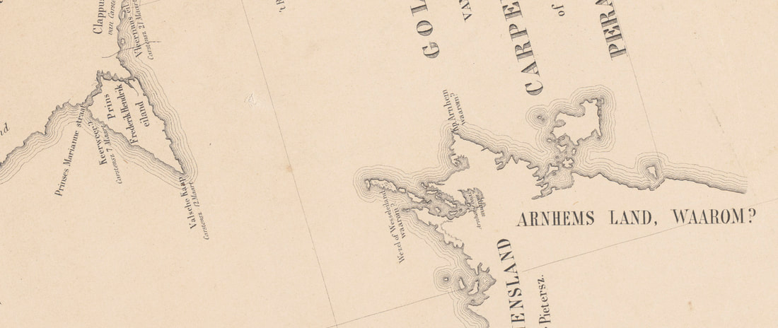
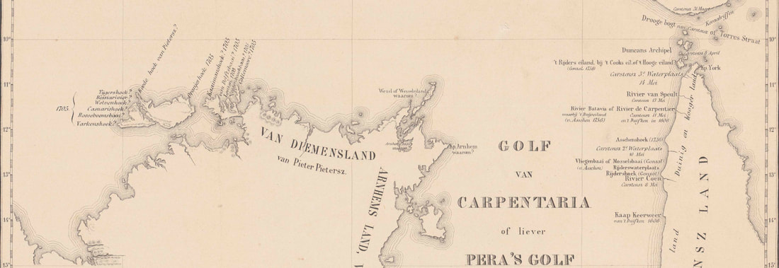
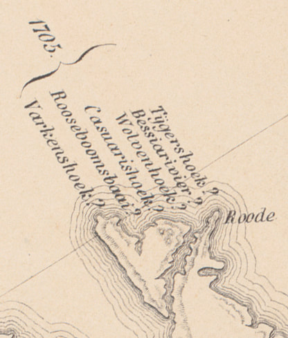
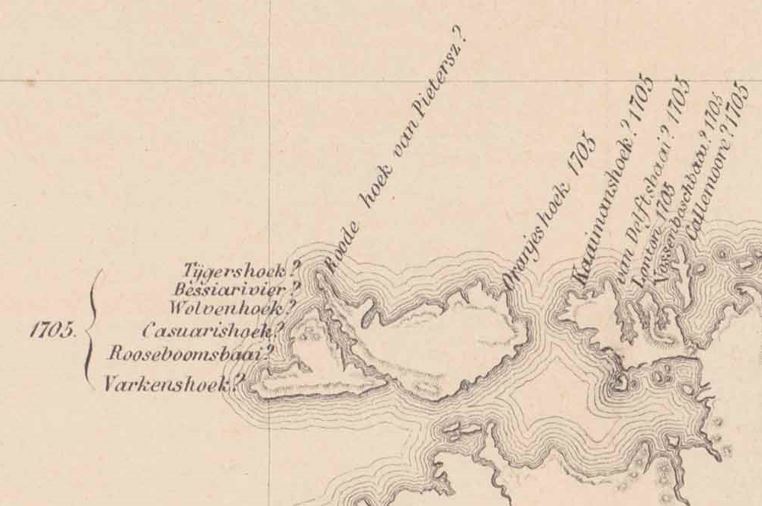
One Dutch Historian – Ludovicus Carolus Desiderius van Dijk went further – quite a bit further, in fact – claiming that it was not the disabled ‘Arnhem’ that made the discoveries but the ‘Pera’ and her master Carstensz. On van Dijk’s Map ‘ARNHEMS LAND’ gets the suffix ‘WAAROM?’ Meaning ‘WHY?’ – Wessel Island also get a WHY? Perhaps because the ‘Adi of Wezeleilan’ is shown off the PNG coast. Further SW along the coast is Keerweer? (turn around) suggesting it was the true extent of early voyages. The 1705 van Delft voyage gets shunted to the west coast of Bathurst Island and the Golf gets renamed. Also in the frame are the 1623 Pool & Pieterzoon voyage & the 1756 Gonzal excursion.
In the familiar absence of any original charts or journals of these expeditions, it seems that one group is saying that the discoveries must’ve been made by the ‘Arnhem’ because it can’t have been the ‘Pera’ & the other camp is saying that it must’ve been the ‘Pera’ because it can’t have been the badly disabled ‘Arnhem’. At least Van Dijk’s Map is the original, though sadly unsigned and it has a reliable publishing date of 1859 - whose to say it is any more illusory than the rest.
Jan Tent has turned his scholarly eye askance upon this curiosity as part of an engaging series of papers on Top End Toponomy.
Jan Tent is a retired academic and current Director of the Australian National Placenames Survey. He is also an Honorary Senior Lecturer at the Australian National University, Canberra, and an Honorary Research Fellow at Macquarie University, Sydney. His onomastic research has mainly concentrated on early European place-naming practices in Australasia, as well as the toponymy of Australia in general.
| 01_tent_the_curious_van_dijk_map_jan_tent.pdf | |
| File Size: | 11086 kb |
| File Type: | |
