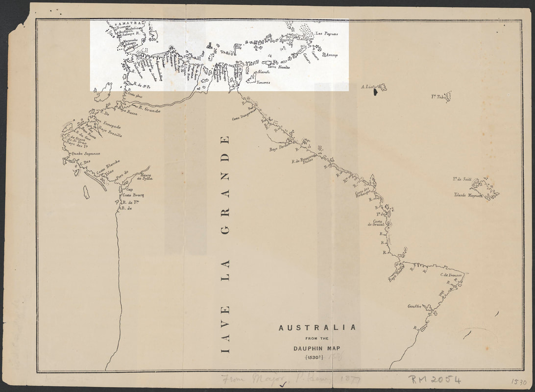
The Dauphin Map ~1530 & Vallard Map ~1547
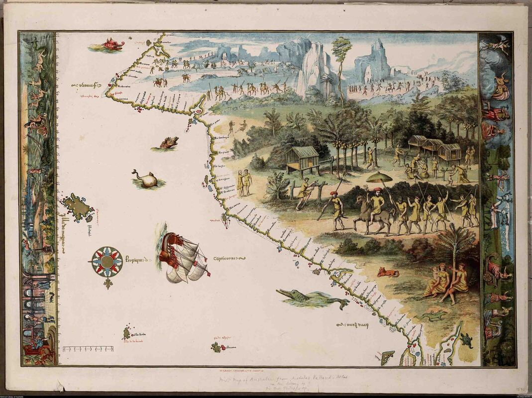
The Vallard Map 1547 - North at bottom - East Coast of Australia -https://catalogue.nla.gov.au/Record/431422
"First map of Australia from Nicholas Vallard's atlas, 1547, in the Library of Sir Thomas Phillipps, Bart. at Middle Hill, 1856" - National Library of Australia Call Number MAP RM 2393 http://nla.gov.au/nla.map-rm2393 - North is at bottom.
Feted as 'The First Map of Australia' - The Vallard Map 1547 was fabricated to impress the British Museum - it failed but survives in the Australian Creation Myth. A sumptuous fake - an inverted view of most of The Dauphin Map - it may have preserved actual early 16th century Portuguese mapping.
The Vallard Inverted & Flipped - North at top
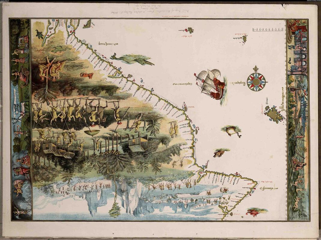
Vallard Map 1547
|
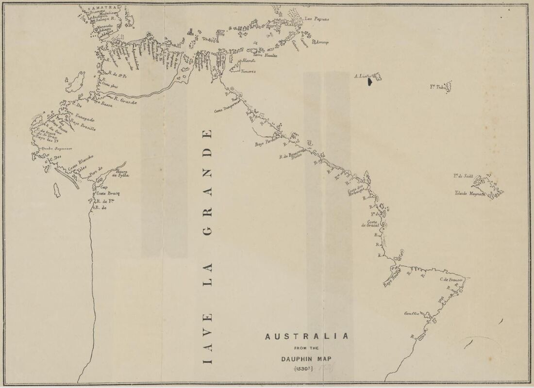
Dauphin Map c1530
|
The Vallard is a precise rendition of the Dauphin - real and imaginary features are transposed with great precision. A scale has been added along with the angular compass rose and the Fleur de Lis indicating North with the pimple at the East cardinal identical to those of the 1670 Secret VOC Atlas.
Vallard Map detail
|
Dauphin Map detail
|
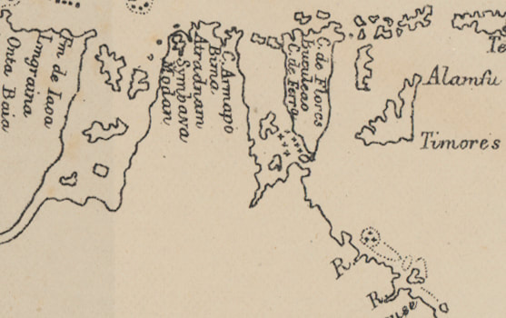
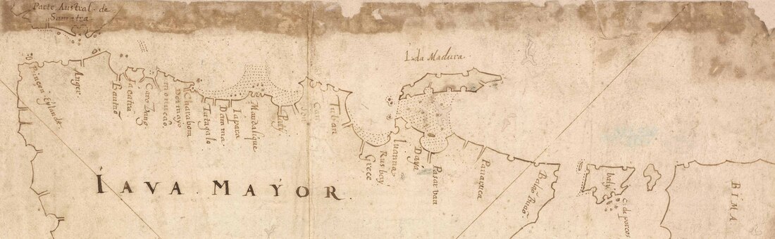
Dauphin Map - Sunda Strait in West to Aru Islands in the East - area of actual mapping of Portuguese 'Empire' early 1500s.
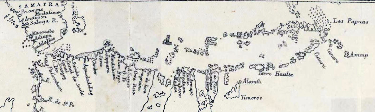
Detail of Dauphin Map - actual mapping of Portuguese 'Empire' from Sunda Strait to the Spice Islands
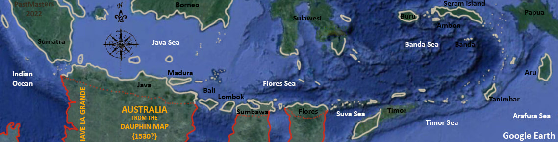
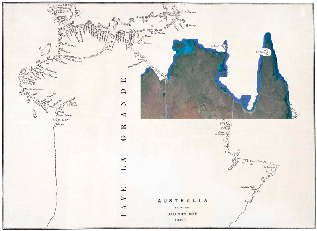
Detail of Dauphin Map - overlain upon Google Earth the white is the original mapping and the red the imaginary areas.
Detail of Dauphin Map - actual mapping of Portuguese 'Empire' prior to mapping of Papua overlain upon Google Earth.
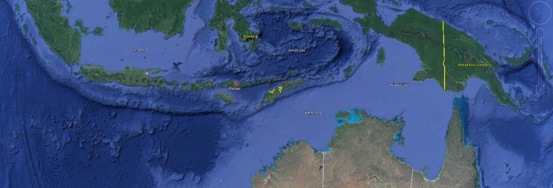
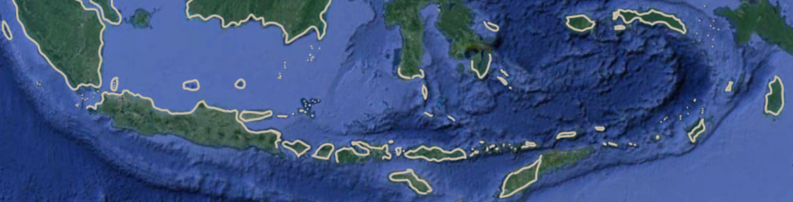
The Tiwi Islands are not at the Sunda Strait east of Sumatra - they are 2,750kms to the east.
Godinho de Eredia 'Java and Australia'?
|
Library of Congress - "This manuscript map of Java and the tip of northern Australia is a copy of an earlier work by the Malaysian-Portuguese cartographer Emanuel Godinho de Eredia (1563-1623). In the 16th century, Portugal sent several expeditions to explore the islands south of Malaysia; it is possible that they gained some knowledge about the geography of Australia from these missions. Some scholars have speculated that the Malays had a knowledge of Australia, which Eredia somehow absorbed. The first documented European sighting of Australia was by the Dutch navigator Willem Janszoon, in 1606."
The Godinho has placenames which concur with the Dauphin but does not show Batavia (Jakarta) suggesting a mapping date at least prior to 1619 when the town was founded. The VOC occupied the site in 1610 so pre-dates publication (1630) by over a century. I does show Java as an island - circumnavigated if not visited.
Intimation of a South Land - wrong shape for the Top End of Australia & 3,000kms adrift. |
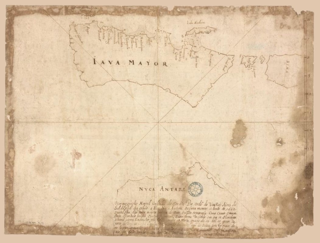
16thC Copy of Emanuel Godinho de Eredia (1563-1623) LOC No. 2021668359
|
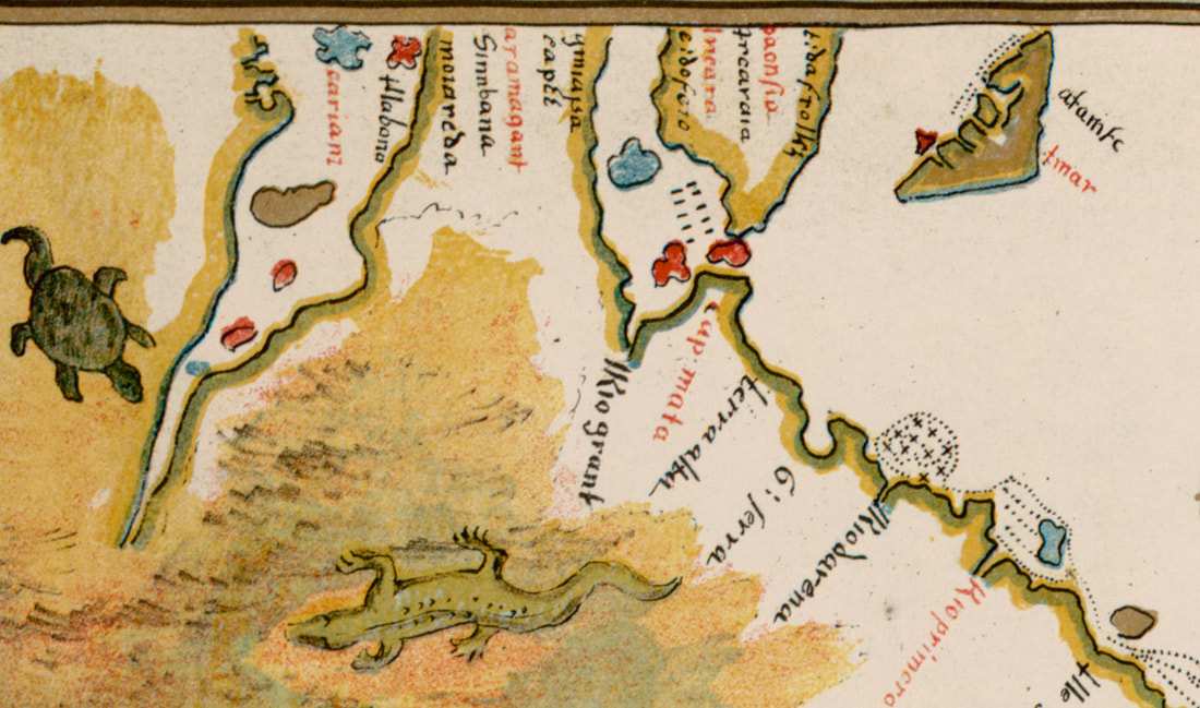
Detail of the Dauphin Map
|
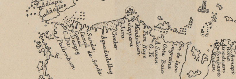
Detail of Godhino de Eredia c 1610
|
The Dauphin Map of the area shows, islets, reefs and shoal water of interest to mariners. The Godhino may be the same source as the Dauphin just fortunate with the Java Island depiction - sharper with Bali & Lombok but very sloppy with the position of Madura Island.
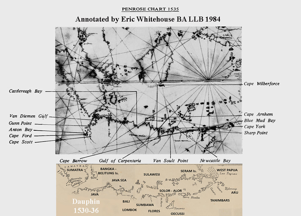
Bois Penrose 1535 interpreted as the Top End of Australia by Eric Whitehouse BA LLB in 1984
Dauphin Map - It's a fake - those islands don't exist - just a bit of fun.