PAST MASTERS
PastMasters
  • Home
    • About Us
    • Objects & Activities
    • Research Projects
    • Index & Links
    • Contacts
    • Latest News
  • Projects & Activities
    • EARLY MAPS >
      • Pre Flinders Maps
      • Jave Le Grande
      • Vallard Map 1547
      • Unsigned & Undated
      • DUTCH MAPS >
        • 1606 Duyfken
        • 1623 Pera & Arnhem
        • 1636 Pool Expedition
        • 1644 Tasman Map
        • 1705 van Delft 1705 >
          • Pre-Cook 1705
        • 1756 Gonzal Expedition
    • First Contact
    • HMS Beagle >
      • Watch Vessel No. 7
      • Beagle Well Darwin
      • Roman Villa Found in Darwin
    • Cairns & Burnt Mounds
    • D'Stretch Marks
    • Eyam - The Plague Days
    • Fakes & Forgeries >
      • William Westall {Flinders}
    • HMAS Patricia Cam >
      • Pat Cam 75th Anniversary
      • The Men & Their Families
      • Ship's Knee MH7
      • Beattie's Yard
      • Palermo Park Dig
      • The Sandy Sanford Story
      • Pat Cam Memorial Yirrkala
    • MACASSANS >
      • Pobassoo Island
      • Port Bradshaw
    • Matthew Flinders - The Long Way Home >
      • Flinders & HMS Cumberland
    • Miscellany >
      • Capt. Cook - Bad Hair Day
    • Mystery Objects
    • NT Fleet Review
    • NT Image Makers & Takers >
      • Foelsche Centenary 2014
      • Ted Ryko
      • Shepherdson Collection >
        • 4. Wireless & Planes
        • 6. Boats
        • 7. Fijian Staff
      • NT Painters & Sketchers
    • OSL Beach Dating
    • Shell Mounds & Middens
    • Territory Treasures >
      • The Loss of HMAS Armidale
      • Boustead Jar & Shell Dunes
      • Dundee Beach Swivel Gun
    • Top End Timeline
  • ARNHEM LAND & BEYOND
    • ADELAIDE RIVER
    • COBOURG PENINSULA >
      • PM Expedition 2017
      • Fort Wellington at Raffles Bay
      • Macarthur Journal
      • Victoria Settlement >
        • Lambrick Family Archive
        • Port Essington Jack
        • Victoria Cemetery
        • VIPs at P.E.
    • DARWIN >
      • Early Darwin >
        • Esplanade SE
        • Esplanade SW
        • Bennett Street
        • Cavanagh Street
        • Goyder's Camp & Early Darwin
        • Mitchell Street
        • Smith Street >
          • Victoria Hotel
      • The Govt. House Gun >
        • Residency Govt. House
        • Government House
      • Top End Heritage Park >
        • Darwin's Heritage Assets
        • Historic Statues
        • Pre-fabrication of Australian History
      • Bombing of Darwin
      • Channel Is. Centenary - Quarantine to Lazarette
      • Doctor's Gully >
        • ZDG Catalina Base
        • 1st Darwin Hospital
      • East Point Reserve
      • Naval Fuel Depot WW2
      • Wagait Beach
      • Z Special & Catalina Base
    • DOWN THE TRACK >
      • Coomalie Landing Ground
      • Daly Waters
      • NT Expedition 1880-89
      • Overland Telegraph & Undersea Cables >
        • OT Pole No, 1
        • OT Stations
    • ELCHO ISLAND PORTRAIT >
      • DT coin Elcho Is.
      • Elcho Past Muster - Workshops, Finds & Losses
      • Galiwin'ku Community
    • ESCAPE CLIFFS
    • GOVE PENINSULA >
      • Catalina Beach WW2
      • Control Tower Museum
      • Gove Airfield WW2
      • Gunyangara
      • Heritage Rangers
      • Nhulunbuy
      • Wurrwurrwuy Stone Pictures
      • Yirrkala
    • GAPUWIYAK
    • GOULBURN Is. Centenary
    • GROOTE EYLANDT >
      • Alyangula
      • Angurugu >
        • Angurugu Lifeboat
      • Bickerton Island
      • Emerald River
      • Groote Rock Art >
        • Angurugu Shelter
        • Groote Rock Art 2
      • Umbakumba
    • MILINGIMBI >
      • Rangers & WW2 Strip
    • OENPELLI - Gunbalanya >
      • Oenpelli Mission 1953/85
      • Oenpelli Mission -Early Days
      • Oenpelli Buffalo Days
    • RAMINGINING
    • TIMOR & Oecussi
    • TIWI ISLANDS >
      • Bathurst Island >
        • Heritage Precinct
      • Melville Island
      • Carslow Beach & the Dutch
      • Fort Dundas & Garden Point >
        • Fort Dundas Bicentenary 2024 >
          • DATES 1824
          • FIVE FORTS
        • FD & Gdn Pt. Finds
        • Lady Nelson & Stedcombe
      • Macs on Melville
      • Snake Bay - Macc Weir
    • TRUANT Is.
    • WESSEL ISLANDS >
      • Ancient Coins in Arnhem Land Expedition
      • Australians Bay
      • Hopefull Bay
      • Kora Kora 2023
      • Mary Bryant Story
      • Wessels 2018
      • Wessel Islands Radar 312RS
      • Wildcard Expedition 2019
  • PastMasters Publishing
    • Arnhemland's Lost Past
    • Early Contact North Australia
    • Wooden Weir - Milikapiti
    • Claiming Australia
    • Beagle Beach Well
    • PastMasters' Papers
  • Isenberg Hoard Analysis

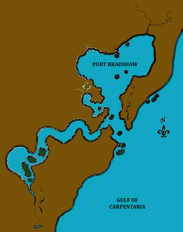
PORT BRADSHAW - YALANGBARA

Picture
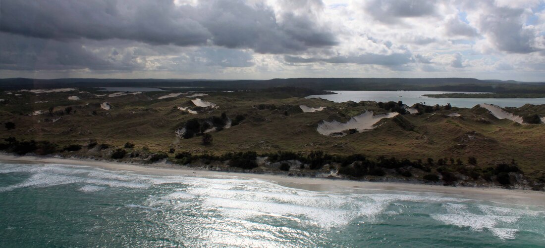
Looking West - the culturally significant sandhills on the spit that encloses the northern portion of Port Bradshaw.
Picture
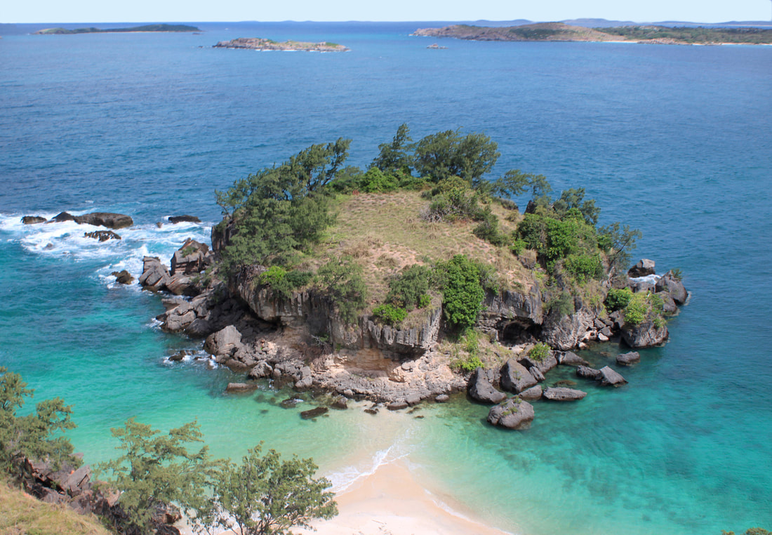
Looking SSW - inside Gwalpilina Pt. at the entrance to Port Bradshaw. On the horizon the islands around Bridgland Is. (Sgt Ray Bridgland NT Mounted Police 1929)
Picture
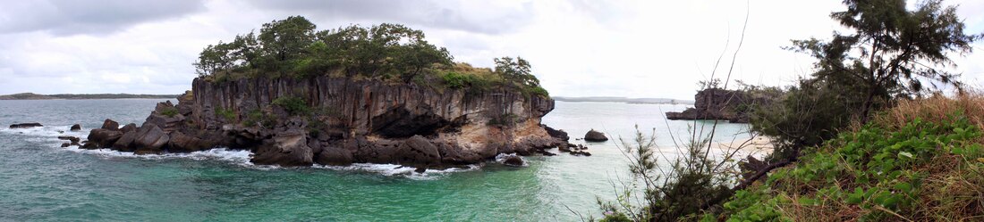
Looking NW. The sentry island has an Osprey nest at right of centre & the orange features are a tough vine.
Picture
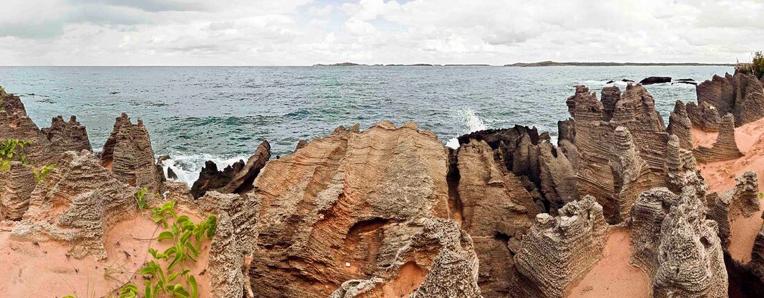
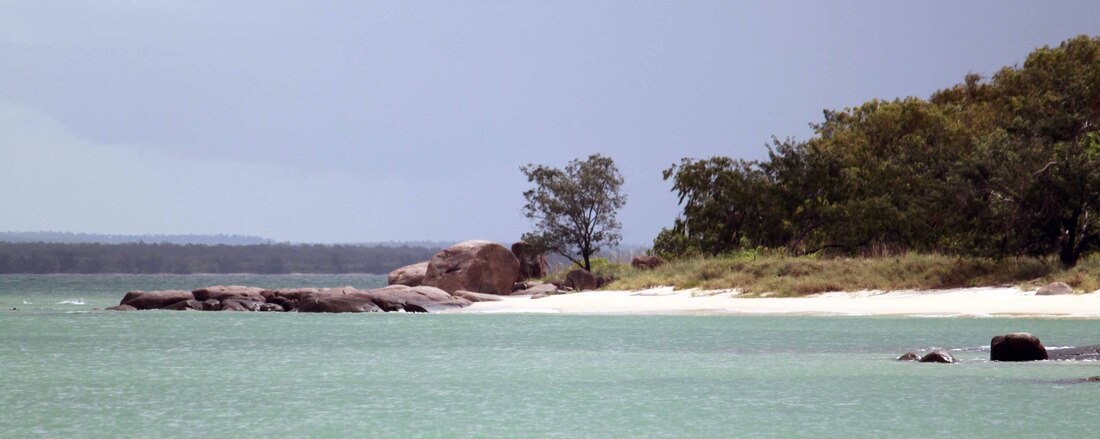
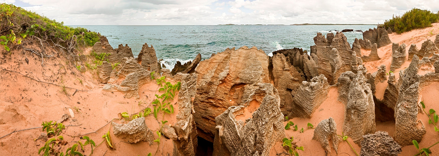
Rock formation at Gwalpilina Point looking South to the island off the entrance to Port Bradshaw
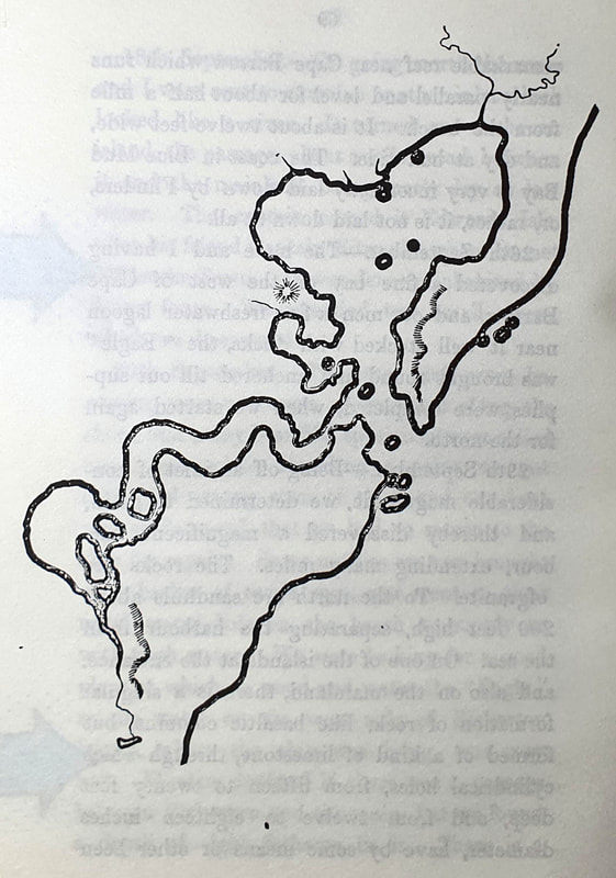
29th September 1867. - "Being off an inlet of considerable magnitude, we determined to go in, and thereby discovered a magnificent harbour, extending many miles. The rocks are of granite. To the north are sandhills about 200 feet high, separating the harbour from the sea. On one of the islands at the entrance, and also on the mainland, there is a singular formation of rock, like basaltic columns, but formed of a kind of limestone, through which cylindrical holes, from fifteen to twenty feet deep, and from twelve to eighteen inches diameter, have by some means been formed. Many large fragments have tumbled down by the undermining of the sea. The perforations of some of the fallen masses pass entirely through them, and are almost perfectly parallel. These limestone rocks are the foundation of the sandhills." (pp 69 & 71 Notes of a Voyage from NSW to the North Coast of Australia - from the journal of the late Francis Napier.)
Picture
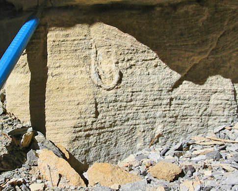
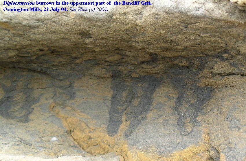
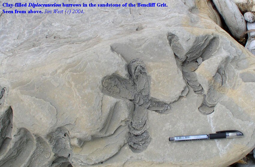
Dr. Ian West is an authority on diplocraterion and their burrowings in the UK shoreline. He was kind enough to provide these images which bear some resemblance to the features at Gwalpinya Point at the northern entrance to Port Bradshaw.
Picture
Picture
Picture
Picture
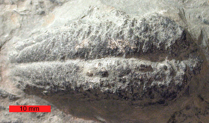
800px-RusophycusOrdovician
Picture
The northern shore of Port Bradshaw at the end of the beach beside Bawaka outstation.
Picture
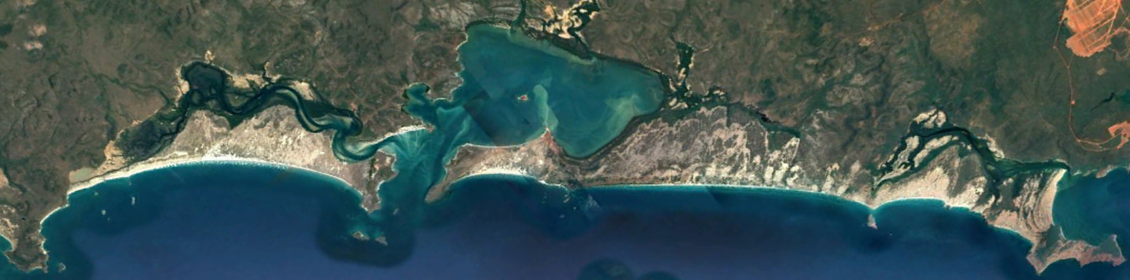
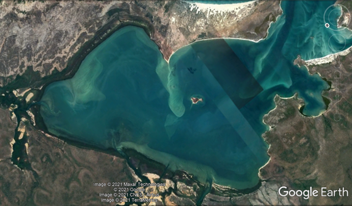
Google Earth image of the coast south of Yirrkala - the bauxite mining areas at far right.
“On a small, fantastic-looking island, in the centre of the harbour and conspicuous from all parts of it, we found several large Tamarind trees, loaded with ripe fruit, and the most complete Malay establishment for preparing beche-de-mer that we have yet seen, with many pieces of bamboo of all sizes, used for drinking vessels and for water carriers, with remains of pottery, sleeping apartments, and two large fishing nets. This bay evidently forms their headquarters.” P.71 Notes of a Voyage from NSW to the North Coast of Australia - from the journal of the late Francis Napier.
Picture
Francis Napier Journal p. 70
Picture
Picture
Picture
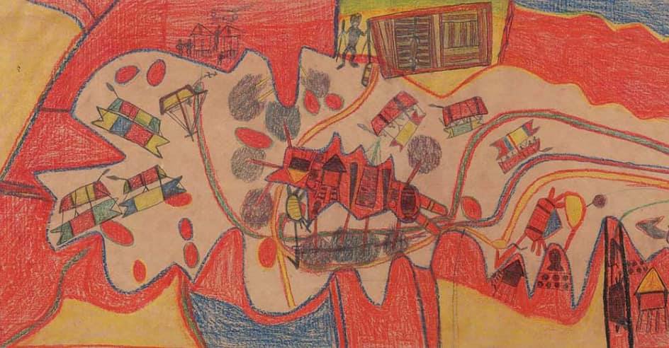
Yalangbara by Mawalan No. 1 (1947) - Bernts.
Picture
Proudly powered by Weebly