PAST MASTERS
PastMasters
  • Home
    • About Us
    • Objects & Activities
    • Research Projects
    • Index & Links
    • Contacts
    • Latest News
  • Projects & Activities
    • Army Towns & Settlements WW2 >
      • Adelaide River WW2
    • EARLY MAPS >
      • The First Map of Australia
      • The First True Map of Australia
      • Jave Le Grande
      • Vallard & Dauphin Maps
      • Early Maps of Australia
      • Who Discovered North Australia
      • DUTCH MAPS >
        • 1606 Duyfken
        • 1623 Arnhem & Pera >
          • 1623 Arnhem & Pera Voyage
          • 1623 Pera - De Leeuw
          • 1859 van Dijk - Carstensz
        • 1636 Pool Expedition
        • 1644 Tasman Map
        • 1705 van Delft >
          • Pre-Cook 1705
        • 1705 Weyland
        • 1756 Gonzal Expedition
    • First Contact
    • HMS Beagle >
      • The Beagle Anchors
      • Watch Vessel No. 7
      • Beagle Well Darwin
      • Roman Villa Found in Darwin
    • Cairns & Burnt Mounds
    • D'Stretch Marks
    • Eyam - The Plague Days
    • Fakes & Forgeries >
      • Flinders by Westall >
        • William Westall {Flinders}
    • Stone Fish Traps >
      • Australian MegaMyths
      • Bentinck & Sweers Traps
      • Stone Traps & Trap Stones
      • Mafic Dyke & Sills
      • Nightcliff Traps
      • World Heritage Dykes
    • HMAS Patricia Cam >
      • Pat Cam 75th Anniversary
      • The Men & Their Families
      • Ship's Knee MH7
      • Beattie's Yard
      • Palermo Park Dig
      • The Sandy Sanford Story
      • Pat Cam Memorial Yirrkala
      • Percy C & MM Memorial
    • MACASSANS >
      • Pobassoo Island
      • Port Bradshaw
    • Matthew Flinders - The Long Way Home >
      • Flinders & HMS Cumberland
      • Flinders Mapping
    • Miscellany >
      • Capt. Cook - Bad Hair Day
      • The Loss of HMAS Armidale
    • Mystery Objects
    • NT Fleet Review
    • NT Histroy in a Hundred Images
    • NT Image Makers & Takers >
      • Florenz Bleeser >
        • The Vic Hotel
      • Foelsche Centenary 2014
      • Ted Ryko
      • Shepherdson Collection >
        • 4. Wireless & Planes
        • 6. Boats
        • 7. Fijian Staff
      • NT Painters & Sketchers
    • OSL Beach Dating
    • Shell Mounds & Middens
    • Territory Treasures >
      • Boustead Jar
      • Dragon Rapide VH-ASK
      • Dundee Beach Swivel Gun >
        • Bali, Dundee & Lisbon Guns
        • Dundee Gun Blog
      • Port Essington Barks
    • Top End Timeline Ancient >
      • Top End Timeline Modern
  • ARNHEM LAND & BEYOND
    • ADELAIDE RIVER
    • COBOURG PENINSULA >
      • PM Expedition 2017
      • Fort Wellington at Raffles Bay
      • Victoria Settlement >
        • Lambrick Family Archive
        • The MacArthurs
        • Macarthur Journal
        • Port Essington Jack
        • The Tilston Collection
        • Victoria Cemetery
        • VIPs at P.E.
    • DARWIN >
      • Early Darwin >
        • Esplanade SE
        • Esplanade SW
        • Bennett Street
        • Cavanagh Street
        • Goyder's Camp & Early Darwin
        • Mitchell Street
        • Smith Street >
          • Victoria Hotel
      • The Govt. House Gun >
        • Residency Govt. House
        • Government House
      • Top End Heritage Park >
        • Darwin's Heritage Assets
        • Historic Statues
        • Pre-fabrication of Australian History
      • Bombing of Darwin
      • Channel Is. Centenary - Quarantine to Lazarette
      • Doctor's Gully >
        • ZDG Catalina Base
        • 1st Darwin Hospital
      • East Point Reserve
      • Naval Fuel Depot WW2
      • Wagait Beach
      • Z Special & Catalina Base
    • DOWN THE TRACK >
      • Coomalie Landing Ground
      • NT Expedition 1880-89
      • Overland Telegraph & Undersea Cables >
        • Daly Waters OT Stn
        • OT & Stuart Artefacts
        • OT Pole No, 1
        • OT Stations
    • ELCHO ISLAND PORTRAIT >
      • The Elcho Island Coin
      • Elcho Past Muster - Workshops, Finds & Losses
      • Galiwin'ku Community
    • ESCAPE CLIFFS
    • GOVE PENINSULA >
      • Caledon Bay Affair
      • Catalina Beach WW2
      • Control Tower Museum
      • Gove Airfield WW2
      • Gunyangara
      • Heritage Rangers
      • Nhulunbuy
      • Wurrwurrwuy Stone Pictures
      • Yirrkala
    • GAPUWIYAK
    • GOULBURN Is. Centenary
    • GROOTE EYLANDT >
      • Alyangula
      • Angurugu >
        • Angurugu Lifeboat
      • Bickerton Island
      • Emerald River
      • Groote Rock Art >
        • Angurugu Shelter
        • Groote Rock Art 2
      • Umbakumba
    • MILINGIMBI >
      • Mission Christmas & New Year
    • OENPELLI - Gunbalanya >
      • Oenpelli Mission 1953/85
      • Oenpelli Mission -Early Days
      • Oenpelli Buffalo Days
    • RAMINGINING
    • TIMOR & Oecussi
    • TIWI ISLANDS >
      • Bathurst Island >
        • Heritage Precinct
      • Melville Island
      • Joe Cooper
      • JS Roe
      • PP King
      • Carslow Beach & the Dutch
      • Fort Dundas & Garden Point >
        • DATES 1824
        • FIVE FORTS
        • FD & Gdn Pt. Finds
        • Lady Nelson & Stedcombe
      • Macs on Melville
      • Snake Bay - Macc Weir
      • Tiwi Artefacts One >
        • Dutch Artefacts
        • MI Opium Pipes
        • FD 'Shako'
        • JS Roe Artefacts
    • TRUANT Is.
    • WESSEL ISLANDS >
      • Ancient Coins in Arnhem Land Expedition
      • Australians Bay
      • Hopefull Bay
      • Kora Kora
      • Mary Bryant Story
      • Wessels 2018 >
        • Wessels 2018 Copy
      • Wessel Islands Radar 312RS
      • Wildcard Expedition 2019
  • PastMasters Publishing
    • Arnhemland's Lost Past
    • Early Contact North Australia
    • Wooden Weir - Milikapiti
    • Claiming Australia
    • Beagle Beach Well
    • PastMasters' Papers
  • Isenberg Hoard Analysis
  • Non-clickable Page
  • DONATIONS
  • ECO Is. CH Summer School
  • B'stead Jar & Shell Dunes Copy
  • Top End Targets
Picture
Picture
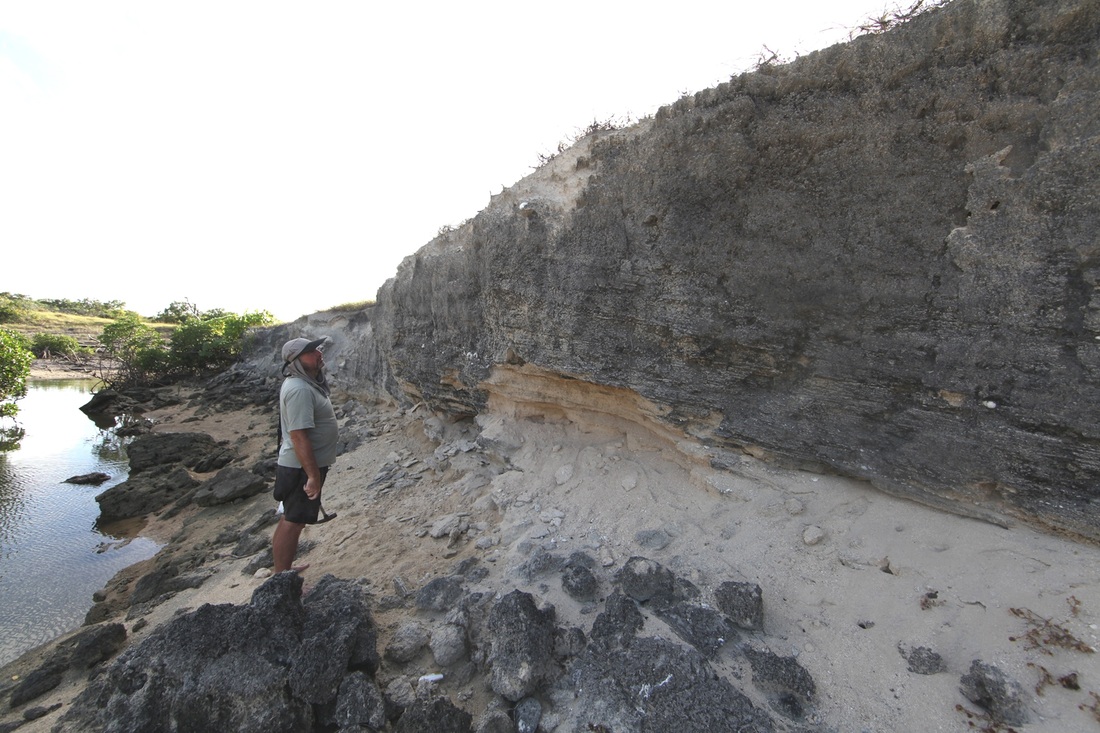
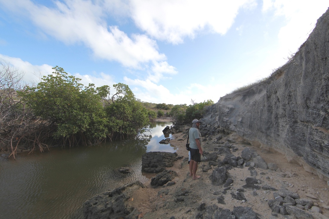
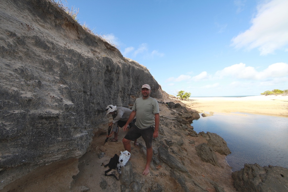
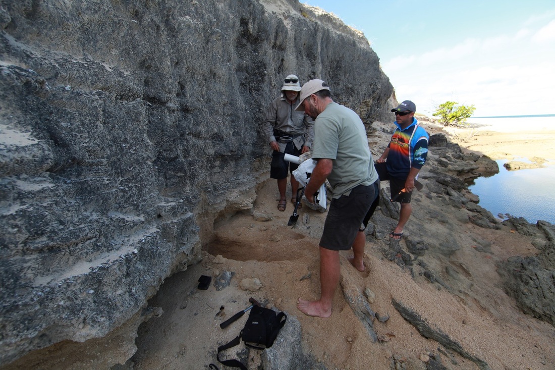
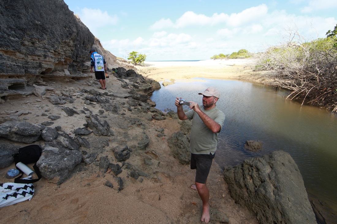
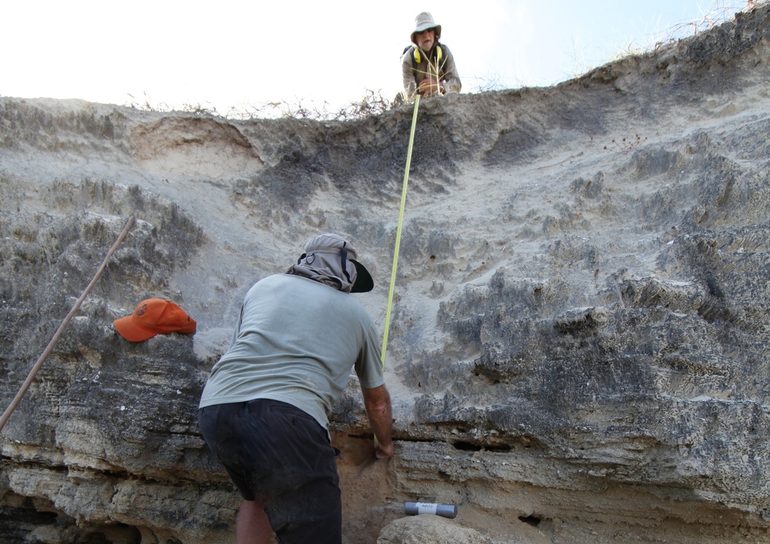
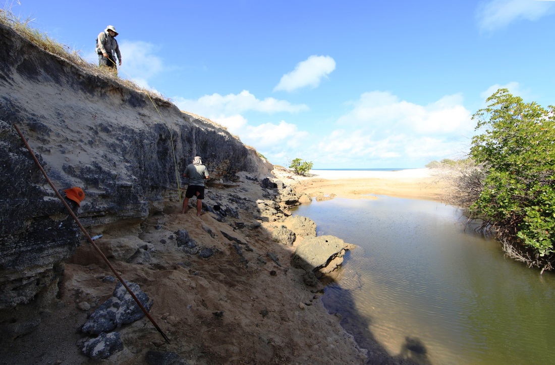
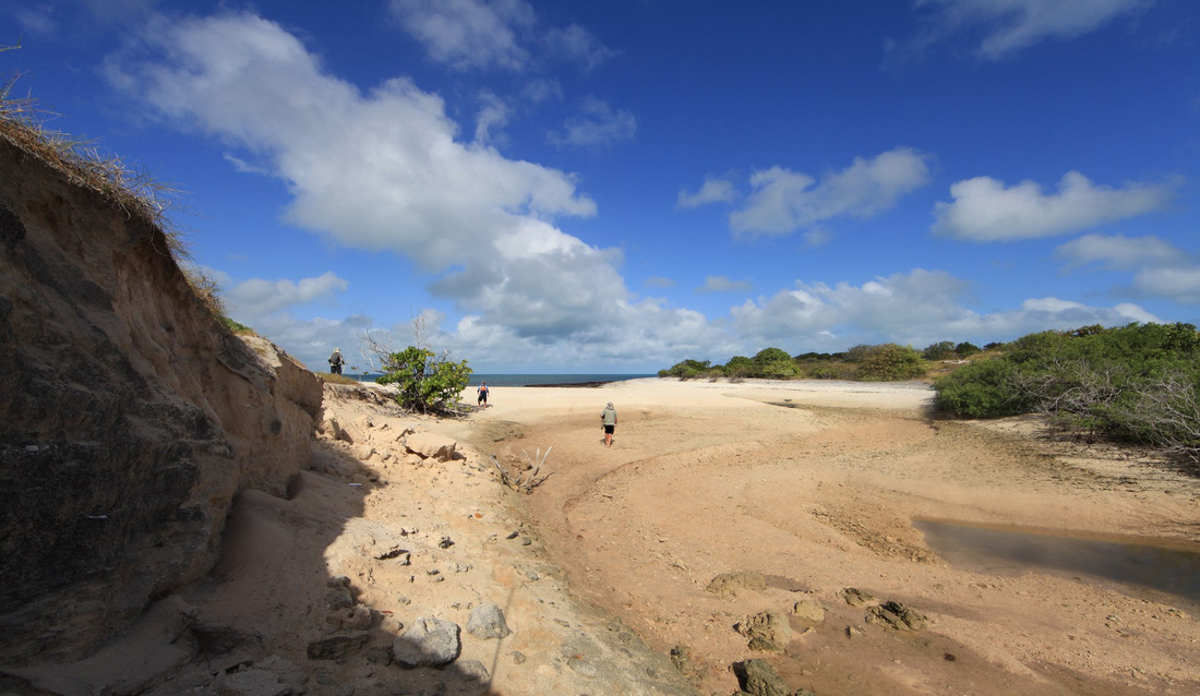
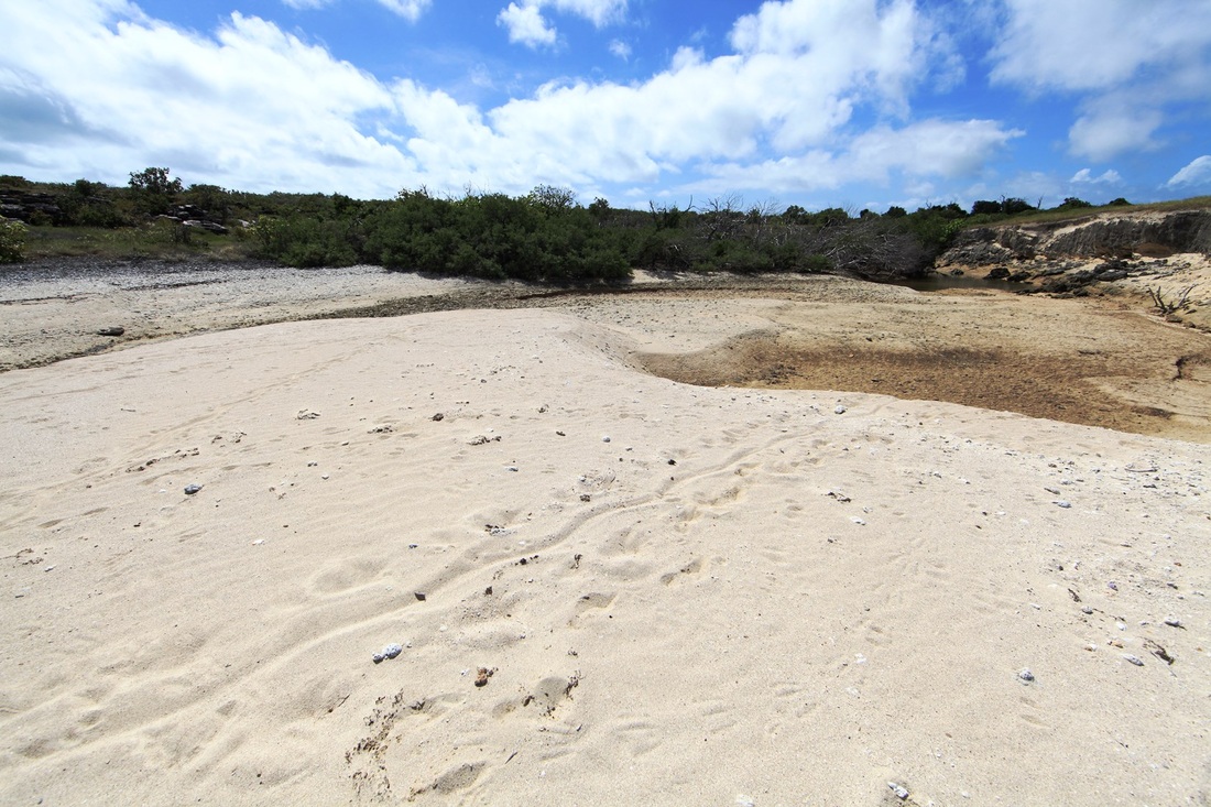
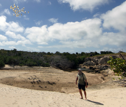
Dr Tim Stone emerges after inspecting the creek from which the samples were taken. Momentarily distracted by a mob of Little Corellas - Tim is going to rendezvous with the boats which are waiting at the mouth of the creek. This at the NE corner of Two Island Bay on the western side of Marchinbar Island. An Archaeologist, Geologist, Geomorphologist & Geochronologist - Tim is sampling buried silica sand from the earliest levels of deposition. This Optically Stimulated Luminescence {OSL} 'beach dating' is the first such analysis performed in northern Australia. The samples are to be processed at Dr Matt Cupper's laboratory at Melbourne University where he & Tim dated the sands trapped in the barrel of the swivel gun found by Christopher Doukas at Dundee Beach. Until relatively recent times such practices would have been rewarded with a trip over the falls in a barrel - Tim & Matt in conjunction with other alchemists at Melbourne & ANU are pioneering the application of geochronological techniques for archaeological applications.

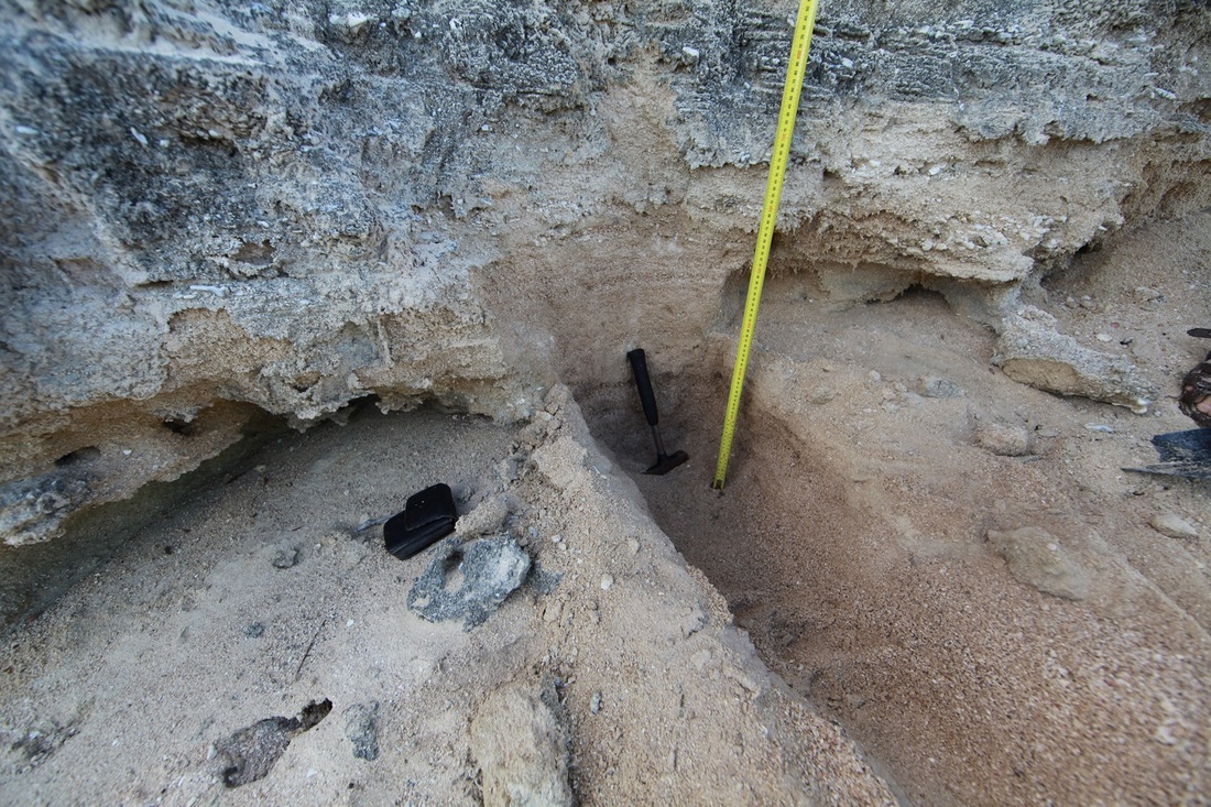
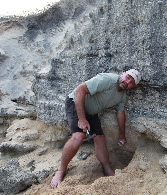
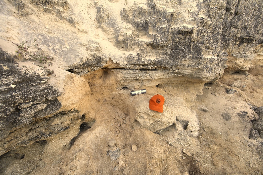
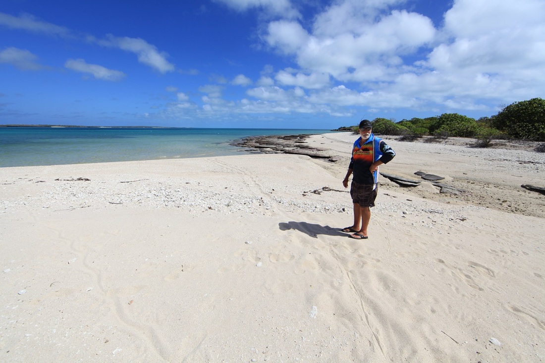
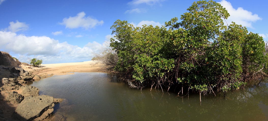
The procedure involves the insertion of a section of 40mm pvc pipe into the section of beach carved by the creek. This prevents light reaching the entombed silica sand particles which are compared to the exposed sands on the end of the tube. Tim's short article below explains the HIR process of 'land rise' exemplified by the image of a stranded shoreline on Marchinbar Island.

Picture
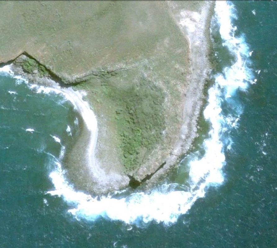
This image is to the right of the stranded beach is from Google Earth - 1.5 miles south of Sphinx Head on the western side of Marchinbar Island in the Wessels at 11 degrees 12.709' S - 136 degrees 42.356' E - it is possible that such a 'land rise' event happened as recently as one thousand years ago. 

Whilst the geological origins of the land are of immense fascination to the Yolngu people and a core subject of Past Masters Workshops - it is the combination of scientific analysis and oral history that points the direction for research as the bulk of Yolngu archaeology has been submerged by millennia of steady sea rise.

It is hoped that these technologies will test the theory that a southern hemisphere equivalent of the 'Little Ice Age' caused sea levels to fall during the first half of the 17th century with the effect of briefly opening a land bridge between PNG and Cape York and accounting for the Dutch crew of the Arnhem & Pera reporting the western end of Torres Strait as a dry river mouth - shown on their chart as rocks and sandy gravel.

Your browser does not support viewing this document. Click here to download the document.
Proudly powered by Weebly