1705 Jacob Weyland Expedition to the South Land
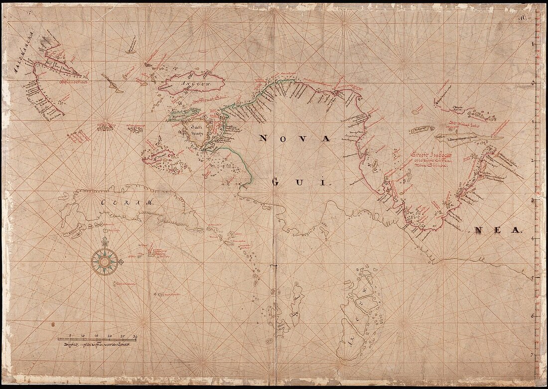
AMH-5317-NA_Map of Halmahera, Seram & Nove Guinea 1705 - 1758
Sailing Instructions - abstract
'Instructions (by the G-G. and Council, dated January 20, 1705) for the officers of the Frigate de Geelvink, along with the Pinnace de Kraanvogel and the Patchiallang Nova Guinea, destined to set out for the outside coast of the said Nova Guinea;
...... the frigate Geelvinck together with the pinnace Craanvogel and the patchiallang Nova Guinea will first run from here directly for Banda...and from Banda continue their voyage to the coast of Nova Guinea.
You will in the first place have diligently to observe, whether there is anywhere a passage from the outside to the inside, and this not only as regards Nova Guinea, but also as concerns Hollandia Nova, so that these orders...will have to be acted up to not only by the officers of the Geelvinck, but also by those of the Vossenbosch; and you should take special care, in case you should find such real or seeming passage, not to run too far into it, lest you should be carried away by currents in the same, and run the risk of accidents; on which account the examination of such passages should nowise be undertaken by the frigate or by the flute, but only by a pinnace or patchiallang; never to any farther distance than the experienced sailors in the same shall deem advisable to enable a safe return out of the said passages, and in no case so far as to get out of anchoring depth'. Full Sailing Orders on Van Delft page.
The Sailing Instructions are dated January 20, 1705 - victualled for a 10 months voyage to be completed at the end of September at Banda.
Wiki - "In January 1705 Jacob Weyland was commissioned by the VOC to travel to the north coast of New Guinea as far as the Schouten Islands and, if possible, even further. One of the most important tasks was to investigate the extent to which the Englishman William Dampier, described in literature as a pirate, had gained a foothold there, to which the English might well be able to lay claim. Weyland was to be back in September of that year, bringing with him accurate maps, as much information as possible, and "if possible, some foreign Indians."
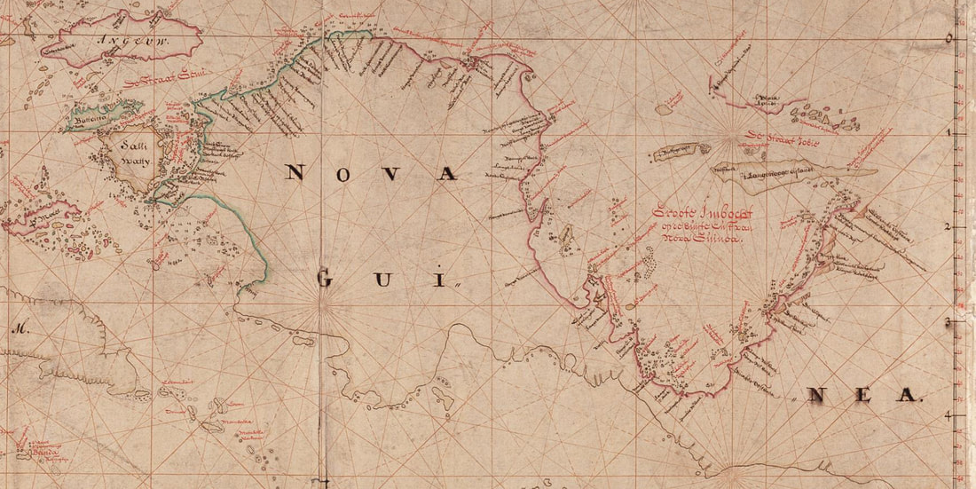
"On June 5, 1705 they reached Geelvinkbaai's Oosthoek where they could not sail any further because of the unfavourable natural conditions. Here the coastline bends to the south and a reduced salinity was measured. It is possible that Weyland had reached the eastern cape of Kurudu Island where the sea is very shallow and where many rivers flow into the sea. The "Grote Kerkberg" was drawn here on the map of Weyland; probably the mountain "Kamusopedai" which was and is used as a prominent target by the locals. Weyland then sailed back along the south side of Japen Island. An island called Dwars in den Wegh was encountered , possibly the current island of Nau.
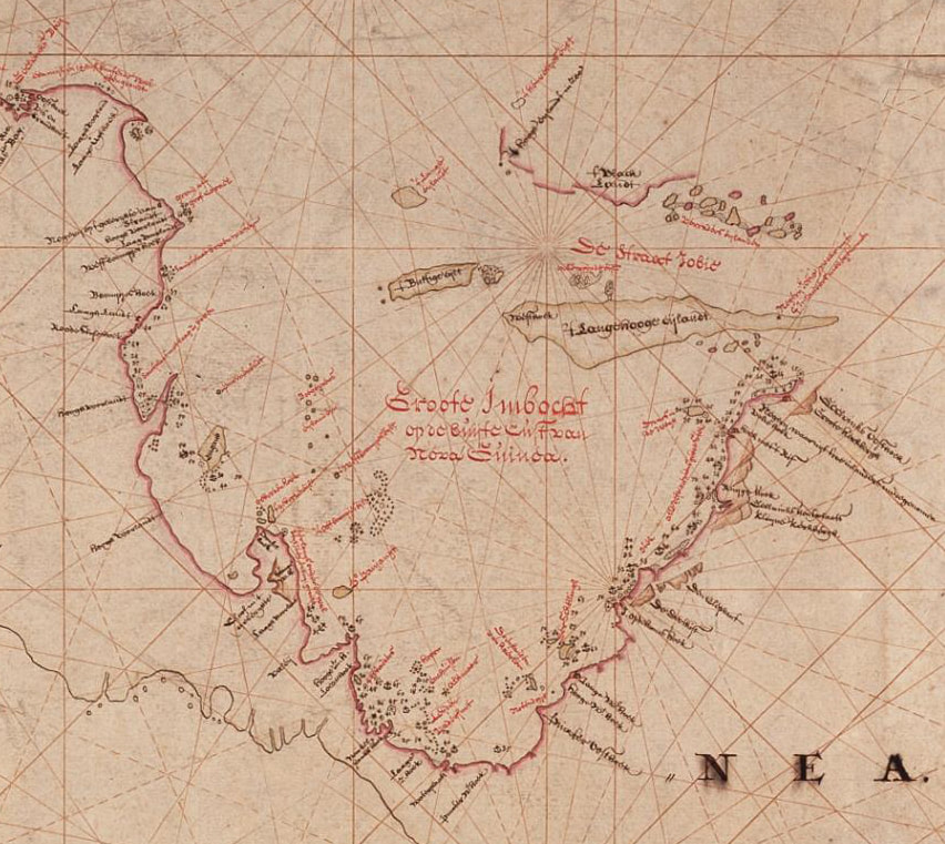
"Cartographic Errors - Weyland's logbook was kept hidden by the VOC and then lost, his map was later used by the cartographer Nicolaas Struijck in 1753 to draw a map. A number of crucial errors were made, which to this day still appear on various maps and atlases and have still not been corrected. For example, near the city of Wewak off the coast of Papua New Guinea, we find a number of islands called Schouten Islands in the Times World Atlasand they are about 950 kilometers off course. This error can be traced back, among other things, to the map that the Englishman Forrest drew when he set off with Struijck's map and got hopelessly lost, after which he openly accused the VOC of circulating false maps to put the English on a to lead astray. Later cartographers such as D'Entrecasteaux and Dalrymple based themselves on the maps of Struijck and Forrest."
"On June 5, 1705 they reached Geelvinkbaai's Oosthoek where they could not sail any further because of the unfavourable natural conditions. Here the coastline bends to the south and a reduced salinity was measured. It is possible that Weyland had reached the eastern cape of Kurudu Island where the sea is very shallow and where many rivers flow into the sea. The "Grote Kerkberg" was drawn here on the map of Weyland; probably the mountain "Kamusopedai" which was and is used as a prominent target by the locals. Weyland then sailed back along the south side of Japen Island. An island called Dwars in den Wegh was encountered , possibly the current island of Nau.
"Cartographic Errors - Weyland's logbook was kept hidden by the VOC and then lost, his map was later used by the cartographer Nicolaas Struijck in 1753 to draw a map. A number of crucial errors were made, which to this day still appear on various maps and atlases and have still not been corrected. For example, near the city of Wewak off the coast of Papua New Guinea, we find a number of islands called Schouten Islands in the Times World Atlasand they are about 950 kilometers off course. This error can be traced back, among other things, to the map that the Englishman Forrest drew when he set off with Struijck's map and got hopelessly lost, after which he openly accused the VOC of circulating false maps to put the English on a to lead astray. Later cartographers such as D'Entrecasteaux and Dalrymple based themselves on the maps of Struijck and Forrest."
|
Sources, notes and/or references
|
|
Conclusion
Little is known of the Weyland fleet as neither his log nor chart survive. Half a century later a map was produced that claims to be based upon the lost chart. Geelvink Bay adorned the charts until renamed Cenderawasih Bay (Birds of Paradise Bay) – the large bight on the north coast of West Papua which has an endemic species of fruit bat called the Geelvink Bay flying fox - Pteropus pohlei.
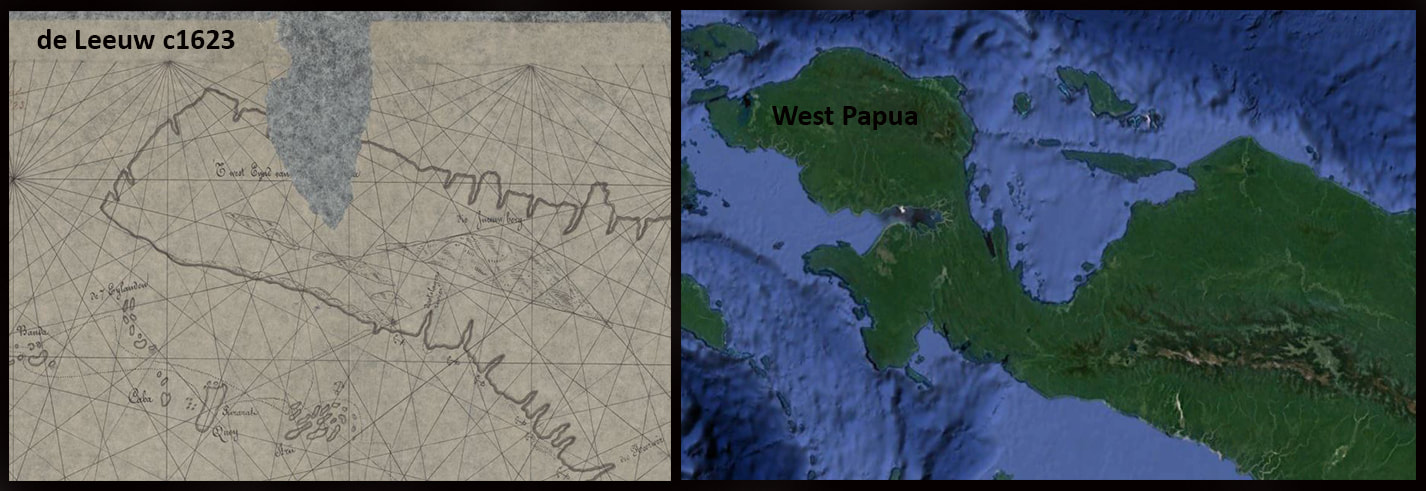
A clumsy but hitherto effective deceit - de Leeuw c1623