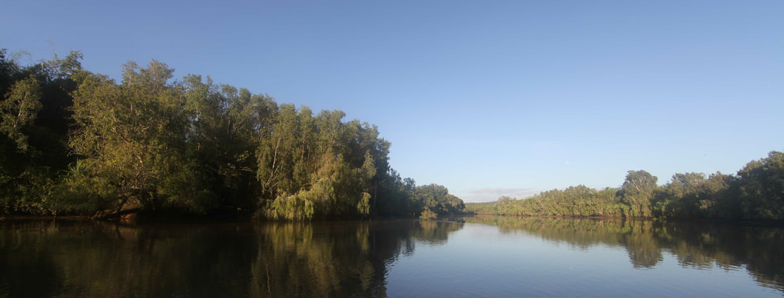
The Adelaide River
Southern tip of Goat Island at right - looking up-stream to the junction.
Discovery of the Adelaide River
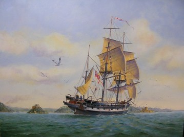 Painting by Ron Scobie of HMS Beagle heading up Sydney Harbour on 24th July 1838.
Some of the most important names in Australian exploration are associated with the discovery of the Adelaide River and the site of South Australia's first colony.
They were surveying aboard the world's most famous ship of science, HMS Beagle, which had carried Charles Darwin on the pivotal five year journey around the world in search of the origin of species.
Many of the crew from that voyage (Wickham, Stokes, Fitzmaurice & Forsyth) were still with the Beagle for the Third Voyage which furnished Admiralty Charts of much of the Australian coast and made discoveries including Port Darwin - the Fitzroy, Adelaide, Victoria and Fitzmaurice Rivers.
They also charted Bass Strait, the north coast of Tasmania and the southern coast of Victoria, including the entrance and significant areas of Port Phillip Bay.
 July 24th 1862 – SLSA B63407
Charles Darwin had been with the Beagle surveying southern Australia but was no longer among the ship's company when, on 27th July 1839, Commander Wickham anchored her in a broad bay off Clarence Strait.
Wickham straight away dispersed his men to search for a great river to carry exploration into the dark interior which would not be crossed until John McDouall Stuart reached the north coast on 24th July 1862.
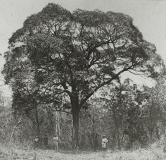
Stuart believed that the had travelled through the valley of the Adelaide River and recommended the site for a commemorative northern capital but had mistaken it for the Mary River.
The location of the blazed tree in Chambers Bay was not resolved for many years and this led many to doubt the veracity of Stuart's claim to have been first to cross the continent from south to north. It was found by A/Government Resident & one time resident of Escape Cliffs - Gilbert McMinn in 1883 and photographed by his companion Inspector Paul Foelsche. (Gilbert's brother William was on the Forlorn Hope's epic voyage.)
Stokes' Journal - Discoveries in Australia continues:-
Wickham straight away dispersed his men to search for a great river to carry exploration into the dark interior which would not be crossed until John McDouall Stuart reached the north coast on 24th July 1862.
Stuart believed that the had travelled through the valley of the Adelaide River and recommended the site for a commemorative northern capital but had mistaken it for the Mary River.
The location of the blazed tree in Chambers Bay was not resolved for many years and this led many to doubt the veracity of Stuart's claim to have been first to cross the continent from south to north. It was found by A/Government Resident & one time resident of Escape Cliffs - Gilbert McMinn in 1883 and photographed by his companion Inspector Paul Foelsche. (Gilbert's brother William was on the Forlorn Hope's epic voyage.)
Stokes' Journal - Discoveries in Australia continues:-
"Impatient to learn the truth, Mr. Fitzmaurice was despatched to examine the head of the bay, whilst the ship was moved towards it, anchoring again one mile North-West from a very remarkable patch of low red cliffs (which from startling circumstances, hereafter to be related, were called Escape Cliffs)……On returning to the ship we found that Mr. Fitzmaurice had arrived, bringing the expected, and very gratifying intelligence, that a large river with two branches, running South-East and South, with a depth of four fathoms, emptied itself into the head of the bay."
They had discovered the Adelaide River which they named for the Queen Dowager and Adam Bay for Vice-Admiral Sir Charles Adam. It was to become the site of South Australia’s first attempt at a Northern Capital for its Northern Territory and would be called Palmerston - the original name for Darwin City & today the name of her satellite city. Sagas of triumph & disaster - not without their lighter moments.
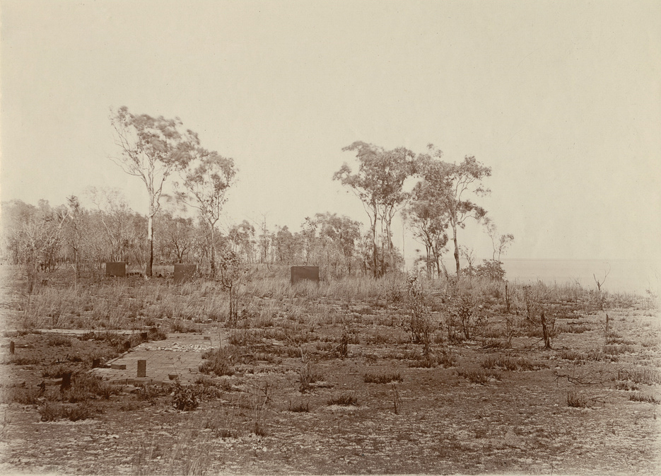
SLSA B-72713-2 'Escape Cliffs, NT looking south' 1899-1918 a
|
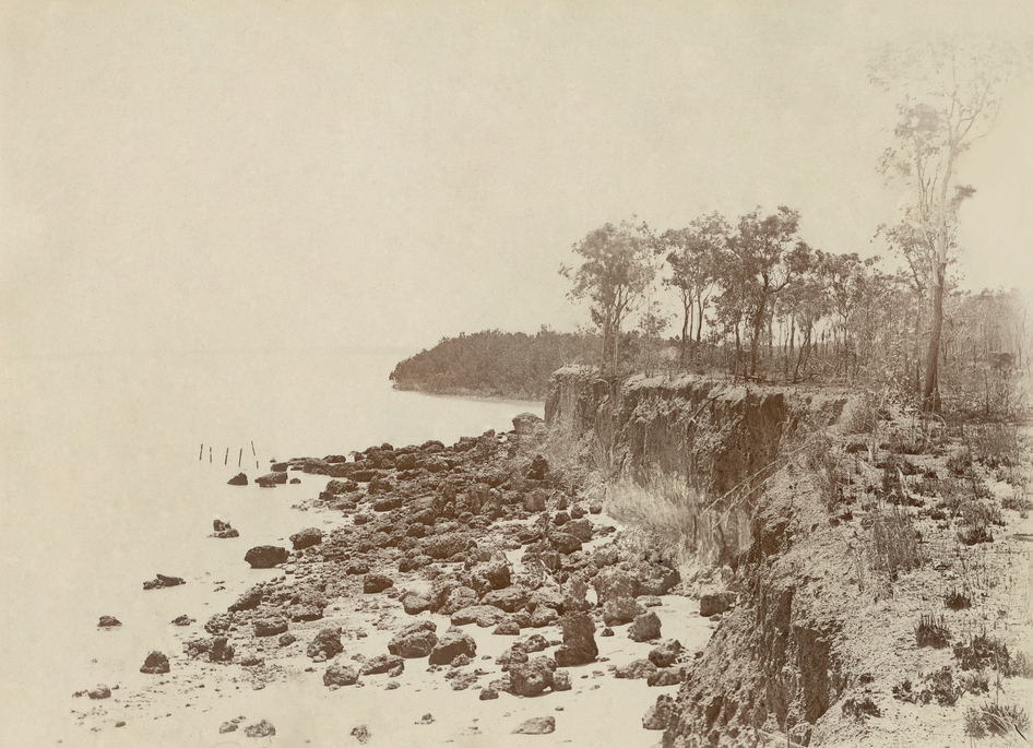
SLSA B-72713-5 'Escape Cliffs NT looking north east'
|
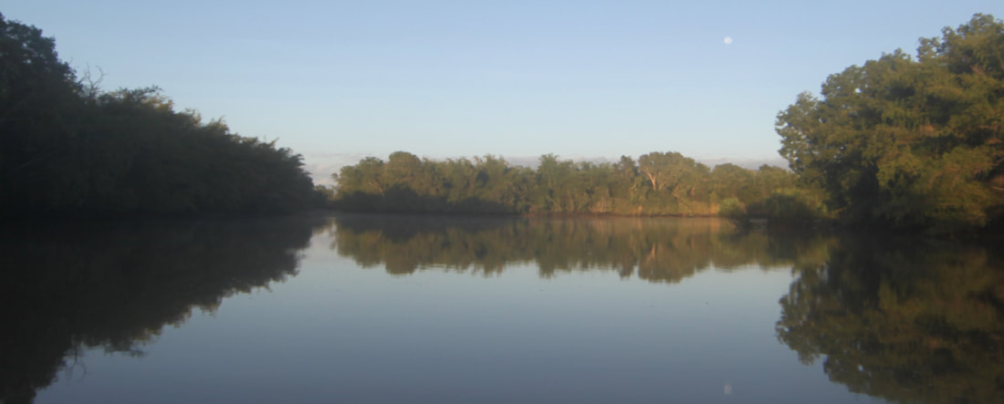
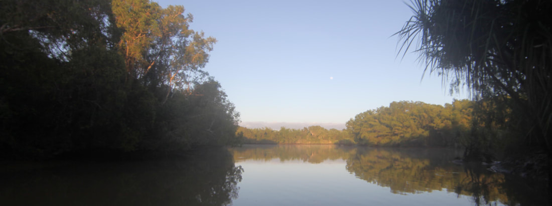
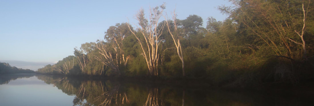
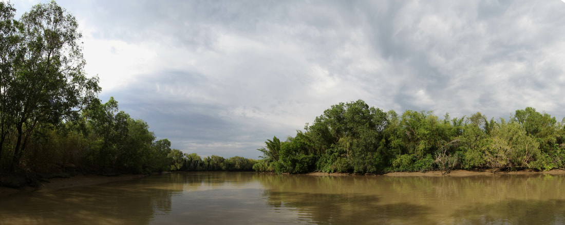
The Adelaide River up-stream from Goat Island
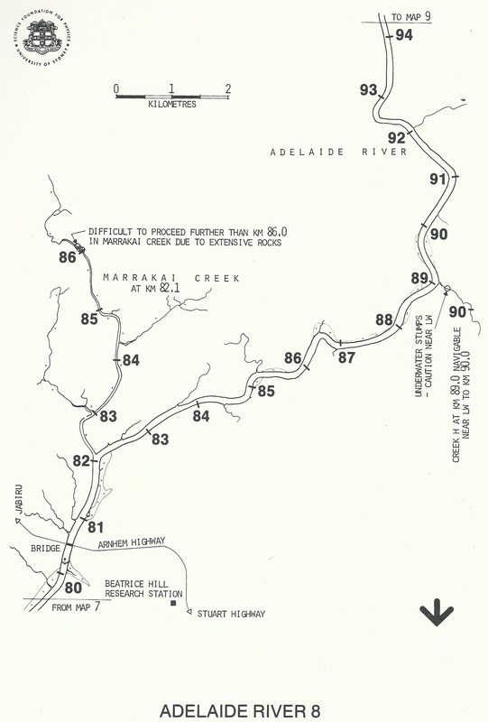
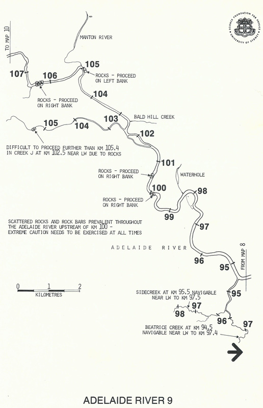
"An exploring party, however, was at once formed, consisting of Captain Wickham, Lieutenant Emery, and Mr. Helpman, who - the next day being Sunday - did not leave before the morning of the 29th, with two boats and four days' provisions". They were to voyage more than 100kms up river past Goat Island and on through the 'S' bends to the extent of dry season navigation below where the Marraki Road now crosses the stream.
The Adelaide River
'This morning the boats returned; they had gone up the Adelaide in a general southerly direction, nearly 80 miles: the windings of the river, which were very great in some places, forming the shape of the letter S. It became at this distance very narrow, and was divided into two branches, one taking a southerly direction, the other an easterly; the latter was too narrow for the boat's oars, while the former was blocked up by fallen trees lying across it. As in addition to the difficulties just mentioned, only one day's provision remained in the boats, the further exploration of the Adelaide was necessarily, though reluctantly, abandoned.
''For thirty miles of the upper part of the river the water was fresh; while the banks, excepting near the point of separation, were low, being not more than five feet above the present level of the river, a circumstance very favourable for irrigation, and the cultivation of rice. Fifteen miles from the mouth they were fringed by the growth of mangroves; and higher up many of the points were thickly wooded, while on either side stretched a vast extent of prairie country, dotted here and there with islands of timber, which served to break the native monotony of the scene. Somewhat less than halfway up, rose on both banks a thick jungle of bamboo, which, in places where the water was always fresh, attained the gigantic height of from 60 to 80 feet. Between 20 and 70 miles from the mouth the soil is a good light-coloured mould; above this, commencing where the bank of the river is marked by a coarse red gritty sandstone projection, the aspect of the country changes from that of low plains to a slightly wooded and gently undulating surface, in some places stony. This character continued to the furthest point reached in the boats, in latitude 12 degrees 57 minutes South, and longitude 131 degrees 19 minutes East.
When they had penetrated thus far into the new lands of Australia, the explorers returned, having experienced sensations of delightful excitement, to which we have before alluded, and which naturally called forth strong emotions of regret in those who were denied a participation in the feverish enjoyment of discovery.
From the highest tree at Captain Wickham's furthest point, the appearance of the country was, as far as the eye could reach, one wearisome level, broken to the southward, at a distance of ten miles, by a rocky mound about 150 feet high.
The Adelaide River
'The river, which for some distance had not been fifty yards wide, with a rocky bed in places, and banks from six to twenty feet high, was subject at this point to a tidal change of level of about three feet, but there was no perceptible stream, and the water which a few miles lower down had been muddy, was here quite clear. Small bamboos and other drift were observed in the branches of the trees eight or ten feet above the water, showing the height which the river attains at some seasons of the year. By the hollows on many of the plains, water appeared to have lain some time, and doubtless parts of this low land were periodically overflowed.
On the point dividing the upper branches of the river some coarse sand was washed up, which on examination was found to be of a granitic character, clearly showing the primary formation of the country through which the Adelaide flowed. The only rocks noticed in the parts traversed by the boats were, as I have before said, of red porous sandstone. The smoke of several large fires was observed up the country, but no natives were seen.
On the point dividing the upper branches of the river some coarse sand was washed up, which on examination was found to be of a granitic character, clearly showing the primary formation of the country through which the Adelaide flowed. The only rocks noticed in the parts traversed by the boats were, as I have before said, of red porous sandstone. The smoke of several large fires was observed up the country, but no natives were seen.
The Adelaide River west bank
MONKEY-BIRDS
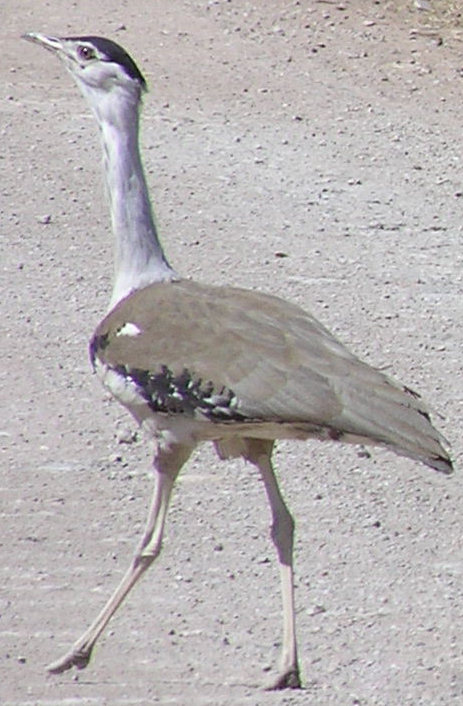
Towards the upper part of the river they noticed a strange bird, very much like a guineafowl in size and manner of running along the ground. The colour was speckled white and brown.
This, doubtless, from Mr. Bynoe's description of one he wounded on the coast in the neighbourhood of the Adelaide, must have been the Leipoa ocellata {Mallee Fowl} of Gould, one of the mound or tumuli-building birds, first seen in Western Australia by Mr. George Moore, and afterwards on the North-west coast, and in South Australia by Captain Grey.
Although known to range over a large expanse of the continent, this was the first time it was discovered in Northern Australia. {Not a Mallee Fowl as too far north – probably Australia’s heaviest flying bird, the Australian bustard or bush turkey - Ardeotis australis}
Two were seen on the east bank on 20th April 2019.
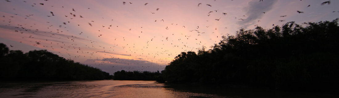
The Adelaide River flying foxes on dusk - 'like an explosion in an umbrella factory'.
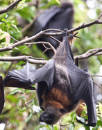
In the reaches where the bamboo grew, flights of large vampires (resembling the Pteropus rubricollis of Geoff.) were met with: they kept continually flying to and fro close over the boats as they passed up, making a screeching disagreeable noise, which, however, was far less unpleasant than the mildewy odour with which they filled the air, calling to mind the exclamation placed by our immortal bard in the mouth of Trinculo.
The heavy flap of the leathern wings of these monkey-birds, as the men called them, was singular, while sometimes a flight would darken the verdure of a bamboo, which, yielding to their weight, bent low, as if before a passing gust of wind. To fix themselves appeared always a difficult, and was certainly a noisy operation, each apparently striving to alight upon the same spot. They first cling to the bamboo by means of the long claw, or hook attached to the outer edge of the wing, and then gradually settle themselves. {Pteropus Alecto - Black Fruit Bat or Flying Fox}
The heavy flap of the leathern wings of these monkey-birds, as the men called them, was singular, while sometimes a flight would darken the verdure of a bamboo, which, yielding to their weight, bent low, as if before a passing gust of wind. To fix themselves appeared always a difficult, and was certainly a noisy operation, each apparently striving to alight upon the same spot. They first cling to the bamboo by means of the long claw, or hook attached to the outer edge of the wing, and then gradually settle themselves. {Pteropus Alecto - Black Fruit Bat or Flying Fox}
Morning mist on the Adelaide River
'The river swarmed with alligators. Fish also abounded; and in the salt water, a kind commonly known in the river Plate by the name of Cat-fish, is plentiful. One that we caught was of the enormous weight of twenty pounds. A large kind of dark bream of excellent flavour was taken in fresh water'.
The Deepest River in Australia
' ... there was a 3-fathom channel at low-water, and in the reaches above, seven in number, trending in a general South-South-East direction, about twice that depth. This imparted to our discoveries the stamp of utility, and as Captain Wickham found it navigable for thirty miles higher up where the water is fresh, we may pronounce the Adelaide the deepest river in Australia.' (John Lort Stokes, Discoveries in Australia)
' ... there was a 3-fathom channel at low-water, and in the reaches above, seven in number, trending in a general South-South-East direction, about twice that depth. This imparted to our discoveries the stamp of utility, and as Captain Wickham found it navigable for thirty miles higher up where the water is fresh, we may pronounce the Adelaide the deepest river in Australia.' (John Lort Stokes, Discoveries in Australia)
The Adelaide River just below the rapids.
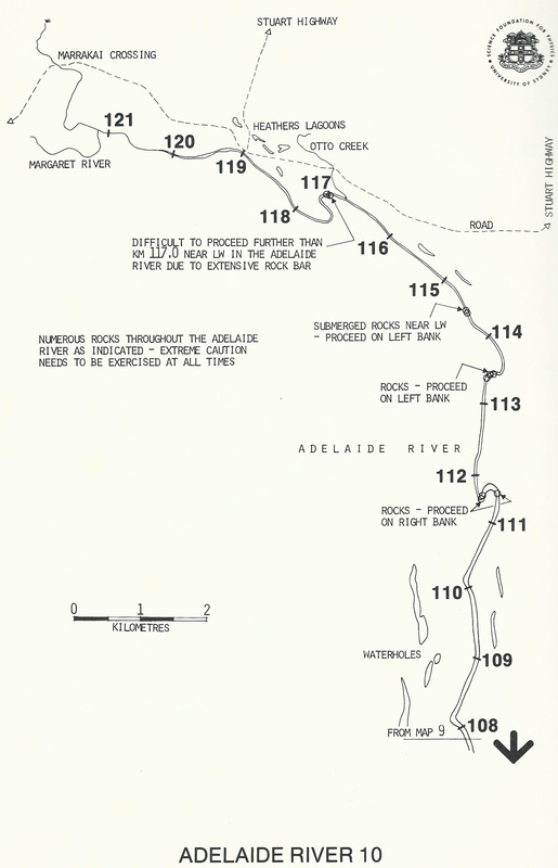
Surveys of Tidal River Systems in Northern Australia - Monograph 15 by Harry Messel, WJ Green, GC Vorlicek & AG Wells
|
|
|
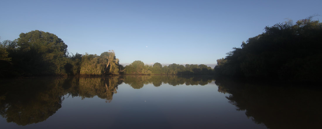
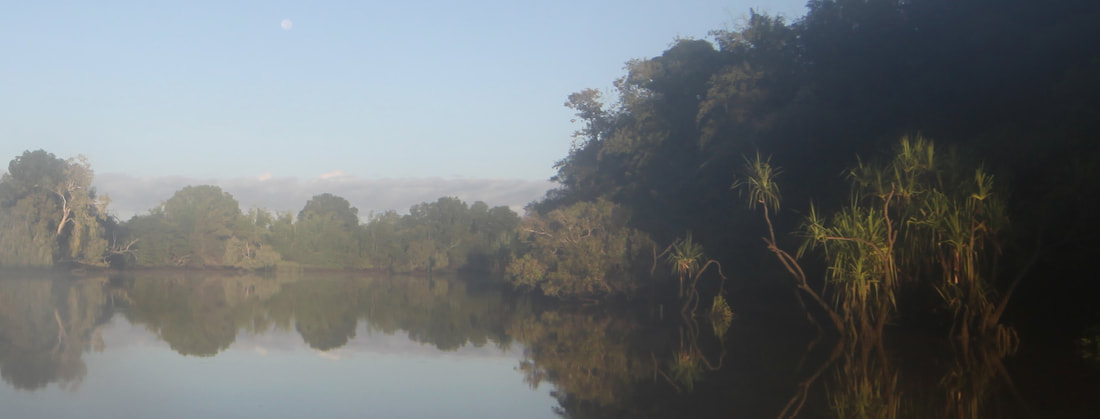
The Adelaide River the full moon reflected in the still water.
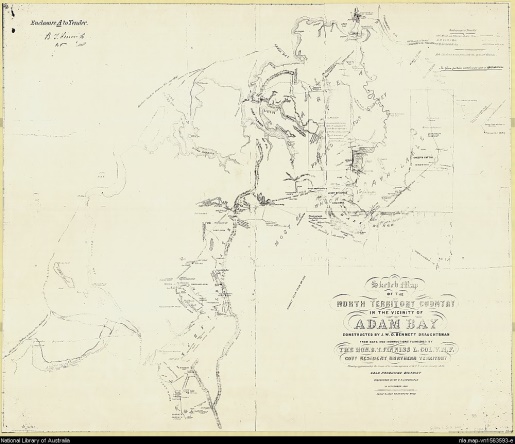
Adam Bay
Hutchison and Howard carried out a survey of Adam Bay and Adelaide River in 1864 and showed Charles Point and Point Stephens on their chart of Adams Bay (British Admiralty Chart 1704).
The Adelaide River
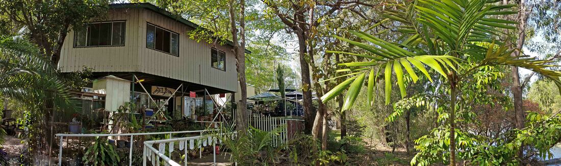
Goat Island Lodge
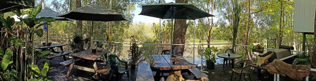
Goat Island Lodge
Sources & Resources
|
| ||||
|
| ||||
|
| ||||||||||||
| voyage_of_forlorn_hope_-_stow.pdf |
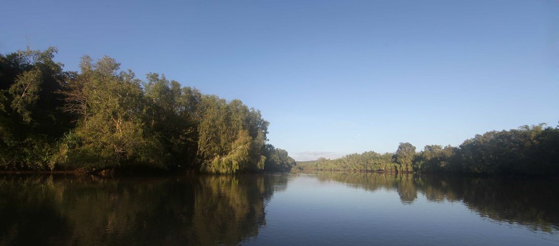
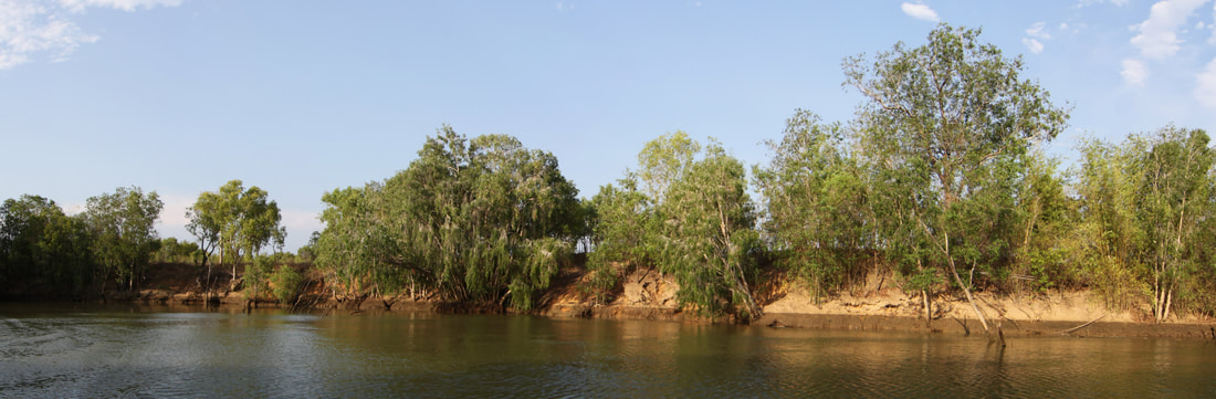
The Adelaide River just north of the start of the 'S' Bends