Research Projects in Prospect
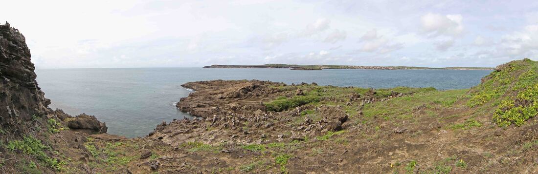
Dundee Beach - a bronze swivel gun was found here in 2010 - research into it's origin is on-going with new Copper isotope analysis in the offing - in Oxford to be precise.
Research Committee
The PastMasters came into being as a result of the quest to answer questions posed by the discovery of 5 Medieval Kilwa and 4 Dutch coins in the Wessel Islands in 1945. Despite being by far the oldest foreign artefacts ever discovered in Australia - nobody had ever visited the find site or searched for a shipwreck vector. That first expedition in 2013 has led to a decade of research into the history and heritage of northern Australia - a passion which we share with the local people and many others besides. We work collaboratively with senior people, community organisations and especially Ranger Organisations with the objective of creating a body of research and skills as a cultural and economic resource for all Australians.
We test hypotheses through archaeological investigation that brings to bear a wide range of scientific skills and techniques - many of which can be adopted by Ranger groups involved in the discovery, analysis and management of their heritage assets. In short, we practise and teach Applied Science, through the application of Archaeological Science {archaeometry}. This includes the use of survey tools such as metal detectors, Magnetometry, LIDAR and Ground Penetrating Radar to locate artefacts and samples which may then be subjected to analytical processes such as Carbon Dating (C14 dating), Optical Stimulated Luminescence (OSL dating), X-ray analysis CT, XRF & XRD.
Each project is considered by our Research Committee - which has six members and is chaired by Ian McIntosh. There are significant cultural and financial considerations, as well as an ever evolving array of geo-physical survey tools and diagnostic tests. These range from basic, non-invasive electron-microscopy and CT scanning, through to one that leaves the artefact a tad radioactive. Almost all testing and results analysis is expensive and time consuming, so a cascade of inquiry needs to be constructed and reviewed at critical, trigger points. Fortunately, we have an international network of friends and colleagues who have expertise in these sometimes arcane sciences.
Research Committee Members: Dr. Ian S. McIntosh (Chair); Dr. Matthew L. Cupper; Michael Hermes; Robert Sheppard; Dr. Tim Stone & Dr. Daryl Wesley.
MAJOR RESEARCH PROJECTS
PastMasters is a registered 'Charity' which enables us, as a 'not-for-profit' organisation, to apply for Grants funding. We have been approved by the Australian Taxation Office for Tax Deductible {DGR} status. Supporters of our work may make tax deductible donations to fund a range of 'trowel ready' research & commemorative projects - a project of personal concern or one of especial fascination.
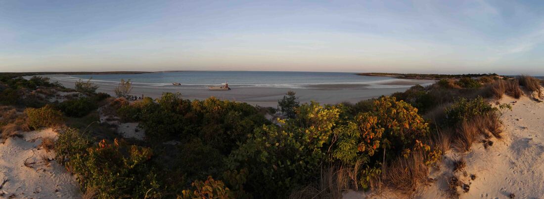
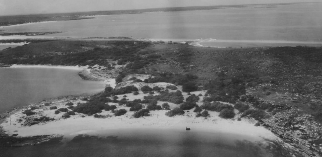
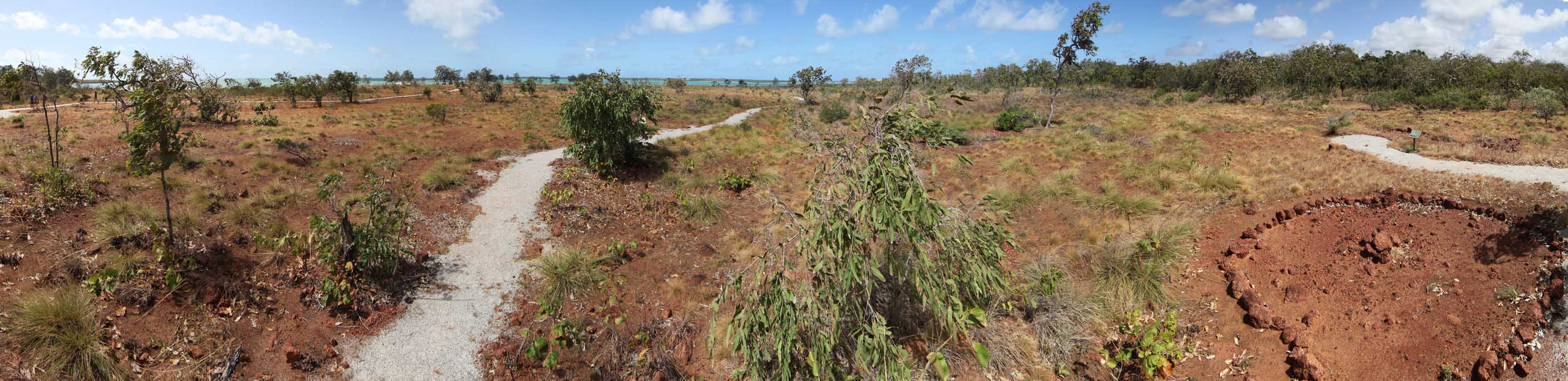
Hopeful Bay beach camp, SW Marchinbar Is. on dawn 2018 - 10 o'clock over ridge Australians Bay - 10.30 o'clock Cumberland Strait - 11 o'clock Pat Cam Survivors Beach.
'Ancient Coins in Arnhem Land'
Anniversary Expedition
|
After a decade of searching & almost 80 years after Australia's oldest foreign artefacts were found - this will at last take us to the actual site where RAAF Radar Operator Morrie Isenberg found the Kilwa Coins in 1945.
A comprehensive metal detector survey with Minelab's new ZVT Technology will support an archaeological report to advance the public record of the five Kilwa coins. Any finds will be staying in the NT - in accordance with the wishes of the Traditional Owner and the Burra Charter. Discovery of the site in 2018 confirmed the intersection of the environmental & documented historical paths which was corroborated by Minelab metal detector finds. |
|
|
This site is the terminal confluence of cascades of trends and determinants which coalesce at these sparkling spring-fed pools of freshwater that crop-out beside the sea around the north Australian coast - a necklace of Arafura Pearls. Some 100 nautical miles from the mainland - at 11degrees south of the equator - where else would oceanic voyagers mark their presence in the traditional way by scattering coins. This explains coins of VOC Dutch & Medieval African origin, being found at a single point of convergence in space, despite being separated by oceans of time.
Location, identification, survey and documentation of RAAF 312RS - Wessels Island Radar Station - will be undertaken to place upon the public record details of the three principal sites and ancillary infrastructure associated with this WW2 establishment which has been lost since 1945. |

|
Particular attention will be devoted to the Yolngu who supported the Radar Station and the Coastwatcher, Winston John 'Jack' Jensen, who together played such an important role in the rescue of the survivors of the sinking of HMAS Patricia Cam - 80 years ago - in 1943.
Jensen Bay - Marchinbar Island - Wessel Islands - Arnhem Land
HMAS Patricia Cam - The Wreck & The Graves
The Patricia Cam was bombed one hour after the midday position was taken. At once losing way, she sank by the bow, on an even keel, heading into the current to a clear sand bottom. The waters are so shallow that there was major concern lest the top of her mainmast broke the surface at low tide, allowing Japanese pearl divers from a floatplane, to gain access to the code books in the locked perforated drawer in the Captain's Cabin. Finding the wreck of the last undiscovered HMAS vessel in Australian waters should be easy but for 8 decades she has eluded all suitors..........how can it be so?
|
New historical research, an eye-witness account and discoveries during the 2019 Wildcard Expedition, have shed new light upon the anomalies and conundrums that have conspired to keep her location hidden for >80 years.
We plan to mount an expedition to find the wreck, confirm her identity and document the site for heritage protection under the Commonwealth Underwater Cultural Heritage Act 2019. Resolution of this mystery will trigger a major closing ceremony that is planned to be jointly hosted, at Yirrkala, by the bereaved Gumatj and Rirratjingu Clans, bringing together the RAN, RAAF and members of all the Pat Cam families both Yolngu and Balanda. A service of remembrance to be conducted by the Rev. Dr. Noel Kentish - son of Rev. Dr. Len Kentish who was taken from the waters as a PoW and murdered by his captors. |
The survivors of the sinking of HMAS Patricia Cam
|
Frank Harding - Len Gairns' Beaufort photographs the survivors on the beach located by The PastMasters in 2014
|
The Guardian of Pat Cam Beach in Gurraka Bay where Percy Cameron & Milirrma Marika were buried & PastMasters fixed a plaque in 2018. Tiger Davey image.
|
CURRENT RESEARCH PROJECTS
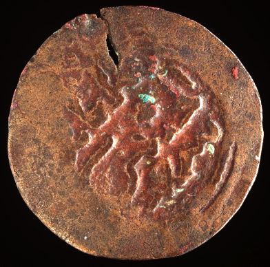
Elcho Island DT Coin
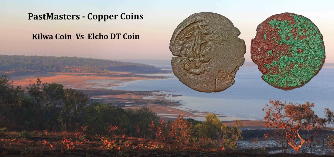
Mission Beach at Galiwin'ku Elcho Island - where MH found the DT Coin in 2018
The 2018 PM Expedition to the Wessel Islands established a base camp at Elcho Island. Michael Hermes found a small, copper coin on the beach not far from a renowned beach spring that the Macassans called Takkerena - The Music Room. A campaign of intensive analysis began in the Imaging Department of Darwin Private Hospital and featured in an article in the Guardian which topped their ratings in Australia, UK & USA and brought many offers of assistance that saw the coin visit laboratories from Adelaide SA to Bristol UK. It is almost pure copper - ergo neither a Kilwa coin nor a modern brass coin - no surface features are discernible. It is wedge shaped {1mm - 0.5mm} - like the Kilwa coin - which may indicate that it was hammer struck, rather than being of mechanical manufacture. Recent XRF has reignited the quest to identify this artefact and place it within a continuum of nautical tradition.
Our numismatist, Peter Lane, is undertaking a review of coins that match a table of determinants - some of the 'smart money' is on a Portuguese Half Real - correct weight & size {D20mm} but they're still many furlongs from home.
A paper is currently being prepared - the webpage will be opened following publication.
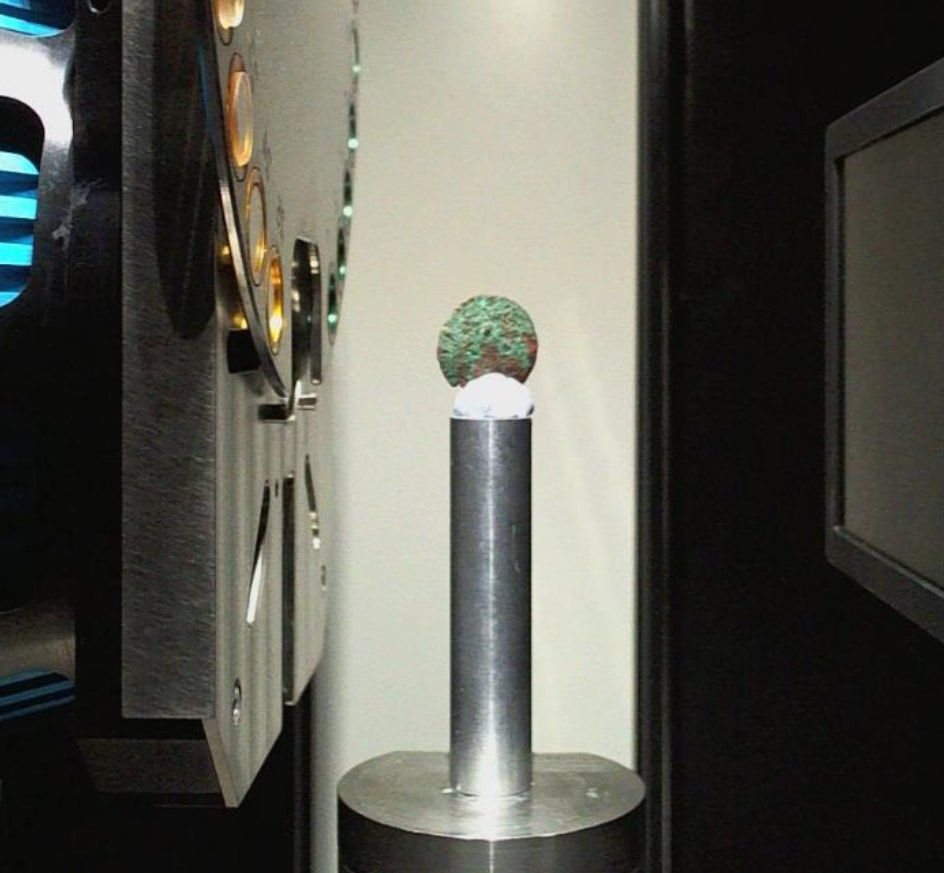
DT Coin - Bristol University CT scan 2019
|
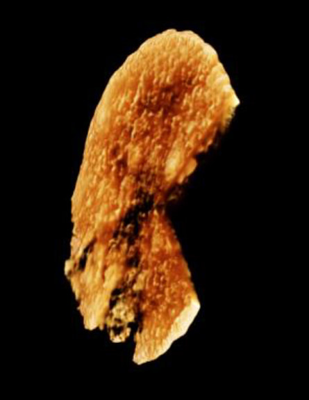
DT Coin - Bristol Uni. CT 2019
|
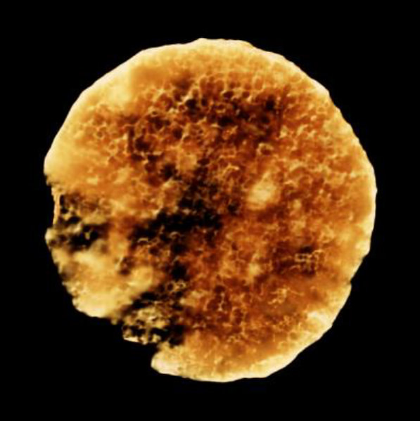
DT Coin - Bristol Uni. CT 2019
|
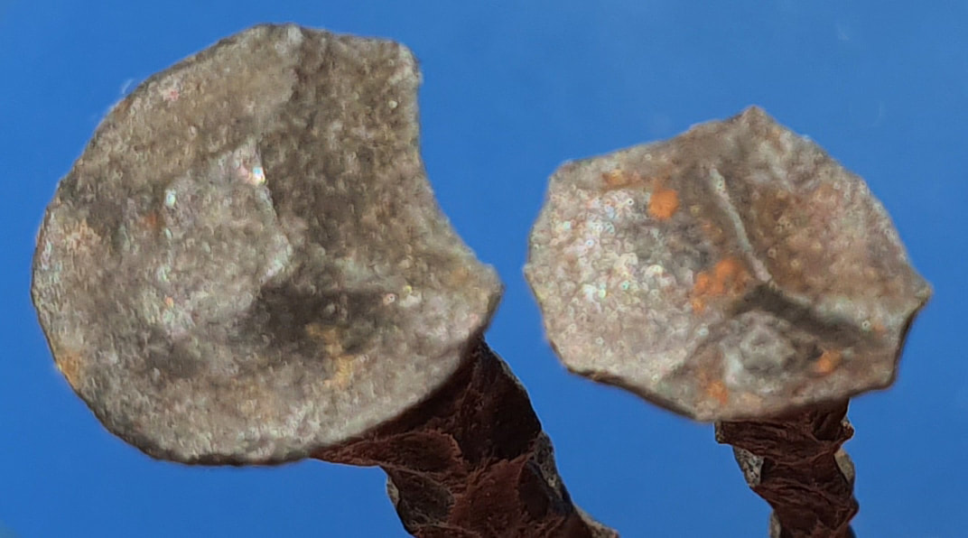
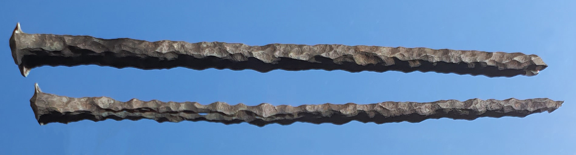
Long Macassans Nails
Melville Bay - Gove Peninsular - cold water inlet
|
These hand-made nails were found on a Macassan site which produced metal detector signals indicating that more nails are dispersed through the site. The opportunity exists to plot the nails against the extant stonelines, ash trenches and smokehouse features in an attempt to identify their purpose.
Perhaps they were bound onto joints in the frames as reinforcing or to anchor the frames to the Stones. There are reports of similar nails found at Port Bradshaw but as they make excellent spear tips it is unlikely that many have survived. Were they brought down as payment for the trepang or for the iron ore from which they are made - of value in themselves and as trade goods - why have they been left behind. The trade was effectively moribund by the mid-1890s and dwindled to a close in the 1906/7 season but there is still a great deal that can be learned from the sites before they are claimed by the sea. The cultural record is replete with references to the Murngin Metalworkers and the making of iron objects but the evidence is yet to be gathered though the implications for this line of research are significant. |

Rangers with the nails
|
|
|
|
The nails have been reported on three undisturbed Macassan sites in East Arnhem region. The first step is non-invasive X-ray diffraction (XRD) analysis of the nails provided by the Traditional Owner. It is proposed that a metal detector survey be conducted to locate the nails and plot them relative to eachother and the general scheme of the accompanying stonelines within a grid. It has been suggested that they may have been used to strengthen the timber/bamboo frames that supported the cauldrons. It is curious that they have survived because they would be excellent for fish spears and a general ready source of iron for spear points etc. Analysis of impurities may yield useful information on signature impurities - those which enhance slag removal and microscopic analysis will reveal the effectiveness of the process. Iron nails are not thought to have been used in Macassan Prau construction but metal did begin to appear with anchor chain towards the end of the trade. The possibility exists that these were not intended as practical nails - merely a convenient form for a trade good - perhaps in payment for services or the iron ore - which is abundant. All Macassan sites are protected under the NT Heritage Act and whilst there is no intention to excavate the sites or lift objects - NT Heritage Branch will be appraised of the intended survey. It is proposed that a LIDAR survey will provide a template for such sites to be used in proposed broad-acre aerial surveys to develop Artificial Intelligence analysis.
|

Brown Iron found at Elcho Is. (XRF Fe 99.882 - Sr 0.118)
|
Iron ore ready for export at the canoe channel cut into the rock. In the bay seaweed gets a foothold on the piles of basalt ballast ejected in favour of the ore.
Wurrwurrwuy Stone Pictures
|
The Dhimurru Rangers have protected and managed the site but Drone imagery & LIDAR is required to reveal the full extent of the archaeology which has not been fully recorded and a great many questions have yet to be posed before a satisfactory explanation can be expected and the site effectively managed.
Whilst there are reports of individual stone pictures there is nothing to match the scale and definition of this unique assemblage. The environs of Macassan Beach and suggestions in the oral history of a major event at this site - probably hold clues to the pictures and their preservation. If this history is to be placed on the public record then it needs to be addressed whilst the clues survive in the cultural record. |
Thought to be the bow of a Macassan Prau
|
A LIDAR survey is proposed over the site and surrounding area as it is believed to be of considerably greater extent and may depict a voyage to Makassar during the days of the trade. This will enable consideration of the site as a whole and potential relationship of items within the scheme. Data will support the on-going management of the site by the Dhimurru Rangers and inform remedial work as necessary. Other stone arrangements exist - though most have not been seen for many decades and none equal the size and diversity of the Wurrwurrwuy site.
Wurrwurrwuy Stone Pictures - at right a fishtrap or a roundhouse - the central hearth & SE opening are suggestive.
Macassan Prau Wrecks
|
The artefact at right is the only known surviving piece of a Macassan Prau, from the days of the Trepang Trade to Australia's Marege Coast - 'the Holy Grail of marine archaeology in north Australia'. A prau wreck was believed an unattainable goal as these slight timber vessels would inevitably fall prey to Teredo Worms, timber gathering natives, bushfires and white ants (termites).
The remoteness of northern Australia and sparse population mean that even if semi-hardwood timbers were to make it ashore, before the ship worms rendered it unrecognisable, there is only a narrow window for survival in a Goldilocks Zone between the sea and the land before the ceaseless degrading and prograding of the beach itself either covers the object or returns it to the hungry sea. The almost complete absence of metal aboard a prau conspires to make it a vanishingly rare find - despite extant records of many such losses and wreckage reported by 19th Century vessels. An extraordinary combination of circumstances has preserved the remains of a Samson Post that has been lightly charred and heavily attacked by Teredo Worms (bi-valve molluscs). The general domed shape is identifiable and the angled belaying grooves are clearly discernible. Entirely independent sources have provided observations and artefacts that match the historical record - which is itself composed of sightings and reports from multiple sources - confirming the date of the wreck of two Macassan Prau, the names of the vessels and their captains - along with detailed accounts of the wreck event and subsequent canoe voyage to reach safety and rescue. There are credible reports of additional material awaiting recovery from the wreck site, on an island in the Gulf of Carpentaria, that is far less remote than most of the places on our 'To Do Map'. The site needs to be surveyed and artefacts matched to the historical record - so that a report can be made announcing the discovery and measures for its protection - in consultation with the Traditional Owner. |
Macassan Prau Samson Post
|
|
An expedition is being planned that will search the identified area for timber wreckage at two adjacent sites. A snorkelling survey will attempt to relocate the anchor chain which protrudes from one line of coral through to others.
The clarity of the water at this location is such that it is highly likely to be visible from the surface on a calm day during the change of monsoon. It is anticipated that there will be a survivors camp where wreckage was collected and ballast stones possibly accompanied by the sort of metal ballast that prau masters collected - including old iron & bronze swivel guns. |
Analysis by Know Your Wood 2016
|
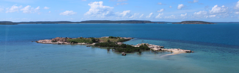
A store island in the Gulf of Carpentaria frequented by Macassan trepangers.
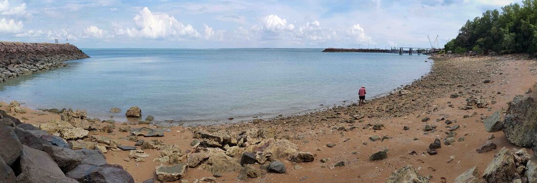
Fog Bay Cannon Ball
|
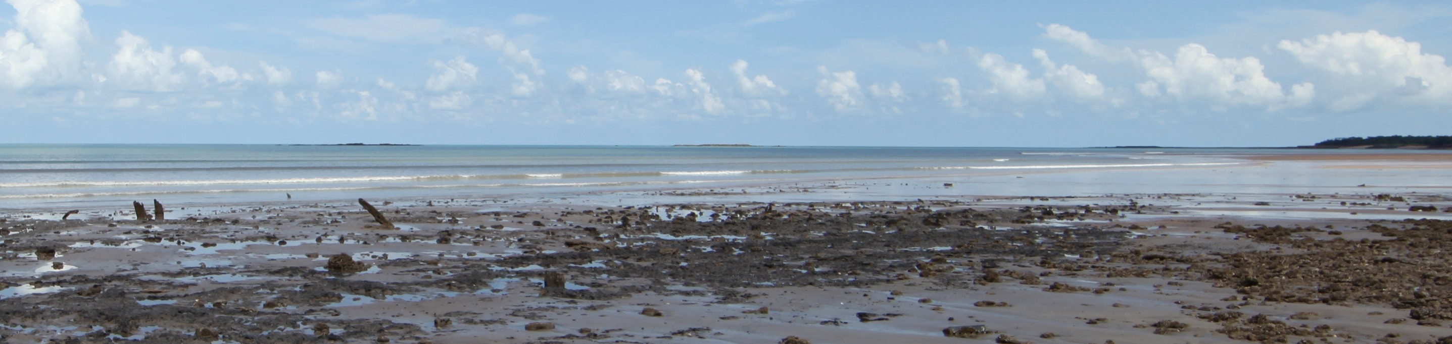
The discovery of two bronze swivel guns and reports of other such artefacts at Dundee Beach suggests a wreck in the vicinity - from which a stone cannonball was raised and involuntarily returned.
The lead in the fabric of the swivel gun has been identified by Oxford University as originating in Andalusia in Spain & OSL dating of sand from within the barrel - by PastMasters Tim Stone & Matt Cupper - has put the weapon underwater for at least 300 years. An understanding of the environmental context is critical to placing the finds in an historical continuum that may predict the location of additional finds. Our archaeologists believe this is our best chance of finding proof of Portuguese visitation to north Australia. |
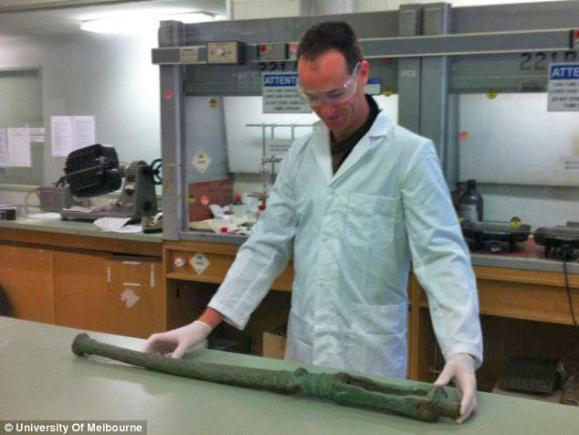
Matt Cupper using OSL to date sand within barrel of the Dundee swivel gun.
|
The GPS location of the cannonball find will be the focus for a multi-beam side scan sonar survey that will take in the adjacent raised anomaly on the sea floor. Submersible remote camera images will determine whether scuba will be initially necessary. It is proposed that the swivel guns may have come ashore still attached to the gunnel timber which has rotted away. No breech chamber (thunder mug) has been found though the iron drift has corroded away and one such mug was found at Dundee by a lady who took it to the Darwin Museum (MAGNT) but nobody was available and her details were not recorded at the desk. A catastrophic wreck should create a debris trail with a concentration of ballast and other heavy objects. This would be the source of other object which have made their way ashore in the intervening period - an intervening calcarenite reef from an old beachline will also be interrogated.
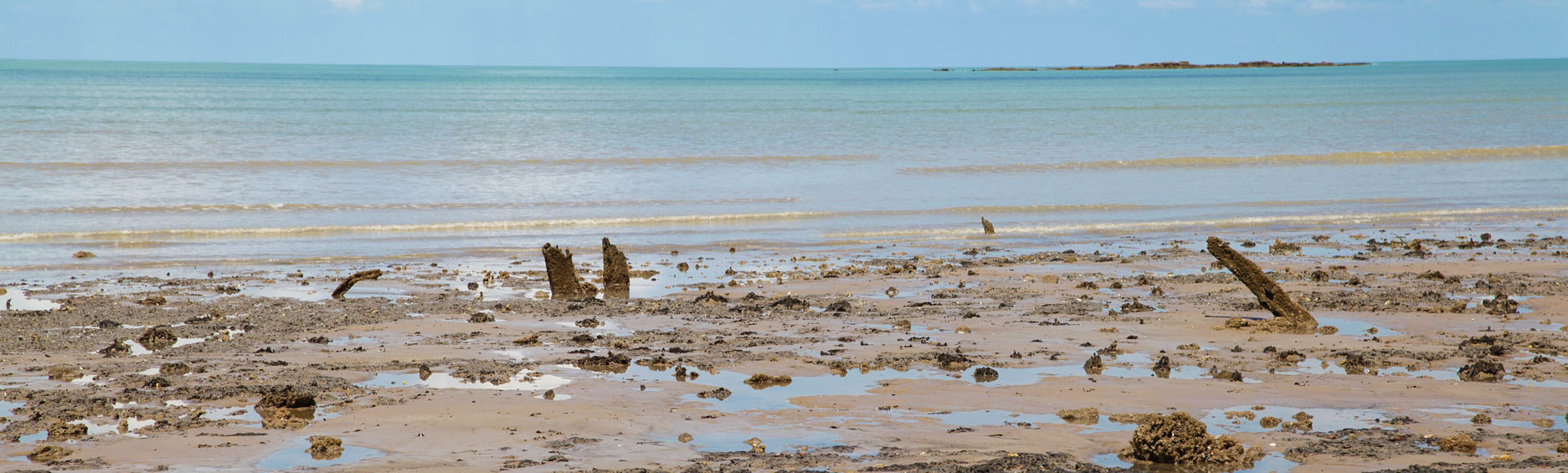
Dundee Beach - where the bronze swivel gun was found by Christopher Doukas
n.b. Once again the Dundee Swivel Gun is being examined in the light of the 1505 Esmeralda wreck artefacts and developments at Oxford University of isotope mapping of copper through the integration of many individual data sets from research institutions around the globe. A paper is being prepared to formalise the work that we've done in the last decade and project a cascade of enquiry.
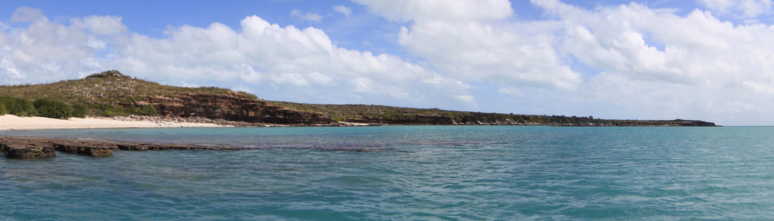
Pobassoo Island
|
The place where Matthew Flinders made the famous encounter with the Macassan fleet in 1803 holds much 'contact history' - as well evidence of the wreck of an earlier vessel of European-style construction with square copper nails, though nonesuch is recorded.
This is an especially important Macassan site which deserves detailed survey and documentation. There is much to learn about the early years of the trade as this was the rendezvous for the trepang fleet which assembled here before and after entering the Gulf of Carpentaria prior to the western drift of the trade and a change in the route to and from Macassar on Sulawesi in modern Indonesia. The date of the earliest Macassan visitation is hotly debated because there appear to have been phasing and changes in what was being collected and where. Exported produce includes hardwood, turtle shell, pearls both fresh & saltwater - iron ore and 'wax' which is believed to be the residue of boiling down palms trees - all of which produce oil that is floated off as wax - a factor that is apparently unique to the Top End of Australia. The area is jointly managed by the Marthakal & Dhimurru Rangers so there is no shortage of willing helpers in this culturally and historically important environment. |
Knapped 19th Century wine bottle
|
Pobassoo Island - 2019
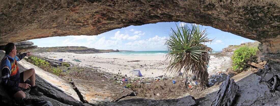
Australians' Bay & The Cave of the Axes
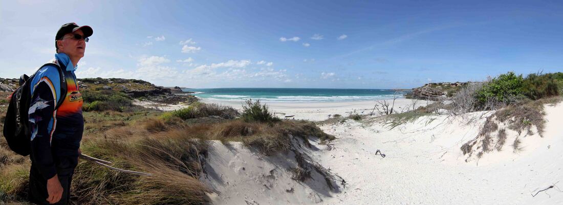
Australians Bay - SE corner Marchinbar Is. where Flinder met 'the Australians' & we fixed a plaque in 2018
|
We have much work to do at the rock art site wherein is depicted Matthew Flinders' ship HMS Cumberland and the axes that he gifted "to the Australians".
In October 1803 Matthew Flinders was sailing the 29 ton Colonial Schooner HMS Cumberland from Sydney to London via the Great Barrier Reef and Torres Strait towards Mauritius. Sighting a gap in the Wessel Islands in the dying light, he saw the shoal water and turned to shelter in a bay at the SE corner of Marchinbar Island. Next morning Flinders was with a shore party chopping up a wrecked Macassan prau for firewood when a group of Aboriginal men wandered down to meet them and following a "friendly intercourse" - Flinders' final act on Australian shores was to present the axes to these Yolngu men whom he diarised as "the Australians". It is believed to be the first time that he formally applied that name to the people of the continent, after making its discovery. There is a section of the painted roof that has dropped intact - face down upon the sand. It is proposed to take an OSL sample in complete darkness from below before raising and photographing the panel. |

Detail - Cave of the Axes
|
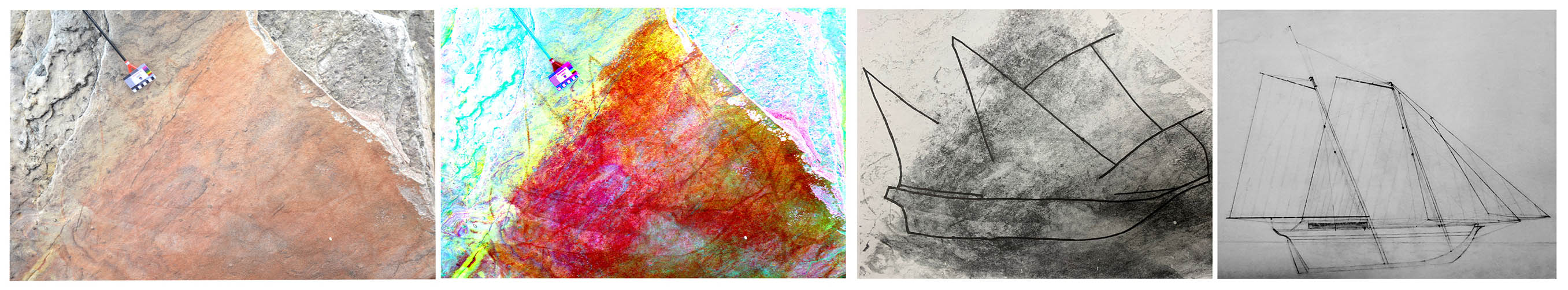
Cave art with scale - D'Stretch image - preliminary outline tracing and HMS Cumberland plans from Greenwich Museums
Australians Bay - IM at left & plaque at right. There's a wrecked prau somewhere on this beach concealed beneath a layer of Indonesian rubbish.
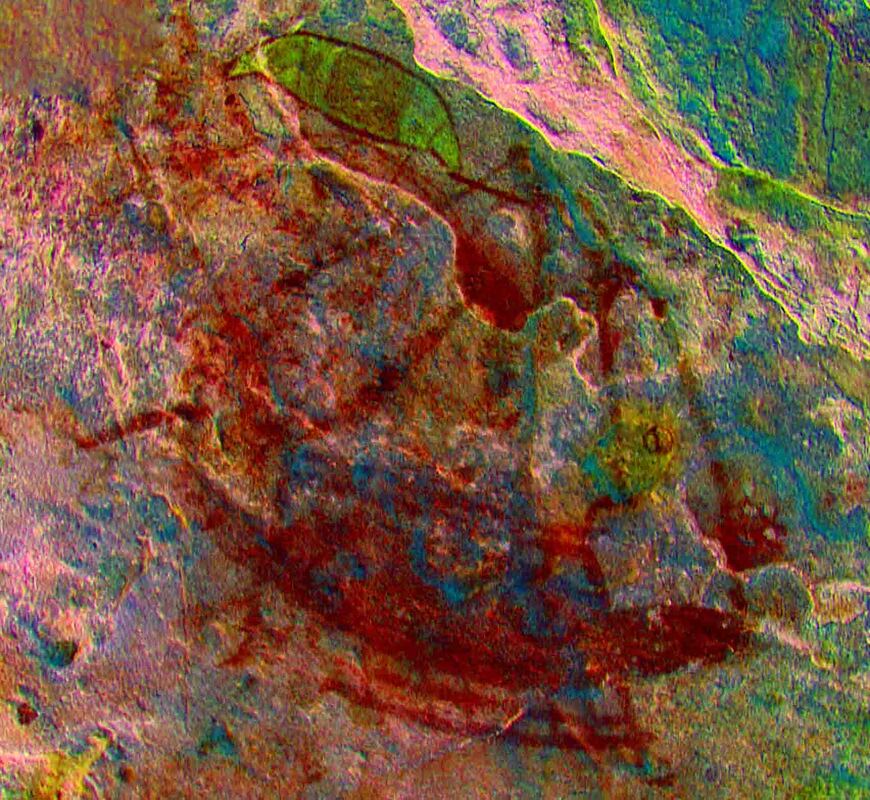
Kora Kora Whale Hunters
|
This D'Stretch image shows what we believe to be a Wurramala Whaling Canoe which is pre-Macassan and represents the earliest depiction of a foreign vessel on the Australian Coast.
The location is adjacent to a source of permanent freshwater and significant cultural sites. The area requires a detailed survey both of rock art and other occupation/visitation areas in an effort to establish this image within an environment that archaeologically confirms the oral history sources. The image of the Kora Kora (Big Canoe) displays a sophisticated use of perspective both in the depiction of the trapezoidal outrigger frame and the foreshortening of the mast.
The panel contains an European style three masted sailing vessel - a human figure and other supportive imagery. |
|
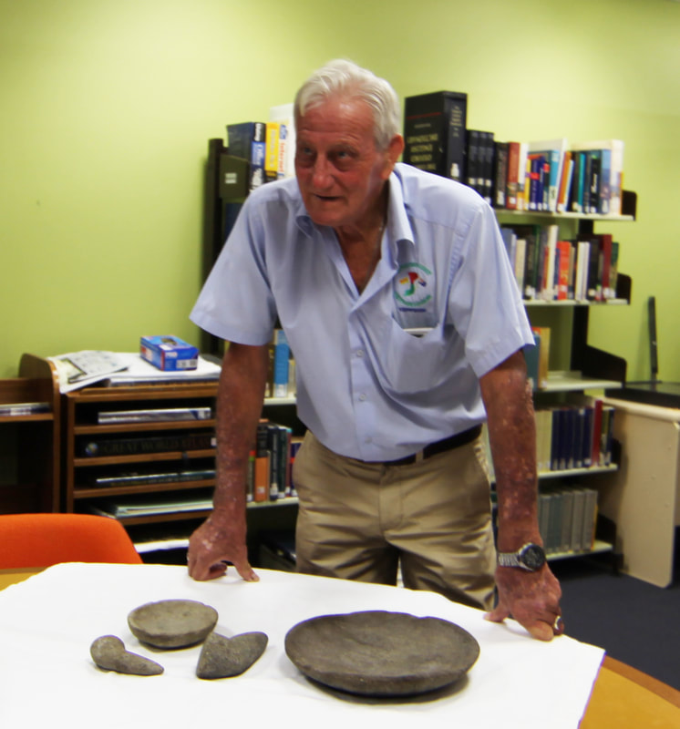
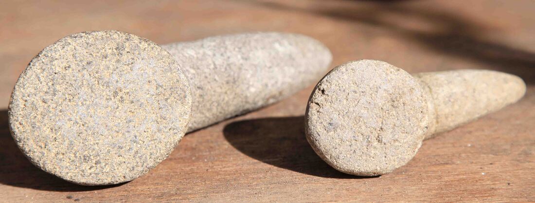
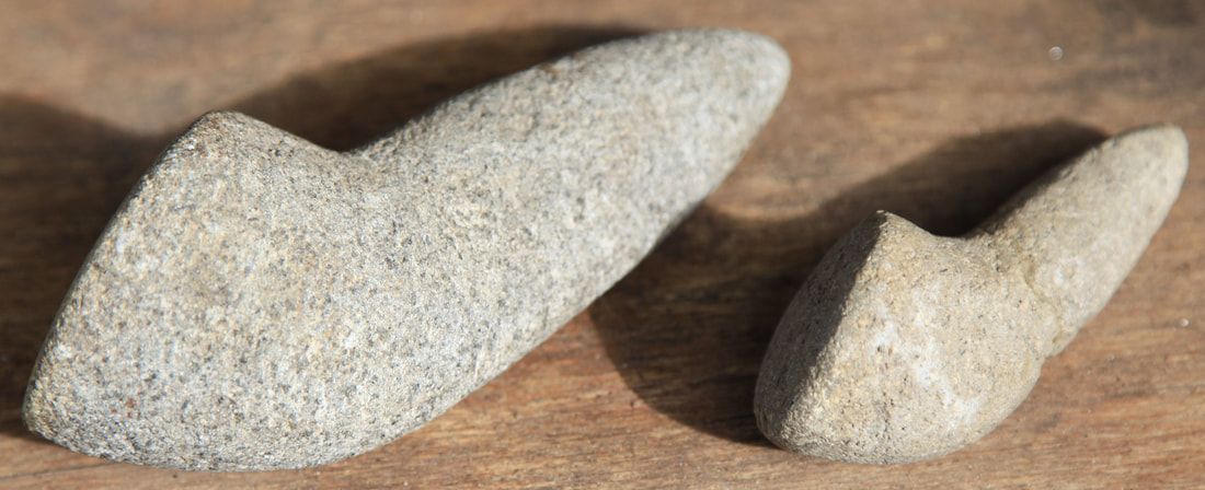
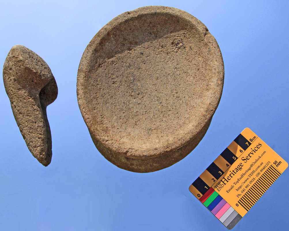
Pestle & Mortar
|
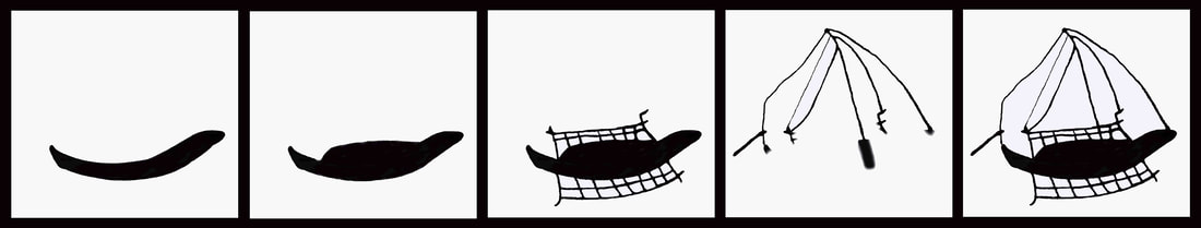
These two pestel & mortar sets were found by the deceased brother of the donor. They were found in the Wessel Islands by James Douglas McQueen, ashore from a RAN Patrol Boat in the mid-1970's - in a sand dune - beside a Tamarind tree skittled in a storm.
The finder was lost at sea and it is the wish of his family that they be researched and placed on permanent display in the Northern Territory. It is proposed that funds be sought to enable the carbon residue be C14 dated and the residue in the fabric also examined as much can be learned. If some antiquity is indicated then XRD may reveal the origin of the stone. Typologically they are SE Asian, Stone Mortar & Pestle (Ulekan & Cobek) widely used throughout Indonesia and Thailand. The finder was lost at sea and it is the wish of his family that they be researched and placed on permanent display in the Northern Territory. |
|
|
|
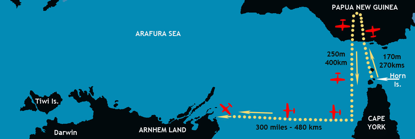
Lt. Sanford P40 Kittyhawk wreck
|
The extraordinary story of how an American Kittyhawk pilot missed Australia by 300 miles and managed to parachute to a tiny island off the Arnhem Land coast. His rescue by three members of the Marika families of the Rirratjingu Clan has become woven into the wartime tapestry of sacrifice and survival.
One of his rescuers would, within a year, become embroiled in the loss of HMAS Patricia Cam off the Wessel Islands where he would die of his wounds and be laid in a beach grave beside Stoker Percy Cameron. His identity and the location of the island grave remained a mystery until The PastMasters discovered a piece of ship's driftwood and followed the breadcrumbs. Sanford eventually recovered and returned to the States whereupon, after the war, he completed his medical studies and enjoyed a long and successful career as a surgeon. The precise location of Sanford's rescue is recorded in a story in language - "We found a white man on an island long ago" they saw him parachute down & his plane spiral down behind him. |
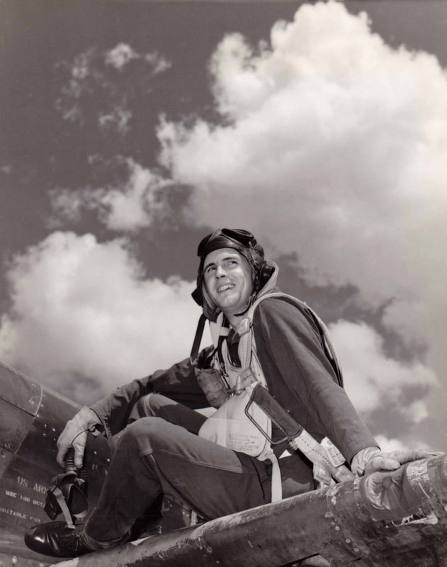
Lt. Clarence E. Sanford
|
The Cave of the Crew
Charles Barrett advocated for national level heritage protection for this site which has been variously interpreted but appears to show six Royal Marines and four others painted at a different time and in a different style. There are several images in a much older style which make this potentially a most important site.
Whilst the general area in the Wessel Islands is known - the terrain is challenging and a drone survey is proposed as the next step towards rediscovery. The only ship known to have visited the eastern side of the Wessels is HMS Cumberland - it is not known whether her crew wore this Royal Marine uniform but there were 10 men plus Flinders.
Whilst the general area in the Wessel Islands is known - the terrain is challenging and a drone survey is proposed as the next step towards rediscovery. The only ship known to have visited the eastern side of the Wessels is HMS Cumberland - it is not known whether her crew wore this Royal Marine uniform but there were 10 men plus Flinders.
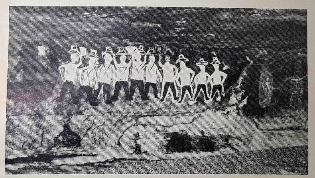
Charles Barrett Cave of the Crew image in Coast of Adventure
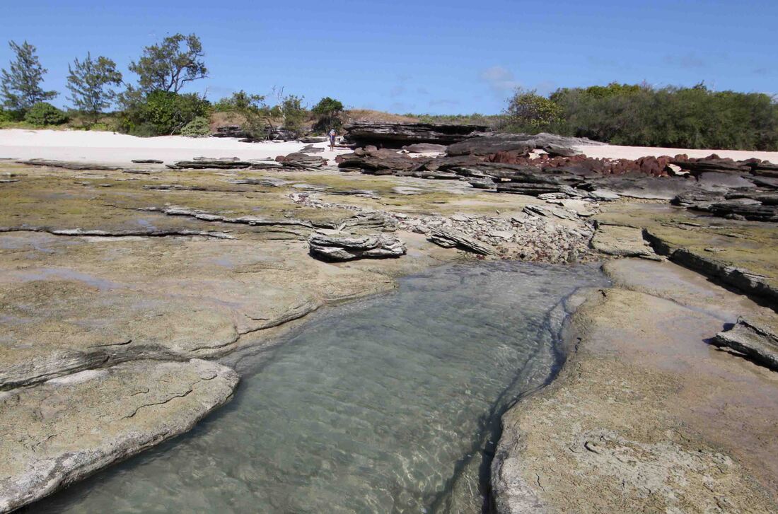
The 109kyo Coastline
This relict coast was discovered in 2019 during our Wessels in the Wildcard Expedition with the Davey family. Analysis of samples will inform further investigations of sites on the beachfront islands and mainland.
Beagle Beach Well 1839
Michael Hermes looks for finds on Beagle Beach below Larrakeyah Barracks Port Darwin
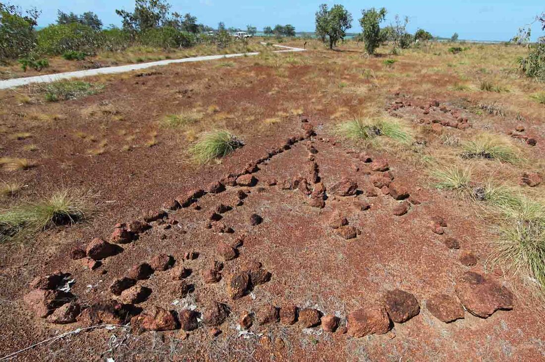
Melville Island Macassan Weir
Meetings with the Clan Group and Tiwi Land Council in September 2023 will canvas the issues and identify objectives for a full-scale archaeological examination of this important but challenging site. Analysis will focus upon the identifying they genus and date of the timber fabric of the bulwark frame and the axe marks which do not appear to have been made by a metal axe. It is now suggested that the timber frame was created to stabilise the outflow point. The undermined cliff has collapsed - the impervious beach layer has also been undermined and collapsed. Metallic and pottery finds are possible though extraction may be problematic. The proximity of the Macassan fish trap may provide indicative dating evidence prior to 1906/7.
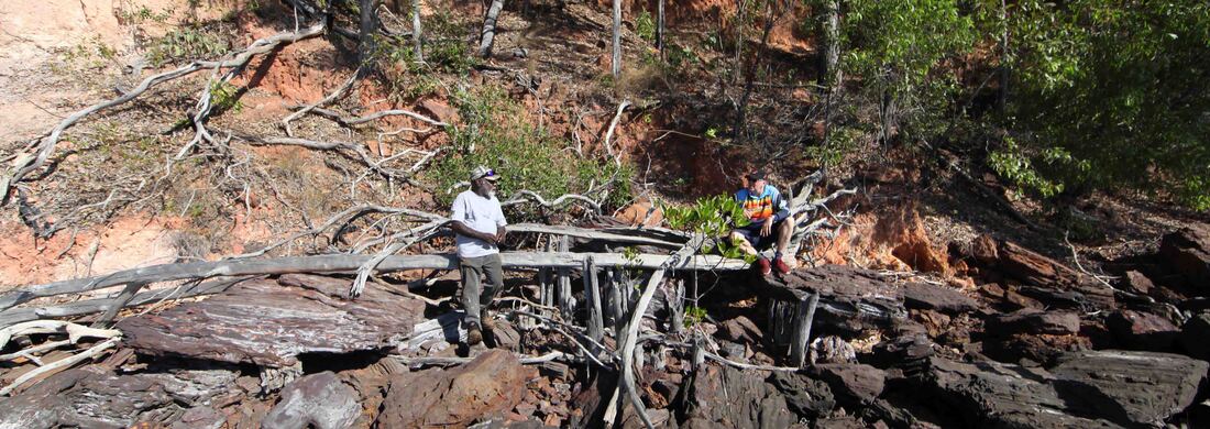
Gibson Farmer and Ian McIntosh at the Macassan Weir - Melville Island.
Elcho Island DT Coin
Commemorative Projects
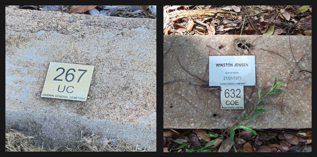
Grave Markers Jack Jensen & Paddy Babawun
|
It is proposed that suitable grave markers be erected at the Darwin General Cemetery for Petty Officer Winston John Jensen RNR and Native Pilot Paddy Babawun Wanambi of Milingimbi who were pivotal to the survival of the men following the sinking, by enemy action, of HMAS Patricia Cam.
Paddy sons are delighted at learning the location of Paddy's grave and the descendants of the survivors of the Pat Cam are anxious to see that these two men are suitably commemorated - perhaps with individual grave markers and a shared plaque at the entrance to the cemetery. Efforts continue to identify family of Jack Jensen in north Queensland. |
|
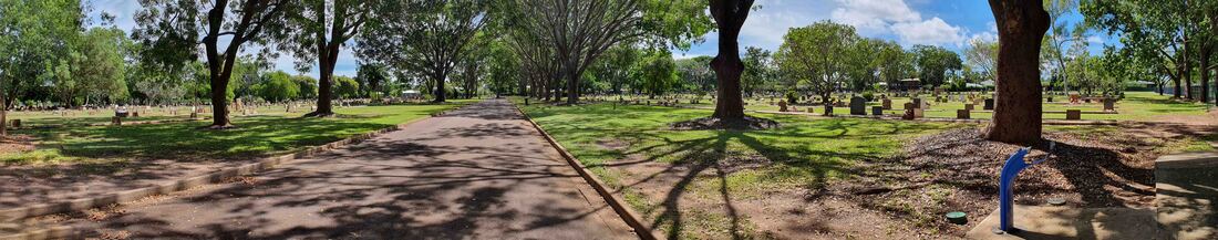
Darwin General Cemetery where Paddy Babawun & Jack Jensen are interred.
The Lambrick children's Grave Markers - Port Essington
|
Emma Lambrick's monument at Port Essington marks the earliest known white woman's grave in North Australia. We'll work with the Lambrick family in the UK & the Black Rocks Rangers to reinstate the lost Lambrick Children's grave markers at Port Essington.
The painting below by the settlement's commandant, John Macarthur, shows a man in the uniform of the Royal Marines standing before the obelisk which is between 2 small graves marked by an urn on a plinth and a conventional stone. GL Lambrick died in 1845 at one year old & their baby, born that year, died in Nov. 1846 perhaps as a consequence of birth trauma. Their mother, Emma Lambrick, died in October 1846 - her husband, George, was a Lieutenant in the Royal Marines promoted to Captain in October 1848 and subsequently to the rank of General. It is possible that the original inscription is on what is now the back of the monument and so unexamined or beneath the shoulder addition facing the artist. Noted also is the ornate and substantial top to the square monument at the extreme left. This is now missing and instead there is a crude inscription to Captain Crawford probably appended erroneously in 1913. This would explain the uncertainty that has arisen over the location of Father Confalonieri's grave and prevented his relocation to Darwin. The stone is white sandstone darkened by cyanobacteria - it was likely originally intended as the Point Smith marker which was subsequently built of local beach rock from the immediate environs. |
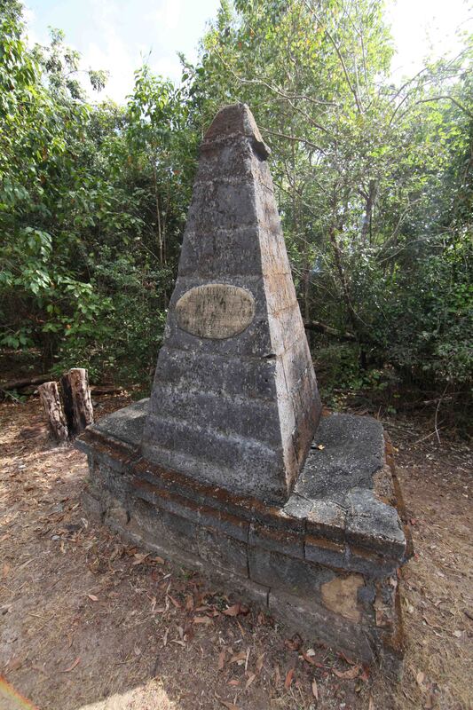
Emma Lambrick monument Victoria PE
|
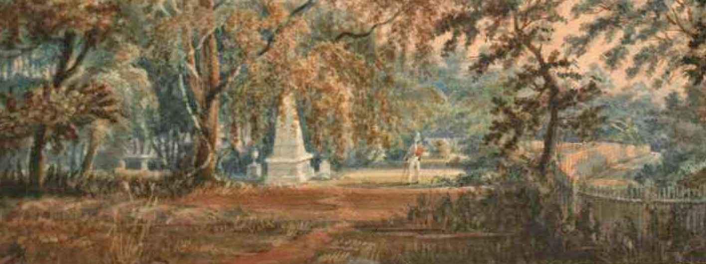
George Lambrick at the graves of his wife Emma and two of their children - NLA by John Macarthur RN
Darwin for Darwin
|
Charles Darwin is always depicted as an aged country gentleman – the epitome of the mature and stable state that nurtured his discoveries for the benefit of all mankind. In fact, he was 5 years with HMS Beagle but when he returned to England in 1836 he was still just 27 years of age. The statue at right stands before his old school which he described as “narrow and classical”. He was removed from school – dropped out of medical school in Edinburgh and narrowly avoided a clerical career. His Origin of Species was a radical attack on church teaching and power that was only published when it was revealed that another researcher had reached the same conclusions. It only survived publication in 1859 because the confrontational Aldous Huxley became ‘Darwin’s bulldog’ to publicly ridicule and shame the opposition which allowed Darwin to retain his scientific and social position from the sanctuary of Down House.
Having identified the step changes of evolution, the critical factor was time. The fossil record held the key and so it was his ‘ceaseless geologising’ that was recalled by his old shipmates aboard the Beagle when they discovered the fine Porcellanite Sandstone in Port Darwin in 1839. Darwin's search for fossils split time to previously unimaginable eons - wide enough for natural selection to take its course. A competition is proposed along the lines of the one which resulted in the Flinders Statue at Euston Station & Flinders University – though our young geologising Darwin will be standing on a porcellanite plinth - naturally. |
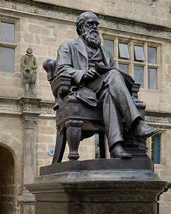
Charles Darwin Shrewsbury UK
|
Fort Dundas Bicentenary 2024
A rapidly evolving project since the visit by HMS Tamar & her return with radar issues which enabled the Royal Navy to be contacted and alerted to the upcoming bicentenary of her forebear heading the flotilla out of England that establish Australia's first free settlement - at Fort Dundas on Melville Island.
Consideration
Each of the individual projects takes us within reach of other targets which need to be developed. It is axiomatic that if you seek - you shall find - though no suggestion of any correlation between the two. All the discoveries and collaborative efforts build towards a body of heritage that has the potential to create a world-class resource for the future benefit of the people of Arnhem Land and the enrichment of the Australian nation. There is much than cannot yet be disclosed and significant cultural sensitivities around certain aspects but there is a vast amount that exists within oral history that is susceptible to re-interpretation and many great sites that old people have not visited since distant childhood and are only known to be in a general area. The early history is recorded in these painted caves and the stories flash back when feet are set once more upon the sacred sand - getting there is the problem.
Sunset over Jensen's Bay, Marchinbar Island NT