Early Maps of Australia
|
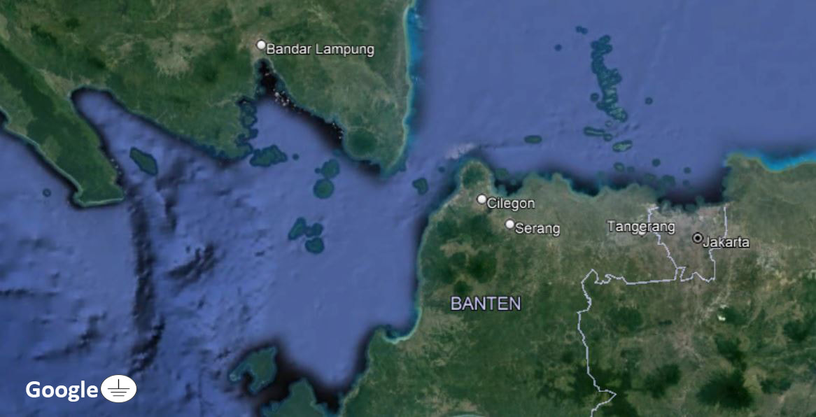
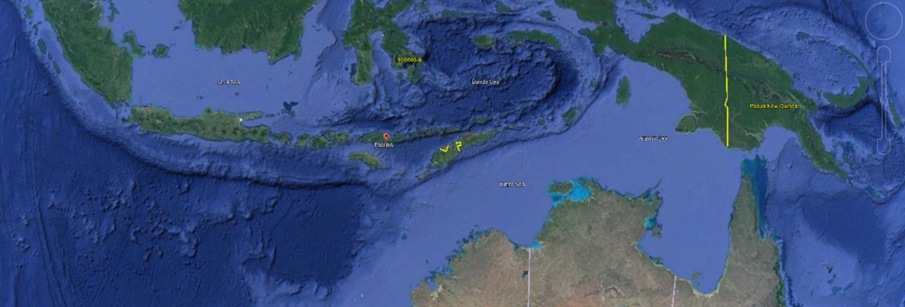
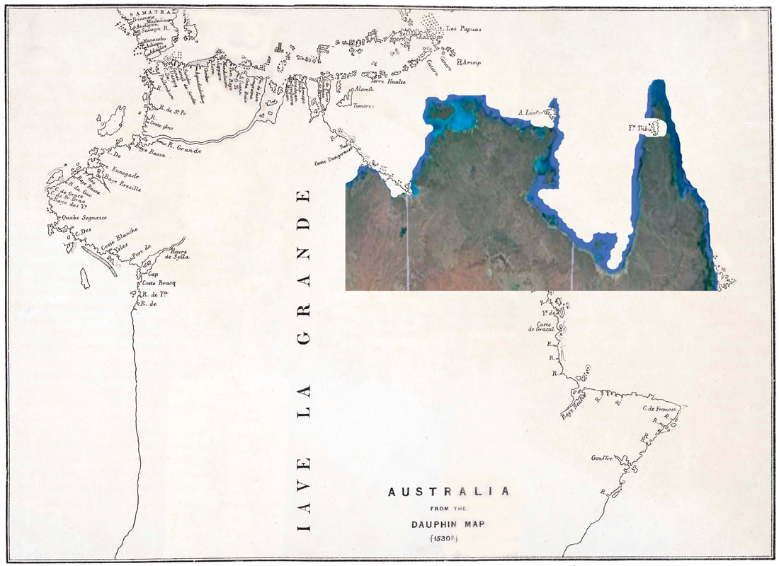
The image above is a Google Earth map overlaid with what is believed to be actual mapping by Portuguese mariners - whose observations and received information created a chart - probably in the first quarter of the 16th century (1500-1525). Their mapping of coasts and shoals is shown in white and the red areas indicates what has been extrapolated in the past to create the fabulous continental land mass that was though to exist - necessarily - to balance the land in the northern hemisphere.
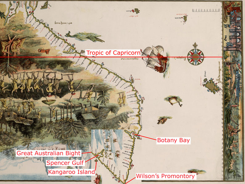
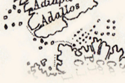
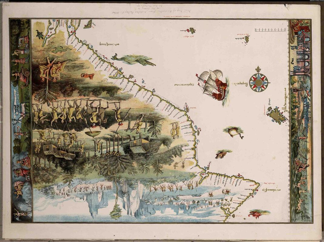
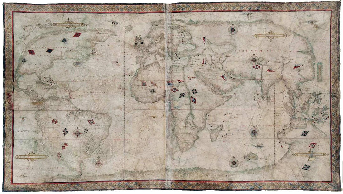
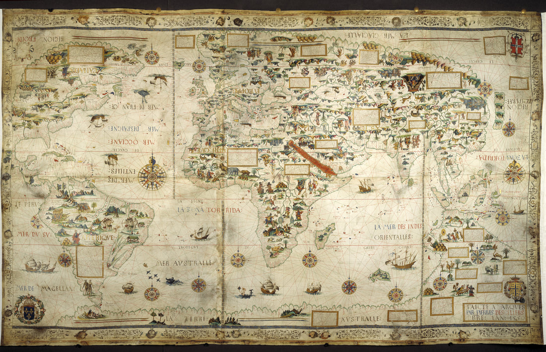
The basic sequence appears to be that the Harleian Map begat the Desceliers Map - which begat The Dauphin Map - which begat the Vallard Map - which, being inverted as "The First Map of Australia" was flipped over and suffered the final indignity of it's once proud prominence becoming unhinged at Botany Bay to dangle down to Wilson's Promontory. The sequence is illustrated below. |
The Dieppe Maps are sumptuous works of art which get progressively more garish as they are corrupted to serve other purposes. There does appear to be a genuine effort, by the mid-16th century Norman cartographers, to compile current knowledge as 'meta mapping' upon a single canvas and to make changes that reflects new information as it arises - as evidenced in the completion of the mapping of Timor. Confounders include - updating with false information and the stubborn perpetuation of accepted fallacies - e.g. the novel creation of the Island of California, in the Americas, was so persistent that it was only finally put to the sword by the issuing of a papal bull.
Despite the suggested portion of Portuguese mapping being clearly bookended by Sumatra and Papua - the imaginary map of Jave La Grande, embracing continental Australia, remains staunchly resistant to all reason. Aside from other considerations - the longevity of the error is indicative of the scant attention paid to anywhere outside of the Spice Islands and why it has proven so difficult to find hard evidence of Portuguese visitation to Australia.
Despite the assumption of the Portuguese being informed by such accomplished mariners as the Macassans & Sama Baju - their portion of the Dauphin Map and its derivatives, still amounts to a 500 year old Road Map to the Spice Islands. In terms of Australian contact history:- If you are already in sole possession of a Treasure Map to riches - far 'beyond the dreams of avarice' - why search for Australia? A consideration that would weigh upon the Dutch.
n.b. Dates are elastic - often representing the date of the atlas into which the map was bound. Nomenclature is often taken from the name of the Atlas, its owner, publisher or lead author/cartographer. Provenance is troublesome so dating is stratigraphic, based upon exponentially expanding knowledge of the sciences and the world, especially the Americas. The Dieppe Maps are sumptuous salon boasts but created by skilled and learned cartographers at the dawn of The Enlightenment. Errors and false premises abound, of course - but the deliberate falsification, fraudulence, forgery and downright stupidity are still some years away.
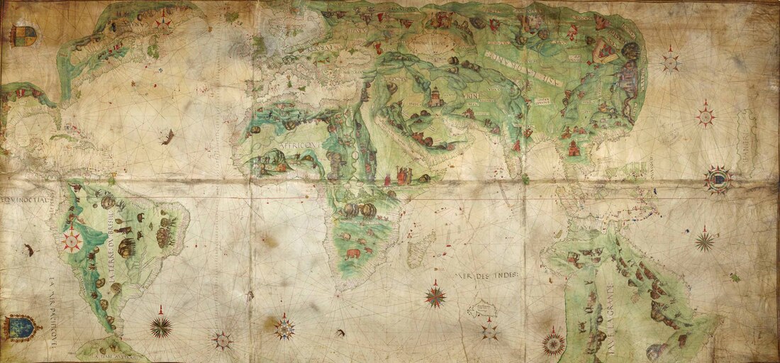
The Harleian Mappemonde c1544 - Unsigned & Undated.
"This large undated, unsigned manuscript map, oriented with South at the top, measuring approximately 4 x 8 feet, derives its name from a former owner, Edward Harley, Earl of Oxford. Its style is that of the Dieppe school of mapmakers; and, based upon that distinctive style, it was probably made about 1544 by either Pierre Desceliers (#378) or Jean Rotz (#343). The St. Lawrence River shows the discoveries of Jacques Cartier on his second voyage of 1535; it may be based on Cartier’s own map, now lost, of that expedition." (www.myoldmaps.com)
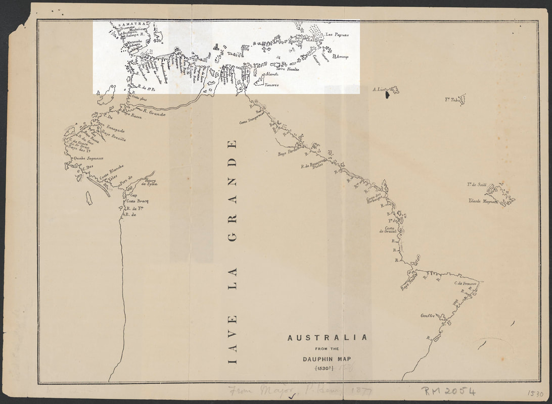
THE DAUPHIN MAP c1530-36 - Unsigned & Undated
"Facsimile map of the Dauphin chart drawn by the Portuguese between 1530 and 1536. Believed to be the earliest known map of Australia. The name Iave [i.e. Java] la Grande is written vertically on the Australian continent. When the Dauphin map is redrawn to the Mercator projection, it does resemble Australia....." National Library of Australia
"Produced in the northern French port of Dieppe, the Harleian or Dauphin map was prepared during the reign of Francois I of France (1515-1547) for his son, the Dauphin. Along with the Rotz atlas, presented to Henry VIII and also exhibited in Mapping Our World, it was one of several maps that have fuelled speculation about a continent resembling Australia, apparently charted by the Portuguese in the early 1500s and recorded by the map-makers of Dieppe. The Harleian map's most outstanding feature, a huge landmass south of Indonesia, is named ''Iave (Jave) la Grande''. Martin Woods SMH
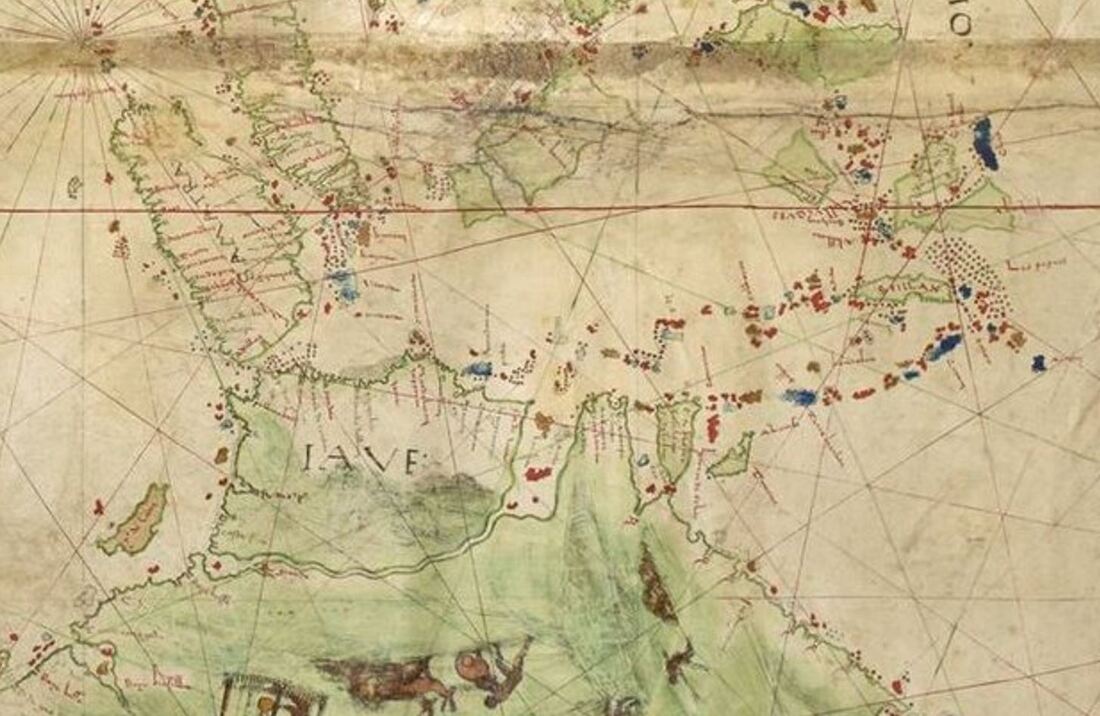
The 'Portuguese Portion' of the Dauphin Map - Sumatra to Papua
The Portuguese voyaged from Europe via the Cape of Good Hope - across the Indian Ocean to the tip of Sumatra. The useful potion of the chart informs a passage of 3,300kms through the Sunda Strait and across the Java, Flores and Banda Seas to the Spice Islands with Papua New Guinea beyond. They have charted the north coast of Java - Madura - Sumbawa - Flores etc - including the shallows and clusters of islands that stretch 200kms south of Sulawesi. They have not charted the south coast of Java, Sumbawa and Flores because they sailed in the lee of the islands - sheltered from the SE Trade Winds. It would be centuries before the south coast of these islands would be visited and charted as every vessel was drawn into the Siren vortex of the Spice Islands.
It is remarkably accurate - clearly identifying shoals and clusters of small islands as hazards to navigation right across to Ambon and Banda in the East. Unlike other early 'maps', it would be an aid to navigation - especially considering the constraints of Longitude prior to the Harrisons' chronometer and the scale of the project - 3,500kms from the West coast of Sumatra to the East coast of the Aru Islands. The Portuguese established their Sandalwood trading post on Makassar Beach, in the Oecussi Enclave of Timor, in 1515 - presumably subsequent to an earlier visit. Concealment of the Spice Islands would have been of paramount importance which suggests the first quarter of the 16th century and perhaps the first decade when the extent of wealth was unknown.
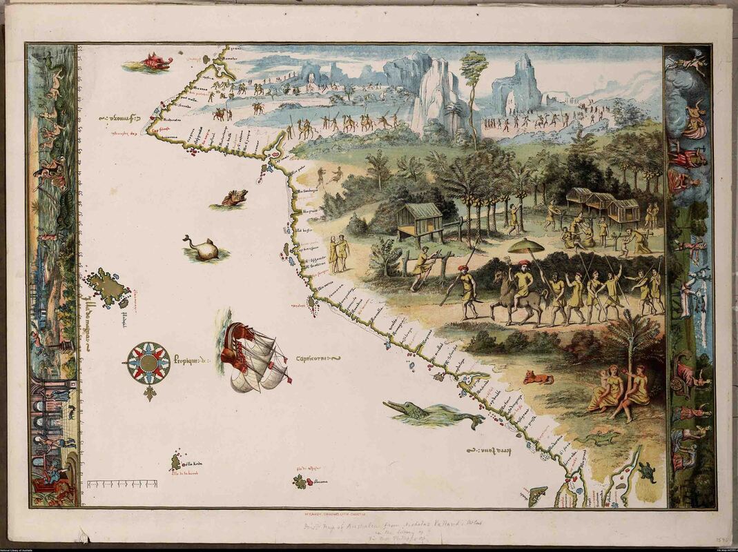
The Vallard Map 1547 - Unsigned, Undated & Ultimately Unhinged
The Vallard is the lower portion of the Dauphin Map - inverted - as seen from Dieppe. At bottom right actual features from the original Portuguese mapping are faithfully preserved. Elsewhere the perpetrator has added a scale and retained the curiously inspired major river mouths. It was created to impress the British Museum - strangely, it failed to do so - finding a home at the Huntington Library in California whilst an impressions held by at the National Library of Australia which echoes the publisher's title "The First Map of Australia".

