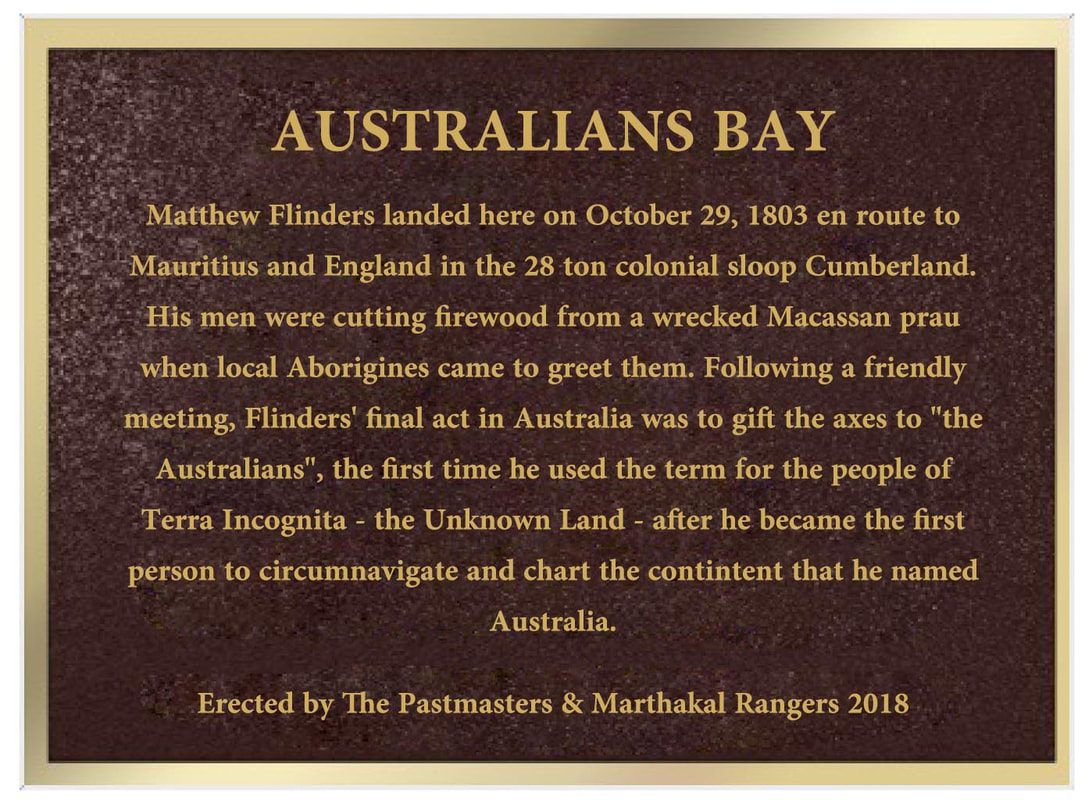
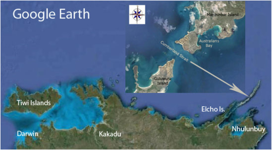
Australians Bay
Australians Bay where the PastMasters affixed a plaque to mark where Flinders' met "the Australians" on his last landfall in the continent which he discovered & named.
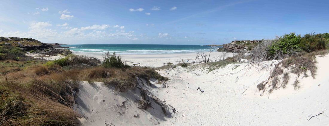
In October 1803, Matthew Flinders was back in the Wessel Islands homeward bound for England in the Colonial Schooner HMS Cumberland. Losing the light, he chose this bay in which to pass his last night in Australia. Next morning found him on this beach whilst his men chopped firewood from the wreck of a Macassan prau. As the morning warmed, a small group of Yolngu wandered down through the dunes for a friendly chat until the turning tide called him back to the sea - never to return. His log recalls that his last act upon the country which he had discovered and named, was to gift his men's axes to "the Australians" who, for the first time, now had a continent to their name.
Ian McIntosh surveys Australians Bay where Matthew Flinders met "the Australians" & where PastMasters affixed a plaque in 2018.
The Australians Bay Plaque - A PastMasters Project
|
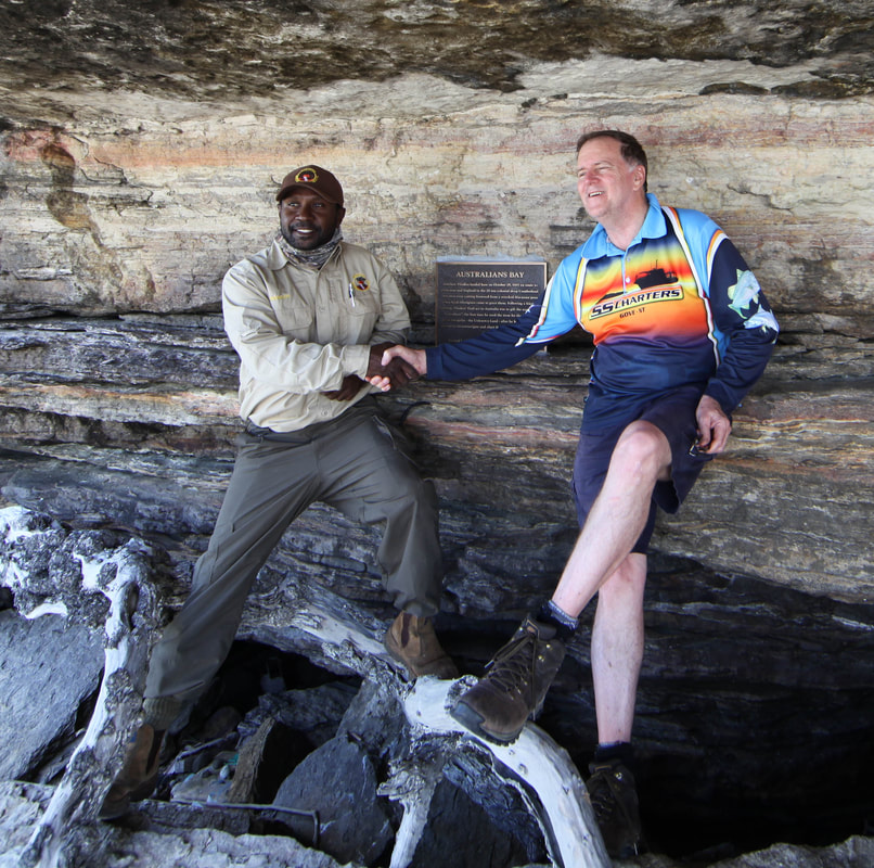
Marcus Lacey of Marthakal Rangers & IM - posing at Australians Bay
|
Flinders' Last Australian Landfall
In October 1803, following the loss of the Investigator, Matthew Flinders was sailing the 29 ton Colonial Schooner Cumberland from Sydney to London where his charts, logs and treasures of the great south land would secure his place amongst the great navigators, cartographers and explorers. Having sailed north through the Great Barrier Reef and the Torres Strait, he headed west across the Gulf of Carpentaria to the coast of Arnhem Land that he had charted some eight months earlier.
Intending to complete his survey of the Wessel Islands by sailing around the northern tip, he was confounded by the wind and tide. Perceiving at last a gap in the islands, he made for the narrow passage but in the dying light saw the tumult of shallow waters and turned away to shelter for the night in a bay out of the tide race.
Intending to complete his survey of the Wessel Islands by sailing around the northern tip, he was confounded by the wind and tide. Perceiving at last a gap in the islands, he made for the narrow passage but in the dying light saw the tumult of shallow waters and turned away to shelter for the night in a bay out of the tide race.
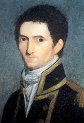 Matthew Flinders Mauritius 1804
The next morning Flinders was ashore on a small beach, in a bay on the SE corner of Marchinbar Island with a party of his men who were chopping up a wrecked Macassan prau for firewood. At length, a small group of native men walked down to meet them and following a "friendly intercourse" - Matthew Flinders' final act on Australian shores was to present axes to these Yolngu men whom he called "the Australians". It is believed to be the first time that he applied that name to the people of the continent that he had discovered, mapped and named.
Traditional Owner, Glen Malawa, is naturally a tad chuffed by this historic connection and supports the proposal to append the name Australians Bay to this symbolically significant site. It is hoped that this may encourage young people to learn more about the Balanda & Yolngu history that swells their abundant cultural inheritance, as a source of pride and future opportunities in research and heritage economics.
The name Australia supplanted 'Terra Australis' which was Sir Joseph Banks' preference). Terra Incognita derived from the notion of a counterbalancing great southern landmass in antiquity. Having charted the southern coast and found no great river or seaway and similarly explored the Gulf of Carpentaria, Flinders answered the question posed in the sailing orders of every explorer of the south land. At Sweers Island, Flinders proved that the great southern land was an island continent - the only one. His maps & journal were published in 1814, the name Australia was accepted by the Admiralty in 1824 & the Commonwealth of Australia began on 1st January 1901. Australia Day commemorates the arrival of the first convict fleet at Sydney.
So with the 'Australians' sorted - the Australian Constitution might properly be amended to include the non-Aboriginal inhabitants of the great south land but not on 24th January - we suggest the 8th May - May 8.....maaate!
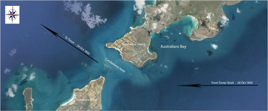
Google Earth image of the bay where Flinders met 'the Australians' and which is proposed to be named Australian Bay.
Matthew Flinders' in the Wessel Islands
HMS Investigator & Schooner Cumberland in Feb. & Oct. 1803
'Had I permitted myself any innovation upon the original term [Terra Australis] it would have been to convert it into Australia; as being more agreeable to the ear, and an assimilation to the names of other great portions of the earth.' Flinders - Voyage to Terra Australis Vol. 1 Intro. iii *note
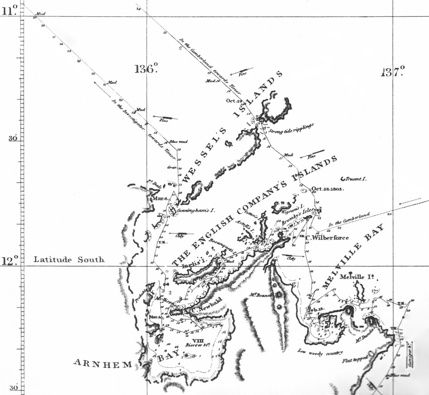
Section of Flinders' chart - Sheet II Plate XIV - Libraries Board of SA 1966 - The voyages of the Investigator and Cumberland are shown.
|
A friendly intercourse with "the Australians"
|
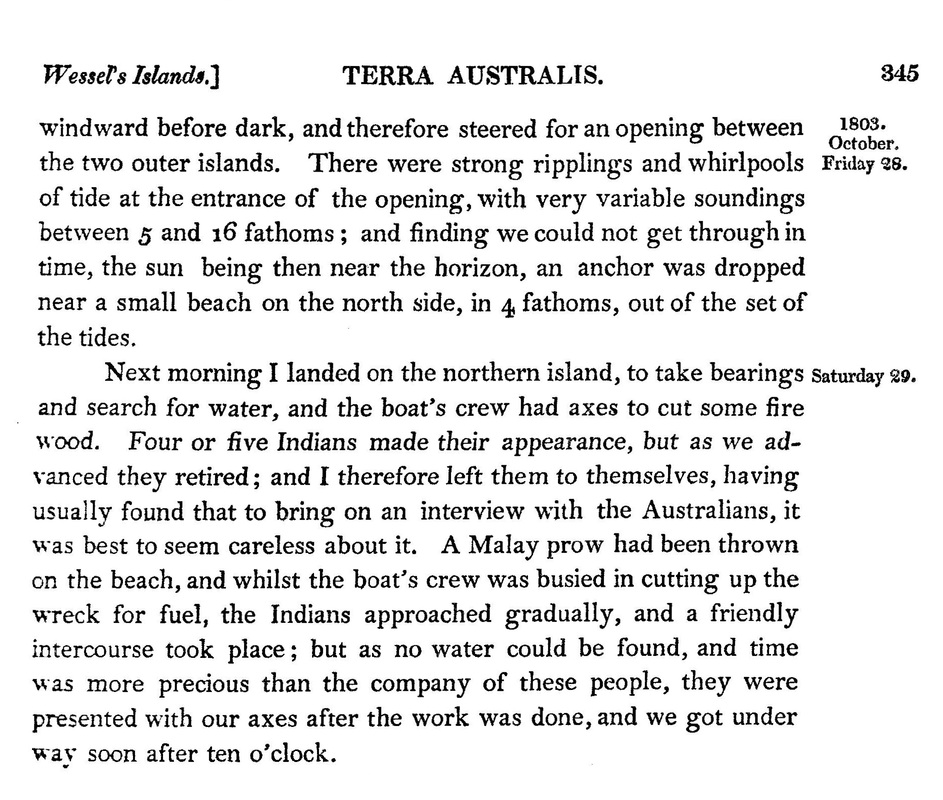
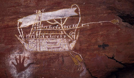
William Westall sketch of a Macassan prau made during the 1803 encounter with Pobassoo in the English Company Islands.
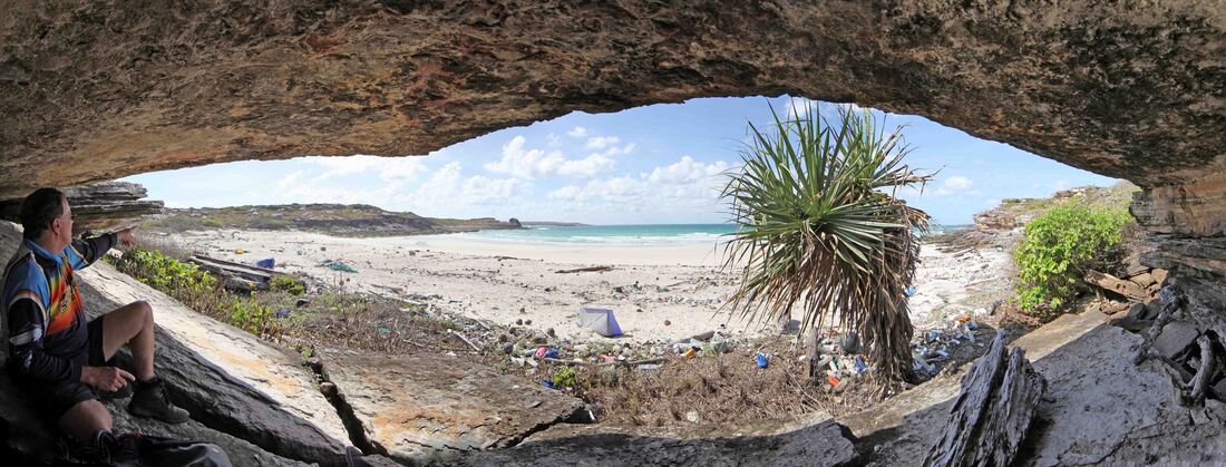
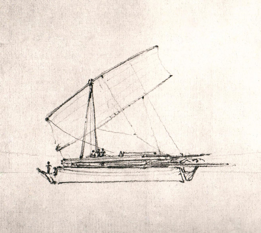
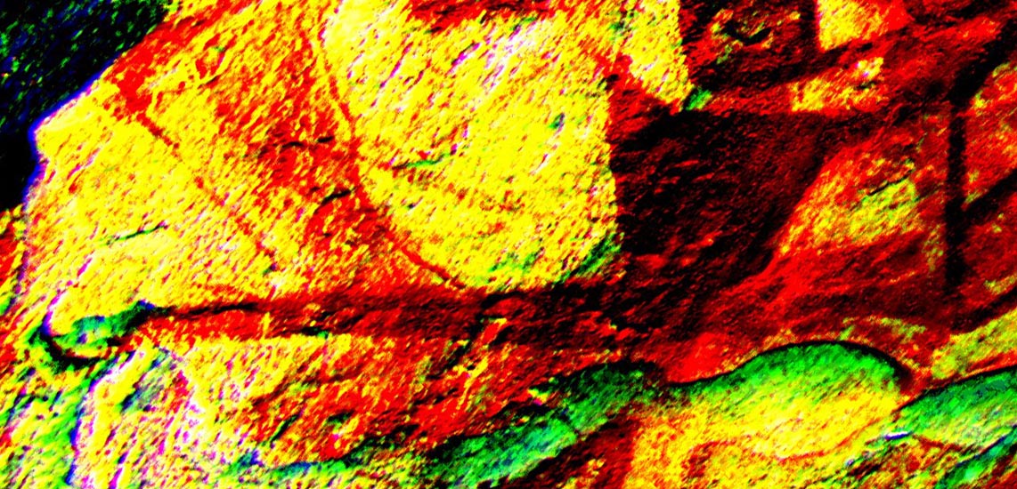
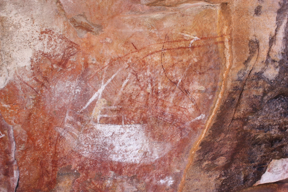
D'Stretch of Rock Art ship in Cave of the Axes near Australians Bay
|
HMS Cumberland - Greenwich Maritime Museums
|
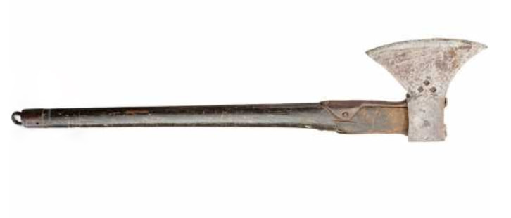
English 18C Sapper axe Royal Engineers
|
Cave of the Axes hard by Australians Bay
|
Macassan Prau over Thylacine's derriere - DW image - MO dog
|
Macassan Prau trolling - Stepwise image
|
The Carpentaria Gyre, that is fed by the Great Indonesian Throughflow Current, was the vector for the prau wreck that Flinders' men were chopping up for firewood when visited by the Yolngu in 1803. Australians Bay is a natural haven from the NW monsoon that brought the Macassan prau fleets onto the Marege Coast and a natural dustbin during the SE monsoon that carried them home again in the Dry Season.
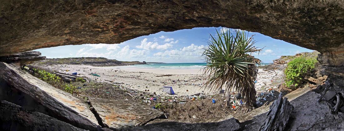
View eastward from the plaque cave at Australians Bay - the rubbish is metres deep - bottles, nets & medical waste.
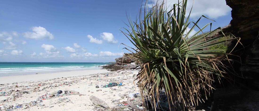
Australians Bay looking SSE